Second Quarter 2014. See below for
Walk Reports and Photos
Walk Reports and Photos for Summer 2014. Click on walk headings below, or simply scroll down the page.
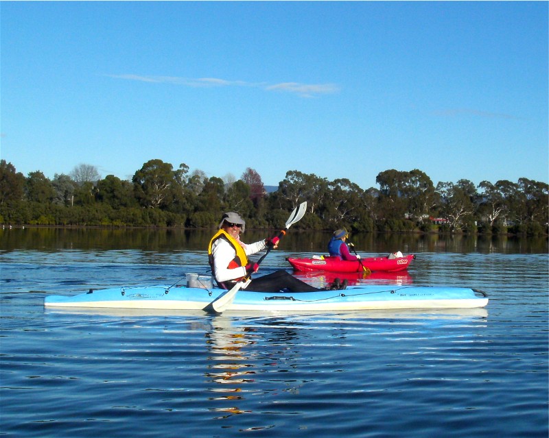
Paddle Durras Lake and Adjoining Creeks, Monday 30 June 2014
Lookout and Old Nelligen Roads, Perrys Lane, Benandarah Area, Sunday 29 June 2014
Pretty Tracks 1 and 2 - Termeil Area, Thursday 26 June 2014
Moruya River Paddle, Sunday 22 June 2014
From Burrewarra Point to Rosedale Beach, Saturday 21 June 2014
Deep Creek Bike Trails in the Tomboye Area, Wednesday 18 June 2014
Malabar Circuit, Sunday 15 June 2014
To Paradise and Return, Thursday 2 June 2014
Shoalhaven Gorge and Wineglass Tor Packwalk, Saturday 7 June - Sunday 8 June 2014
Don Moir Telegraph Station, Wednesday 4 June 2014
Deep Creek Dam Circumnavigation, Sunday 1 June 2014
Broulee and Surrounds, Thursday 29 May 2014
Blackbutt Road, Tabourie Lake Circuit, Saturday 24 May 2014
Long Beach to Maloneys Beach and Return, Wednesday 21 May 2014
Quartpot Road to an Old Road Area near Buckenboura River, Sunday 18 May 2014
Lemon Tree Creek, Thursday 15 May 2014
Tomakin Mini Trek, Saturday 10 May 2014
Forest Circuit around Mogo Old Town, Wednesday 7 May 2014
Bus trip to the National Arboretum in Canberra, Sunday 4 May 2014
Car Camp at Bendethera, Friday 2 May - Monday 5 May 2014
Durras Lake and Coastal Highlights, Thursday 1 May 2014
Pebbly Beach to Kioloa and Return, Saturday 26 April 2014
Search for Wreck Site of WW2 Avro Anson Aircraft, Wednesday 23 April 2014
Upper Durras Lake and Benandarah Creek, Thursday 17 April 2014
Corang Cascades, Sunday 13 April 2014
Ringlands Circuit Narooma, Wednesday 9 April 2014
Carters Creek & Wallaby Road, Sunday 6 April 2014
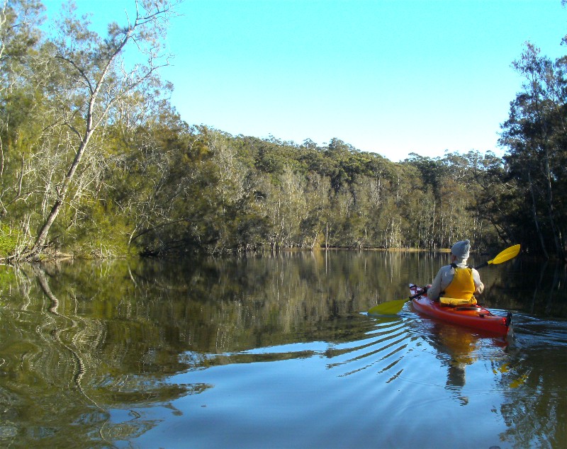
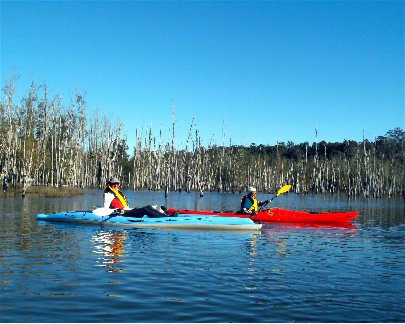
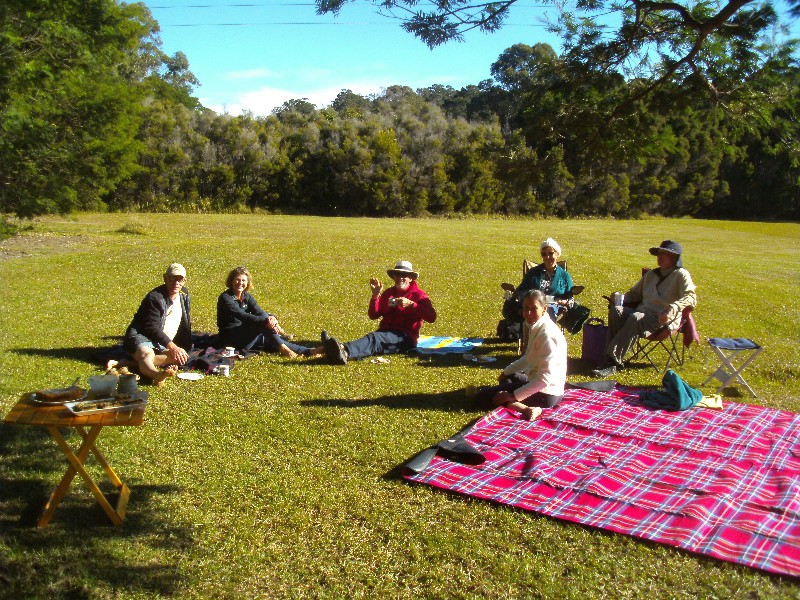
Paddle Durras Lake and Adjoining Creeks
Monday 30 June 2014
 |
 |
 |
| Dennis in East Lynne Creek Photo by Karen M Click on thumbnail to enlarge photo |
Bob and Nancy in the flooded forest Photo by Karen M Click on thumbnail to enlarge photo |
Sharon's back paddock Photo by Karen M Click on thumbnail to enlarge photo |
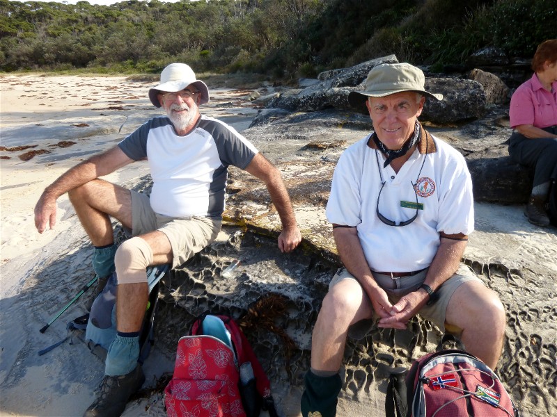
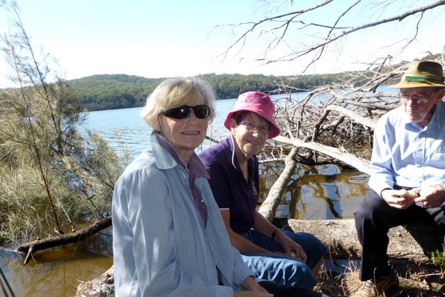
It was a relief after several days of high winds and cancelled bushwalks, that our paddle day turned out still and sunny. Twelve paddling bushwalkers headed up to Sharon's place on Benandarah Creek to launch the boats and follow her into East Lynne Creek which runs through forest and farmland to a road bridge on Mt Agony Road. Durras Lake is currently closed to the sea, so the water level is high and excellent for kayaking.
Just before the bridge, a small mob of kangaroos swam across the creek in front of us to get to the field in the sun on the other side. Ian also pointed out the still visible route of a horse-drawn tramway running beside the creek which linked a sawmill on Mt Agony Road with jetties on Cullendulla Creek. There were also the remains of a bridge across a shallow inlet over which trams transported timber for ferrying from Cullendulla around to the Bay and then onto the market.
After a circuit of an upper reach of Durras Lake, we found a spot in the sun
and spent far too long basking, chatting and eating lunch. On the way back, we explored
a small lagoon, and then sat in the sun for far too long again, enjoying coffee,
tea and cake in Sharon's back paddock.
Karen M
Lookout and Old Nelligen Roads, Perrys Lane, Benandarah Area
Sunday 29 June 2014
Cancelled due to strong winds
Pretty Tracks 1 and 2 - Termeil Area
Thursday 26 June 2014
Cancelled due to strong winds
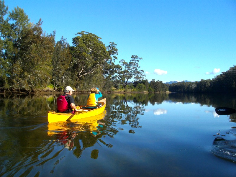
Moruya River Paddle
Sunday 22 June 2014
 |
 |
 |
| Bob and Betty near town Photo by Karen M Click on thumbnail to enlarge photo |
Ian and Lyn Photo by Karen M Click on thumbnail to enlarge photo |
Morning tea in the sun Photo by Karen M Click on thumbnail to enlarge photo |
Sunday dawned an ideal paddling day - clear, sunny and still. After a quick car shuffle, 6 of us set off from Moruya town wharf upstream to Yarragee reserve - about 6 km. It was low tide which attracted quite a few wading birds feeding in the mangrove roots along the banks. The spoonbills were so busy sifting their way through the sand, they didn't notice us gliding by.
The water was amazingly clear and because it was so still, there were
reflections everywhere. We paddled towards the mountains on the horizon until
reaching Yarragee reserve, when some of us sat in the sun by the water and enjoyed lunch before
reluctantly packing up and heading home.
Karen M
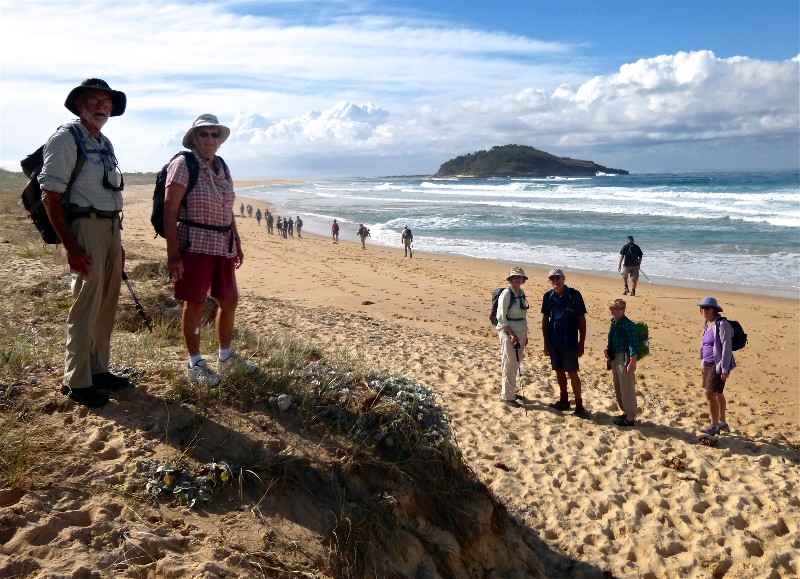
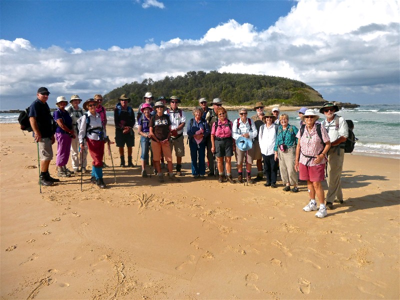
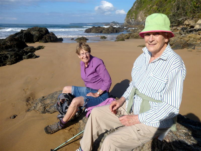
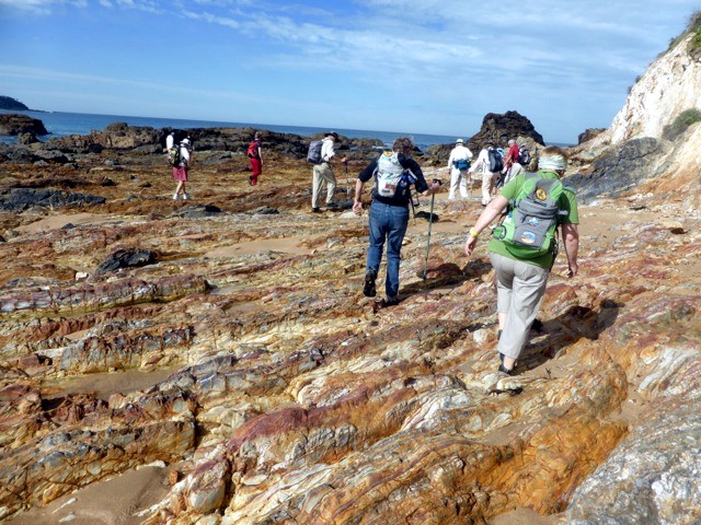
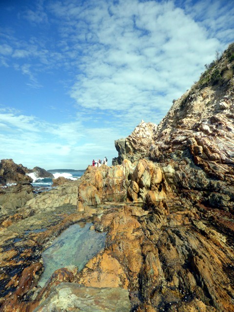
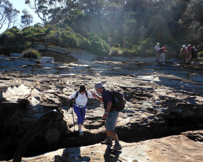
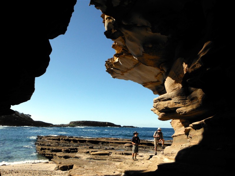
From Burrewarra Point to Rosedale Beach
Saturday 21 June 2014
 |
 |
 |
| At Jimmys Island near Rosedale Photo by Karen M Click on thumbnail to enlarge photo |
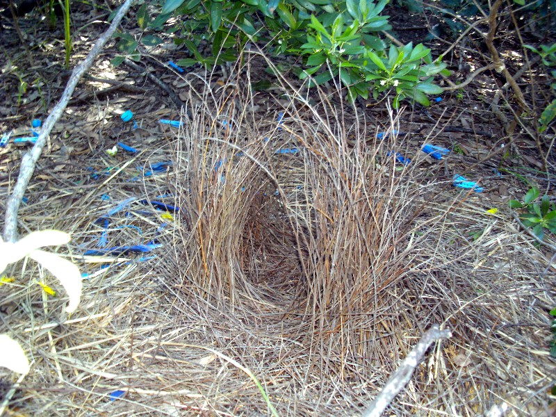
Bowerbird's bower Photo by Karen M Click on thumbnail to enlarge photo |
Lunch at Tranquil Bay Photo by Karen M Click on thumbnail to enlarge photo |
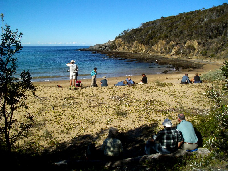
Nineteen Batemans Bay Bushwalkers turned out on a glorious winter Saturday morning for a 9km hike from Guerilla Bay to Rosedale and back. The walk started with a tour of Burrewarra Point, with its extensive views north and south along the coast. This headland is also interesting botanically with its stands of very old Saw Banksia and red flowering Correa.
The walk then headed to the beaches of Guerilla Bay, over the headland to Tranquil Bay, over the next headland to Nuns Beach, and then around the rocks past Jimmy's Island to Rosedale Beach. There, a Rosedale member shared the location of a Bowerbird's bower, surrounded by blue pegs, bottle tops and pieces of packing strap.
The return journey followed a slightly different route, mainly through the
bush behind the beaches, although Tranquil Bay is a perfect secluded spot for
lunch in the winter sun overlooking the water.
Karen M
Deep Creek Bike Trails in the Tomboye Area
Wednesday 18 June 2014
 |
 |
| Bob T, Pat and Bev Photo by Karen C Click on thumbnail to enlarge photo |
Bob M and a flowing Deep Creek Photo by Karen M Click on thumbnail to enlarge photo |
Fourteen Bay Bushwalkers really enjoyed Karen C's walk following small tracks along and over babbling brooks through the pretty forest off Tomboye Road last week. The little running creeks tumbled over river stones and rocks, some sporting pretty lichens.
The forest was particularly pretty after the recent rain and all admired the beautiful tall spotted gums and iron bark trees, some complete with orchids way up near the tops but not in flower yet. We spotted red correa flowers as well as a variety of other shrubs in flower. Echoing through the trees, we could hear lyre birds going through their repertoire, and we saw a variety of small birds as well as some native pigeons.
Unfortunately part of this walk will be logged next month and only
bare earth left behind.
Pat
Malabar Circuit
Sunday 15 June 2014
Cancelled due to rain - will be on again next Program
To Paradise and Return
Thursday 2 June 2014
 |
 |
| Mary, Lin and Ian Photo by Karen C Click on thumbnail to enlarge photo |
Heather, Karen and Lin Photo by Joan Click on thumbnail to enlarge photo |
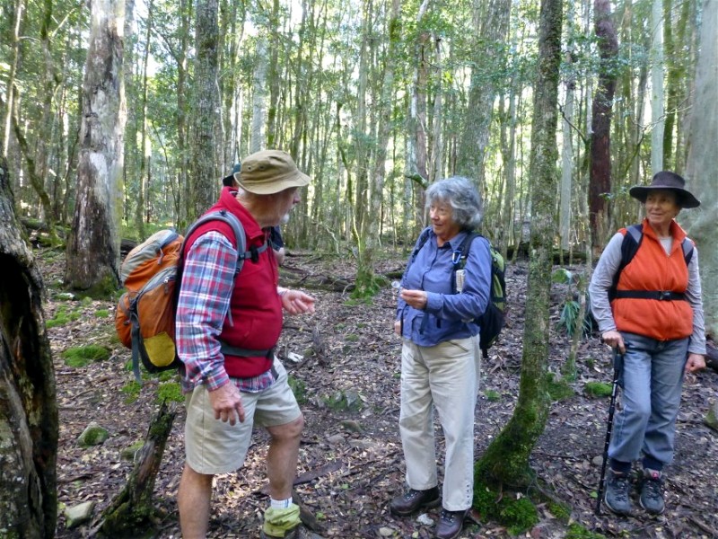
A clear sunny winter's day and 12 Batemans Bay Bushwalkers met at Nelligen Wharf for a medium grade 11 km walk. A drive along Bolero Mountain Road, past the quaintly named Battered Possum Road, had us at the start of the walk.
Our steady uphill progress gave us distant views of Batemans Bay, the Toll Gate Islands and further on, the sinuous winding Clyde River. As we gained height, the Castle, Byangee Walls and Pigeon House Mountain came into view. We passed Spotted Gums, Burrawangs, Indigofera and a variety of Wattles and after recent rain the bush looked sparkling fresh and it was a pleasure just to be out there walking.
As we stopped for morning tea, right on schedule, we were serenaded by a male Lyre bird practising his bird mimicking songs - we hope she will be impressed as we were.
Now it was downhill along a forgotten partly overgrown track, time to watch your feet when stepping over fallen trees and branches, no time now to look at views. On reaching the bottom of the hill the country changed, highlighting the amazing diversity of eucalypts in the area. Yellow Stringybark, Blackbutt, Bloodwood and Mountain Grey Gum were just some of the species identified.
Our lunch spot beside the aptly named Paradise Creek, had moss covered rocks to sit on and burbling clear water to reflect the overhanging greenery - paradise indeed.
Finally our leaders led us along a narrow unmarked winding track up a ridge to
the road that led us, uphill of course, finally back to our cars. Thank you
Mary and Stan for another marvellous walk
Karen C
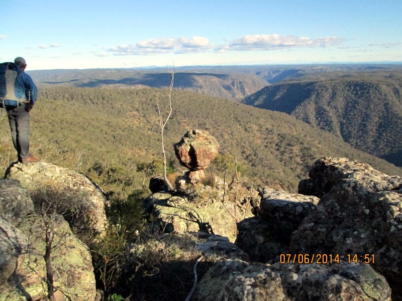
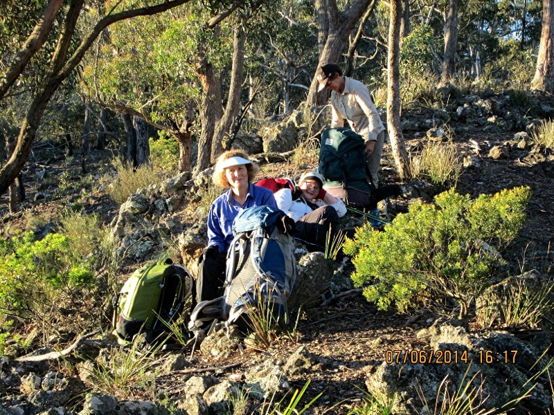
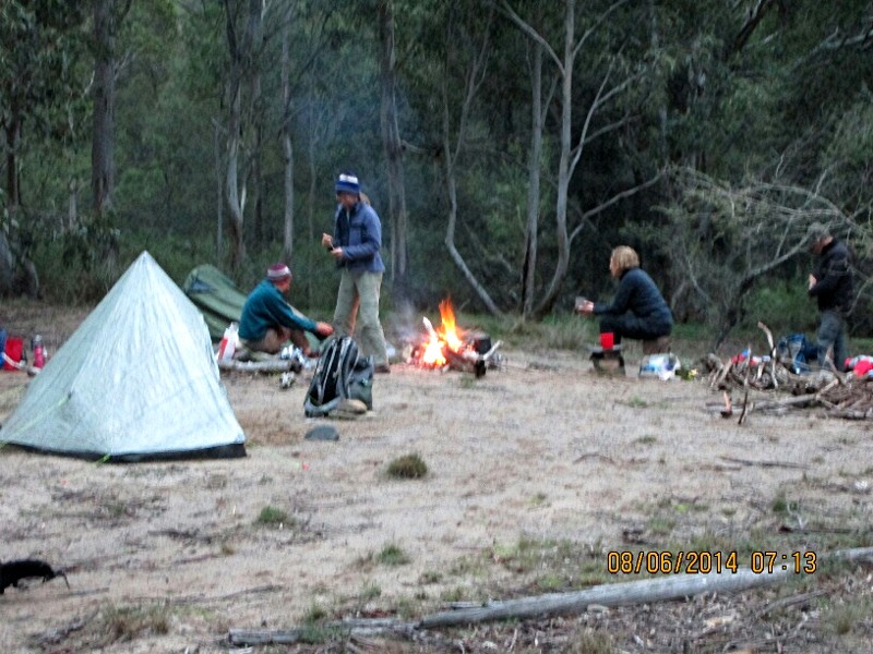
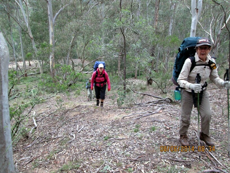
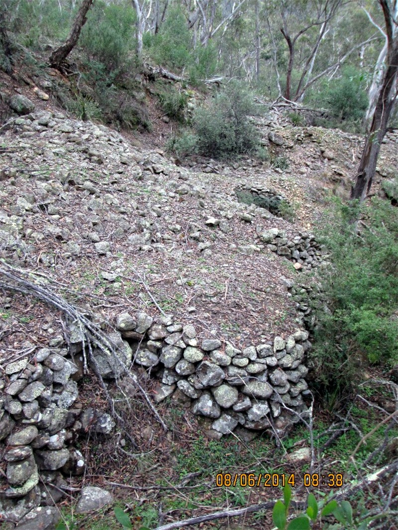
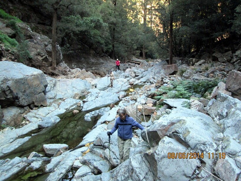
Shoalhaven Gorge and Wineglass Tor Packwalk
Saturday 7 June - Sunday 8 June 2014
 |
 |
 |
| Ian at Wineglass Tor Photo by David Click on thumbnail to enlarge photo |
Lin, Kay and Glenn on open ridge before descent to Shoalhaven River Photo by David Click on thumbnail to enlarge photo |
Breakfast on Sunday morning Photo by David Click on thumbnail to enlarge photo |
 |
 |
 |
| Glenn and Jenny leaving camp Photo by David Click on thumbnail to enlarge photo |
Old gold diggings Photo by David Click on thumbnail to enlarge photo |
Approach to Sparks Falls Photo by David Click on thumbnail to enlarge photo |
The walk proposal description said it all - an overnight walk in a tough and interesting place. Great scenery and 2 old gold mine sites to visit. This walk is described in the book Fitzroy Falls and Beyond, refer to Map 8.
Day 1 7 intrepid walkers (David, Ian, Lin, Glenn, Bronwyn, Jenny and Kay) began the walk at about 0830 just north of the Tullyangela Clearing on the Tolwong Road (405319). Ian, Lin and Bronwyn had camped Friday night beside the road. David, Glenn, Kay & Jenny departed Batemans Bay at 0500 on the Saturday morning.
The route to the first old mine site (The Peach Tree Canal on Tims Gully Creek) basically follows the cliff line along the north side of the unnamed creek. This creek is the first creek south of North Oaky Creek. Walking was relatively easy along the exposed rock near the cliff line. To the north east of the cliff line there were patches of ankle high vegetation that was also easy to walk through, but these were often broken by stands of thicker tea tree or wattle regrowth that took quite some effort to get through.
Map 8 (and the accompanying walk notes) point out that walkers should be able to find a relic of the gold mining in the form of what appears to be a stone bakers oven. Unfortunately a minor navigation error by the walk leader caused the group to miss this relic...bugger! Oh well, we now have a reason to visit this area again to find this elusive oven. (Note to self: don't rely totally on your GPS, get your compass out too, take your time, study the map and look at every little curve in the contours - they all tell a story!). The navigation error led to an interesting scramble down a fragmented 20m rock face to Tims Gully Creek.
Lunch was at the upstream end of the Peach Tree Canal. This canal was cut through the rock ridge of a sharp bend in Tims Gully Creek to allow the circa 1890 gold miners to get to the bed of the creek.
Our next target was Touga Trig on the cliff line on the east side of the Shoalhaven River. This cliff provides a great view of the Great Horseshoe Bend and contains a distinctive rock formation known as Wineglass Tor. The rock cairn of Touga Trig has a visitors book which showed that there had only been 2 other visitors since the Club last did a day walk to Touga in August 2013. A few quick photos and then some determined walking was required to complete the 4km and 540m descent to the camp site situated 200m north of the Tims Gully Creek/Shoalhaven River junction. 3km of this distance was easy walking with almost no scrub, but a few interesting navigation decisions to sort out. The remaining 1km was very steep and rocky with spectacular views over the cliff to the lower part of Tims Gully Creek.
We reached our camp site in a weary state with just enough time to begin to set up camp before it got dark at 1700h.
Day 2 We began day 2 shortly after 0800h. Immediately above our camp site we found the tail end of the water race that supplied water to the alluvial gold workings. Evidence of the gold working is in the form of large areas of disturbed ground covered in piles of head sized boulders. In many places the boulders are neatly arranged in walls to facilitate the movement of water.
Barring the odd fallen tree, the water race made easy walking for the first 1km of our route upstream on Tims Gully Creek. For most of our walk upstream there was little flowing water, just the odd clear pool. We had a morning tea stop at the junction with Touga Creek. Walking the creek was a mixture of gravel beds, rock hopping and easy walking in fern glades along flat terraces beside the creek.
At grid ref 35831 we left our packs to complete the remaining 300m of creekbed walking to have a look at Sparks Falls. This last 300m contained several large bedrock formed pools and flowing water. The falls are about 40m high and stop any further progress upstream on Tims Gully.
Our route out of the creek began with a steep rocky climb south from where we had left our packs. The initial climb of 220m in a distance of 500m (a grade of 1 in 2.3 or 40%) required a few rest stops the last being lunch at about 363328. From this point we had a good view of Sparks Falls and the part of Tims Gully Creek we had walked up during the morning. A number of small birds including an eastern spinebill moved around the sparse scrub and trees of our lunch spot.
Our route then followed a large arc of a more gently graded ridge where some careful navigation was required at times. This brought us to western edge of the plateau that straddles the Tolwong Road. Navigation then required us to follow a compass bearing (or GPS go to point) for 2km to reach the saddle at the head of Little Oaky Creek. Unfortunately for all of this 2km we had to contend with a continuous battle through spindly wattle regrowth - not pleasant walking conditions. (The topo map shows possible lighter vegetation to the north east of the chosen route. However the aforementioned saddle would still be the goal, so a deviation from the straight line course would be longer and may not be any easier going.) From the saddle a south easterly course, through still more wattle scrub, brought us back to the Tolwong Road. The car drivers then set off for a 2.5 km packless walk along the road to retrieve the cars. The remainder of the walkers had the billy boiled for a quick cuppa before we loaded up at sunset for the drive home.
Further information on the old gold mining in this area is contained in Barry
McGowan's book, Bungonia to Braidwood.
David
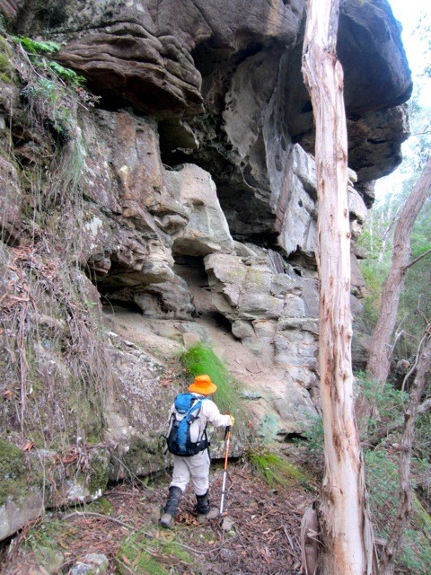
Don Moir Telegraph Station
Wednesday 4 June 2014
 |
 |
| Climbing Don Moir Hill Photo by Karen C Click on thumbnail to enlarge photo |
Hello, is anyone there? Photo by Karen C Click on thumbnail to enlarge photo |
This is a 9.5 km walk through the forests of Murramarang National Park via old forestry roads, which was enjoyed by 9 walkers.
We walked and talked our way 5 kms east towards the ANU forest and beach study area, bypassing the entry to ascend the short, steep incline of Don Moir Hill. At the top we found an old wartime observation post made of local stones stacked to form protection for a telegraph station expected to provide warning of any approaching WW2 enemy attacking our sparsely populated coastal area.
A lengthy area of the walk traversed a surprisingly large cabbage tree palm
forest, interspersed with many large different types of eucalypts which had
been spared the logging which occurred in the area early in the 20th century.
Karen M
Deep Creek Dam Circumnavigation
Sunday 1 June 2014
Cancelled due to rain - will be on again next Program
Broulee and Surrounds
Thursday 29 May 2014
Today Betty led 16 bushwalkers on an interesting 14 km walk through the beaches and bush of Broulee. Heading south we inspected the Canoe Tree enroute along various bush tracks to the ocean for morning tea. It was then a pleasant walk along the beach and up to Broulee Headland for splendid views over the surrounds.
Broulee Island was our next destination with lunch at a vantage point high
on the northeast tip where seals were spotted. Continuing on, we visited the
grave of Elizabeth Maleber who died in 1842. To complete the walk we returned via
a different route. Thank you again Betty for a lovely walk.
Lynne
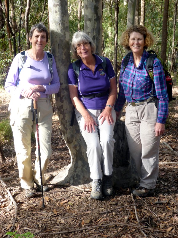
Blackbutt Road, Tabourie Lake Circuit
Saturday 24 May 2014
 |
 |
 |
| Tabourie Beach Photo by Joan Click on thumbnail to enlarge photo |
Group in front of Crompton Island Photo by Joan Click on thumbnail to enlarge photo |
Bob J and Bob C Photo by Joan Click on thumbnail to enlarge photo |
Over 20 walkers turned out on a perfect late Autumn day for a walk led by Karen C at Lake Tabourie. The route was a 9 km circuit taking in coastal forests on the way to the beach, where firm sand made the walking easy. The tide proved a little too high for us to visit Stokes and Crompton Islands, so we had to admire them from afar.
Along the way information signs installed by NPWS gave a background to the geomorphology and history of the Lake and its surrounds. Until the sea level rose 6,500 years ago the shore-line was a long way further out, and where Tabourie Lake is now, was a valley.
Any weight lost as a result of the exercise involved was soon replaced on the
way home by slices of apple pie and cream, carrot cake, and milkshakes at East
Lynne Roadhouse.
Mike
Long Beach to Maloneys Beach and Return
Wednesday 21 May 2014
 |
| Lesley and Marilla at Long Beach Photo by Joan Click on thumbnail to enlarge photo |
It was a stunning sunny autumn day on Wednesday 21 May when seventeen bushwalkers enjoyed the 7 km walk from Long Beach to Maloneys Beach. There was not another soul on the beach as the group walked to the northern end of Long Beach along the track at the back of the beach through the public reserve amongst large banksias and wattle in flower.
With the low tide it was possible to walk around the headland over colourful rocks to Maloneys Beach and continue to the northern end where many kangaroos welcomed the group for lunch at the picnic shelter.
The return walk to the cars was via the top headland track and back to the
beach past beautiful houses with beautiful views. How lucky are we to live in
Batemans Bay. Many thanks to leaders Bob and Joan.
Author?
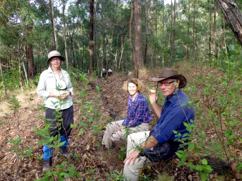
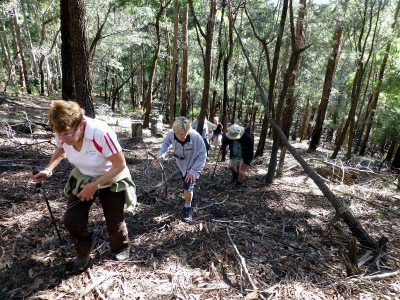
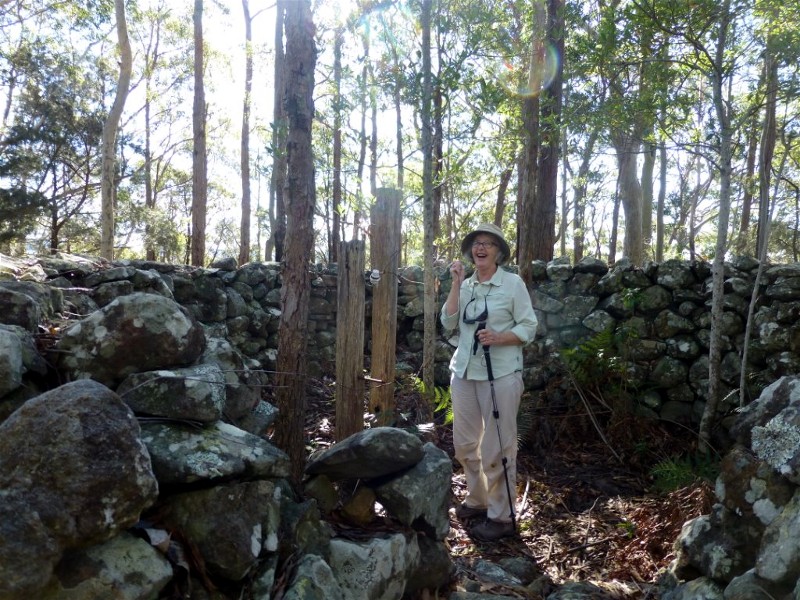
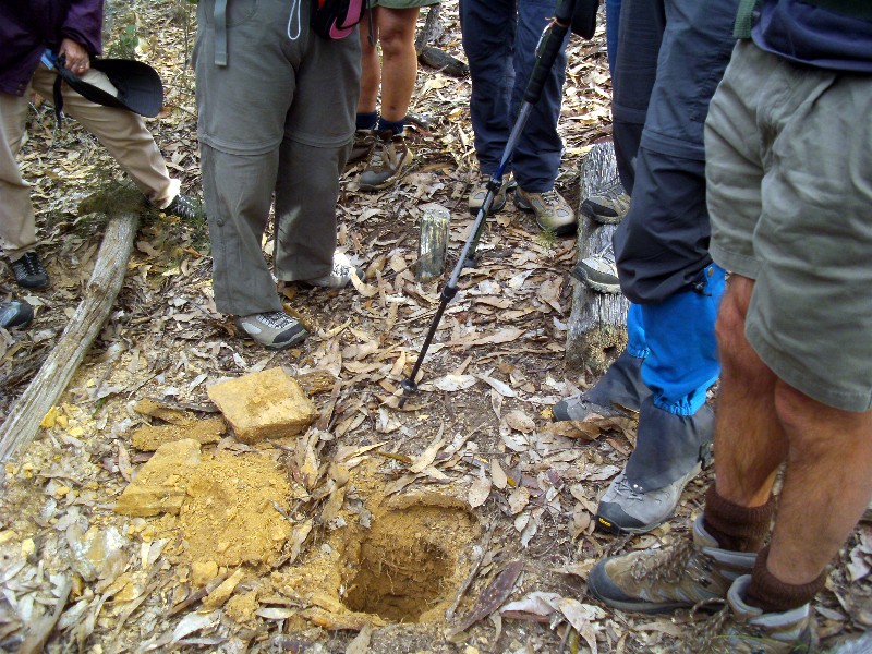
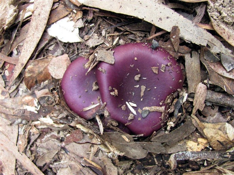
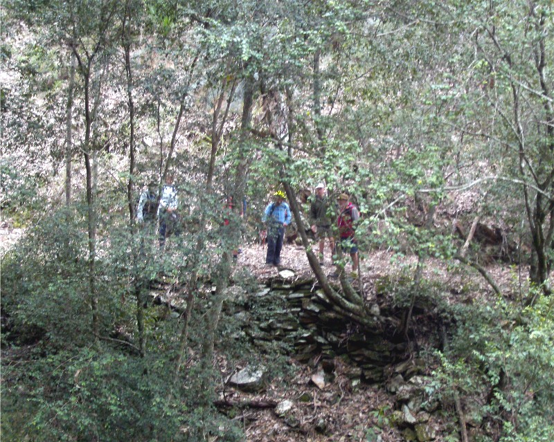
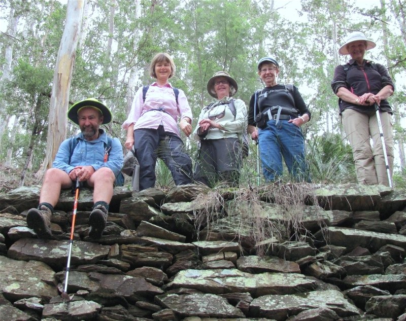
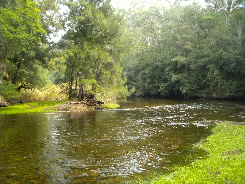
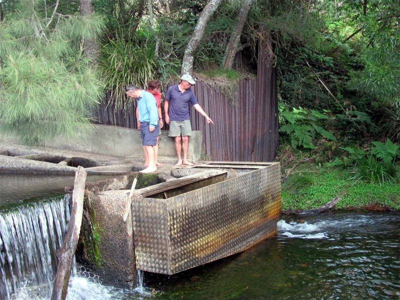
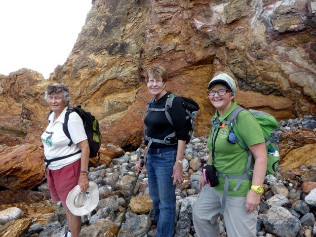
Quartpot Road to an Old Road Area near Buckenboura River
Sunday 18 May 2014
 |
 |
 |
| Hole in the ground with boots aka original State Forest boundary survey peg Photo by Karen M Click on thumbnail to enlarge photo |
One of the many types of fungus found on the walk Photo by Helen Click on thumbnail to enlarge photo |
Abandoned roadway through bush Photo by Karen M Click on thumbnail to enlarge photo |
 |
 |
 |
| Dave, Jane, Mary, Lesley and Karen on retaining wall of abandoned road Photo by Helen Click on thumbnail to enlarge photo |
The view at lunch Photo by Karen M Click on thumbnail to enlarge photo |
Dave, Glenn and Martin inspecting the fish ladders at Buckenboura Weir Photo by Helen Click on thumbnail to enlarge photo |
We had a very informative and enjoyable walk along part of the old South Coast Route from Sydney on 18 May. Dave, our leader showed us old maps and surveying points (buried metal pipes and wooden marker posts) used along the route and a large part of the stone retaining wall for the road, built by hand over 100 years ago. We had a lovely spot by the Buckenboura River for our picnic lunch watching the tide come in and photographed the many interesting toadstools that were still "flowering".
A short detour to the fish ladders at Buckenboura weir on the way back completed our historic walk.
Helen
Lemon Tree Creek
Thursday 15 May 2014
No report received
Tomakin Mini Trek
Saturday 10 May 2014
 |
 |
 |
| Rockhoppers Photo by Donna Click on thumbnail to enlarge photo |
Another gorgeous autumn day Photo by Donna Click on thumbnail to enlarge photo |
Ainslie, Lesley and Kay Photo by Donna Click on thumbnail to enlarge photo |
No report received
Forest Circuit around Mogo Old Town
Wednesday 7 May 2014
No report received
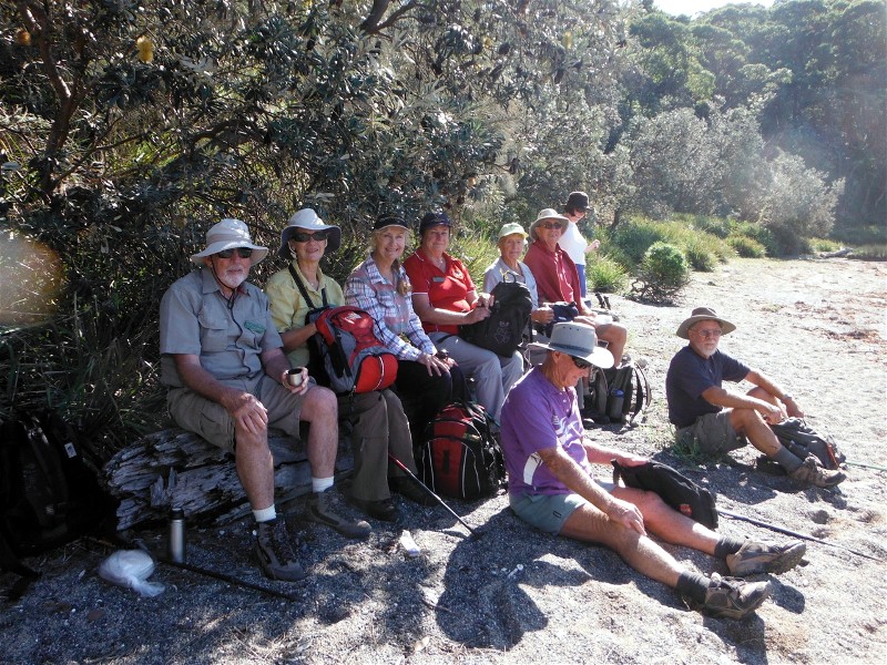
Bus trip to the National Arboretum in Canberra
Sunday 4 May 2014
This event was attended by 23 bushwalkers, who from all feedback, thoroughly enjoyed it. We travelled very comfortably in a 28 seater coach supplied by Rixons, who also served morning tea in Braidwood of fresh baked slices and a hot cuppa.
On arrival at the Arboretum we were met by a guide for a prearranged tour - a must to get the most out of the day. We were blessed with a sunny clear day until the last half hour when we were reminded just how bitter the wind can be when you decide to go up the Clyde Mountain.
Lunch was had at the Arboretum's Sprout Cafe and was delectable.
Kay
Car Camp at Bendethera
Friday 2 May - Monday 5 May 2014
Cancelled
Durras Lake and Coastal Highlights
Thursday 1 May 2014
 |
 |
 |
| Lunch in autumn sunshine Photo by Brian Click on thumbnail to enlarge photo |
What a gentleman - Geoff and Elizabeth Photo by Brian Click on thumbnail to enlarge photo |
Sandstone arch Photo by Brian Click on thumbnail to enlarge photo |
Nine walkers set out from South Durras near Murramarang Resort to complete an interesting circuit that took us along Cookies Beach and through bush tracks to Durras Lake where we had morning tea. As we walked Geoff showed us historical points of interest including the tram track, axle and a boiler from the timber industry of the area. It was a perfect day for walking - clear skies and a gentle breeze.
Continuing through South Durras and into Murramarang National Park, the majestic spotted gums with an understory of burrawangs were noted. A deep purple 'flag' lily and large red burrawang seed pods made a contrast. Lunch was at Dark Beach and a log provided the perfect place from where a soaring sea eagle was spotted.
After lunch the group split into two - those who chose the rocks with interesting geological formations and those who chose the headland where a group of kangaroos were noted. Meeting up at the end of the rock platform we all continued along the beach and back to our cars, having walked thirteen kilometres of very diverse scenery on a perfect day.
Thank you Geoff & Elizabeth
Marilyn
Pebbly Beach to Kioloa and Return
Saturday 26 April 2014
I remember walking along the coast from Pebbly Beach to Pretty Beach over thirty years ago when there was very little of the present track. In recent years the National Parks and Wildlife Service has improved eroded sections of the track with steps, but there are still sections where there is no track. This was where our group of thirteen was slowed down considerably as they clambered over quirky rocks, from jagged boulders to large rounded stones. All the way we enjoyed glimpses of bays through forest trees.
When we arrived at civilisation in the form of flush toilets and picnic tables
at Pretty Beach, we were ready for lunch. From here is a wonderful view south to
Point Upright, Burrewarra Point, and in the hazy distance Mt Dromedary. As it was
already 12.30 we agreed with our leader Len that we skip the next bit on the
program to Kioloa, and start our return to Pebbly.
Ainslie
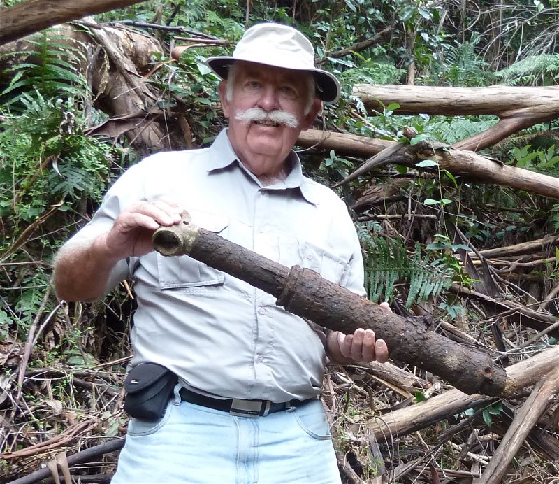
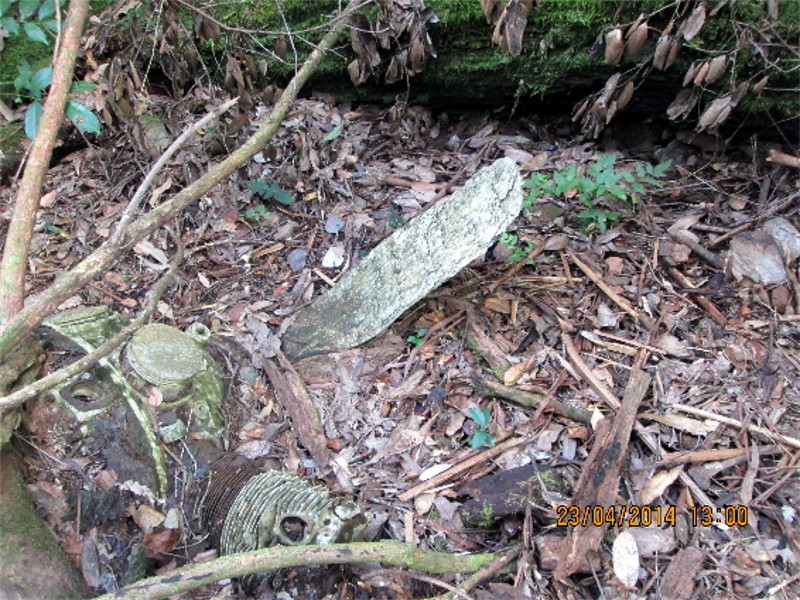
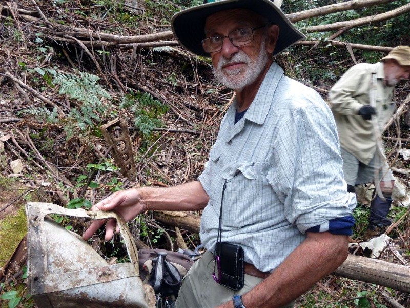
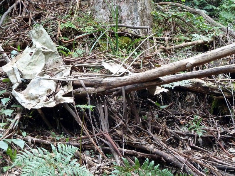
Search for Wreck Site of WW2 Avro Anson Aircraft
Wednesday 23 April 2014
 |
 |
 |
| David on the side of Pigeon House Photo by Charles Click on thumbnail to enlarge photo |
David, Bob T and Bob B on the slippery slope Photo by Charles Click on thumbnail to enlarge photo |
Charles with what appears to be a section of the forward hydraulic landing gear Photo by Bob T Click on thumbnail to enlarge photo |
 |
 |
 |
| Engine with propeller attached Photo by David Click on thumbnail to enlarge photo |
Stan Photo by Charles Click on thumbnail to enlarge photo |
A poignant symbol of a tragic accident Photo by Bob T Click on thumbnail to enlarge photo |
During bad weather on the 9 September 1943, an Avro Anson Mark 1 (registration AW799 from No 73 Squadron RAAF Nowra Base) crashed on the south-east side of Pigeon House Mountain, 16 kilometres west of Ulladulla.
Three crew; Flight Sergeant Robertson (pilot), Flight Sergeant Richards (wireless operator) and Flight Sergeant Higgins (navigator) were killed on impact. Records remark on the difficulty of recovering the remains at that time due to the rough terrain. Slopes in this area are between 40 and 45 degrees and comprise loose scree and plant debris.
A RAAF expedition, charged with locating the crash site was undertaken on 22 October 2003 and the wreck located, however, due to the inexplicable instrument failure of two GPS units, the site location was not correctly recorded.
Five members of Batemans Bay Bushwalking Club undertook a walk on Wednesday 23 April 2014 to attempt to reach the wreckage.
The terrain is tortuous with many feet-tangling grasses, lawyer vine, loose scree and impassable rock formations encountered. The total walk was somewhere between 3 and 4 kilometres but took five hours to complete.
The remnants of the plane were found just one hundred metres from the RAAF recorded (incorrectly) nominated site, but the foliage was so dense, vision was restricted to 10 to 20 metres and could have been easily missed.
The wreckage was scattered over a wide area and included the remains of two
engines, one with propeller attached, numerous pieces of aluminium fuselage,
fuel tank and fuel lines.
Charles
Upper Durras Lake and Benandarah Creek
Thursday 17 April 2014
 |
 |
 |
| The smiling Bhuddas, Lesley, Sharon & Joe Photo by Donna Click on thumbnail to enlarge photo |
Susan, Lesley and Doug Photo by Donna Click on thumbnail to enlarge photo |
The purple brigade Photo by Donna Click on thumbnail to enlarge photo |
No report received
Corang Cascades
Sunday 13 April 2014
Cancelled due to bad weather - will be on again next Program
Ringlands Circuit Narooma
Wednesday 9 April 2014
 |
| Jean, Karen, Rodney, Bev and Joan in Flying Fox Rainforest Photo by Joan Click on thumbnail to enlarge photo |
Our leader Karen took us on a slightly different version of this old favourite walk. Local resident and Club member Wendy came along to fill us in on the historic landmarks along the way, and also showed us through her newly planted native garden halfway along the track.
Most of this walk runs along the banks of Wagonga Inlet and ends up in Flying Fox
Bay where there is a surprising pocket of rainforest, complete with strangler figs, birds
nest ferns and stinger trees over a carpet of ferns.
Karen M
Carters Creek & Wallaby Road
Sunday 6 April 2014
No report received