Third Quarter 2014. See below for
Walk Reports and Photos
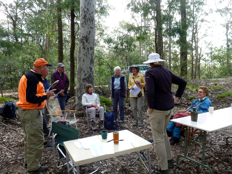
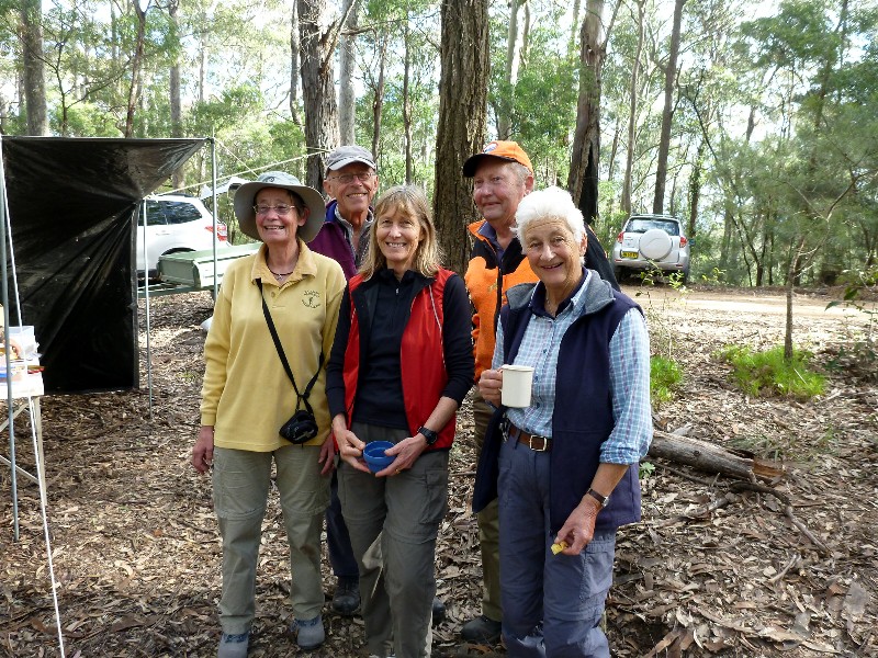
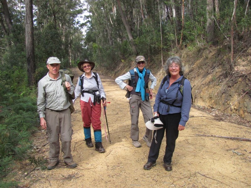
Walk Reports and Photos for Winter 2014. Click on walk headings below, or simply scroll down the page.
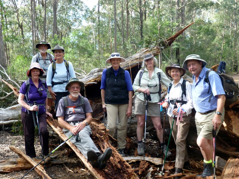
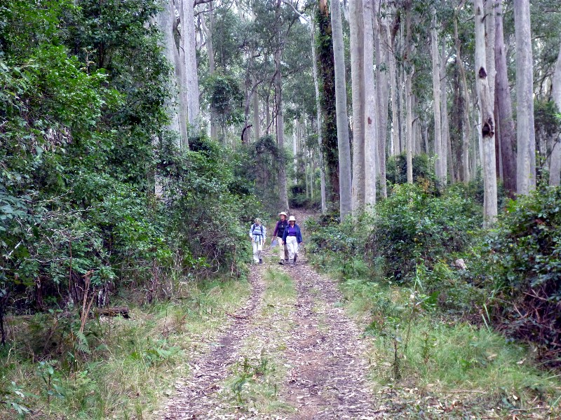
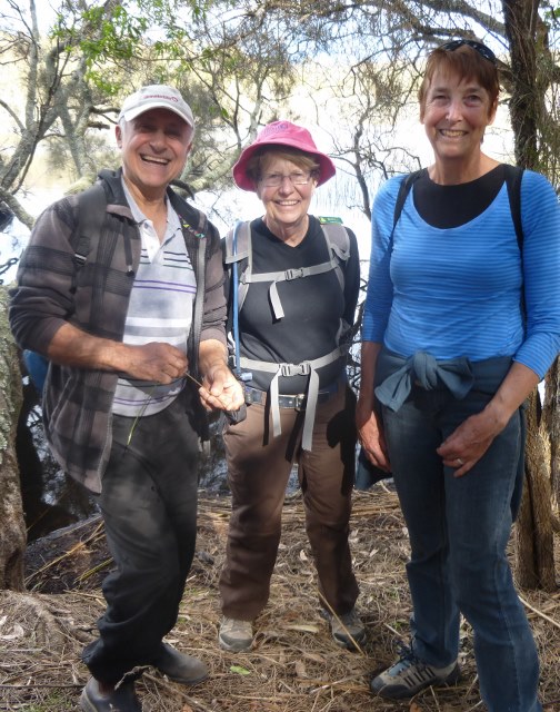
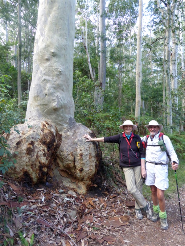
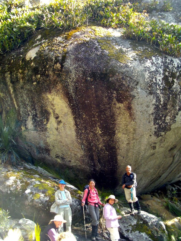
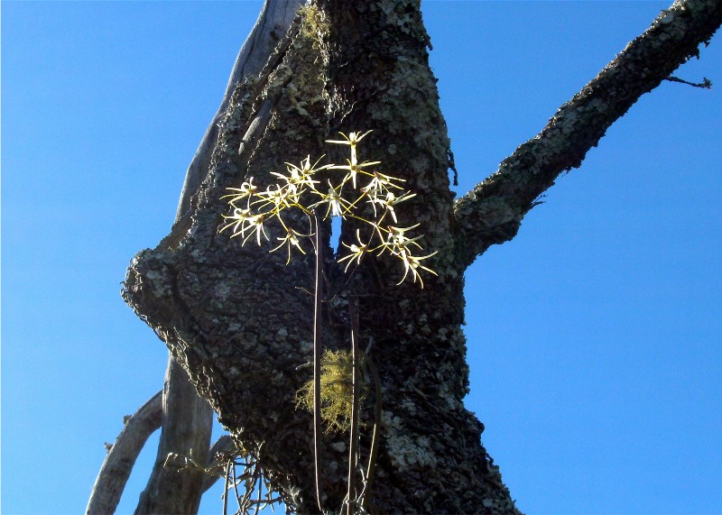
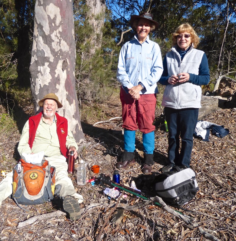
Nelligen Area - Dry Creek Walking and Rock Orchids, Sunday 28 September 2014
Ulladulla Ramble, Wednesday 24 September 2014
Spring Creek Fire Trail, Sunday 21 September 2014
Cockwhy Ridge, Thursday 18 September 2014
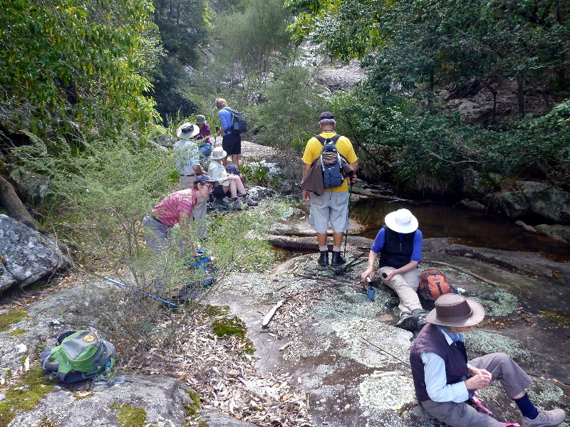
Corang Cascades, Saturday 13 September 2014
Bushtracks of Bergalia, Wednesday 10 September 2014
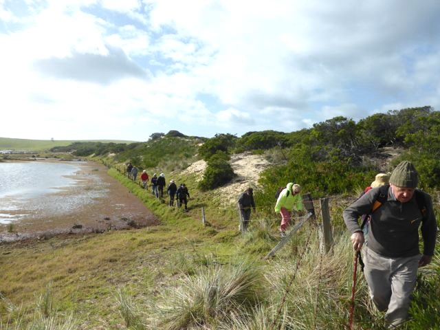
Long Beach to beyond Reef Point via Beaches and Cliffs, Sunday 7 September 2014
Annual Rogaine, Thursday 4 September 2014
Murramarang National Park Bush and Beach, Wednesday 13 August 2014
Pigeon House Mountain WW2 Aircraft Crash Site, Sunday 24 August 2014
No Name Mountain, Thursday 21 August 2014
Pig Road and Currowan Creek, Saturday 16 August 2014
Durras Lake Walking Trail, Wednesday 13 August 2014
Pack Walk to Admiration Point, Friday 8 August - Sunday 10 August 2014
Potato Point and Blackfellows Point Road, Sunday 10 August 2014
Benandarah State Forest, Thursday 7 August 2014
Coila Lake and Coila Creek Paddle, Wednesday 6 August 2014
Coles Creek Caves, Saturday 2 August 2014
Broulee Island and Beach to Mossy Point, Wednesday 30 July 2014
Bolaro Mountain Granite Tor Tour, Wednesday 30 July 2014
Durras Lake Paddle, Monday 28 July 2014
Deep Creek Dam Circumnavigation, Sunday 27 July 2014
Exploring West Nelligen, Thursday 24 July 2014
Sherringham Farm, Saturday 19 July 2014
North Head and Northwards, Wednesday 16 July 2014
Malabar Circuit, Sunday 13 July 2014
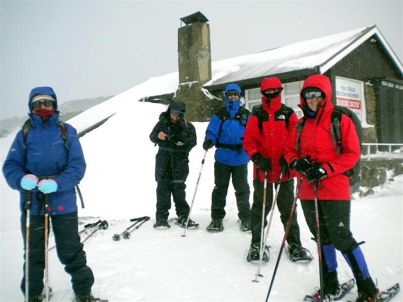
Snow Shoe Walking from Jindabyne Camp, Friday 11 - Sunday 13 July 2014
Bengello Beach Track to Moruya Airport and Return, Thursday 10 July 2014
Nelligen Area - Dry Creek Walking and Rock Orchids
Sunday 28 September 2014
Postponed - Shooters registered to hunt in forest on day of walk.
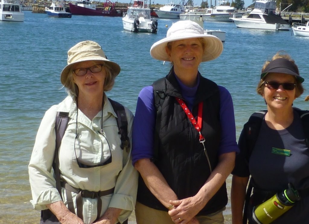
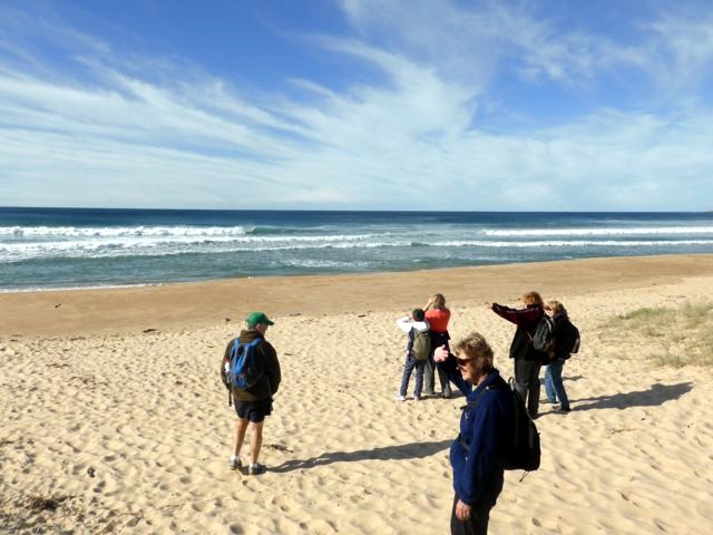
Ulladulla Ramble
Wednesday 24 September 2014
 |
 |
 |
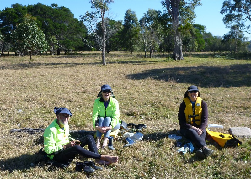
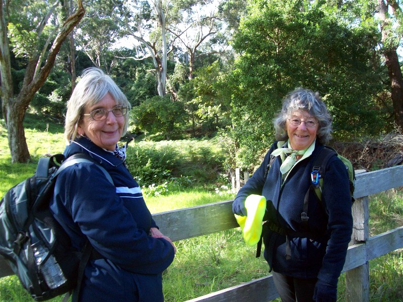
| Mary, Karen and Jill Photo by Karen C Click on thumbnail to enlarge photo |
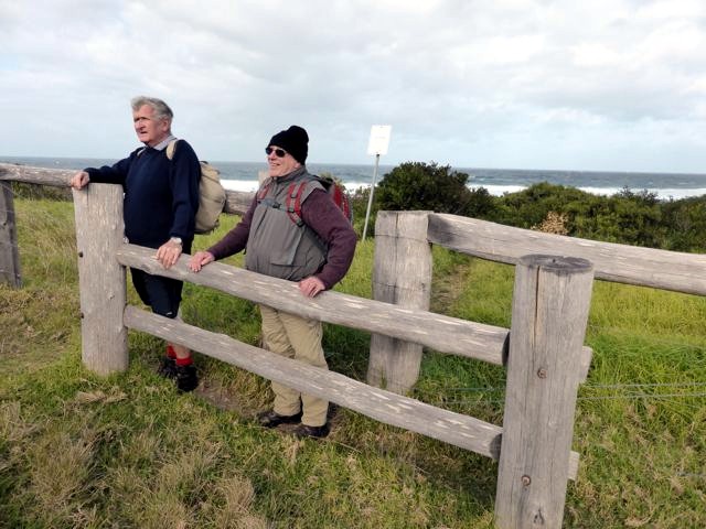
Patrick and Bob Photo by Karen C Click on thumbnail to enlarge photo |
At the Lighthouse Photo by Bob M Click on thumbnail to enlarge photo |
 |
 |
 |
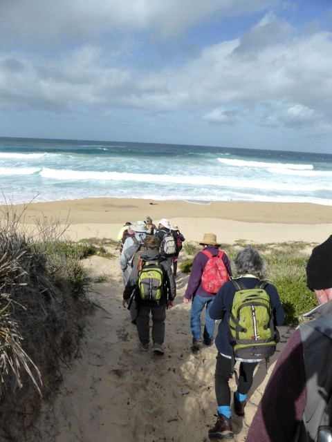
| Lunch overlooking the beach Photo by Bob M Click on thumbnail to enlarge photo |
Looking back on where we walked Photo by Bob M Click on thumbnail to enlarge photo |
Pigeon House looms Photo by Bob M Click on thumbnail to enlarge photo |
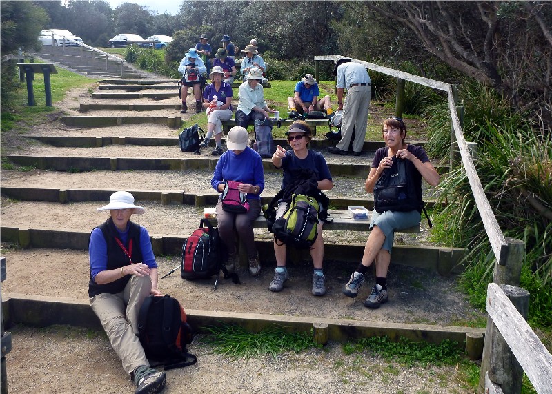
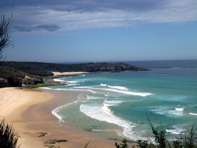
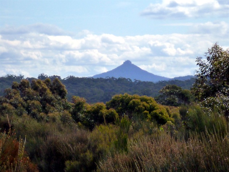
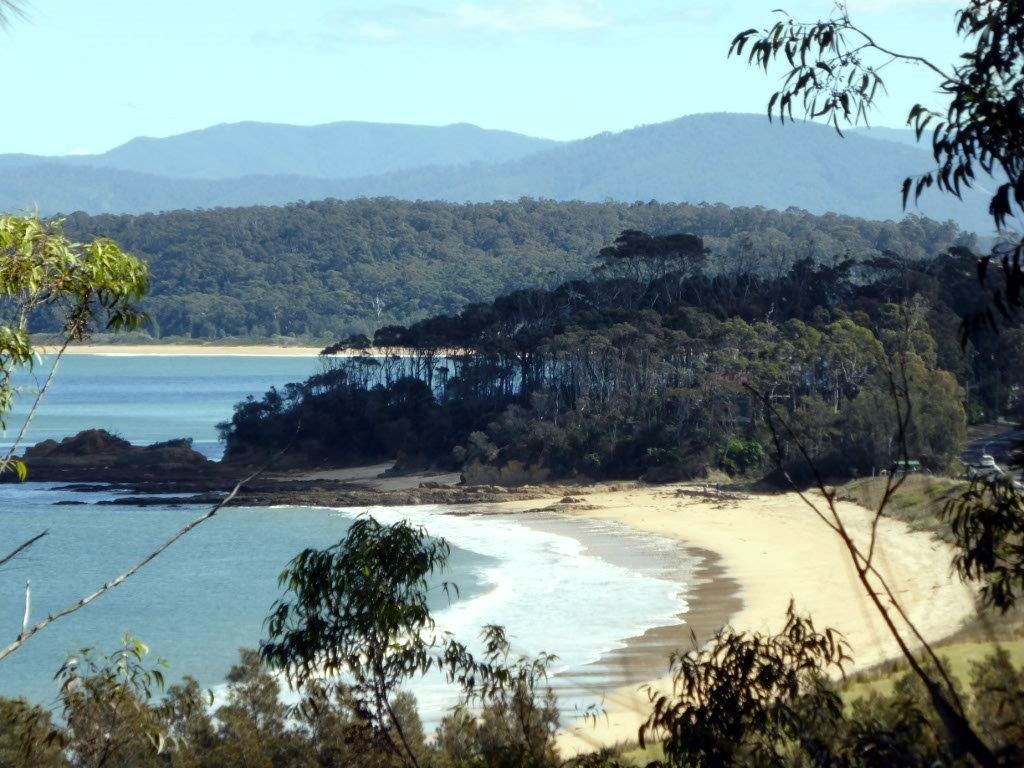
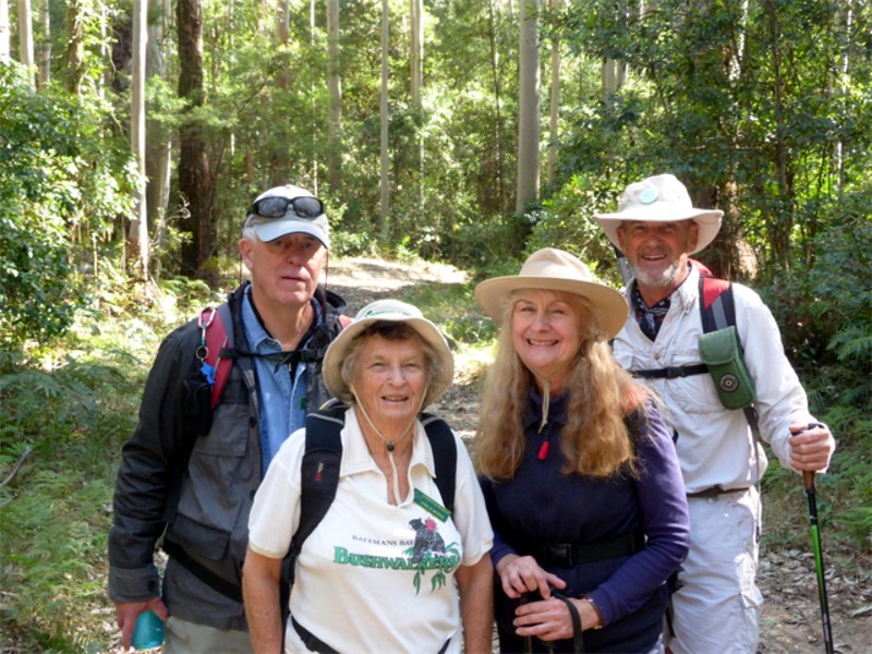
On Wednesday 24 September 15 BBBWalkers enjoyed a wonderful day walking from Millard's Creek, Ulladulla to Blackburn Head, Burrill. Highlights included the "One Track for All" cultural trail, the harbour with its ancient, tessellated rock formations, Warden Head Track and Lighthouse, and the South Pacific Heathland Reserve.
A profusion of flowering plants captivated us all. These ranged from the tiniest orchids, to a giant flowering Turpentine tree growing on the banks of Millard's Creek and, as a special treat, a spectacular waratah found in the South Pacific Heathland.
Trekking the headlands and beaches we enjoyed extensive views as far North as
Jervis Bay, to Montague Island in the South, and clearly defined in the West,
Pigeon House Mountain. This 13 km walk was certainly a winner, well researched
and led by Mary and Stan.
Sharon
Spring Creek Fire Trail
Sunday 21 September 2014
 |
 |
 |
| Descending to the creek Photo by Bob M Click on thumbnail to enlarge photo |
Lunch on Spring creek Photo by Bob M Click on thumbnail to enlarge photo |
Heads down on the hills Photo by Bob M Click on thumbnail to enlarge photo |
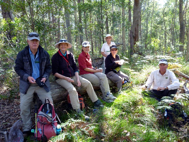
On Sunday 21 September a cheerful band of 15 bushwalkers were led by Betty to Spring Creek. We started off in bright sunshine at 9.30am and, after a pleasant wander, reached a pretty rock platform on Spring Creek for lunch at noon.
The creek was flowing in a dazzling, sunlit stream as it tumbled down a series of
small waterfalls. We saw flowering rock orchids and bright pink Indigophera. We
all enjoyed the exercise provided by the ups and downs of the 10km walk, and
Betty was warmly thanked for guiding us all so expertly.
Bob M
Cockwhy Ridge
Thursday 18 September 2014
 |
 |
| Regenerating forest Photo by Bob M Click on thumbnail to enlarge photo |
Betty and wattle Photo by Bob M Click on thumbnail to enlarge photo |
A brilliant Spring Thursday and 10 keen bushwalkers were out to do a 12km circuit walk on tracks and trails behind East Lynne. We walked through open forest, regenerating logged areas, and moist remnant rainforest gullies. Along the way there were wildflowers in profusion, great for keen photographers. Spring is just the best time of year to see the wonderful variety of flora in our woodlands. Purple Prostanthera species, red Kennedia rubicunda twining over ground and bushes, yellow Acacia and an abundance of cream Zieria caducibracteata to name just a few.
The challenge of crossing a creek, flowing fast after all our lovely rain, faced the group and most managed to get across without getting too wet. A steep uphill walk followed to a sunny clearing with lots of logs as seating and the warmth of sun to help dry the odd damp shoes, socks and trousers while we enjoyed lunch.
Later as we walked up one of the many tracks, we spotted a glimpse of white flowering small trees and discussion ensued regarding identification. It was thought to be Phebalium squameum, the common name being Satinwood.
An interesting enjoyable walk, which ended with optional afternoon tea at
East Lynne Store, thanks to Leader Val for a lovely day.
Karen C
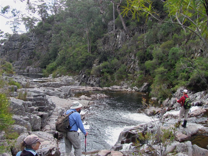
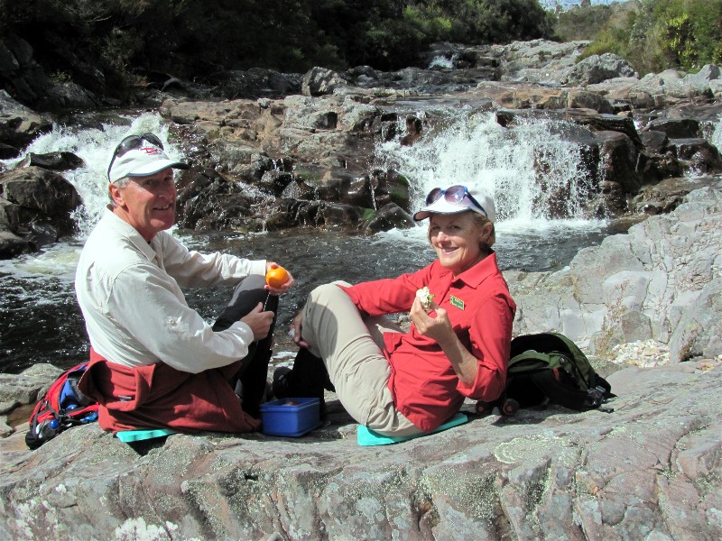
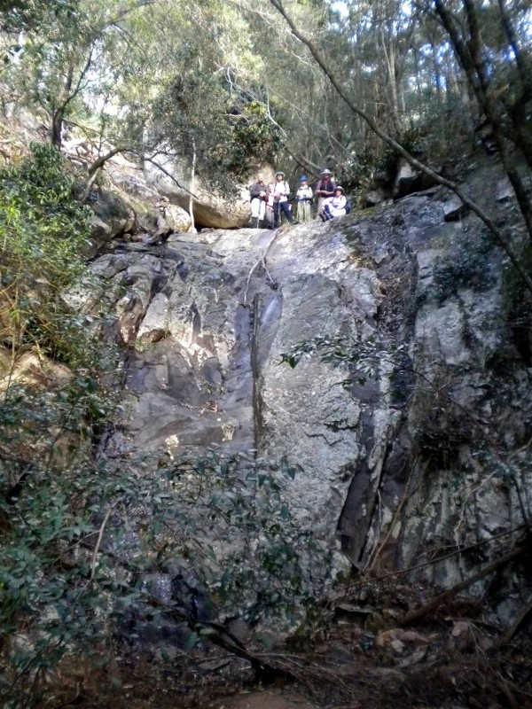
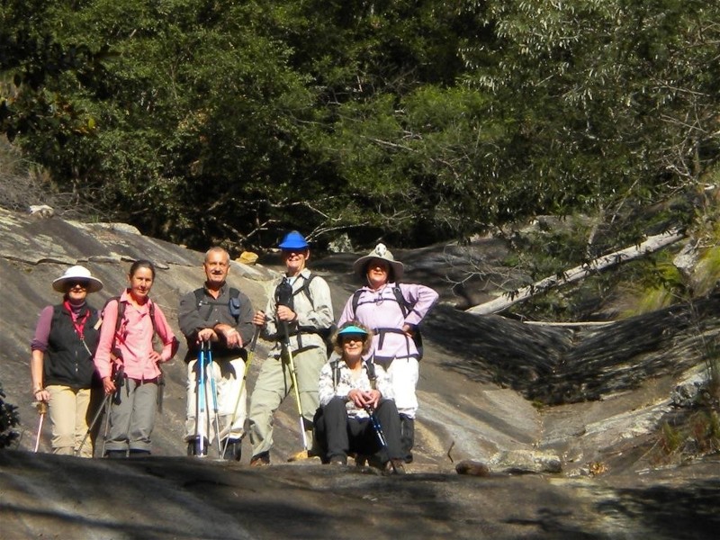
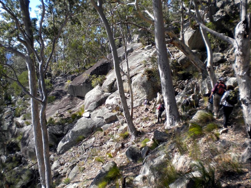
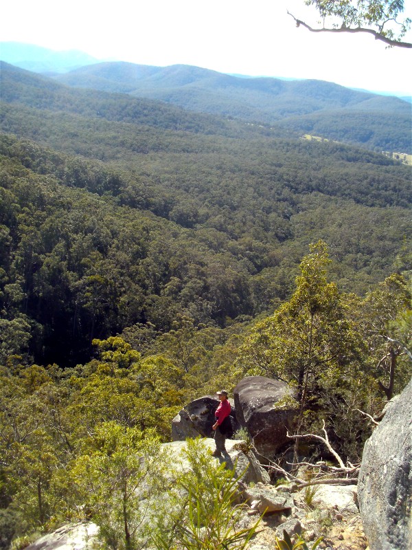
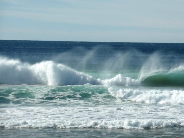
Corang Cascades
Saturday 13 September 2014
 |
 |
 |
| Corang Cascades Photo by Helen Click on thumbnail to enlarge photo |
Brian and Chris Photo by Helen Click on thumbnail to enlarge photo |
Brian, Chris, Len, Helen, Martin and Val Photo by Helen Click on thumbnail to enlarge photo |
Whilst many Batemans Bay Bushwalkers were holidaying in Vanuatu, six of us headed for a more local, but just as classic destination, Corang Cascades. Whereas Vanuatu has warm clear blue coastal waters, Corang Cascades have clear fresh running waters, just what a hot bushwalker needs to cool off!
The outward journey was pleasantly cool and cloudy and the emerging spring flowers (iris, hakea, heath, pea, grevillea and hardenbergia) were much admired along with some old knarled trees and large conglomerate rock formations. Three creek crossings requiring a little careful footwork were easily negotiated and we were glad of long sleeves as we followed the path through stands of tea trees. The sun came out, we heard the waterfalls as we approached, and the cascades were beautiful in full flow. Three of us enjoyed a quick dip in the invigorating pools before lunch at a perfect spot by the river.
The return journey meant retracing our steps back to the cars at Wog Wog. An
excellent full day of walking in Morton National Park.
Helen
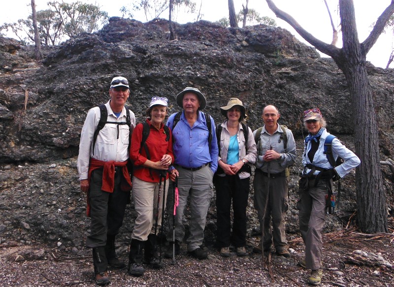
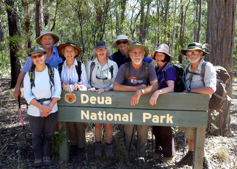
Bushtracks of Bergalia
Wednesday 10 September 2014
 |
 |
 |
| The creeks were flowing Photo by Bob M Click on thumbnail to enlarge photo |
Deua National Park Photo by Bob M Click on thumbnail to enlarge photo |
Smashed coastal grey box over Dwyers Creek Road Photo by Bob M Click on thumbnail to enlarge photo |
After a night of constant rain 9 bushwalkers set out for the Deua National Park, and State Forests surrounding Dwyers Creek for a 14 kilometre circuit up ridges and through gullies. We were surprised that the country wasn't a lot wetter after all the recent rain - some of the creeks were still reasonably dry, although there was a lot more water in Dwyers Creek than we had seen for a long time.
The bower wattles were in full bloom, as was the pink boronia, and the Pomaderris and
Philotheca buds were just about to burst. The walk ended on Dwyers Creek Road where
a huge coastal grey box gum tree had smashed itself into giant shards of wood blocking
the road.
Karen M
Long Beach to beyond Reef Point via Beaches and Cliffs
Sunday 7 September 2014
 |
 |
 |
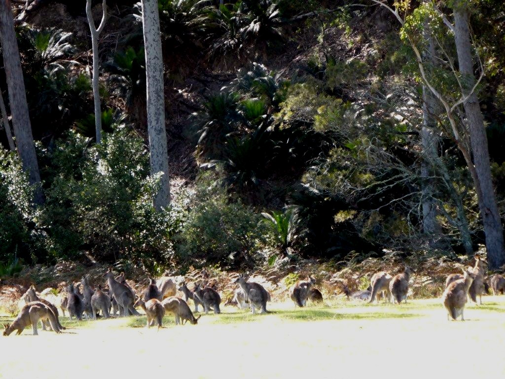
| Maloneys Beach Photo by Kay Click on thumbnail to enlarge photo |
Kangaroos at Maloneys Photo by Kay Click on thumbnail to enlarge photo |
Mark and Wendy Photo by Kay Click on thumbnail to enlarge photo |
On a glorious spring day a small group of Bay Bushwalkers chose to
spend Fathers Day hiking from Long Beach to Reef Point via beaches and
cliffs. Highlights were a detour through the burrawangs of Murramarang National Park
and some delicate rock scrambling over the multi-coloured sediment rock
of Acheron Ledge. A pair of dolphins came in to have a peep at us
while lunching at Reef Point.
Nancy
Annual Rogaine
Thursday 4 September 2014
 |
 |
 |
| Susan, Karen and Karen Photo by Bob M Click on thumbnail to enlarge photo |
Len announcing the scores Photo by Bob M Click on thumbnail to enlarge photo |
The winners Jan, Jan, Wendy and Jo with Len Photo by Bob M Click on thumbnail to enlarge photo |
The Batemans Bay Bushwalkers Annual Rogaine was held in the forest south of Durras on Thursday 4 September. Each year, the Rogaine's founder Len sets out, with help from other club members, a treasure hunt with a difference. This year 3 teams of bushwalkers spent 6 hours seeing how many of the widely dispersed controls they could find. Points are earned with each control "bagged", with the more difficult-to-locate controls earning the highest points.
The winning team this year was the from the Narooma Dalmeny Bushwalkers Club
(not to be ever invited again!) who scored a remarkable 274 points. All who
took part in the Rogaine enjoyed the experience and expressed their thanks to
Len for organising this excellent bushwalking event.
Bob M
Murramarang National Park Bush and Beach
Wednesday 13 August 2014
Cancelled due to bad weather
Pigeon House Mountain WW2 Aircraft Crash Site
Sunday 24 August 2014
Fewer than 4 members - unofficial walk
No Name Mountain
Thursday 21 August 2014
Walk cancelled
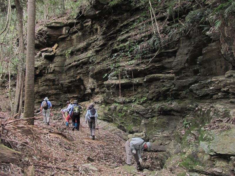
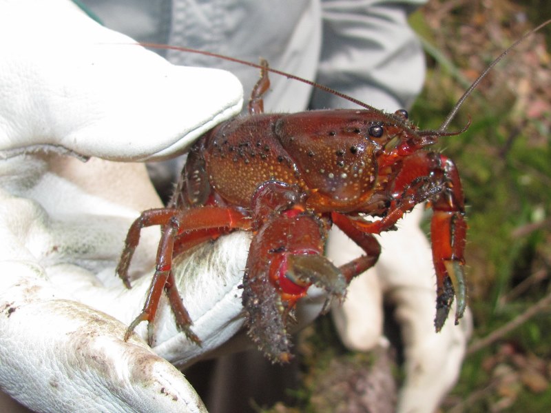
Pig Road and Currowan Creek
Saturday 16 August 2014
 |
 |
 |
| Strolling along Pig Road Photo by Helen Click on thumbnail to enlarge photo |
Martin, Betty, Val and Pat Photo by Helen Click on thumbnail to enlarge photo |
Val having a rest Photo by Helen Click on thumbnail to enlarge photo |
 |
 |
 |
| Rockfaces of Currowan Creek Photo by Helen Click on thumbnail to enlarge photo |
Yabby Photo by Helen Click on thumbnail to enlarge photo |
Look, dry feet! Photo by Helen Click on thumbnail to enlarge photo |
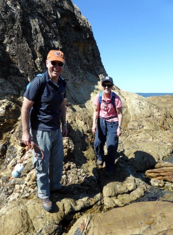
Undeterred by the forecast of rain and the risk of wet feet from creek walking, six keen walkers took to the hills of Pig Road, Wallaby Road and No 4 Logging Road. We were rewarded by an excellent cardio-vascular workout (Pig Road was all uphill), gullies of lush vegetation, warm sunshine, absolutely no rain and perfectly dry feet as the creek was not flowing.
Our leaders saved the best till last when we walked in and by the upper reaches of
Currowan Creek which contained a few clear pools of water and had some dramatic rock
faces on its bends. An interesting discovery was a defiant yabby (carefully handled
with gloves on) and some orchids (yet to flower) entwined with a delicate air plant.
We spotted a black wallaby, we collected only one leech (that we were aware of) and no
pigs were seen. An excellent day out, thank you.
Helen and Martin
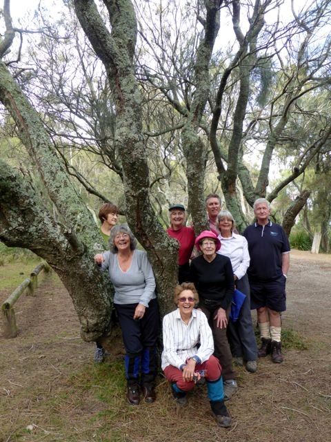
Durras Lake Walking Trail
Wednesday 13 August 2014
 |
| Helen, Elizabeth and Anne get a bird's eye view Photo by Joan Click on thumbnail to enlarge photo |
Murramarang National Park in the North Durras forest provided the Batemans Bay Bushwalkers with a very pleasant easy walk of 8km led by Joan. The walk along the North Durras Lake Trail leads from a small carpark about 2km from the highway on Mt Agony Road around the lake to the well marked popular Discovery Trail. This trail introduces walkers to many types of large trees (preserved by timber fellers of bygone years) and also includes a grove of Cabbage Palms as well as Dendrobium teretifolium (Rat's Tail Orchid) hanging on the trunks of lakeside Casuarina trees.
The 16 walkers enjoyed their 4 hours in the rather cool breeze and occasional welcome
sunshine.
Pack walk to Admiration Point
Friday 8 August - Saturday 10 August 2014
 |
 |
 |
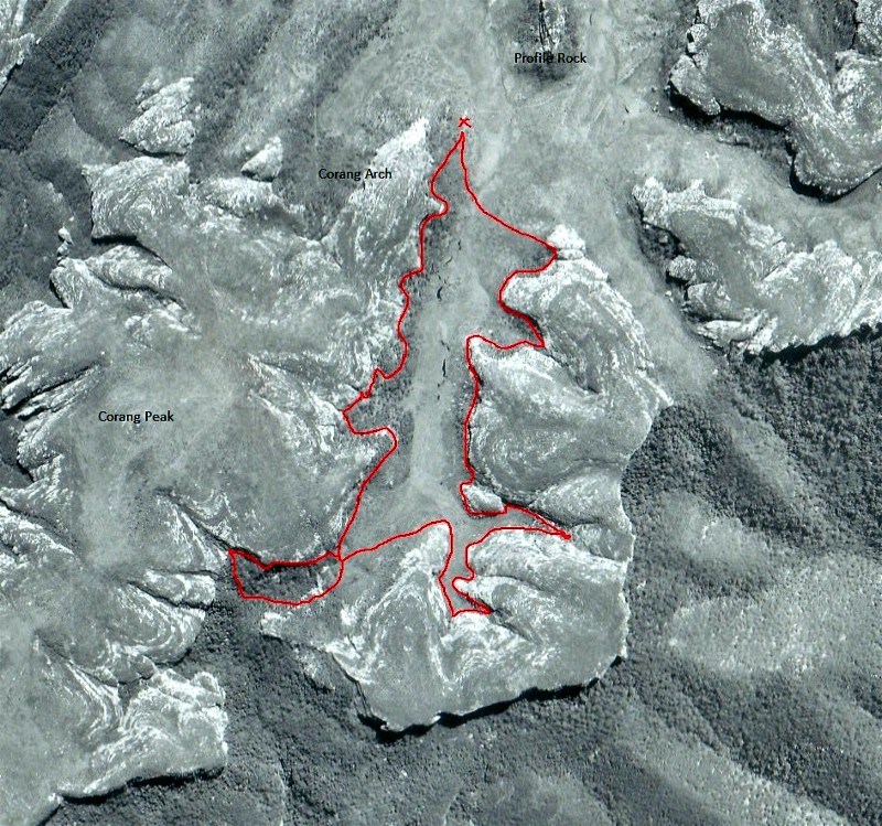
| Aerial photo showing route of cliffline exploration Photo supplied by Ian Click on thumbnail to enlarge photo |
Ian, Wendy & Bronwyn in burnt scrub Photo by David Click on thumbnail to enlarge photo |
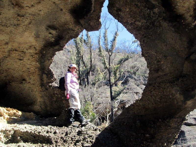
Wendy in map of Australia cave Photo by David Click on thumbnail to enlarge photo |
 |
 |
 |
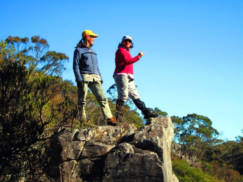
| Wendy & Bronwyn at Corang River rock Photo by David Click on thumbnail to enlarge photo |
David contemplates extensive honeycombing in the conglomerate Photo by Ian Click on thumbnail to enlarge photo |
Three grubs, Bronwyn, David & Wendy, after a hard days exploring Photo by Ian Click on thumbnail to enlarge photo |
This three day walk in the western Budawangs was planned to take advantage of a wildfire which swept northwards from the Yadboro River last summer, running over the escarpment in the vicinity of Corang Peak and pulling up at the Corang River. For a few brief years, until the scrub starts to take over again, there is opportunity to explore more easily those areas off track which are of interest to us. This walk was originally planned to traverse the cliffline under Admiration Point but the headwaters of Canowie Brook eventually became the focus and that is where we went.
Four Club members, Wendy, Dave, Bronwyn and Ian left Wog Wog carpark under sunny skies and a cooling light breeze - perfect walking conditions. The effect of the fire was very evident. With much of the undergrowth removed the track is easier to walk than normal and thankfully most of the boardwalk is still in good condition.
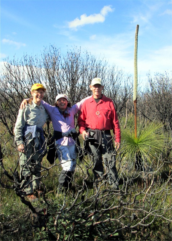
We lunched at the eastern end of Korra Hill and, leaving our packs, weaved our way through the blackened skeletons of Banksias and Hakeas to Admiration Point, picking up the old 1980's track along the way. New growth is already sprouting and the grass trees were in full bloom, their flower spikes impressively large and heavily visited by honey bees. The view southward from the Point to Wirritin and Currockbilly Mountains and east to the Clyde valley is extensive and grand but recommended only while the scrub en route is minimal.
We pressed onward to the end of the Corang Arch ridge. Along the way the removal of much of the scrub opened up magnificent views northward of the Budawangs plateau. In the early afternoon we set a comfortable base camp at the Canowie Brook camp site on the main track and then spent two hours until sunset exploring the cliffline nearby. We noted the relatively unused camp overhangs there.
After a chilly night and cold misty morning on a rising northwest breeze, with only day packs, we crossed the extensive grassy swamplands and for six hours explored the upper catchment of Canowie Brook (see aerial photo). We started on the eastern line of cliffs and overhangs, pushing up every valley and gully. Some of the overhangs were enormous, many with extensive "beaches" beneath. The honeycombing in the conglomerate rock is some of the best yet seen in the Budawangs. One very cosy "room" in particular had three windows, two with balconies, as well as a door.
We explored 6 kilometres of cliffline and there were many camp caves available but none showing any sign of previous habitation except by the locals - a metropolis of wombats who appear to feed nocturnally on the large grassy swamplands in the valley below.
The wildfire intensity was sufficient to remove all the ground litter as well as the leaves and small branches of the trees. The low level scrub was reduced to either blackened skeletons or to almost ground level, the remnant stems now a sea of short stakes camouflaged with green regrowth - perfect tripping obstacles for weary bushwalkers!
However, without the interfering vegetation the views were now largely uninterrupted and extensive - we often paused to absorb the beauty of the valley. Most of the boggy grasslands also burnt but the regrowth has been fast and luxurious, the plains now a beautiful uniform carpet of green and gold.
We lunched on the edge of the escarpment (technically the Budawang Range which is the watershed of the Shoalhaven and Clyde River catchments). Here, the otherwise imposing cliffline of 50-100 metres in height breaks to a small leap of only tens of metres allowing the traveller one of the few points of entry to the plateau from the Yadboro River valley. By careful selection of a route at GR 373910 we were able to descend through the cliffline into the relative darkness of the rainforested headwaters of Freeman Creek, a steep tributary of the Yadboro River.
In this basin the fire had had much less effect. The going was steep and tough, riddled with house sized boulders long ago departed from the cliffs above. Unfortunately, the base of the cliffline did not hold the interest of its eroding counterparts on the plateau so, although the rainforest was pleasant enough, it was not enough to hold us and, time awasting, we retreated to the grasslands of the Brook. We returned to camp weary and blackened grubs of the fireground.
On the third day we leisurely returned to Wog Wog via the Corang River, stopping to admire the main cascades downstream of its junction with Canowie Brook, always worth the trouble of the rock hopping required.
Although this exercise was initially labelled as an Admiration Point walk, and indeed
we did visit the Point, something we probably won't do again when the scrub returns,
it is more appropriately remembered as a Canowie Brook Headwater Exploration.
Despite the ever present soot and charcoal encountered we were very satisfied
with what we found.
Ian
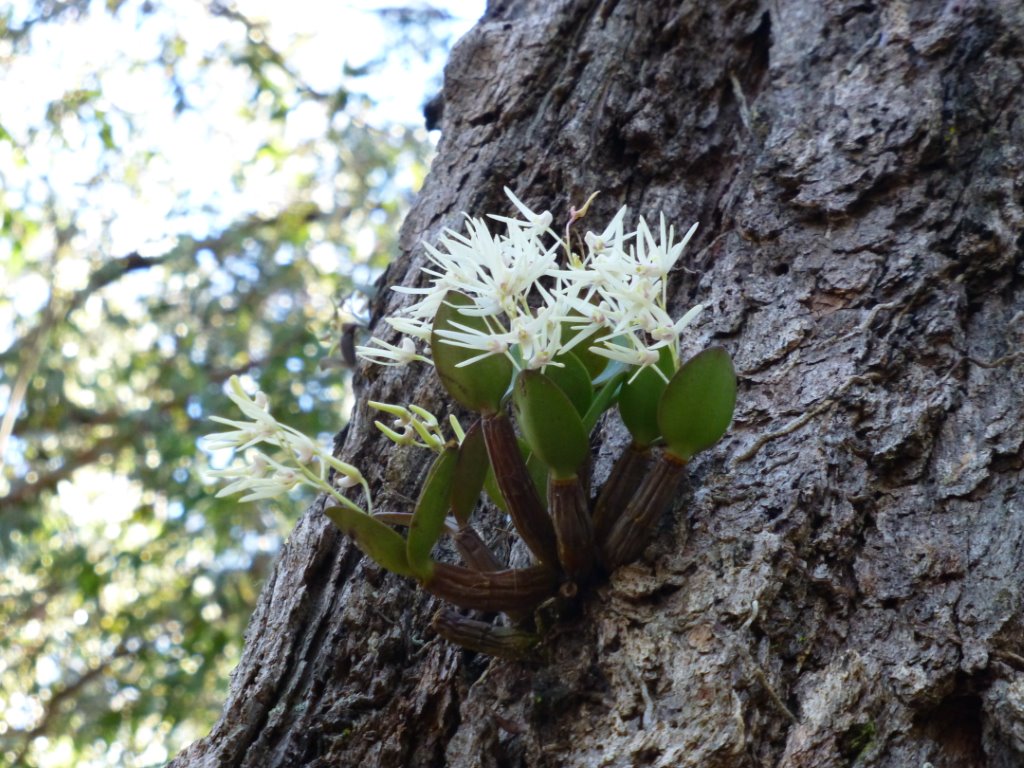
Potato Point and Blackfellows Point Road
Sunday 10 August 2014
 |
 |
| Ironbark orchids Photo by Karen C Click on thumbnail to enlarge photo |
Tony, Lesley & Cathy Photo by Joan Click on thumbnail to enlarge photo |
Last Sunday's walk down at Potato Point was ten kilometres, according to Bob, with Lesley leading the fourteen walkers. A lovely Sunday morning with just a little cool breeze but turning into quite a warmish walk. Stopped for morning tea by the fallen log at the turn off to Lake Brunderee. We walked down to Lake Brunderee, a beautiful sight with some Swans in the middle of the lake and a magnificent looking Sea Eagle riding the thermals above the lake. Quite a lot of Iron Bark growing with the little tiny orchids growing off their bark. After leaving Lake Brunderee we walked down to Tuross Lake where we sat and had lunch.
Thank you all for a lovely, easy and satisfying walk, must have been easy I pulled
up fine this morning.
Tony
Benandarah State Forest
Thursday 7 August 2014
 |
 |
 |
| Karen and Bob Photo by Donna Click on thumbnail to enlarge photo |
Bob C, Ainslie, Carol, Bob M Photo by Donna Click on thumbnail to enlarge photo |
Morning Tea Photo by Bob M Click on thumbnail to enlarge photo |
12 enthusaiastic walkers led by Bob C set off - up hill and over dale. An energetic
walk through beautiful forests featuring towering blue and spotty gums with a few native
cherry trees sprinkled through for good measure. Everyone agreed that this was a
particularly pretty walk, very ably led.
Donna
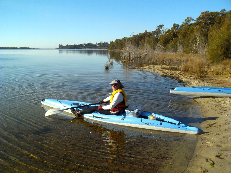
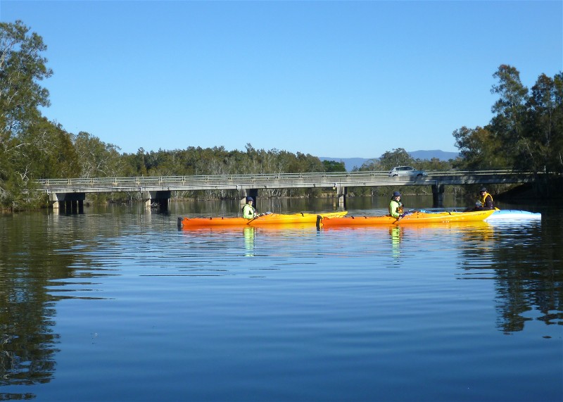
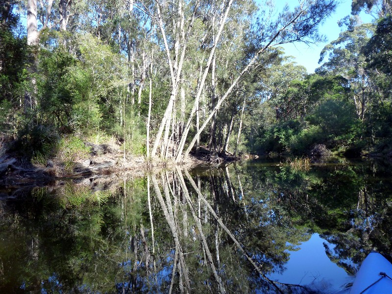
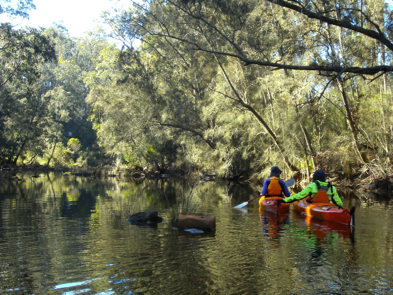
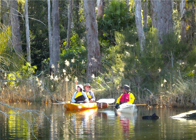
Coila Lake and Coila Creek Paddle
Wednesday 6 August 2014
 |
 |
 |
| Bob launches into Coila Lake Photo by Karen M Click on thumbnail to enlarge photo |
Highway bridge over Coila Creek Photo by Bob M Click on thumbnail to enlarge photo |
Coila Creek reflections Photo by Karen M Click on thumbnail to enlarge photo |
 |
 |
 |
| Mary and Stan Photo by Karen M Click on thumbnail to enlarge photo |
Flooded lagoon by lake Photo by Bob M Click on thumbnail to enlarge photo |
Warm, comfy lunch spot Photo by Bob M Click on thumbnail to enlarge photo |
It was a chilly start for the 4 paddlers who rendezvoused at Coila Lake for a 14 km paddle to the head of the lake and on into Coila Creek.
We soon warmed up, and enjoyed the amazing numbers of different birds which surrounded us in the trees, in the sky, on the banks, and in the water. As we entered the creek and paddled under the highway bridge, we were greeted by great flocks of moorhen on the water, and what appeared to be a juvenile sea eagle being harrassed by magpies and ravens. Further along there were a couple of azure kingfishers flitting along the banks.
We took our time in the creek, as the reflections were just incredible - it was like paddling on a mirror. The water was crystal clear and we were disappointed when we had to turn around at a fallen tree we couldn't get past.
Fortunately we had a very light breeze out on the lake, and nothing at all in the
creek, and a clear blue sunny sky. Another great day to be a Batemans Bay Bushwalker.
Karen M
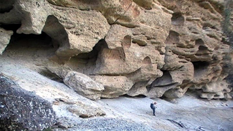
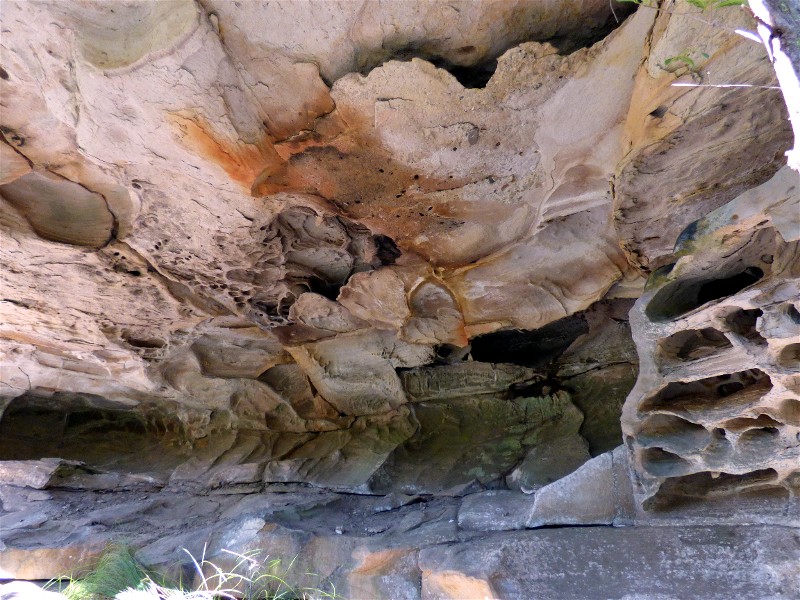
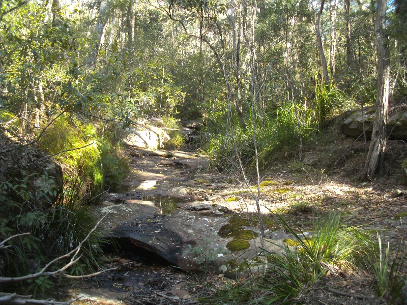
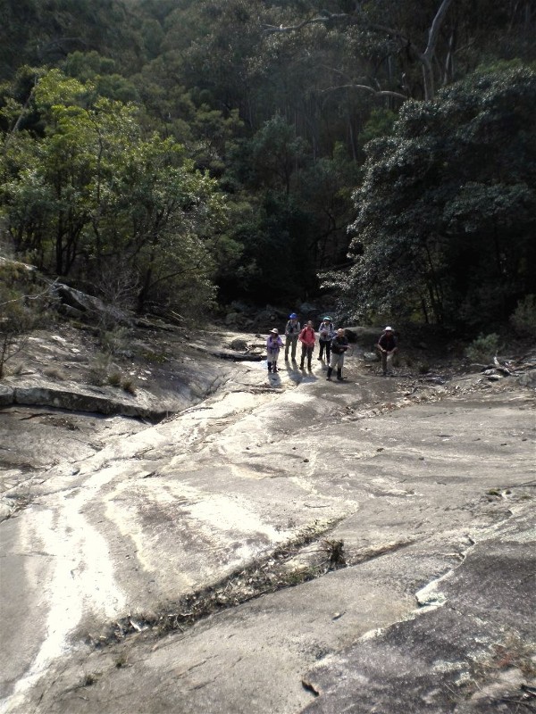
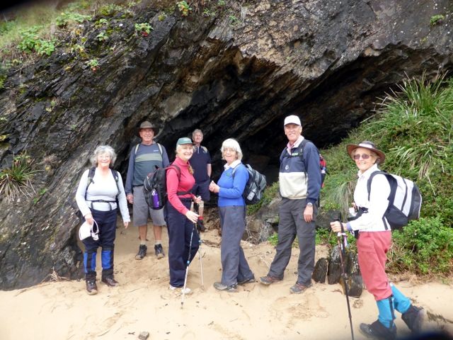
Coles Creek Caves
Saturday 2 August 2014
 |
 |
 |
| Coles Creek Cave Photo by Karen M Click on thumbnail to enlarge photo |
Ancient grinding stone Photo by Karen M Click on thumbnail to enlarge photo |
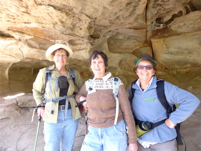
Lesley, Heather and Jill Photo by Donna Click on thumbnail to enlarge photo |
 |
 |
 |
| Weathered sandstone roof of overhang Photo by Nancy Click on thumbnail to enlarge photo |
Lunch overhang Photo by Donna Click on thumbnail to enlarge photo |
Sandstone bed of Coles Creek Photo by Karen M Click on thumbnail to enlarge photo |
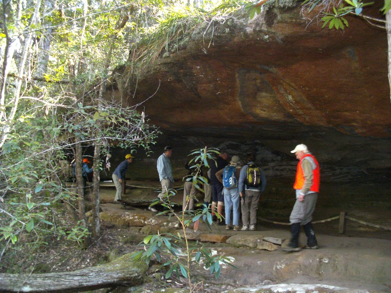
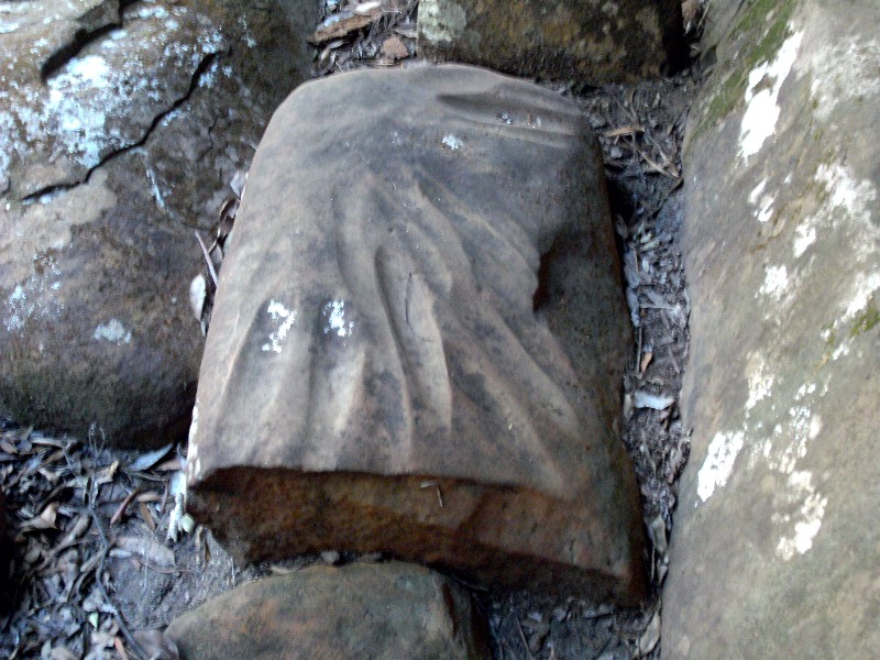
With an air of expectation, 26 members of Batemans Bay Bushwalkers followed Leaders Dennis and Nancy through forest and creek gullies near Conjola to explore the Coles Creek Caves.
After reaching the first and most prominent cave with its rock art and stone tool making site, the group bravely bushbashed through eucalypts, geebungs, grevillea, mountain devils and other native vegetation to find and explore the other caves. Some had small markings, while others had very interesting sandstone formations weather blasted over time.
The return journey was along the picturesque Coles Creek. The Coles Creek
Caves are situated in a culturally sensitive area which should be respected by
all visitors.
Nancy
Broulee Island and Beach to Mossy Point
Wednesday 30 July 2014
14 bushwalkers and 2 young visitors enjoyed a the easy midweek walk around Broulee Island. The weather just lovely, warm enough for all to wear t-shirts.
At our morning break Barbara gave us some history of the Broulee area, which is fascinating, thanks Barbara.
The reward of this walk was to finish at the Muffin Shop where we all
imbibed in the goodies on offer. Thanks to Trish for putting this walk on.
Denise
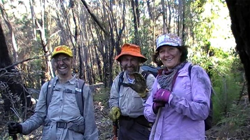
Bolaro Mountain Granite Tor Tour
Wednesday 30 July 2014
 |
 |
 |
| Looking down the giant slide of Bolaro Mountain Falls Photo by Ian Click on thumbnail to enlarge photo |
First drop of Bolaro Mountain Falls Photo by Ian Click on thumbnail to enlarge photo |
Karen, Lynne, Michael, Bronwyn, Lin and Wendy Photo by Ian Click on thumbnail to enlarge photo |
 |
 |
 |
| Traversing the long contour of massive granite slabs and boulders under Bolaro Mountain Photo by Ian Click on thumbnail to enlarge photo |
Ian surveying the view from lunch Photo by Karen M Click on thumbnail to enlarge photo |
Mother of all tors covered in rock orchids Photo by Ian Click on thumbnail to enlarge photo |
Almost to the day, two years ago the Club sampled the granite outcrops on the northern slopes of 650 metre high Mount Bolaro, just west of Batemans Bay. On this occasion we picked up the more spectacular outcroppings under the very picturesque spotted gum and burrawang forest which characterises this area.
Under a sunny sky seven Club members, Michael and Lynne, Karen, Bronwyn, Wendy, Lin and Ian, left Old Bolaro Road with a firm plan in mind. We navigated our way to the base of our first destination - a granite bedrock long cascade which we nicknamed Bolaro Mountain Falls. This long smooth slippery dip drops 100 vertically and the same horizontally. With only a small catchment there was just the remnant of a water trickle from autumn rains but even in its dry state it was impressive. With care we were able to attack rock face directly, a fast way to gain height and a great way to see the extent of the drop.
At the top, exhilarated, and then through a small section of dry rainforest, we encountered another small waterfall guarded by a giant boulder festooned with Rock Lilies ready to burst with flower, requiring another camera session.
After such a pleasant surprise we headed east to our next destination, traversing difficult rocky terrain through pretty and pure spotted gum forest overtopping a, at times dense, understorey of burrawangs. We dropped into and out of steep gully heads, each with their own little patch of protected moistened glens, one with a large lonely Soapy Box and a few attendant Stinging Trees among the broken rock. Soon, we were back into the huge slabs and boulders of the granite outcrops, particularly inspiring examples of geological nature at its best.
Lunch was enjoyed on the edge of a "cliff", about as "cliffy" as a line of huge rounded granite outcrops could be described. We had extensive views along the Currockbilly Range to the Castle and Pigeonhouse, stolidly guarding the southern extent of the Budawangs 40 km to the north.
Pressing on with the traverse at 400 metres above sea level we soon encountered the mother of all tors, a magnificent 15+ metre high boulder with a very large overhang (meeting place of the local wallabies) and sporting a healthy head of "hair" - more masses of Rock Lilies. More photos.
Turning for home we descended a long ridge of easy walking through a pleasant open forest through nothing else but Spotted Gums, Burrawangs and granite boulders. At the very lower slopes we skirted recent logging, a reminder that this was a working forest. A short cross country jaunt, again through easy open spotted gum forest, brought us to the waiting cars.
It took almost 6 hours to walk the 5 kilometres, an indication of the rocky
terrain, and it was graded medium/hard. It is definitely a walk worth repeating,
possible in sections to avoid some of the worst of the steep, rocky traverse.
Ian
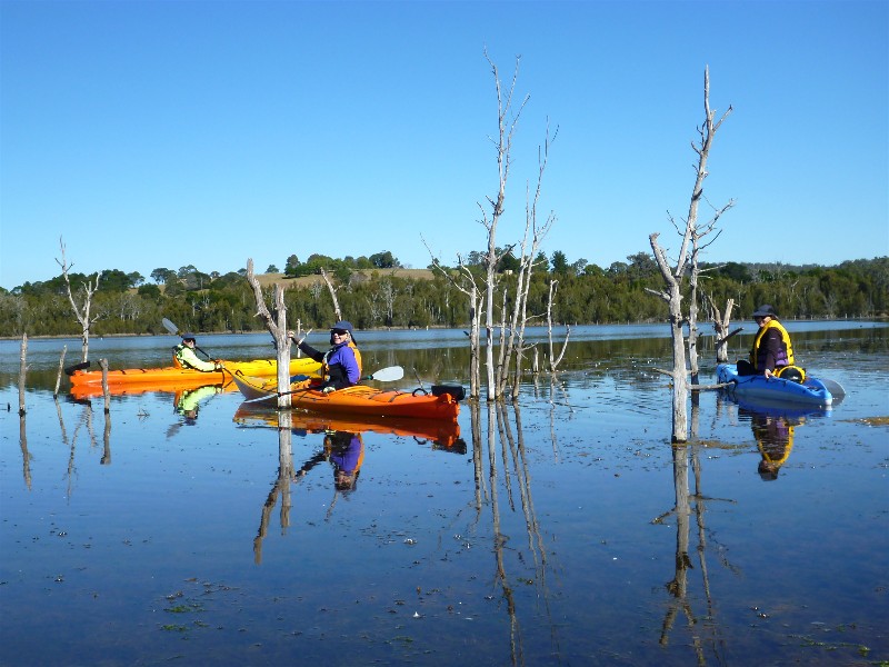
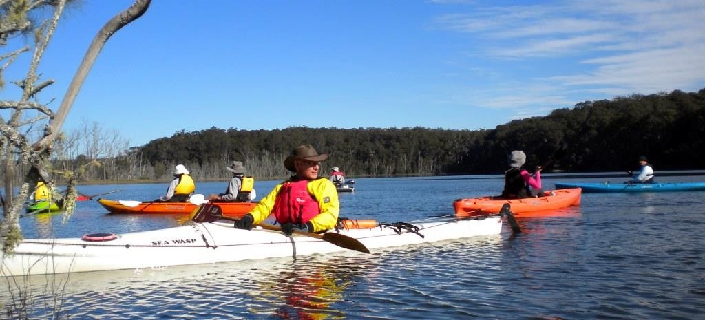
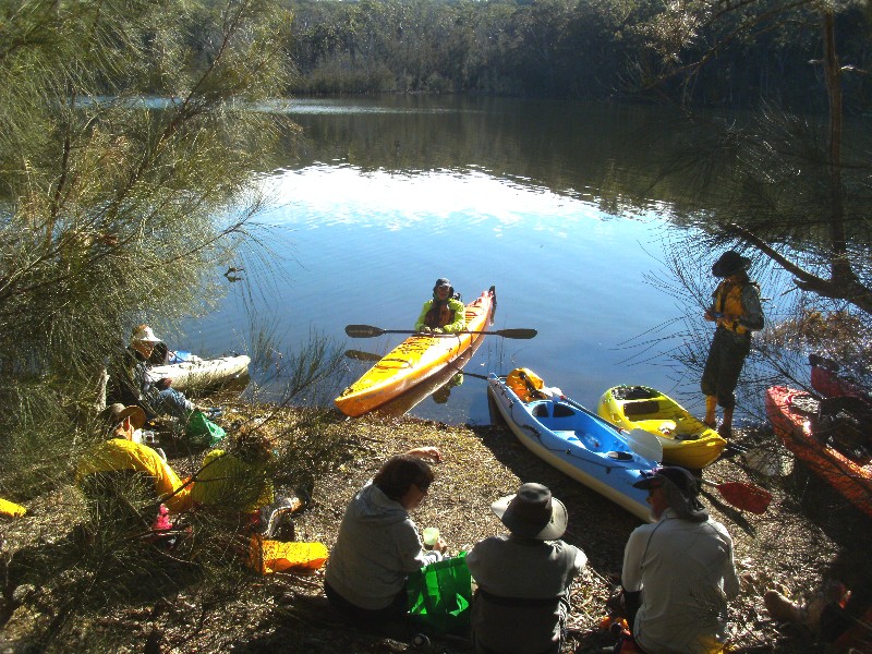
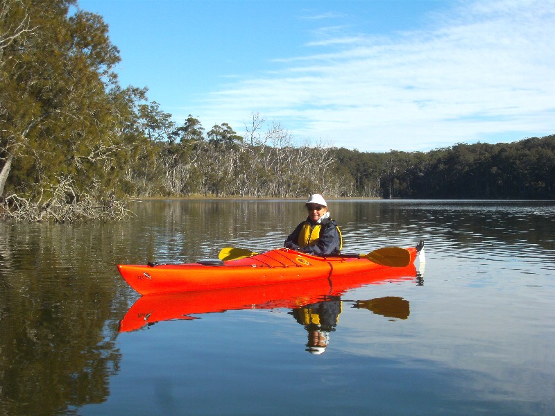
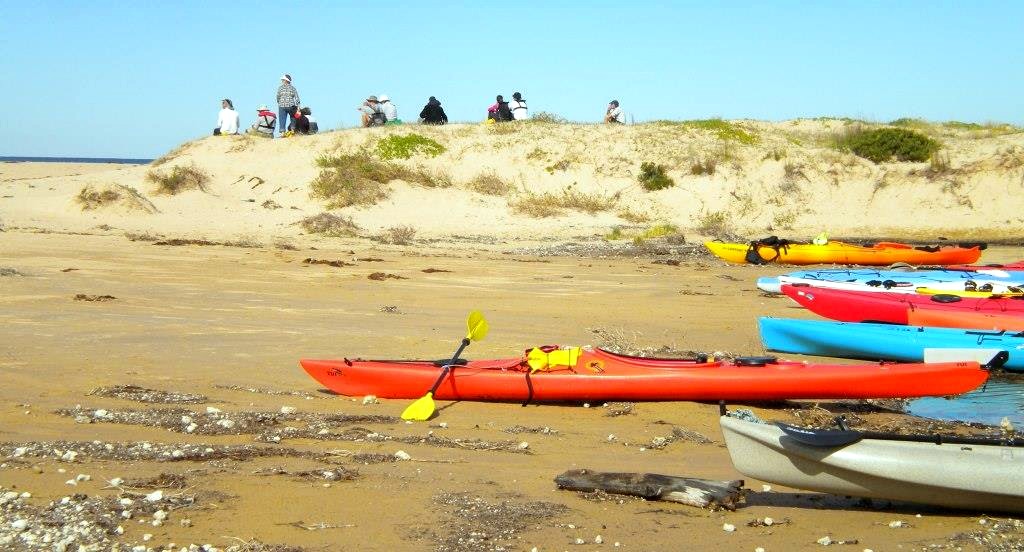
Durras Lake Paddle
Monday 28 July 2014
 |
 |
 |
| Ian and paddlers Photo by Lin Click on thumbnail to enlarge photo |
Morning tea in the sun Photo by Karen M Click on thumbnail to enlarge photo |
Nancy Photo by Karen M Click on thumbnail to enlarge photo |
 |
 |
 |
| Flowering Rats Tail Orchids Photo by Karen M Click on thumbnail to enlarge photo |
Elizabeth, Geoff and Ian in the creek Photo by Karen M Click on thumbnail to enlarge photo |
Lunch at the mouth Photo by Ian Click on thumbnail to enlarge photo |
Who would have thought that paddling in the dead of winter could be fun? Thirteen Batemans Bay Bushwalkers hoped so when they turned up with their kayaks at South Durras Lake Boat Ramp early on Monday. It was 6 degrees, but the sun was shining out on the lake, which was as still as a millpond.
With Durras Lake currently closed to the ocean and the consequent significant rise in water level, Leaders Dennis and Nancy took the opportunity to explore some of the shallower reaches of the waterway, including a couple of creeks in behind North Durras which are usually shallow muddy ditches. These creeks became especially interesting when we discovered that the native Rats Tail Orchids which festoon the sheoaks along the banks were coming into flower.
After exploring the creeks, paddlers were reluctant to leave the water, so
the Leaders decided to continue to the closed mouth of the lake for lunch. We
sat on the dunes in the sun with splendid views all around, marvelling at yet
another perfect south coast Winter's day.
Karen M
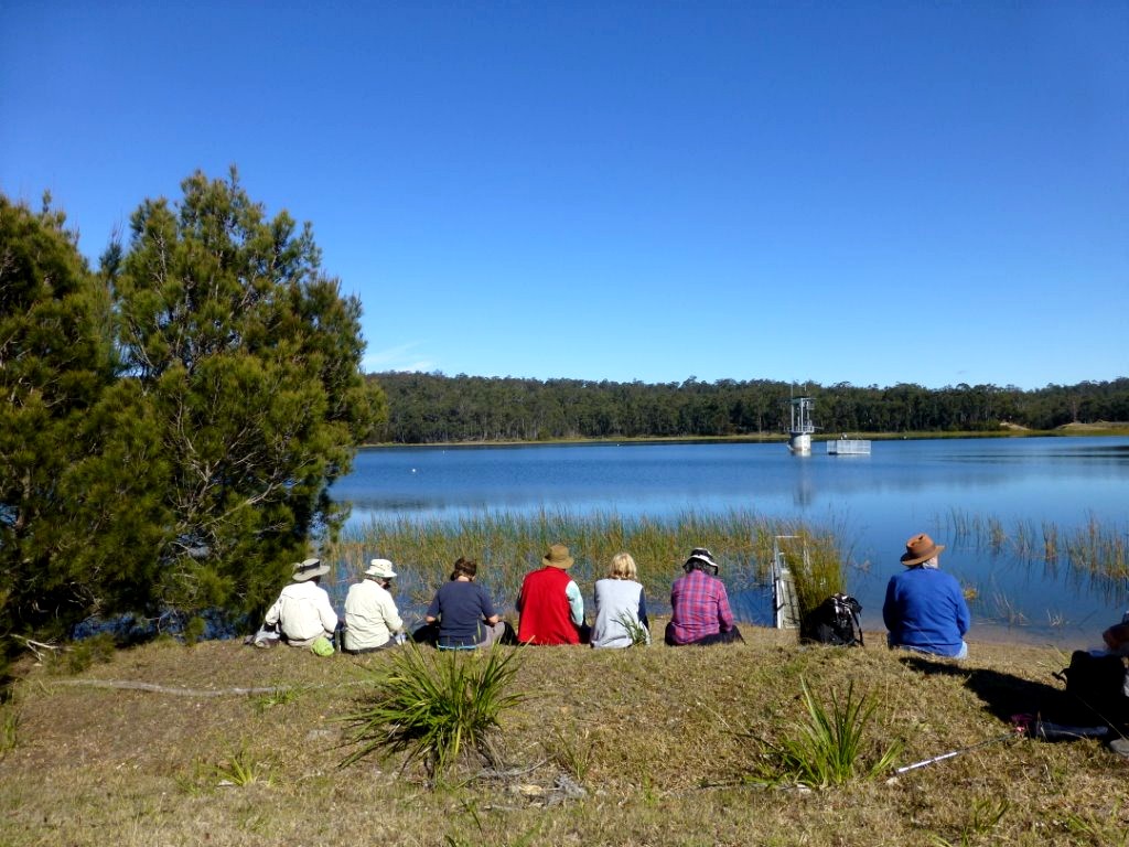
Deep Creek Dam Circumnavigation
Sunday 27 July 2014
 |
 |
| Perfect Lunch Spot Photo by Karen C Click on thumbnail to enlarge photo |
Lin, Bob and Pat Photo by Mary Click on thumbnail to enlarge photo |
Many Batemans Bay Bushwalkers have circumnavigated an island both in Australia and overseas but they rarely do the converse - circumnavigate a body of water. Recently, 28 Club members did just that, walking around Deep Creek Dam, just south of Batemans Bay. This pondage of 4,900 megalitres is Eurobodalla Shire's principal water storage.
Despite its close proximity to the town, the dam's catchment of 320 hectares is a parcel of public forested land few have appreciated. It is notable that the Club until now had not walked the entire catchment.
The walk was very enjoyable. The weather was perfect - sunny, mild and no wind - an early spring day. The route was astutely led by Bob T, taking advantage of the many bike tracks in the area, avoiding the steep climbs and descents. The best view was saved for lunch, on the dam wall overlooking the lake. There was discussion on how long it would take to drink all that lovely fresh water, but then nature called.
This walk is certain to become a favourite.
Ian
Exploring West Nelligen
Thursday 24 July 2014
 |
 |
| Geoff, Pat and Betty Photo by Mary Click on thumbnail to enlarge photo |
In the creek Photo by Mary Click on thumbnail to enlarge photo |
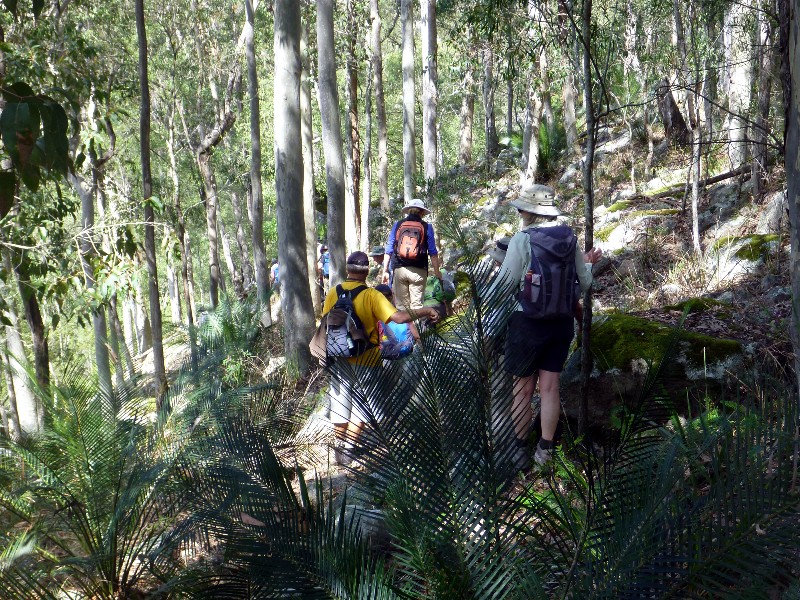
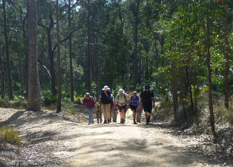
16 Bushwalkers participated in an 11km walk led by Stan and Mary. This walk took in the region west of Nelligen with its numerous hills and many fire trails criss crossing the state forest. After a few warm-up hills and ridges, a pleasant diversion down into a gully and along a dry creek bed was enjoyed.
A steep climb back up to the ridge top and few more hills had us to a
pleasant lunch spot in the forest, before, yes, some more hills back to our
cars. A good winter walk to stretch the legs.
Lynne
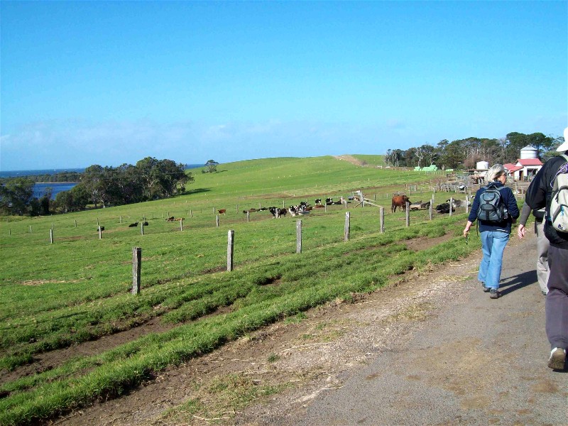
Sherringham Farm
Saturday 19 July 2014
 |
 |
 |
| Sherringham Farm Photo by Terry Click on thumbnail to enlarge photo |
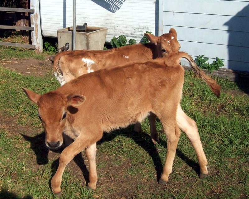
Jersey calves Photo by Terry Click on thumbnail to enlarge photo |
Karen and Pat Photo by Terry Click on thumbnail to enlarge photo |
 |
 |
 |
| Patrick and Patrick Photo by Donna Click on thumbnail to enlarge photo |
Down to the beach Photo by Donna Click on thumbnail to enlarge photo |
Skirting the swamp Photo by Donna Click on thumbnail to enlarge photo |
With a old fashion Tasman Sea low and Mother Mountain as back drops and Tilba living up to its traditional name, 14 hardy souls joined me on the 19th for Mrs Lucas' dairy farm walk. Walking down Sherringham Lane we passed her herd in full production grazing the lush basalt pastures. The bull paddocks were next with the boys waiting in quietude and anticipation.
With Little Lake to the North we crossed around the eastern end of Bobundara Swamp where we came upon what I think was a huge Mainland Black Tiger Snake culling the local frog population. They are known in this area and active periodically throughout the winter.
The wind was in the right place as we climbed Haxstead Road back to our
starting point. Hope all enjoyed the walk as much as I, as I truly love this
part of our world.
Patrick
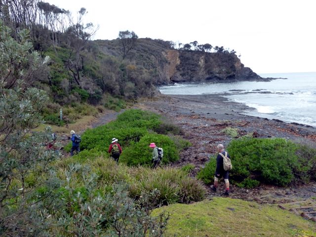
North Head and Northwards
Wednesday 16 July 2014
 |
 |
 |
| Pat with her group Photo by Donna Click on thumbnail to enlarge photo |
Checking out a cave Photo by Donna Click on thumbnail to enlarge photo |
Murramarang coastline Photo by Donna Click on thumbnail to enlarge photo |
Ten Batemans Bay Bushwalkers turned out last Thursday in spite of an inclement weather forecast for a lovely walk through part of the Murramarang National Park.
At one of the headlands they saw two large seals casually floating around an offshore reef, and another keen eyed walker spotted a whale spout out to sea.
All enjoyed walking through the freshly rained-upon shrubs and under-storey
of the tall gum trees.
Pat
Malabar Circuit
Sunday 13 July 2014
 |
| Bob, Betty and Elaine Photo by Joan Click on thumbnail to enlarge photo |
On a frosty but clear morning on Sunday 13 July, twenty-five walkers led by Bob Thurbon explored the Malabar Circuit track. The track led through bush and followed the fence line of a property for some time as the group saw some kangaroos amongst beautiful, large spotted gums and flowering banksias. Walking up Brierley Road to the top of the ridge there were stunning views of Moruya River and the township of Moruya, with picturesque mountains as a backdrop for the morning tea stop.
Heading downwards the track led to Apex Park beside the Moruya River, where
picture perfect scenic views of the river and birdlife were enjoyed during lunch.
This park has excellent information boards about the granite pit which supplied
Sydney Harbour Bridge and the Cenotaph in Sydney's Martin Place, with granite.
An easy track back to cars ended a most enjoyable walk for all.
Elaine
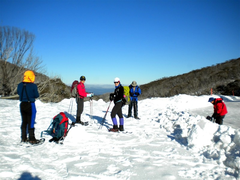
Snow Shoe Walking from Jindabyne Camp
Friday 11 - Sunday 13 July 2014
 |
 |
 |
| Start on Saturday Photo by Lin Click on thumbnail to enlarge photo |
Mike and Lynne Photo by Lin Click on thumbnail to enlarge photo |
Glenn Photo by Lin Click on thumbnail to enlarge photo |
 |
 |
 |
| Start on Sunday Photo by Lin Click on thumbnail to enlarge photo |
Horse Flat Photo by David Click on thumbnail to enlarge photo |
Winter wonderland Photo by Lin Click on thumbnail to enlarge photo |
Participants: David, Lynne, Michael, Glenn, Lin and Jenny.
The weather forecast was a little doubtful for our first day out, snow showers
all day and wind up to 50km. At least there will be some fresh snow. The
destination for today is Mt Duncan and the Porcupine Rocks about 3km southwest
of the Perisher ski resort. We departed Jindabyne at about 0800, but it proved
to be slow trip to Perisher Valley Resort car park. This was due to a
combination of factors: high traffic volume (school holidays and the best snow
cover in years), snow on the road, so chains for non 4WD vehicles, and slow
careful driving for all.
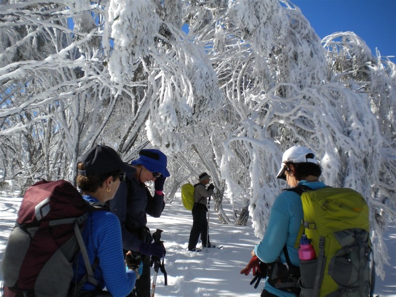
Arrived at Perisher at about 0930 and prepared our gear in the NPWS building, a great spot to get sorted out before heading out on any backcountry snow trip. The short walk from the car park to the NPWS building gave us a taste of the temperature. This led us all to put on an extra layer under our goretex coats and over pants over existing leg covering. However despite the cool breeze and falling snow we all needed to stop after about 10 minutes of snowshoeing and adjust our clothing layers to cater for warming up once we started walking.
For our outward route we followed the western bank of Rock Creek. The snow cover was great, very dry and generally consistent firmness. All participants didn't take long to get used to the snowshoes. The dry snow gave us the opportunity learn the first of the many tricks to know about snow travel. Snow can build under your snowshoe (or cross-country ski) or between boot and snow shoe. So every 10 or so steps you need to thump your foot down to dislodge this built-up snow. Second lesson is avoid patches of snow where grass or leaves are just poking through. Stepping on this snow can soon find your snowshoe and boot stuck in bush 600mm below the surface of the snow.
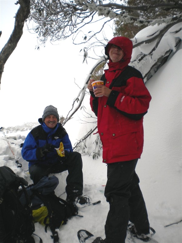
We reached the wide saddle on the west side of the Porcupine Rocks at about 1230. Visibility was not good so no point making the climb to Porcupine Rocks. We found a sheltered spot beside a large boulder with some additional shelter from a large snowgum tree and lunch was on. Lesson 3, it does not take long to begin to get cold when you're not moving, so lunch in the snow is never a leisurely affair. (According to the BOM, top temperature at Perisher Resort was minus 0.2 deg.)
Luckily the sun came out for a short time after lunch so it did not take long to warm up again. Our return route was again following Rock Creek, this time following the guide poles on the east side of the creek. We initially had a go at exiting our return journey by going east along the cross-country pole marked track. However a look at the map showed that extra distance was a bit more than expected and it began to snow more heavily. So discretion being the better part of adventure, we backtracked and resumed the more direct route back to the NPWS building. Total distance covered about 7km.
The drive back to Jindabyne proved almost as slow as in the morning. There was snow cover all the way down to the Waste Point surge tank (123m elevation). This snow was on the road too, so once again some cautious slow driving was called for. On the way we saw several small mobs of kangaroos feeding in the new snow cover.
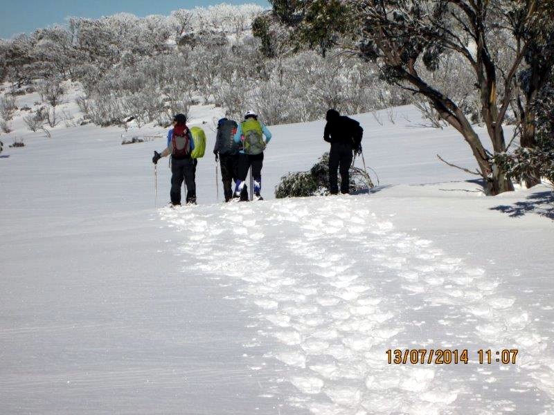
Sunday 13 July - second day of snowshoeing
Today our weather was totally different to yesterday. Wall to wall blue sky and
no wind. Conditions don't get much better for back country snow travel. The top-up
of new snow yesterday means snow cover will be fantastic.
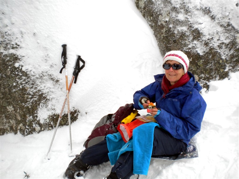
Our starting point was Dead Horse Gap a few kilometres west of Thredbo on the Alpine Way. Traffic was much lighter today. Road condition was clear to Thredbo and then a bit of cautious driving to the Gap. From the Gap we headed southwest slowly climbing the spur that leads to a clearing called Horse Flat. The climb and Horse Flat give great views of South Ramshead to the north and the distant high country of Victoria to the west and south.
The leaves and branches of the snow gums in this area where heavily laden with yesterday's fresh snow. As the sun warmed this leaf-supported snow it would fall off with a plop or tinkle, sometimes on the head of an unsuspecting snowshoer. According to the BOM the top temperature in Thredbo village was 2 degrees. It is amazing what being in bright sunshine and climbing a steep hill can do to warm one up. Since Dead Horse Gap we were all down to minimal clothing layers.
We reached a high point (1820m) about 1km south east of Horse Flat. This high point gave us a great view to the south with The Pilot Mountain on the horizon capped with snow and cloud. Lunch was at a saddle (134544). Our route so far has followed the Great Dividing Range, on our left the Thredbo River which flows into the Snowy River, to the right the upper part of the Murray.
After lunch we turned our snowshoes north east and ploughed our way through
the soft snow down to the head waters of the Thredbo River. We gingerly crossed
the River via the metal mesh bridge, snowshoes still on. The route back to the
cars now followed the just discernible Cascade Firetrail and the increasing
number of cross county ski and snowshoe tracks. This area is normally popular
with backcountry day trippers but today we had it all to ourselves. Distance
travelled about 8km, lowest point 1560, highest point 1830.
David
Bengello Beach Track to Moruya Airport and Return
Thursday 10 July 2014
 |
 |
 |
| John and Bev Photo by Donna Click on thumbnail to enlarge photo |
Bengello Beach Photo by Donna Click on thumbnail to enlarge photo |
Bengello surf Photo by Donna Click on thumbnail to enlarge photo |
We had a lovely walk with 15 people. We walked along the track behind the
beach through the parallel dune formation and the banksia and eucalyptus forests.
When we reached the beach at the end of the track near the Moruya Airport
windsock, we got saw the that the ocean was very rough, but a sight to see.
It was good to have 3 visitors walking with us.
Bev