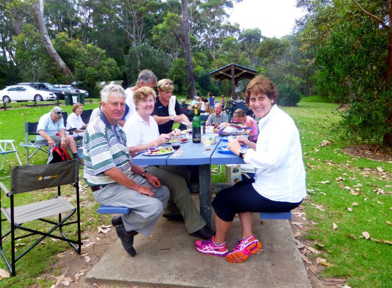
First Quarter 2015. See below for
Walk Reports and Photos
Walk Reports and Photos for Summer 2015. Click on walk headings below, or simply scroll down the page.
Depot Beach to Pebbly Beach - Coast and Forest Circuit, Wednesday 15 April 2015
Pebbly Beach, Snake Bay, Mt Durras Loop, Sunday 12 April 2015
Pebbly Beach to Snake Bay Coastal Walk, Thursday 9 April 2015
Moruya River Ramble, Wednesday 1 April 2015
SUGARLOAF CREEK, CLYDE MOUNTAIN, SATURDAY 16 AUGUST 1986
Sugarloaf Creek Pools, Sunday 29 March 2015
Pinkwood and Treefern Walk, Monga National Park, Thursday 26 March 2015
Durras Lake and Discovery Trail, Saturday 21 March 2015
Big Bit Lookout and Immediate Surrounds, Wednesday 18 March 2015
No Name Mountain Creek Descent, Sunday 15 March 2015
Pedro Point to Congo Creek and Pedro Swamp, Thursday 12 March 2015
Paddle Cyne Mallowes Creek, Monday 9 March 2015
North Durras Forest, Lake and Beach, Saturday 7 March 2015
Currowan Creek Hidden Jewel - Cascade and Ravine, Wednesday 4 March 2015
FIRST BBBW CAMP, CLYDE RIVER GORGE, SATURDAY 5 AND SUNDAY 6 OCTOBER 1985
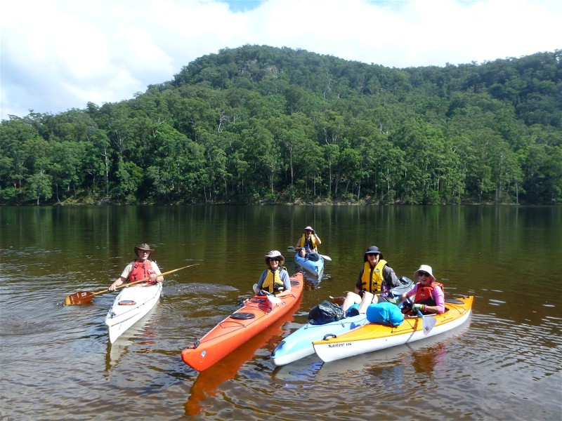
Tallowa Dam Paddle and Camp, Friday 27 February - Sunday 1 March 2015
Deua River and Pinkwood Creek, Sunday 1 March 2015
Quandolo Island and Moruya South Head, Thursday 26 February 2015
Kioloa Beach to Bawley Point, Saturday 21 February 2015
South Durras and Murramarang National Park, Wednesday 18 February 2015
Paddle to Bumbo Lake and Creek, Tuesday 17 February 2015
Bawley Point to Meroo Head, Sunday 15 February 2015
Bawley Point to Termeil Point Circuit, Sunday 15 February 2015
MOUNT DROMEDARY 30 YEARS AGO, SATURDAY 29 JUNE 1985
Tabourie to Termeil Point Circuit, Thursday 12 February 2015
Tinderry Range, Saturday 7 - Sunday 8 February 2015
Currowan Creek Meander, Wednesday 4 March 2015
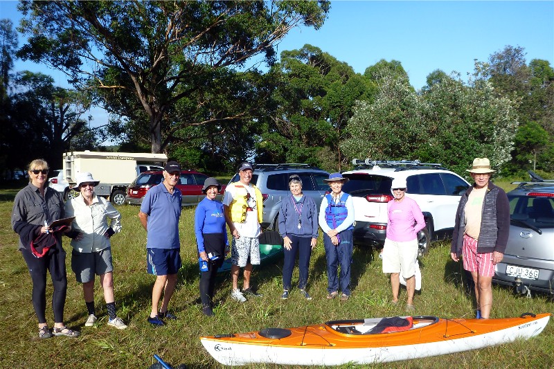
Paddle Skills and Equipment Orientation, Thursday 5 February 2015
Durras Lake and Coastal Highlights, Wednesday 4 February 2015
Denhams Three Beach Walk with Sausage Sizzle to Follow, Sunday 1 February 2015
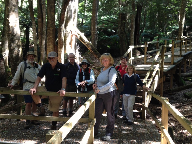
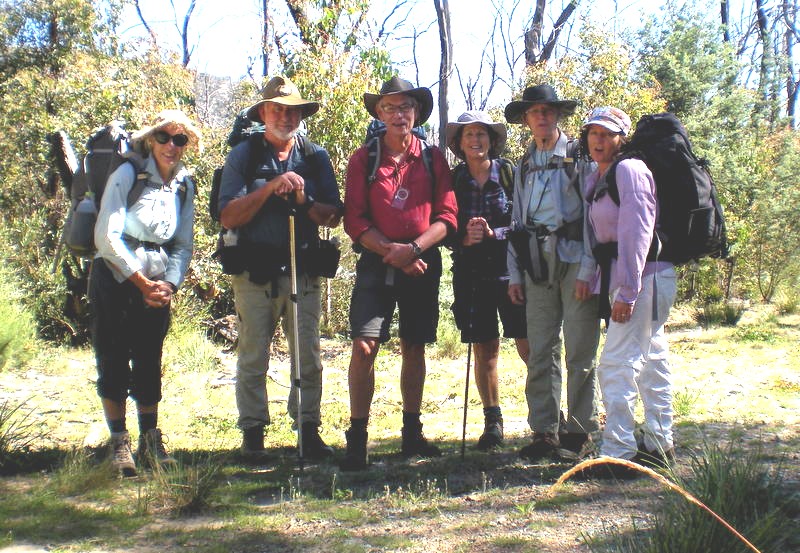
Depot Beach to Pebbly Beach - Coast and Forest Circuit
Wednesday 15 April 2015
Benign weather and contrasting bush and beach scenery combined to make this a memorable day. This classic walk in the Bushwalkers repertoire was ably led by Jill and attended by 14 members and one guest. Someone remarked on the unusual composition of this particular group, a near 50/50 split between men and women, whereas normally women outnumber the men.
Cars drove in convoy to the starting point at Depot Beach. The walk itself began along bush tracks behind Depot Beach, soon joined a steady climb along forestry roads, amongst spotted gums and macrozamias. The eucalypts appeared of considerable age, many whose trunks were off vertical but tightly held by emergent root formations.
The road joined the main descent to Pebbly Beach where we had morning tea. The expected local fauna (wallabies and kangaroos) did not eventuate: perhaps shy? The return along the shore platform and amongst the pebble formations was most enjoyable and we finished by having lunch at Depot Beach.
Total time 4 hours.
John M
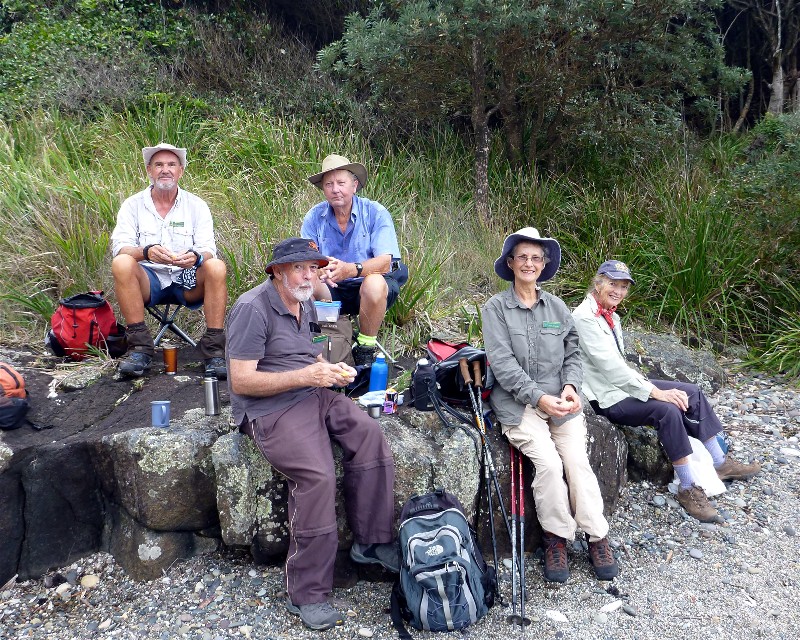
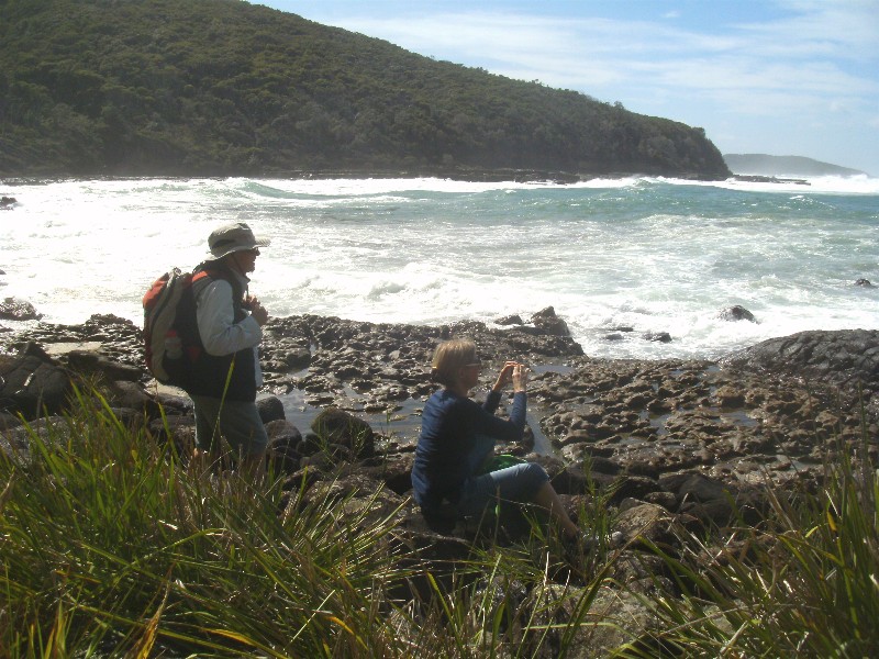
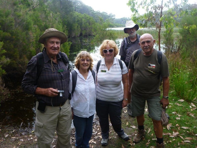
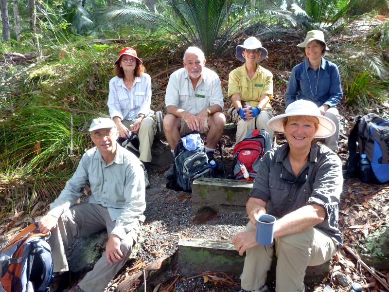
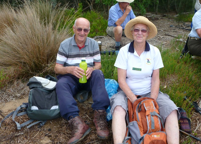
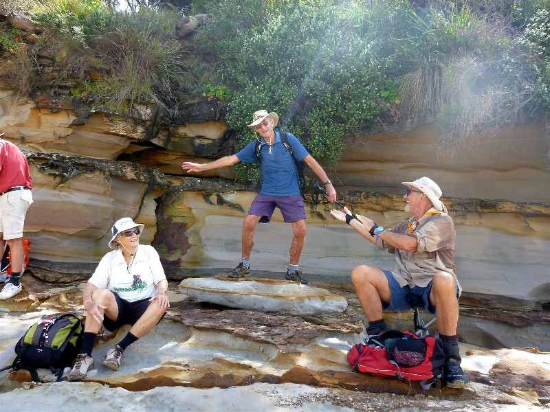
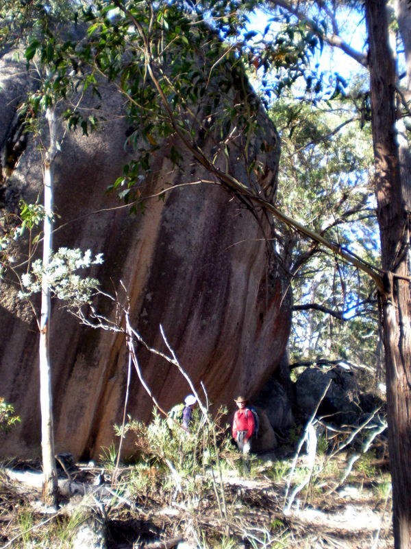
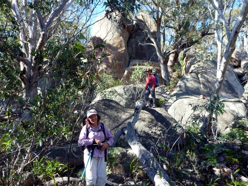
Pebbly Beach, Snake Bay, Mt Durras Loop
Sunday 12 April 2015
 |
 |
 |
| Morning tea at Snake Bay Photo by Karen M Click on thumbnail to enlarge photo |
Peter, Bob, Len and Phillip Photo by Karen M Click on thumbnail to enlarge photo |
Bob at the old farm dam Photo by Karen M Click on thumbnail to enlarge photo |
On the weekend Peter and Marilyn led 7 other walkers from Pebbly Beach northwards again along the coast to Snake Bay, whereupon we abruptly turned left and headed up through the scrub on the east face of Durras Mountain. Peter then found the old farm track which leads straight up the ridge between 2 deep rainforest choked gullies to the top of the mountain.
On the way we passed old fencelines and visited the dam built to supply freshwater to the farm once occupying the land on the summit. A mercifully short leech and tick ridden bash through shoulder high grass and bracken brought us out to the track which runs along the top of the mountain.
Then it was a pleasant downhill jaunt back to finish at Pebbly Beach.
Karen M
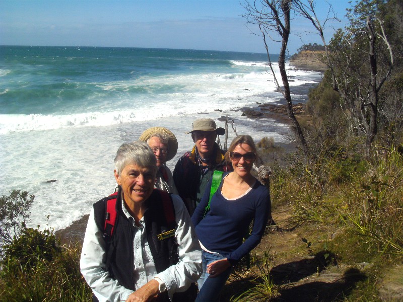
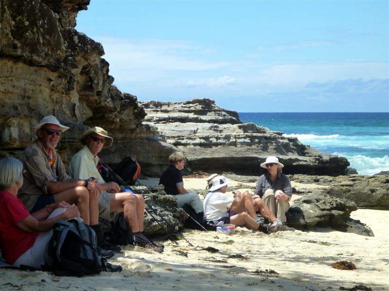
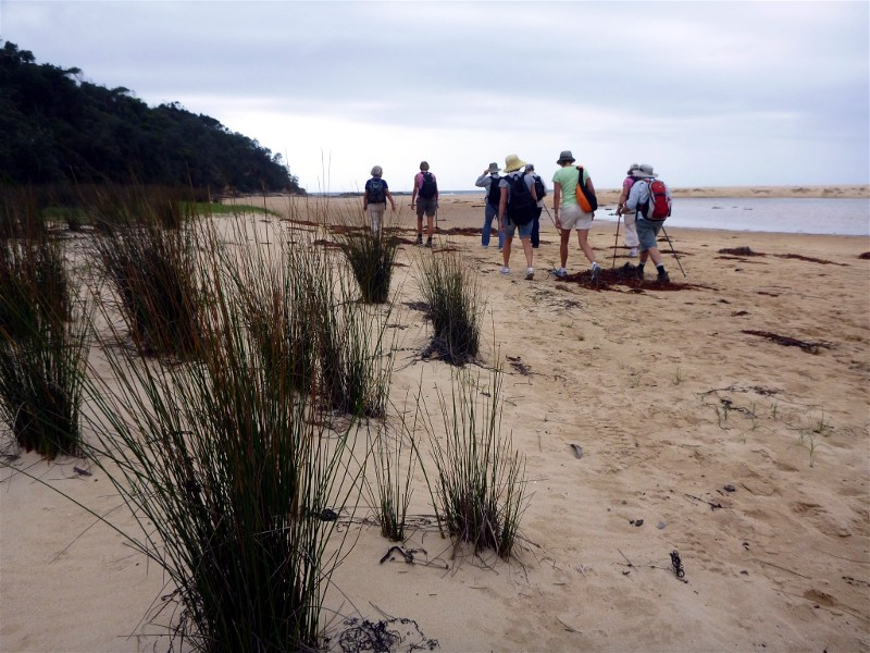
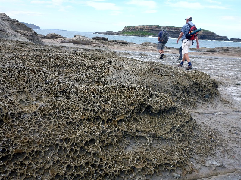
Pebbly Beach to Snake Bay Coastal Walk
Thursday 9 April 2015
 |
 |
 |
| Bev, Gillian, Bob and Nicola Photo by Karen M Click on thumbnail to enlarge photo |
Bev and Nicola at Snake Bay Photo by Karen M Click on thumbnail to enlarge photo |
Joan, Carol and Elaine Photo by Karen M Click on thumbnail to enlarge photo |
During the week, Joan led 7 other walkers from Pebbly Beach northwards along the coast to Snake Bay and back. It's a surprisingly undulating track through temperate rainforest and past little coves, headlands and beaches.
Unusually, we saw quite a few others on the track because of the school holidays.
The beaches in this area are interesting because they are pebbly beaches made up
of round stones. The exception is the mis-named Pebby Beach, which is sandy.
But the main drawcard on this walk was the wild seas, crashing onto the rocks
and breaking over the headlands. We spent an interesting lunch break at Snake
Bay enjoying the fury of the ocean all around us.
Karen M
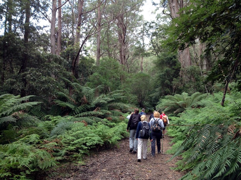
Moruya River Ramble
Wednesday 1 April 2015
 |
| Jan, Denise, Joan, Mike, Elaine, Elaine and John Photo by Karen C Click on thumbnail to enlarge photo |
Wednesday's walk for the Batemans Bay Bushwalkers had us meeting for the start of our walk at Lions Park on the north side of Moruya. It was a lovely sunny autumn day and heading across the bridge, the river sparkled in the sunshine and there were fish to be seen in the water below. Bream, Mullet, Sting Rays and Jelly Fish were identified and the remains of fish scales on the footpath showed that some lucky fisherman had been successful the night before. The huge Silky Oak, (Grevillea robusta) in Russ Martin Park welcomed us as it has been welcoming visitors to Moruya for so many years.
We continued on under the bridge, admiring the local art works and followed the footpath west with tantalising glimpses into backyard gardens on the left and river views on the right, past the Bowling Club to the water feature in Chesher Park. An amazing variety of colourful shrubs and flowers were admired, we were too late to see the Lotus flowering, they had finished, but their unusual seedpods were commented on.
We then headed back to town, past the swimming pool, to the Reserve and a welcome morning tea break. Then eastwards along the winding track, to the Casuarina forest and Mangrove Swamp, where Ryan's Creek flows into the Moruya River. A huge web made by a Golden Orb spider stopped us and Bob, our leader, related to us the sex lives of these interesting creature, and it doesn't end well for the males!!
Our walk finished back at the park with the options of coffee and cake, always
welcome. Thanks Bob, from 9 happy bushwalkers.
Karen C
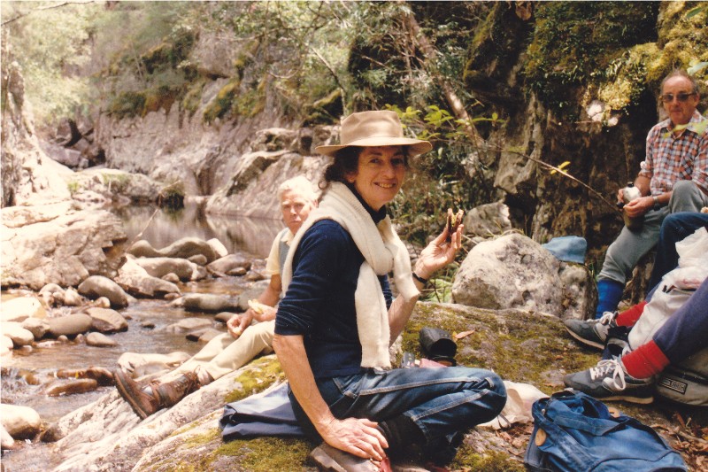
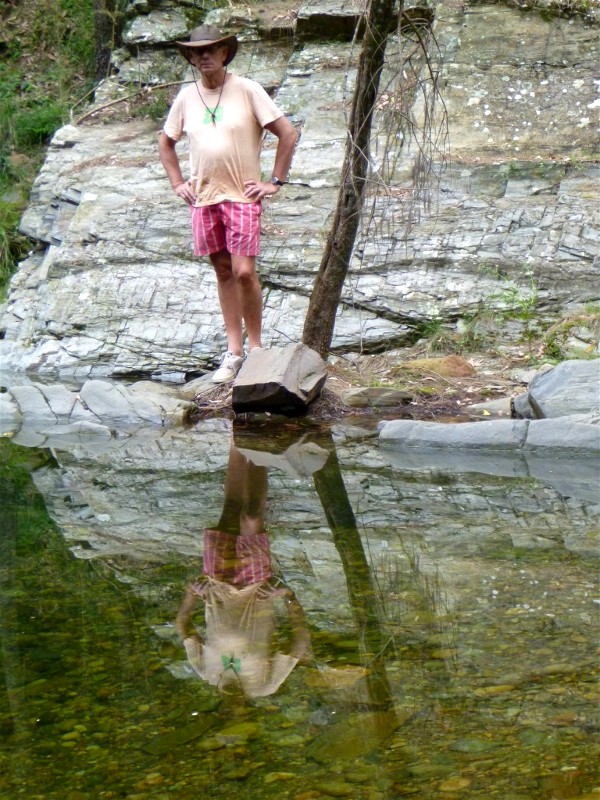
SUGARLOAF CREEK, CLYDE MOUNTAIN
SATURDAY 16 AUGUST 1986
 |
| Val in Sugarloaf Creek in 1992 Photo by Pat Click on thumbnail to enlarge photo |
This walk report details the first time Valerie ventured into Sugarloaf Creek back in August 1986. Sadly no photos exist, but we do have the one above of Val in the same creek in 1992.
Valerie led 6 members (Helen Clegg, Arnold Cadd, Lloyd Donnelly, Eike and Paula Jakobasch) on a walk classified as Rockscrambling/Exploratory -Hard. This was an understatement. The terrain was probably the roughest of any walk undertaken by the Club so far. However, as compensation for this, it was probably one of the most beautiful walks we have done.
The descent was steep but easy underfoot compared to what was to come afterwards. After 100m we met the creek and immediately had to portage around the side of a 50m cascade with a 10m sheer drop waterfall at the bottom.
Moving on down we came shortly to a jumble of gas cylinders and steel beer barrels in the bed of the creek. As we did not imagine they had been put there on purpose we concluded that a truck in the past had gone over the edge and spilled its load which didn't stop until it got to the bottom.
Rainforest was everywhere. Very little sunlight got in. Orchids abounded on moss covered tree trunks. Multi-trunked pinkwood trees were unusual. Ferns of all sorts from the tiniest to the largest were there in profusion, some high up on a Churnwood tree.
The going was very difficult. Several times we had to detour up the steep sides of the valley to get around parts of the creek bed we couldn't negotiate. All the way we were thankful for trees, shrubs, vines, rockledges to hang on to - to pull ourselves up or stop us from falling.
We lunched on one of the few flat areas of the creek in a dell surrounded by treeferns. Valerie, who of course had not been there before, was asked whether what we were seeing was what she had expected when planning the walk. She said, "Yes, but it's much better than I expected".
At the top of one 15m almost vertical cascade, Eike's foot slipped on a rock and he fell like a log, face and camera down, into the rocky creek bed. For one heart-stopping moment we feared he might slip forward over the edge. But he didn't. When he got up dripping wet we were relieved that he was OK. He remarked rather ruefully that he was "attempting some underwater photography".
By 3pm we could go no further. The creek entered a deep ravine only 2 feet wide with sheer walls. Valerie explored above one side and Eike the other, but there was no way on except in the wrong direction. So we had afternoon tea.
Retracing our steps a little we commenced climbing out up the side of the valley.
Valerie had planned a 6 hour walk; we reached the Kings Highway exactly 6 hours
from the walk start. On the map we had covered only 3 kms, so perhaps we actually
walkd about 4 kms.
Arnold Cadd
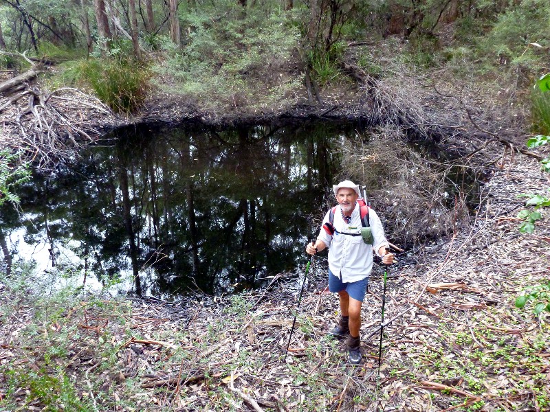
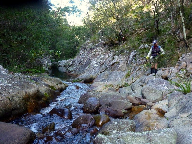
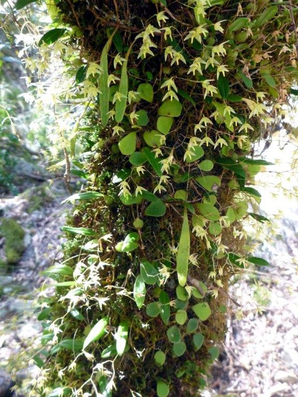
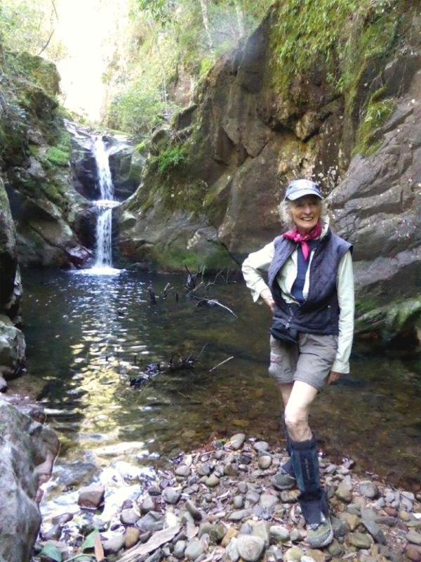
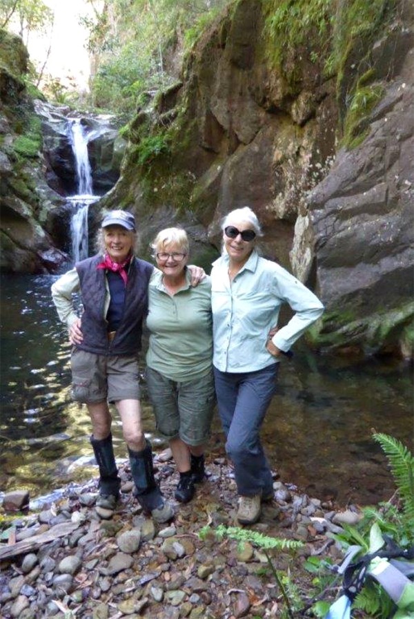
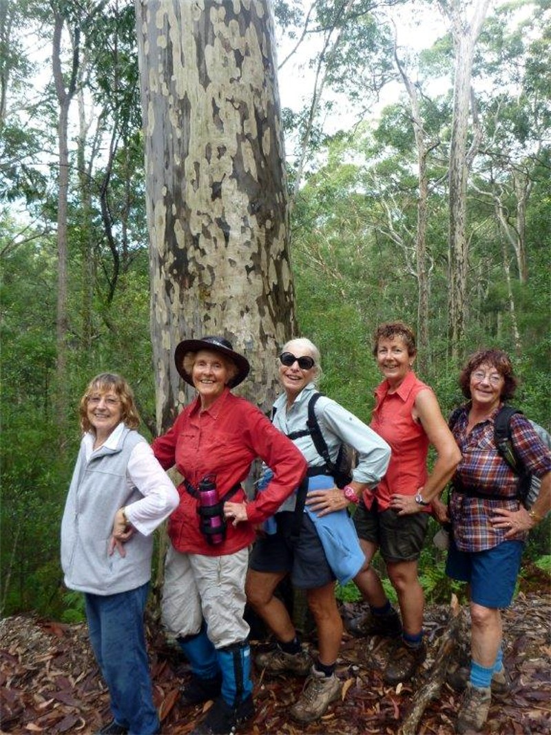
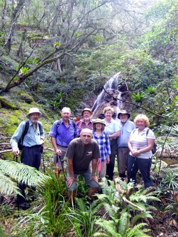
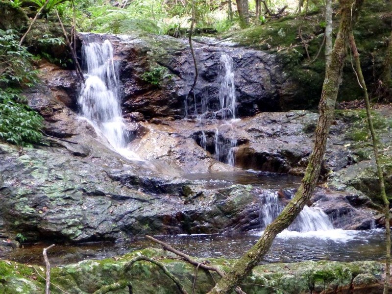
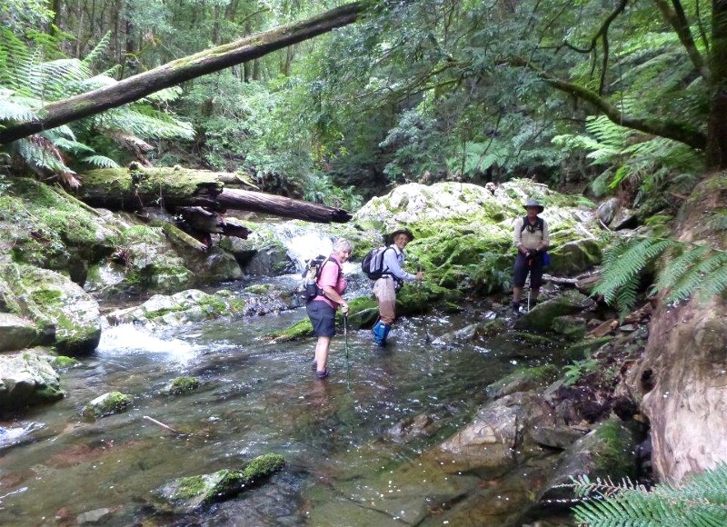
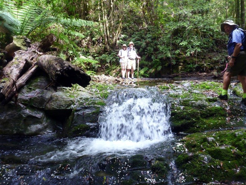
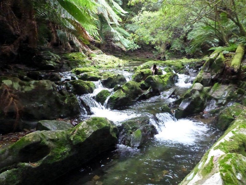
Sugarloaf Creek Pools
Sunday 29 March 2015
 |
 |
 |
| Val alongside Sugarloaf Creek Photo by Bob T Click on thumbnail to enlarge photo |
Delicate flowering orchids Photo by Bob T Click on thumbnail to enlarge photo |
Val, Elaine, Sharon and Kay Photo by Bob T Click on thumbnail to enlarge photo |
 |
 |
 |
| The Queen of the Bush herself Photo by Kay Click on thumbnail to enlarge photo |
Elaine and Bob beside the spa pools Photo by Kay Click on thumbnail to enlarge photo |
Val with Kay and Sharon Photo by Kay Click on thumbnail to enlarge photo |
It seems to be my good fortune to regularly be accompanied on bushwalks by a number of lovely ladies. So it was when we ventured up Sugarloaf Creek to view "Nature's Spa Pools". Though it requires over 3 hours of walking and wading, photo opportunities and posing, Valerie, Sharon, Kay and Elaine went up the creek with me, through temperate rainforest, featuring tiny fungi and orchids, tall tree ferns and giant blue gums. After lunch, we went into the tributary, and paid homage to Valerie's spa pools.
So perfect they seemed to have been designed and built, they formed the backdrop
for numerous group and individual photos by all our several cameras. Valerie
bid them a fond farewell, saying that at 82 she doubted she'd be back, but such
is the perennial ability of "the queen of the bush", that anything is possible.
We reluctantly turned away from their entrancing beauty and began to retrace our
steps down the valley, finally emerging with relief and satisfaction for team
congratulations at the car. We agreed it was not only well worth the effort,
but felt like a privilege to see this wonderful feature.
Bob T
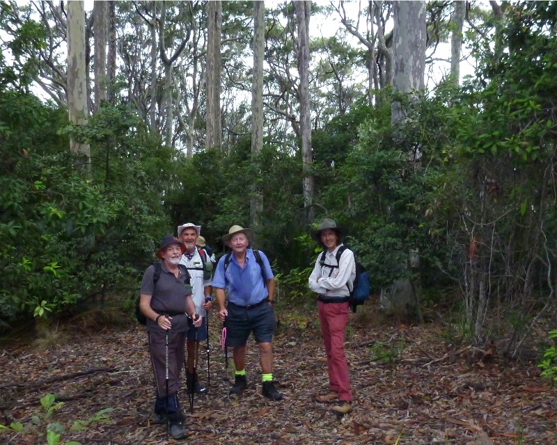
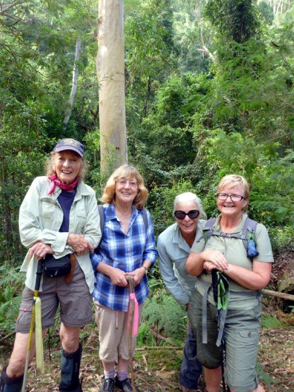
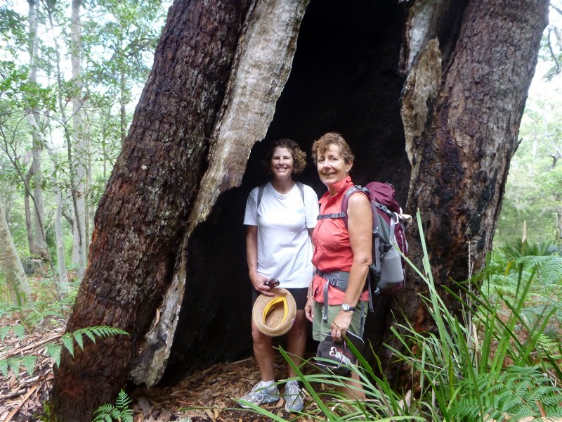
Pinkwood and Treefern Walk, Monga National Park
Thursday 26 March 2015
 |
 |
 |
| Wall to wall treeferns Photo by Wendy Click on thumbnail to enlarge photo |
Penance Grove boardwalk Photo by Wendy Click on thumbnail to enlarge photo |
Walking past flowering pinkwoods Photo by Wendy Click on thumbnail to enlarge photo |
Eight members took part in what has to be one of the most spectacular walks in the surrounding area. On arrival at the Mongarlowe River picnic area we began our walk down the old River Forest Road lined with tree ferns, lush foliage and tall trees. Although it was evident that most of the Pinkwoods (Eucryphia moorei) had blossomed we were fortunate enough to occasionally see the odd tree still in flower.
The group then enjoyed morning tea adjacent to the Mongarlowe River before heading back to explore Penance Grove, where many of the plant species date back thousands of years. We made our way along a bush track to the ancient rainforest which is decorated with ferns, mosses and lichen. Penance Grove was so-named because of the anguish felt by Monga lovers when many ancient tree ferns were decapitated. Numerous fern stumps bear testimony to this sad event. The rainforest was easy to navigate with the aid of a well-constructed boardwalk which provided a great viewing platform to take in this mystical place. The dappled sunlight filtering the Grove gave it a surreal sense of being.
We finished the walk stopping to lunch at the well-equipped picnic area nestled
in the shade of a eucalypt forest.
Wendy
Durras Lake and Discovery Trail
Saturday 21 March 2015
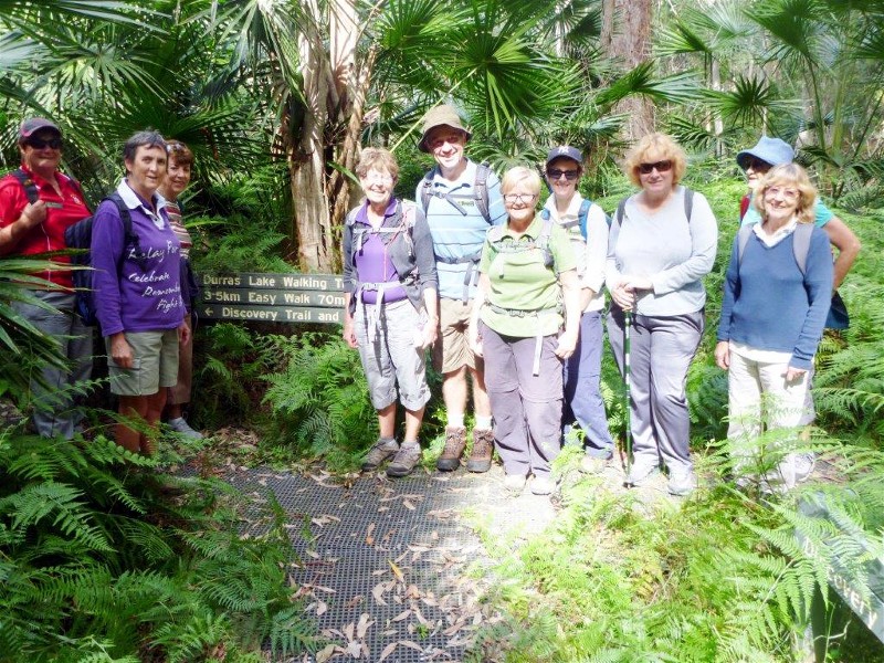 |
| Robyn, Heather, Lesley, Mark, Kay, Wendy, Deb, Denise and Elaine Photo by Bob T Click on thumbnail to enlarge photo |
No report received.
Big Bit Lookout and Immediate Surrounds
Wednesday 18 March 2015
 |
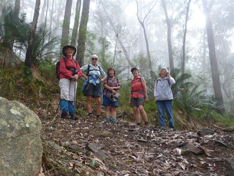 |
 |
| Elaine, Betty, Sharon, Glenn and Pat Photo by Bob T Click on thumbnail to enlarge photo |
Women in the mist Photo by Bob T Click on thumbnail to enlarge photo |
Big Bit Lookout Photo by Bob T Click on thumbnail to enlarge photo |
Undaunted by thunder and rain, 5 ladies charged off up the slopes and through the gullies, allowing me to tag along, T.E.C. by default. Some of the gullies had delicate myrtle understory, punctuated by magnificent tall, straight spotted and blue gums. The rain freshened all the foliage, and the spotted gums glistened in their stark new colours, while various herbal aromas added to the experience.
About halfway up the meandering walk the rain eased, and we moved on up through
the wet forest, which now was clothed in mist, and then emerged onto the lookout
in bright sunshine, as the storm moved away to the north. After lunch, Glenn had
us searching for a geocache, which I found, cunningly hidden in an old ammo box,
deep under a yellow (sick?) burrawang. The descent was via a bewildering
succession of tracks and gullies, past more huge trees, until we emerged at the
cars, after a delightful and enjoyable day.
Bob T
No Name Mount Creek Descent
Sunday 15 March 2015
Cancelled??
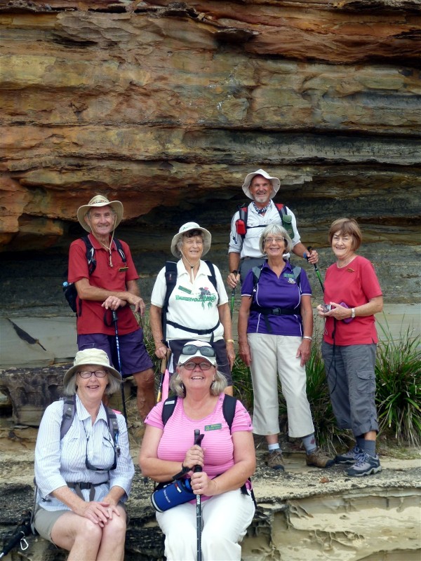
Pedro Point to Congo Creek and Pedro Swamp
Thursday 12 March 2015
 |
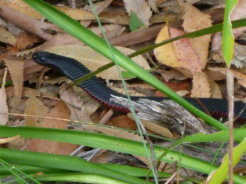 |
 |
| Bob admires Pedro Swamp Photo by John F Click on thumbnail to enlarge photo |
Close encounter with a red belly black Photo by John F Click on thumbnail to enlarge photo |
John, Elaine, Deb, Bob and Simeon Photo by Bob T Click on thumbnail to enlarge photo |
BBBW group set off with 6 intrepid walkers led by Bob T on a visually invigorating walk along a track from Moruya South Head to Pedro Point. The picturesque rain forest track gave way to an interesting walk along the sand dunes, spotting numerous bird and animal prints in the sand as well as wide ocean views. The photographers were spoilt for choice today and happily 'clicked' away, snapping everything including the gorgeous vistas, colourful butterflies, flowers, various rough tree barks and an odd black snake who got a little up close and personal with our walk leader.
We headed inland for morning tea along Congo Creek (surprising a couple of
paddlers when they rounded the bend of the creek and found us dangling our legs
over the bank whilst enjoying our sustenance). Pedro Swamp was another pretty
rest stop with a number of black swans gracing the waterway, then back to walking
along the path through forest and fruit-laden burrawangs (startling colour
contrasts of bright orange and deep greens of these fruit made for more interesting shots),
then we were back at the beach for a quick bite of lunch and the finish of another happy
bush walk.
Deb
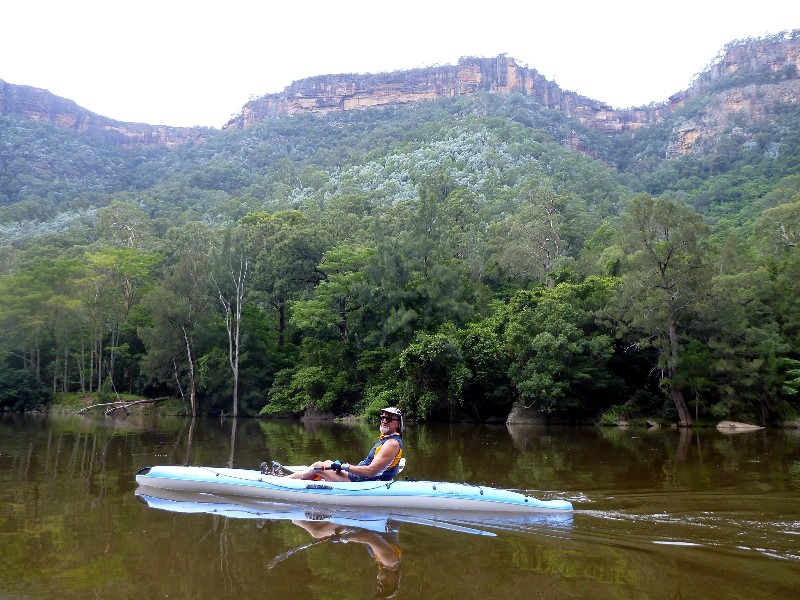
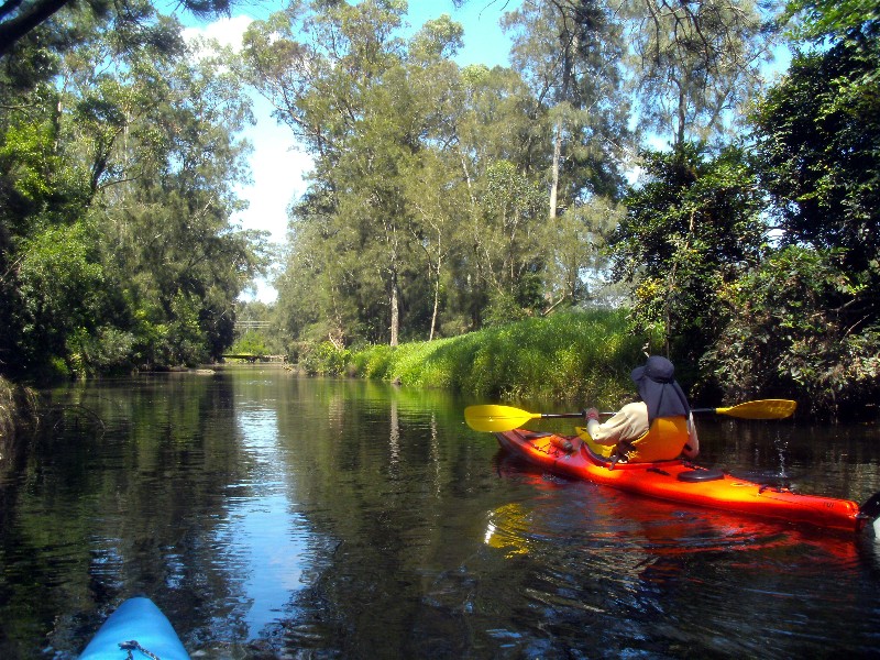
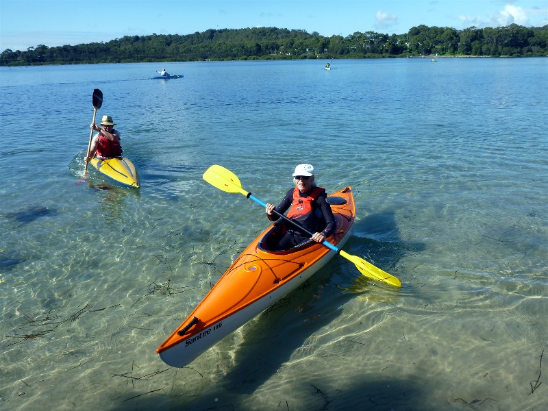
Paddle Cyne Mallowes Creek
Monday 9 March 2015
 |
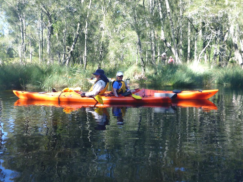 |
 |
| Paddlers in the Mist Photo by Bob M Click on thumbnail to enlarge photo |
Dennis and Nancy Photo by Bob M Click on thumbnail to enlarge photo |
Cyne Mallowes Creek Photo by Bob M Click on thumbnail to enlarge photo |
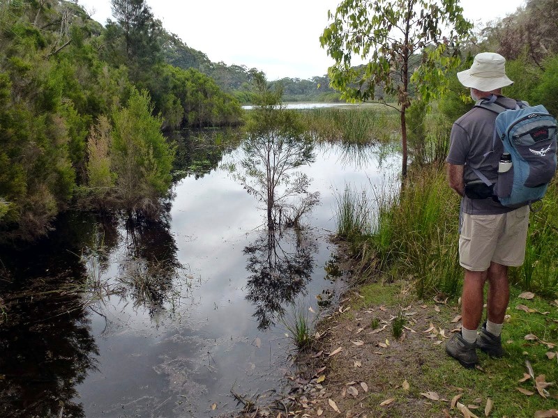
North Durras Forest, Lake and Beach
Saturday 7 March 2015
 |
 |
 |
| Martin, Denise, Peter, Marilyn, Helen and Karen Photo by Bob M Click on thumbnail to enlarge photo |
Durras Lake Photo by Helen Click on thumbnail to enlarge photo |
Bob heading for Point Upright Photo by Helen Click on thumbnail to enlarge photo |
 |
 |
| View from lunch on Point Upright Photo by Bob M Click on thumbnail to enlarge photo |
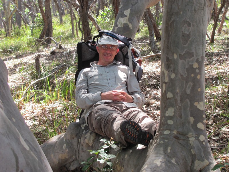
Martin finds a comfy tree Photo by Helen Click on thumbnail to enlarge photo |
With half the Batemans Bay Bushwalkers holidaying in Melbourne, there was a small turn out of seven for a lovely walk show-casing the highlights of Murramarang National Park.
From Depot Beach to the Discovery Trail on Lake Road; Durras Lake with some
beautiful reflections on still water; to North Durras beach and the climb up the
headland and detour to Point Upright itself; we enjoyed the varied scenery and
fabulous views, not to mention the towering spotted gums and lush vegetation
encouraged by the wet summer. Gang gang cockatoos, whip birds and a golden whistler
greeted us, grey kangaroos eyed us as we walked past, and a goanna scuttled out
of our way. The sea was clear as usual, just right for a dip after an excellent
13km walk
Helen
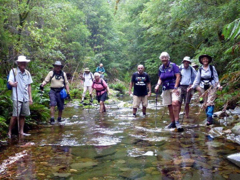
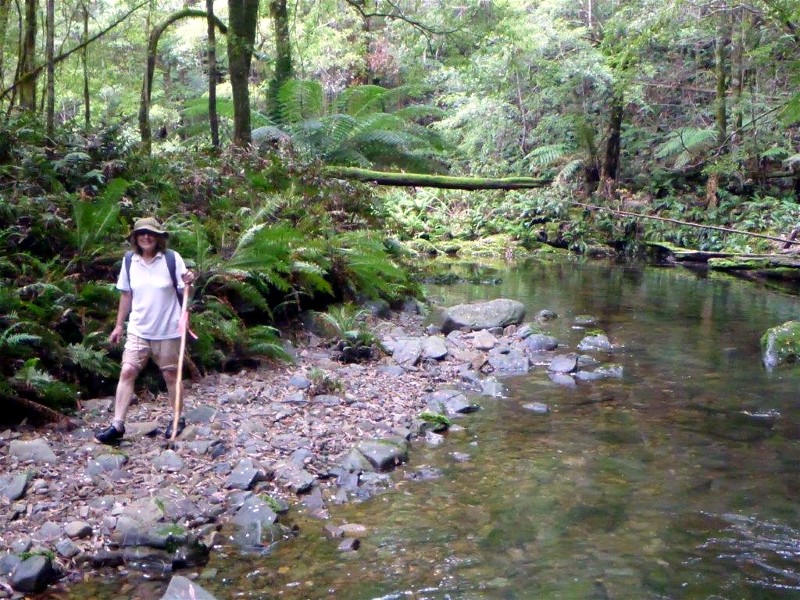
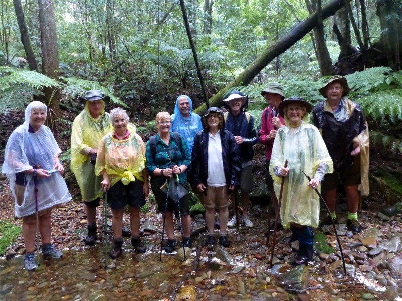
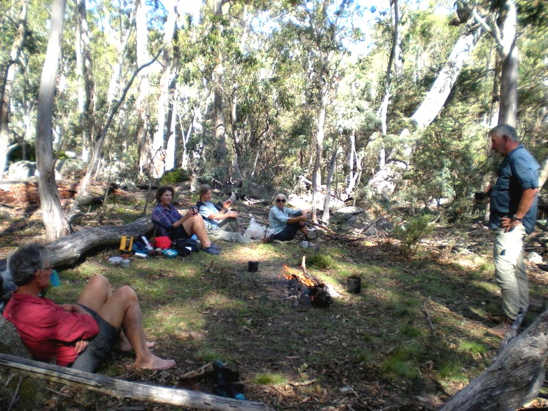
Currowan Creek Hidden Jewel - Cascade and Ravine
Wednesday 4 March 2015
 |
 |
 |
| Crossing the creek Photo by Donna Click on thumbnail to enlarge photo |
In the creek Photo by Donna Click on thumbnail to enlarge photo |
The cascade Photo by Bob T Click on thumbnail to enlarge photo |
 |
 |
 |
| Walkers Photo by Donna Click on thumbnail to enlarge photo |
The waterfall Photo by Bob T Click on thumbnail to enlarge photo |
Staghorns above Currowan Creek Photo by Donna Click on thumbnail to enlarge photo |
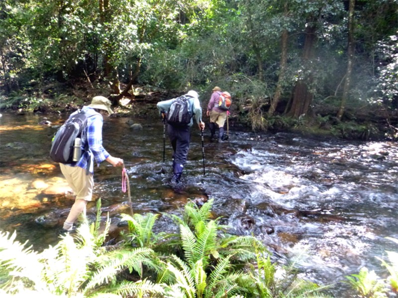
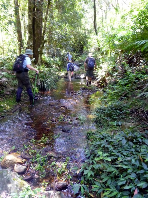
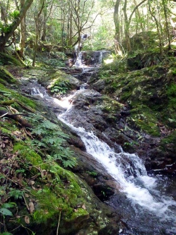
Walk Leader, Cliff, calls it "Currowan's Hidden Jewel". As Currowan Creek near Leechey Flat is itself beautiful, with giant river oaks adorned by staghorn and birds nest ferns, this is quite a claim, but to see is to agree. All 9 of us who ventured there were rewarded with his cascade in good flow, predictably populated by ravenous leeches, but still a delight to see.
Although the scrub in places was much thicker than last year, due to all the
rain, and the climb out was a bit stiff in the hot sun, we all emerged happy and
satisfied.
Bob T
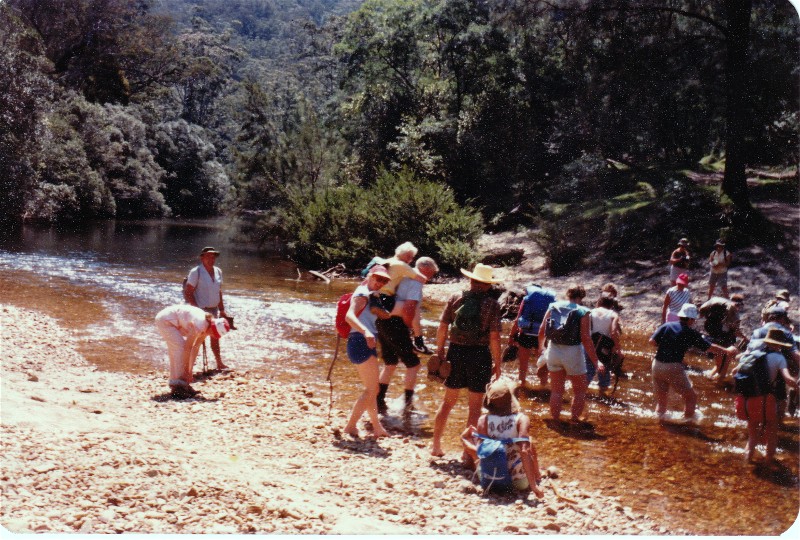
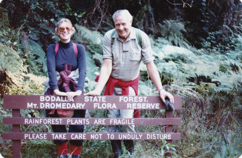
FIRST BBBW CAMP, CLYDE RIVER GORGE WITH OVERNIGHT CAMP AT YADBORO FLAT
SATURDAY 5 AND SUNDAY 6 OCTOBER 1985
 |
| Second creek crossing Click on thumbnail to enlarge photo |
This is the (edited) report of the first Club Overnight Camp and Club Backpack, organised by Val Harris and Dennis Ewart and attended by 33 bushwalkers.
The entrance to Yadboro Ranch ($5 per car per night for use of campsite and latrine) was 200 metres to the right after crossing Yadboro Bridge so we paid our money, drove onto the grass camping area and cooled off in the shade with drinks before starting off on our walk. It was nearly 11am before we really got going and the day was a scorcher so our first creek crossing was quite a relief despite fast flowing water over stones that were slippery and a bit painful for some. The 2nd creek crossing wasn't so fast flowing. Eric Wright hoisted Dorothy Giddings on his back and waded across with her pick-a-back, but she still managed to drop her sneakers into the stream.
After we had lunch, we farewelled Valerie's group who were going up into the gorge to camp overnight. The walk across the floor of the gorge through tussocks of grass with high cliffs and their many caves around us, and Pigeon House looming close was the best part of the walk for me.
Back at the camp site around 4pm some pitched their tents, and some cooled off with a swim in the knee deep creek at the far end of the paddock - Meriel Miles looking truly elegant in a slinky one piece swimsuit and ugh boots. Some of us made it a one day excursion and didn't stay for the campfire at night and the morning walk along the river bank.
Saturday's sunshine became drizzle on Sunday and people broke camp at various times. Margaret and Russ Kennard stayed on to keep the 3pm rendezvous with the backpackers at a spot some 5.5 kms from the campsite.
Val's group was at the pick up point at 2.50pm and they said that Val has an
unerring sense of direction and is an excellent navigator in rugged country
with no real tracks. She also resolved any problems that arose in that difficult
terrain and is a leader to be trusted implicitly.
Freda Stephenson
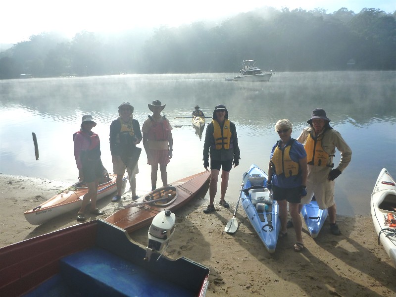
Tallowa Dam Paddle and Camp
Friday 27 February - Sunday 1 March 2015
 |
 |
 |
| Gear stowed and ready to leave Photo by Lin Click on thumbnail to enlarge photo |
Awed by the view Photo by Lin Click on thumbnail to enlarge photo |
The perfect campsite Photo by Ian Click on thumbnail to enlarge photo |
 |
 |
 |
| Red cedar hugging Photo by Lin Click on thumbnail to enlarge photo |
Ian and his reflection at Rotten Creek Photo by Lin Click on thumbnail to enlarge photo |
Bob enjoys the serenity Photo by Karen M Click on thumbnail to enlarge photo |
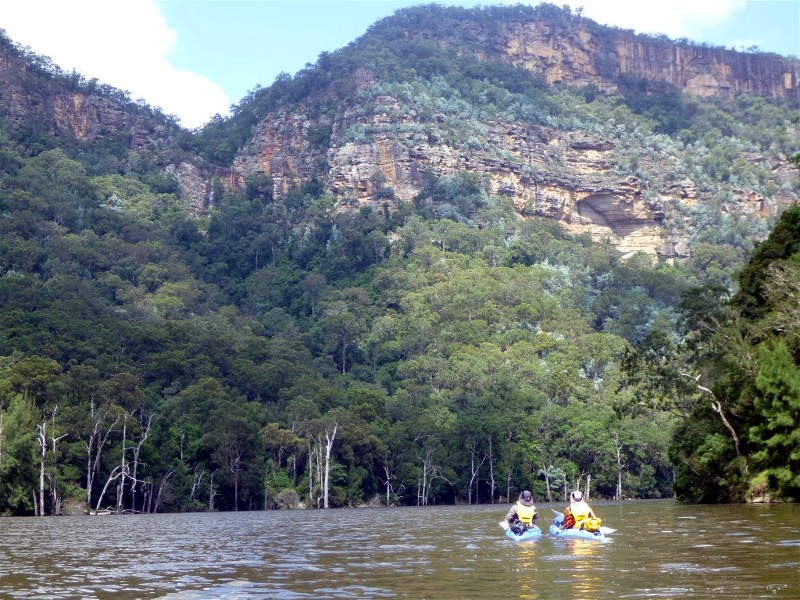
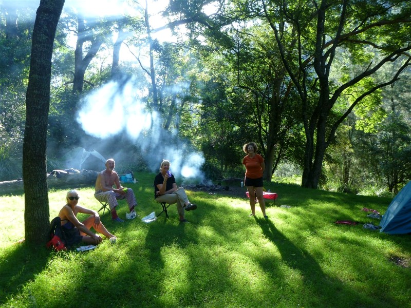
Last November Ian and Lin led a 2 night/3 day paddling expedition on Lake Yurunga at Tallowa Dam near Kangaroo Valley. For those of us who couldn't make it then, they kindly agreed to lead the same trip again in late February 2015. This time Karen, Bob and Sharon joined them on what proved to be a wonderful weekend.
It takes about 2.5 hours to drive the 162 km from Batemans Bay to the launch point at Tallowa Dam. We went on a Friday to ensure we could secure the campsite Ian and Lin had in mind for us, and to generally avoid the traffic and crowds which flock to the area on the weekends. Neither Karen, Bob, nor Sharon had been to Tallowa Dam before, so we were in for a real treat. Conditions were absolutely perfect for the 14 km paddle westwards along the lake. It was important to have streamlined boats with plenty of storage space for camping gear, and good paddling fitness, as paddling 14 km is fairly strenuous exercise, and moreso if there's a headwind.
After leaving the open water adjacent to the dam wall, the lake narrows between the towering sandstone walls of the Shoalhaven Gorge. It's like being in the Blue Mountains, but on water. The lower walls of the gorge are precipitously steep, plunging straight down into the lake, and covered with an interesting variety of vegetation. The upper walls are sheer sandstone cliffs and bluffs. Along the waterline, iridescent blue and grey striped waterdragons bask on every available sunny rock.
Every couple of kilometres there appears a narrow grassy bank, and it is on these that paddlers camp. We stopped at one at the confluence of Bullangalong Creek for a leg stretch and morning tea - about 8 km from the start point. Then we paddled another 5 km on narrowing water, with even higher cliffs to a sandy beach and hidden grassy campsite. Great swimming spot as well.
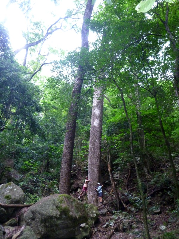
Next day (Saturday) Ian took us on the short walk up Wirritin Creek to see some huge red cedars. Smaller versions also grow along the gorge, together with the more finely shaped white cedars. We also stopped to watch a lyrebird fossicking around in the leaf litter. Then we paddled a short distance further west to Fossickers Flat (via some thrilling white water) to explore the swimming holes of Rotten Creek. Here Ian was very excited to find an unusual slender snake-like creature in the water - later identified as a Horsehair Worm.
Evenings in camp were spent cooking on the campfire and listening to the nocturnal ramblings of the wildlife - possums, wombats, owls, monitor lizards and goodness knows what else. In the mornings we were woken by a dawn chorus of birds, including the weird meowing screech of the catbird. We were surrounded by lyrebirds in full song - indeed they were in fine form all along the gorge. This place is a nature lover's paradise.
On Sunday we reluctantly packed up camp for the paddle back to civilisation. All possible campsites along the river had been annexed, and a flotilla of craft accompanied us on our leisurely trip back to the dam. Rounding the last bend we were amazed at the sheer number of boats pulled up all along the bank near the launch ramp, and the carpark was overflowing with paddlers, picnickers and fishermen. A very good reason to avoid the weekends.
We were incredibly lucky with the weather - warm days, cool evenings, virtually no wind, and great water temperature for swimming. No sooner had we loaded the boats and had lunch, than the southerly change arrived bringing hail, torrential rain and a sudden and dramatic temperature drop.
Many thanks to Ian and Lin for taking us to such an incredible spot. Can we
go again sometime please??
Karen M
Deua River and Pinkwood Creek
Sunday 1 March 2015
 |
 |
 |
| Taking the plunge Photo by Bob T Click on thumbnail to enlarge photo |
Elaine finds dry land Photo by Bob T Click on thumbnail to enlarge photo |
Nancy, Betty and Dennis Photo by Bob T Click on thumbnail to enlarge photo |
 |
 |
 |
| Bob and Elaine with Len among Pinkwood petals Photo by Bob T Click on thumbnail to enlarge photo |
Mossy rapids of Pinkwood Creek Photo by Bob T Click on thumbnail to enlarge photo |
Damp but Undaunted Photo by Bob T Click on thumbnail to enlarge photo |
11 enthusiastic walkers waded gingerly into the upper reaches of the Deua River behind Moruya on Sunday morning, 1st March.
Following recent rains the river was flowing quite fast in places and crossing smallish rapids could be quite tricky on slippery, underwater rocks. However, as we had hoped, the river was lined with Pinkwoods just coming into bloom and we were all justly rewarded as we marvelled at the beautiful ferns and mosses lining the banks and the apple-blossom like petals floating on the water.
Wading up the Deua for approx 1 km to the river junction, the group veered
and followed the Pinkwood Creek for another kilometre. Again, the creek was
lined with Pinkwoods, tree ferns and mosses, petals falling like snow. Even a
sharp thunderstorm did not dampen our spirits as we left of the riverbed and
headed up the hill towards home. This walk is arguably one of the most beautiful
in the bushwalkers' calendar.
Nancy
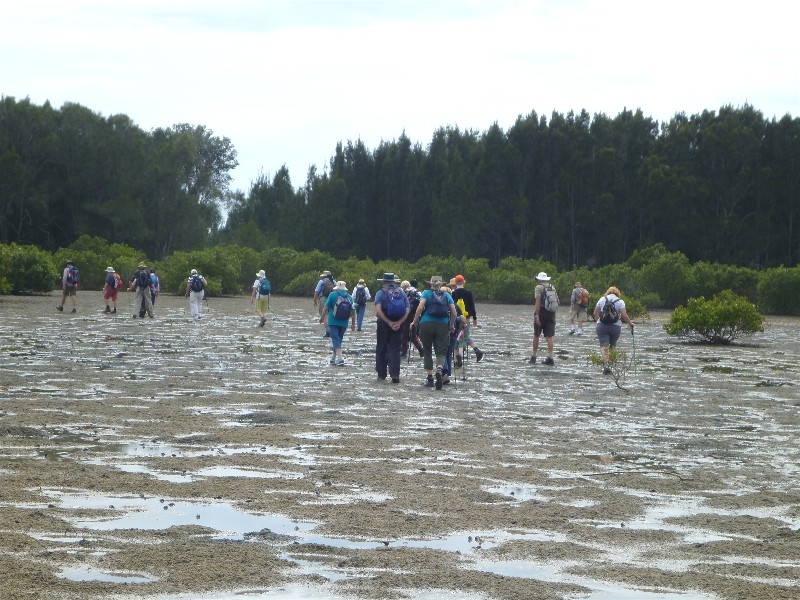
Quandolo Island and Moruya South Head
Thursday 26 February 2015
 |
 |
 |
| Foundation Members, Grant and Meriel Photo by Karen M Click on thumbnail to enlarge photo |
Circumnavigating Quandolo Island in the Moruya River Photo by Karen M Click on thumbnail to enlarge photo |
The throng on Shelly Beach Photo by Karen M Click on thumbnail to enlarge photo |
 |
 |
 |
| Shelly Beach Photo by Karen M Click on thumbnail to enlarge photo |
Gillian and Elaine and historic Toragy Head graveyard Photo by Karen M Click on thumbnail to enlarge photo |
View from historic South Head Pilot Station Photo by Karen M Click on thumbnail to enlarge photo |
On an overcast pleasant day, 30 keen walkers set out from the Elizabeth Road car park in the Eurobodalla National Park for Quandolo Island. With a low tide, we were able to cross to the island without getting our boots too wet by avoiding the pools of water left by the tide and hopping from one sandy refuge to another, at the same time, scattering the large armies of Soldier Crabs which were scuttling out of the way before us.
Reaching the surrounding mangroves, we proceeded to circumnavigate the island, stopping for morning tea where there were views up the river. During the walk we saw a large number of new mangrove shoots.
Eventually we left the island and headed for the breakwater and then the beach from which we could see as far as Burrewarra Point. After walking along the breach, we turned right at the Pole of Lost Soles and headed for the picnic area where we had a brief stop before heading up the hill to the old Toragy Cemetary for lunch with a view out to sea.
After lunch we continued along the road with bush either side of us and
caught glimpses of Moruya Beach through the scrub. Back in Elizabeth Road and
before heading back to the cars, we took a short walk up to the Pilot Station
to see the magnificent views north, east and west over the Moruya River and
Moruya Heads. A perfect end to the day's outing which was enjoyed by all.
Susan
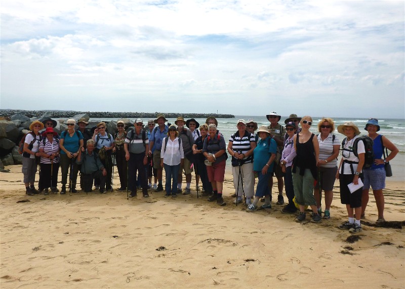
Kioloa Beach to Bawley Point
Saturday 21 February 2015
 |
 |
 |
| One of the many beaches on the walk Photo by Kay Click on thumbnail to enlarge photo |
Leaders Brian and Christine with Bev, Ailza and Denise Photo by Kay Click on thumbnail to enlarge photo |
Marle, Ann and Jenny Photo by Kay Click on thumbnail to enlarge photo |
What a delightful walk. 16 bushwalkers set off loaded with enthusiasm and an esky in the cars for the bbq picnic dinner.
This is a great feature walk and one of nine important Aboriginal areas in NSW. Murramarang Aboriginal area consists of 60 hectares and contains the largest complex of middens dating back to the ice age - many artefacts have been discovered and preserved over the years. The walk was well marked out and we were able to read many notice boards telling us about the wildlife and history of the area.
The day became rather warm and humid - no shade was to be had, but we did get some much needed breeze when we were walking on the beaches. The sand was firm which made walking easier as we proceeded to Cormorant, Gannet, Murramarang, Cat and Kitten and Bull Pup Beaches (the last two being named after two of the twelve ships that were wrecked on the rocky shores in the area) We stopped at Racecourse Beach for afternoon tea then walked on to Shelly and Kioloa beaches to the waiting cars to drive us back to Bawley Point for our bbq.
This walk was in memory of Ron Evans who led it many times over the years.
Thank you to both Brian and Christine for a great day.
Ann
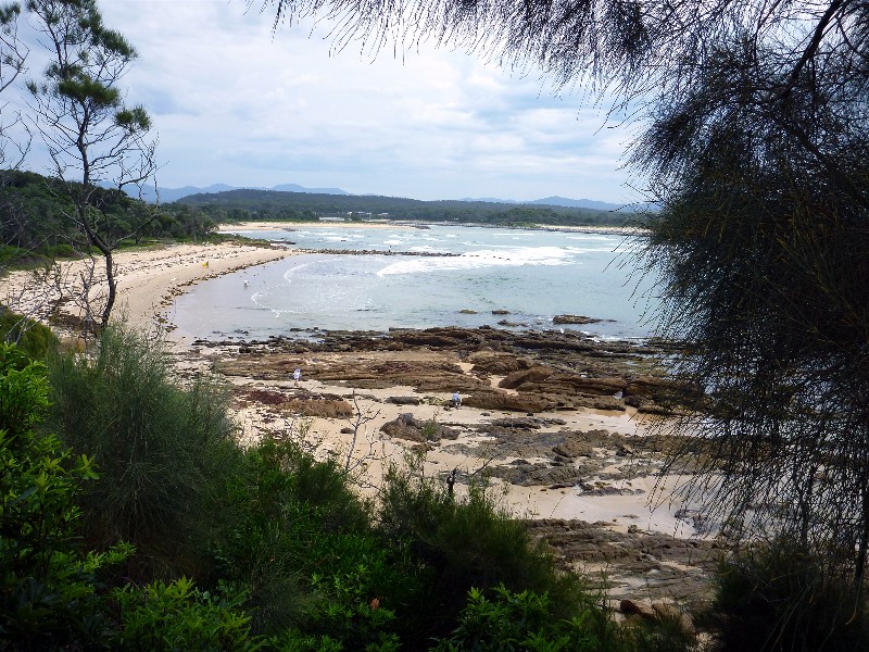
South Durras and Murramarang National Park
Wednesday 18 February 2015
 |
| Mary and Wendy on a South Durras early morning Photo by Karen C Click on thumbnail to enlarge photo |
Our walk on Wednesday 18 February started with a leisurely breakfast at Cookies Beach picnic area. After using the recently renovated rest rooms and admiring the mosaic art work on exterior wall of same, we set off south where you take in the wonderful Murramarang National Park bushland - Burrawangs, old misshaped Spotted Gums, Kangaroos, just breathtaking.
Later taking the track through what the locals call the Enchanted Forest to the beaches, we walked Emily Miller Beach and around the rock face enjoying the golden warm colours of the sculpted sandstone cliffs.
Back on track to Flat Rock where morning tea was enjoyed while
taking in the spectacular view of that part of the coast line, one
could linger there all day. Back to Cookies Beach via bush and road, a
wonderful morning.
Thank you Leader, Ian H.
Ailza
Paddle to Bumbo Lake and Creek
Tuesday 17 February 2015
 |
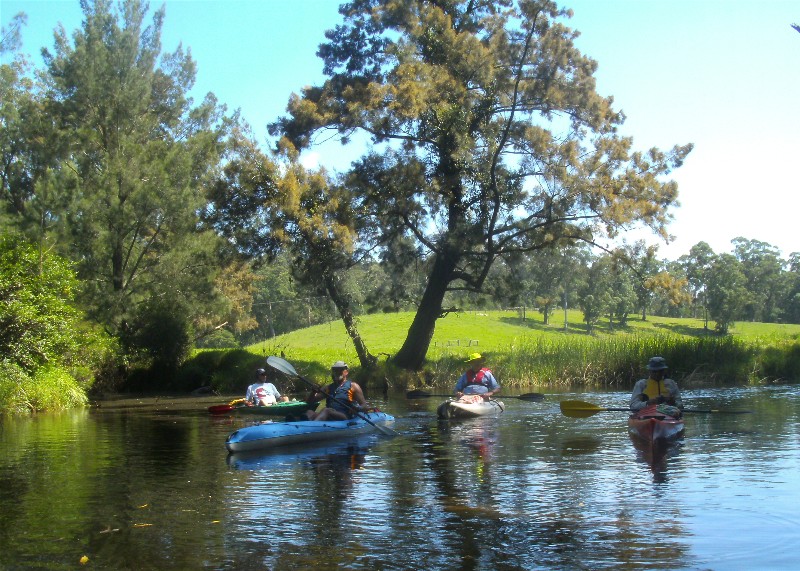 |
 |
| Bumbo Creek Photo by Karen M Click on thumbnail to enlarge photo |
Turn around point on the creek Photo by Karen M Click on thumbnail to enlarge photo |
One of the wooden bridges spanning the creek Photo by Karen M Click on thumbnail to enlarge photo |
6 paddlers enjoyed a sunny paddle starting at Snake Flat on the Tuross River. We
turned into Bumbo Creek and diverted into Bumbo Lake, exploring several of its
bays and arms, before stopping on the shore for morning tea. Then back into
the creek, paddling upstream past forest and farmland, under the old wooden bridge
and as far as we could go before being stopped by trees and debris blocking our path.
We enjoyed lunch while relaxing on the shady bank of the creek, before paddling the short
distance back to our start point.
Karen M
Bawley Point to Meroo Head
Sunday 15 February 2015
Charles led this shorter version of the walk below, also starting at Bawley Point,
but turning around at Meroo Head.
Bawley Point to Termeil Point Circuit
Sunday 15 February
 |
 |
 |
| One of many beaches on the walk Photo by Lin Click on thumbnail to enlarge photo |
Morning tea in the shade Photo by Bob M Click on thumbnail to enlarge photo |
Karen and Wendy Photo by Kay Click on thumbnail to enlarge photo |
 |
 |
 |
| Mike surfs the sandstone Photo by Karen M Click on thumbnail to enlarge photo |
Shady lunch spot Photo by Lin Click on thumbnail to enlarge photo |
Lin and Glen in burnt out tree Photo by Ian Click on thumbnail to enlarge photo |
This was a 14 km circuit led by Karen C, and the second of the series of coast walks between Tabourie and Tuross, north to south. Another glorious south coast day to enjoy the beaches, views, sandstone rock formations, coastal lakes and forest.
Starting at Bawley Point we walked north to Willinga Point, Nuggan Point, Meroo Head and Termeil Point. On the way we passed 5 beaches and Willinga Lake, Meroo Lake and Termeil Lake.
The return walk through the forest took us behind the sand dunes where we had
a good look at the lake systems and heard a little about some of the historic tramway
routes in the area transporting timber from the forests to the mills on the coast. Thanks to
Karen C leading a really interesting and scenic bushwalk.
Karen M
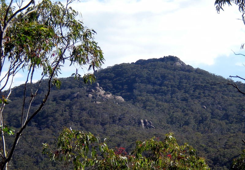
MOUNT DROMEDARY 30 YEARS AGO
SATURDAY 29 JUNE 1985
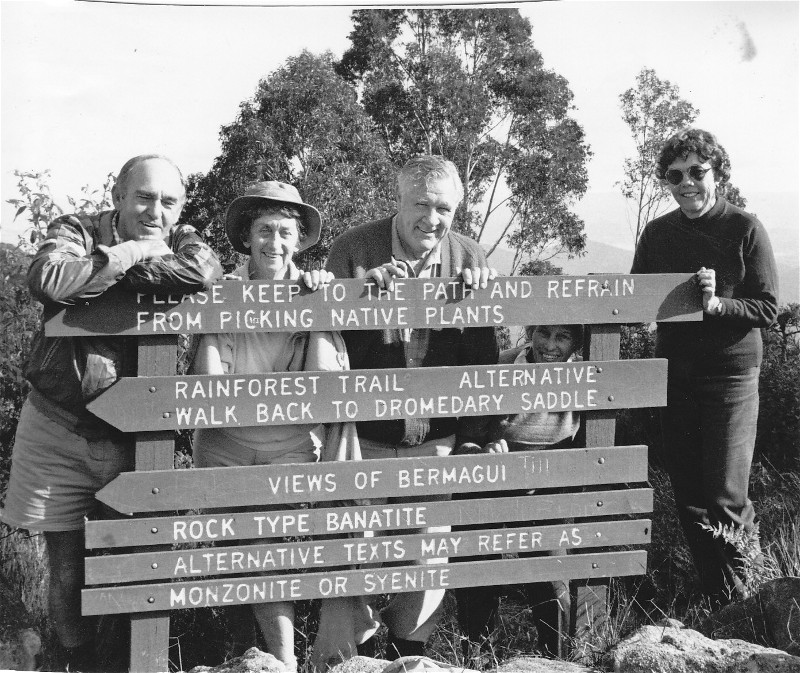 |
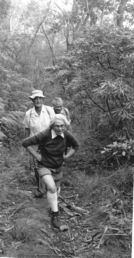 |
 |
| Dennis & Betty Ewart, Eric Wright and Jean Kenway Click on thumbnail to enlarge photo |
Leader Mavis Wulfing, John Maxwell and Eric Wright Click on thumbnail to enlarge photo |
Meriel Miles and Eric Wright Click on thumbnail to enlarge photo |
To celebrate our Club's 30th Anniversary, we will revisit some of the best Walk Reports and photos from the old days. Here is a particularly evocative example.
This is the original account of Batemans Bay Bushwalkers' second official walk and first ascent of Mount Dromedary, attended by 22 people.
Another sunny winter's day dawned for the Batemans Bay Bushwalkers to climb Mt Dromedary. Leaving Pam's Store just after 10am, the fairly steep shoulder was negotiated with only a few stops to get our breath and to turn around and see the expanse of sky, sea and green fields scattered with trees and rocky tors. Then through forests of tall, slender eucalypt on the sunny side until we came to the damper part where the tree ferns were so prolific.
Fortunately the track was not so steep and became less arduous and more enjoyable. After a short break at the picnic area we then went along the edge, getting glimpses of the ocean through the trees. The lush growth on the wetter southern side of moss, ferns, treeferns, creepers and soft woods caused much stopping and admiring.
The most awe inspiring part of the walk was the rainforest near the top; no sun, tall slender trees, huge rocks with tops of fern, moss on logs and rocks. The group stood and wondered and absorbed the atmosphere and the subdued green light.
A great deal of huffing took us to the summit and there was the view, clear and almost without haze. Pigeon House and The Castle to the north, Bermagui below us and to the west cleared green patches in amongst ridge after ridge, heavily timbered.
After lunch we went down by the shortcut, which was very trying on the knees, then around the edge to the picnic area again. There a short diversion took us to the TORS, a most unusual rock formation. Well worth it!
Back to the cars and downhill all the way, but accompanied by lyrebirds showing off to one another, calling from valley to hilltop. Fascinating to stop and listen to their marvellous imitations!
Although it was considered a hard walk, the group said it was worth it because
of the beauty and variety of the flora. This makes a good summer walk as so much
is still in shade.
Mavis Wulfing
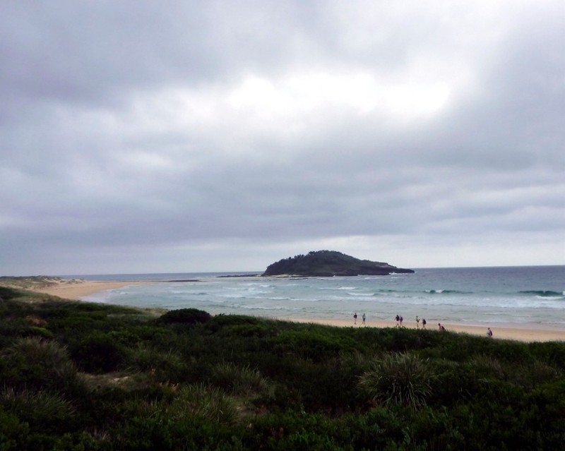
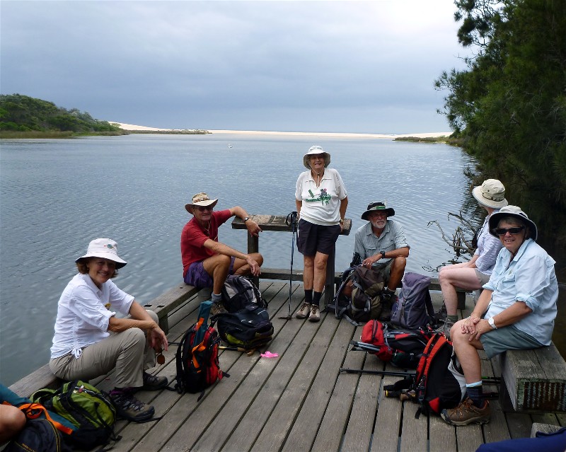
Tabourie to Termeil Point Circuit
Thursday 12 February 2015
 |
 |
 |
| Bob's prime view of Termeil Lake Photo by Lin Click on thumbnail to enlarge photo |
Ainslie, Mike and Ailza at Termeil Point Photo by Bob M Click on thumbnail to enlarge photo |
Beachwalking from Termeil Photo by Lin Click on thumbnail to enlarge photo |
 |
 |
 |
| Mike, Ainslie, Bob, Karen, Joan, Mary and Debbie Photo by Lin Click on thumbnail to enlarge photo |
Crampton Island Photo by Lin Click on thumbnail to enlarge photo |
Lunch with water views Photo by Bob M Click on thumbnail to enlarge photo |
"Happy 30th Anniversary'
This year the Batemans Bay Bushwalking Club celebrates thirty years of bushwalking, and to celebrate this anniversary the club has planned a series of day walks that will cover the coast from Tabourie to Tuross.
The first of these walks, held last Thursday, saw 21 bushwalkers, including 4 visitors, take to the bush at the eastern edge of Tabourie village. Following bush tracks the group made their way through the Meroo National Park until they reached the shore of Termeil Lake. After morning tea on the lakeshore, we circled around the Termeil Point Camping area. From the number of campers tucked in amongst the trees, it was obvious that this National Park camping area is a popular one.
It was then down to the beach where we headed north past Stokes Island, and across a rocky headland before heading up over the dunes to a bush track just behind the beach. Our return to beach walking was just short of where Lake Tabourie runs out to sea. As the lake was now open, and we were facing an incoming tide, it was decided to postpone any crossing to Crampton Island - maybe next time at a low tide! So turning west, we headed to the beautiful foreshore walk that skirts the southern side of Lake Tabourie.
Along the foreshore we found the perfect lunch spot - a timber jetty out over the lake. Though the day had been heavily overcast with gusty winds, looking back east from the jetty, we were treated to a perfect photo opportunity, the lake, heavy grey clouds and a long stretch of light yellow sand.
It was then but a short walk back to the cars.
Mary
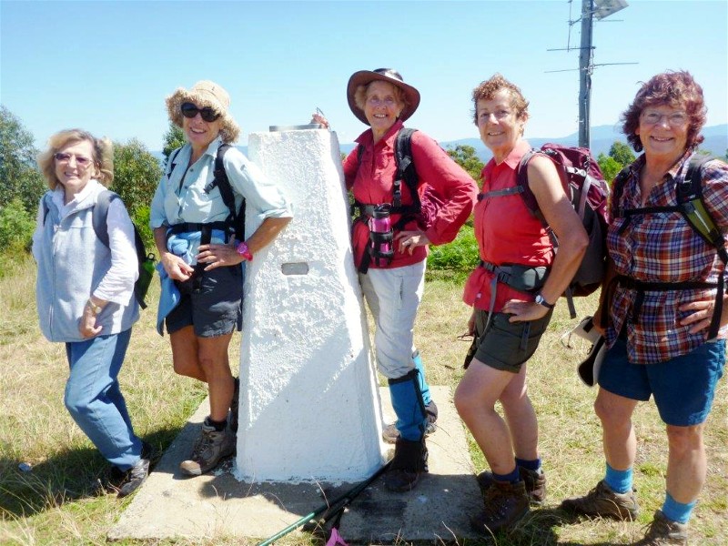
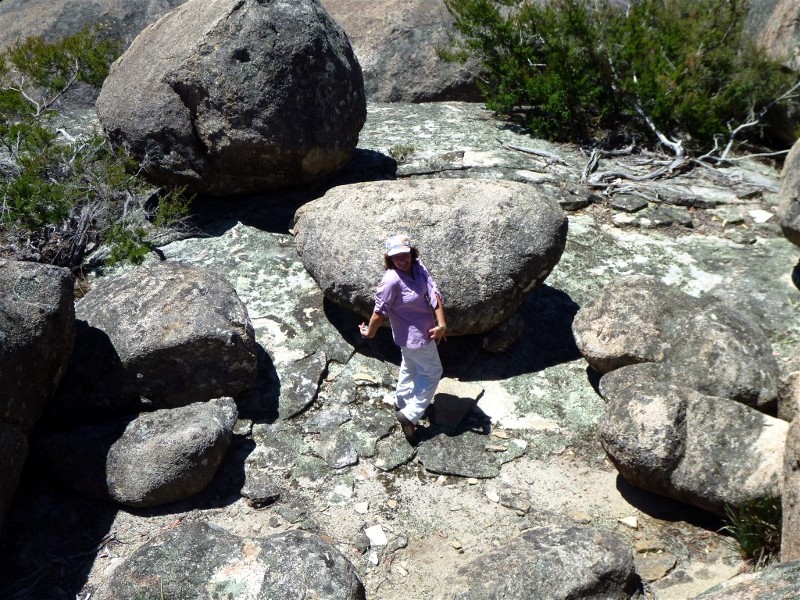
Tinderry Range
Saturday 7 - Sunday 8 February 2015
 |
 |
 |
| Merry band of walkers ready to go Photo by Wendy Click on thumbnail to enlarge photo |
Wendy waltzes across a boulder catwalk Photo by Lin Click on thumbnail to enlarge photo |
Camping under the snow gums Photo by Wendy Click on thumbnail to enlarge photo |
 |
 |
 |
| Tinderry peak from the north Photo by Wendy Click on thumbnail to enlarge photo |
The granite boulders were huge Photo by Wendy Click on thumbnail to enlarge photo |
Ian and Wendy contemplate yet another rocky obstacle Photo by Lin Click on thumbnail to enlarge photo |
Between Captains Flat and Michelago, separating the Murrumbidgee and Queanbeyan Rivers, is the 30 kilometre long Tinderry Range. It is an eastern outlier of the much larger Kosciusko massive and is an important high country link to the coast.
The backbone of the Tinderry Range is a 12 kilometre north-south ridge of spectacularly large granite slabs and monoliths rising to 1,600 metres above sea level and is mostly within the 12,000 hectare Tinderry Nature Reserve. The main range attracts winter snowfalls and supports sub alpine vegetation among the granite outcrops whilst the eastern foothills are rolling hills of open tablelands eucalypt forest.
The foothills allow for pleasant easy to medium grade cross country walking but the main range can be difficult, in places requiring rock scrambling through giant boulders. The views from both Tinderry and Tinderry Twin peaks are extensive.
Being largely surrounded by private property, access to the area is limited and visitation by bushwalkers, although close to Canberra, is infrequent and is not encouraged by the reserve's management. Apart from surrounding firetrails, there are no tracks on the main range.
On a third attempt (first attempt no walkers, second attempt washed out) our Club, represented by Wendy, Sharon, Graeme, Bronwyn, Lin and Ian, visited the Tinderry Ranges in early February. We entered from the Tinderry Road near Round Flat and walked north, climbing 200 metres into the granite massif area east of Tinderry Peak. At lunch, a nearby bouldery rock slab gave us clear views where we could pick out Palerang, Currockbilly and Budawang Mountains 50-70 kilometres to the northeast.
Mooching on we camped in the headwaters of Tinderry Creek, just upstream of Bluebell Swamp. On the second day worked our way south under the shadow of Tinderry Peak, across Roberts Creek and found the firetrail again not far from our start point.
The weather was agreeable and it was a pleasant journey, marred only by a walker having health problems which unfortunately necessitated a slow pace and a reorganised route to safely exit the area. So we missed some features we planned to visit. However, we saw some very impressive granite monoliths, the larger of which soared above the tree canopy. Walking through the sub alpine forest was also very pleasant, a welcome change from our usual coast haunts.
Recent rains meant every gully had water available, something which certainly could not be normally relied on in most summers. As we have noted since winter, it has been a good season for snakes. We observed both a tiger and red bellied black, both in very good condition and both at close range, one at eye level in our first search for camp water. We looked elsewhere!
Unfortunately, the area has some negatives. It is plagued by pigs, their diggings were almost everywhere and we saw at least four groups. There was also evidence of goats.
The high area of the reserve is carrying heavy ground litter and wood debris making it a sitting duck for a catastrophic bushfire. This area last carried a bushfire in 1957 and since then it has been hazard reduction burnt only once, 40 years ago. The strategy of fire exclusion is a failure, well illustrated by the ugliness in the southern area which was comprehensively cooked in 2009.
The out of control pigs and the inevitability of a hot wildfire are real threats
to the high Tinderrys but hopefully, before too long, we will return to explore
more of the granite outcrops and perhaps the lower hills adjacent to the Queanbeyan
River.
Ian
Currowan Creek Meander
Wednesday 4 March 2015
 |
 |
| Looking down on morning tea Photo by Bob T Click on thumbnail to enlarge photo |
At the top of the cascade Photo by Bob T Click on thumbnail to enlarge photo |
On Saturday February 7th there were 19 walkers, led by Cliff in Currowan Creek. This walk has been done before in drought conditions, when it was an easy walk along a dry creek bed through very pretty riparian dry sclerophyll forest. This time things were very different - the forest was just as attractive, but the creek was flowing fresh and clear between green mossy banks. A wet December and January had achieved a transformation, and although the day was hot, under the trees was cool.
The walk was not as easy this time, as we had to cross and re-cross the creek
to find a route along the banks, and the damp leaf litter was leech heaven. Some
walkers got wet feet, and one who shall remain nameless got rather more than the
feet wet, but there were no complaints - especially when we finished at Cliff's
delightful forest home for a barbeque lunch, scones and cream, and a dip in his
pool for any who wished to enjoy the opportunity.
Mike
Paddle Skills and Equipment Orientation
Thursday 5 February 2015
 |
 |
 |
| The group at Moruya River Photo by Bob M Click on thumbnail to enlarge photo |
Sharon's new boat Photo by Bob M Click on thumbnail to enlarge photo |
Personal flotation devices are compulsory Photo by Bob M Click on thumbnail to enlarge photo |
As you can see from the photos there was a pleasing turnout to Ian's information and orientation session on paddling. Sharon had bought a new boat, Rodney had a new car loading system, and there were several new faces hoping to find out what sort of boat and gear they needed to get started on the water.
The Moruya River turned on perfect paddling conditions for some first time
tryouts in all the different boats, and Ian and Sharon deliberately ditched their kayaks
to practise deep water rescue skills (successfully) - while the rest of us just looked on admiringly!
Karen M
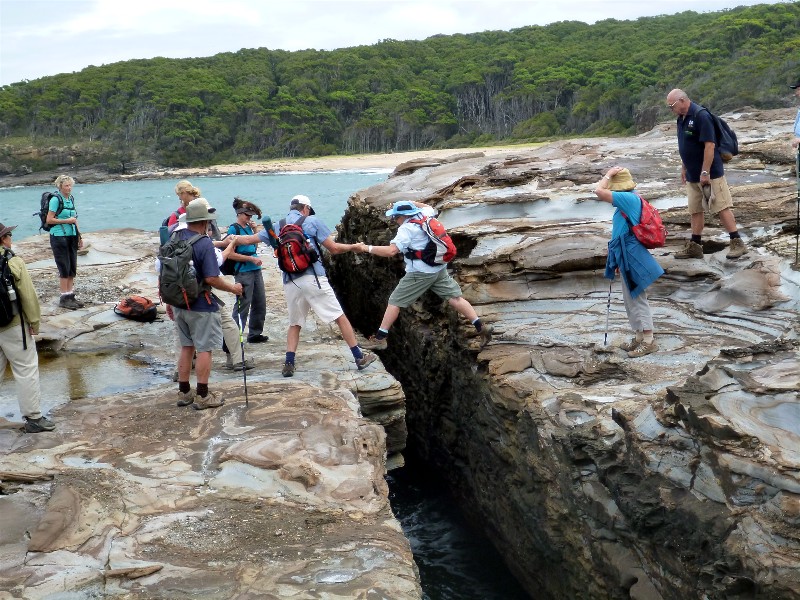
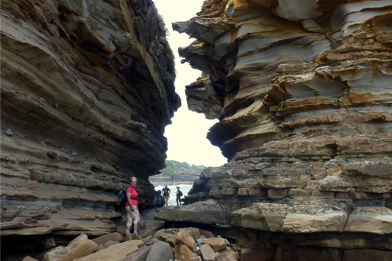
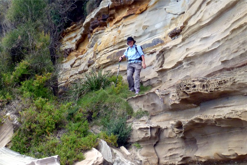
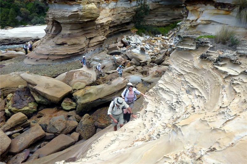
Durras Lake and Coastal Highlights
Wednesday 4 February 2015
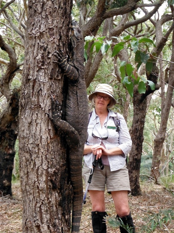 |
 |
 |
| Mary and the Goanna Photo by Bob M Click on thumbnail to enlarge photo |
Bev jumps the gap Photo by Bob M Click on thumbnail to enlarge photo |
Karen walks through the volcanic dyke Photo by Bob M Click on thumbnail to enlarge photo |
 |
 |
 |
| Elizabeth Photo by Bob M Click on thumbnail to enlarge photo |
Stan and Mary on sandstone platform Photo by Bob M Click on thumbnail to enlarge photo |
Curious honeycombed formation Photo by Karen M Click on thumbnail to enlarge photo |
There are few better places to showcase the natural beauty of our region than the Murramarang National Park. The area around the South Durras township is particularly special and it was here that 15 club members and 2 visitors set off on the first programmed walk of the new year.
The 13 kilometre figure of eight circuit took us through the towering Spotted Gums and Burrawangs that the park is famed for, as well as several of the magnificent beaches and rock platforms along the Durras coastal strip. Among the highlights were the eastern shore of Durras Lake, where we found machinery parts and other evidence of the timber industry of times gone by.
After a relaxed lunch at Dark Beach, we were surprised to encounter a goanna (Varanus Varius), the size of which was beyond what any of us had ever seen. At more than two metres in length, it was big enough and bold enough to remain low on a tree trunk and allow itself to photographed up close.
The much-anticipated drama of jumping "the gap" at the north end of Emily Miller Beach was completed without incident, as the group continued in and among the massive rocks, absorbing the awesomeness of the geological sandstone formations which are a feature of the area near Wobbegong Bay.
A final stroll along Mill Beach completed a wonderfully varied and
interesting day. Thank you to Geoff & Elizabeth for sharing your backyard with us.
Brian
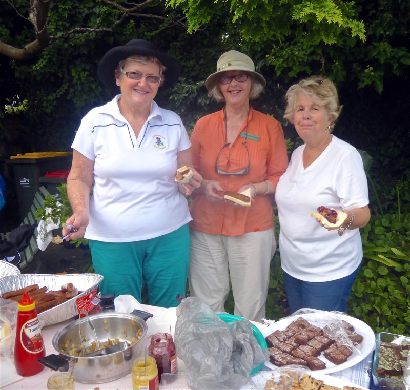
Denhams Three Beach Walk with Sausage Sizzle to Follow
Sunday 1 February 2015
 |
| Helen, Mary and Lyn Photo by Joan Click on thumbnail to enlarge photo |
The special celebratory 30th Anniversary Year for Batemans Bay Bushwalkers began with a Denhams Three Beach Walk followed by a sausage sizzle for 53 members in the garden of Lyn and Barry. The weather was kind and all enjoyed a relaxing time walking and catching up with each other since the week before Christmas. Denhams Beach and the walk south around the next two small headlands is a favourite beginning for members every year for all the adventurous walks in the year to come.
There is a planned program of 30th Anniversary Celebration Walks which include
members' favourite walks and Walking the Coast from Termeil to Tuross. These are walks
that members old and new have enjoyed over many past years, and memories and past
photos of these walks will be part of the enjoyment during the year's events and
festivities.
Joan