Second Quarter 2015. See below for
Walk Reports and Photos
Walk Reports and Photos for Autumn 2015. Click on walk headings below, or simply scroll down the page.
Ryans Creek - Four Crossings, Saturday 27 June 2015
Narrawallee Nature Reserve, Wednesday 24 June 2015
Dalmeny to Narooma, Sunday 21 June 2015
Cullendulla Creek via Square Head to Long Beach, Thursday 18 June 2015
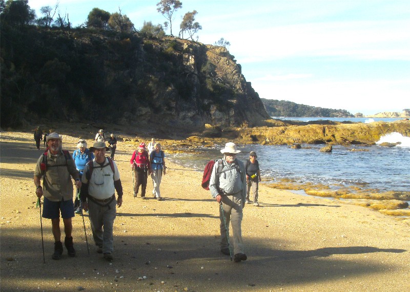
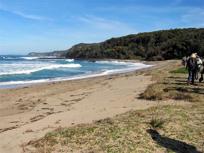
Long Beach to Beyond Reef Point via Beaches and Cliffs, Saturday 13 June 2015
Durras Mountain and the Giant Strangler Fig, Wednesday 10 June 2015
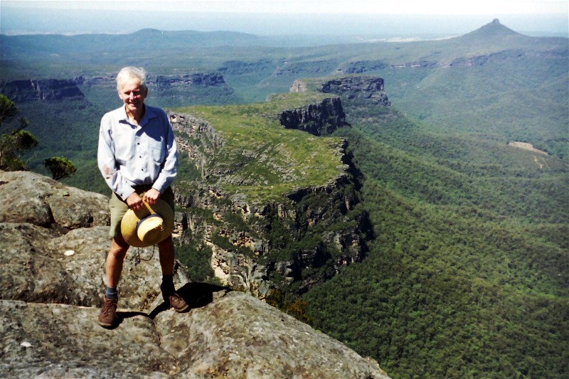
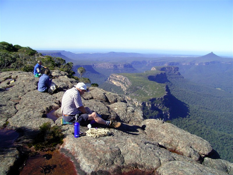
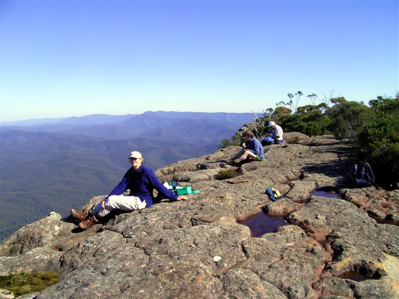
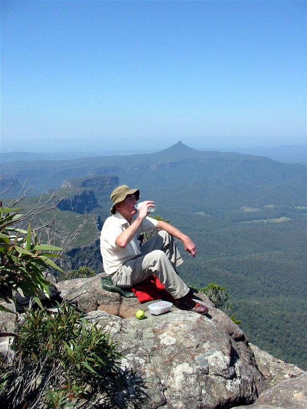
Historic Photos of The Castle and Byangee Walls Walks
Little Dromedary Mountain, Sunday 7 June 2015
Corang River to Explore Old Gold Mine Water Race, Friday 5 - Sunday 7 June 2015
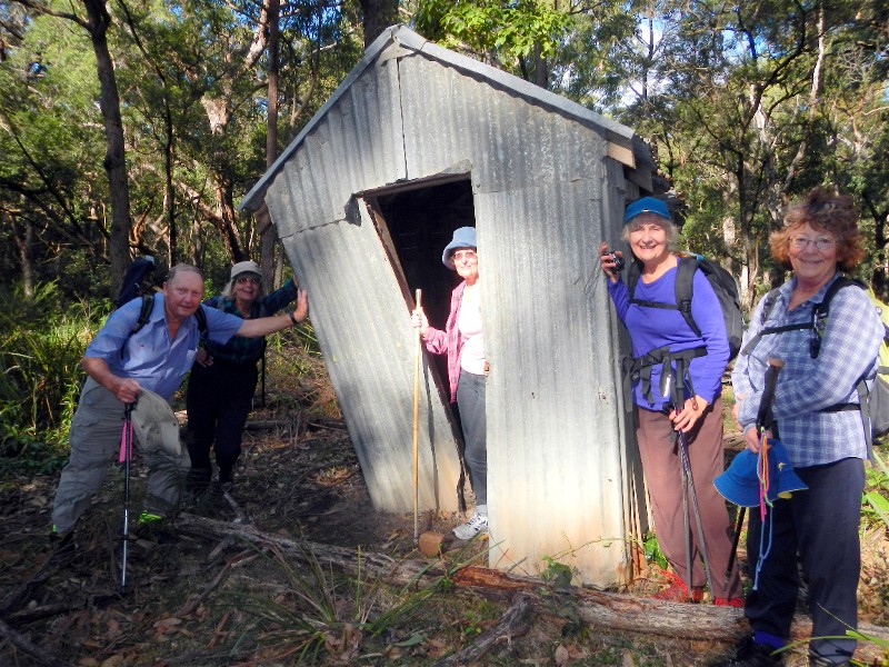
Billys Hut from Lyons Road, Thursday 4 June 2015
Mystery Bay, Saturday 30 May 2015
Maloneys Beach to North Head for Lunch, Wednesday 27 May 2015
Tomaga River Paddle, Thursday 21 May 2015
Wasp Head to North Head One Way, Sunday 24 May 2015
Lookout Road, Old Nelligen Road and Perrys Lane, Thursday 21 May 2015
Feed Shed Creek Circuit, Saturday 16 May 2015
Bartleys and Punt Arms, Durras Lake, and Ocean Beaches, Wednesday 13 May 2015
Pollwombra Mountain, Sunday 10 May 2015
Currowan Creek and Peach Tree Gully, Thursday 7 May 2015
Barefoot Bowls Social Afternoon, Saturday 2 May 2015
Point Upright to Depot Beach and Return, Wednesday 29 April 2015
Tracks and Mines near Moruya, Sunday 26 April 2015
Merry Beach to Snake Bay, Thursday 23 April 2015
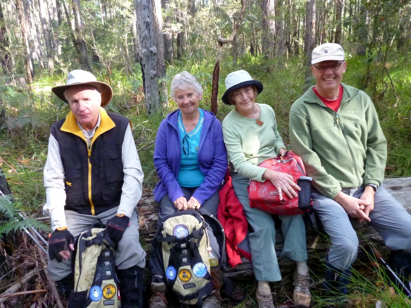
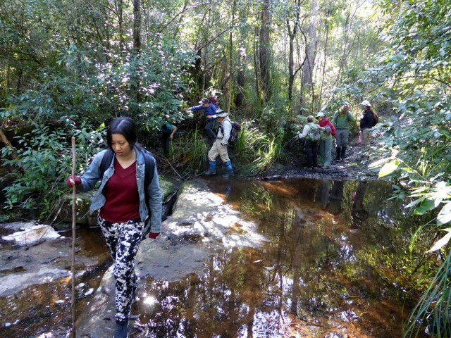
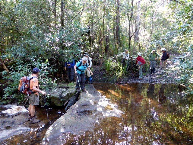
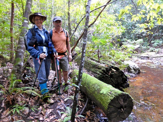
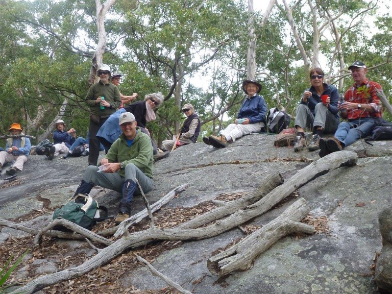
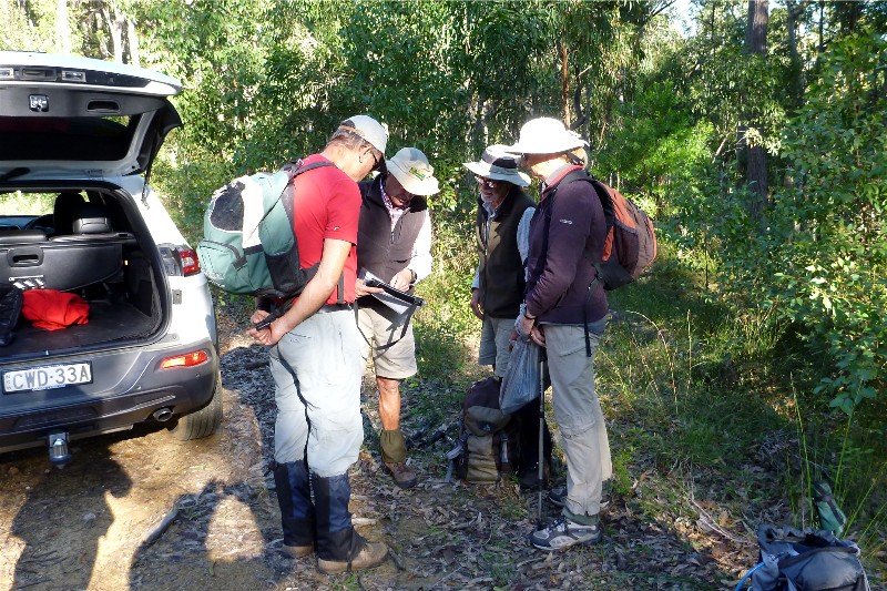
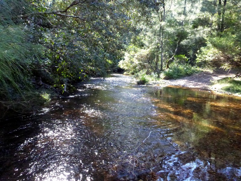
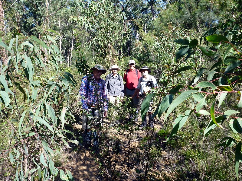
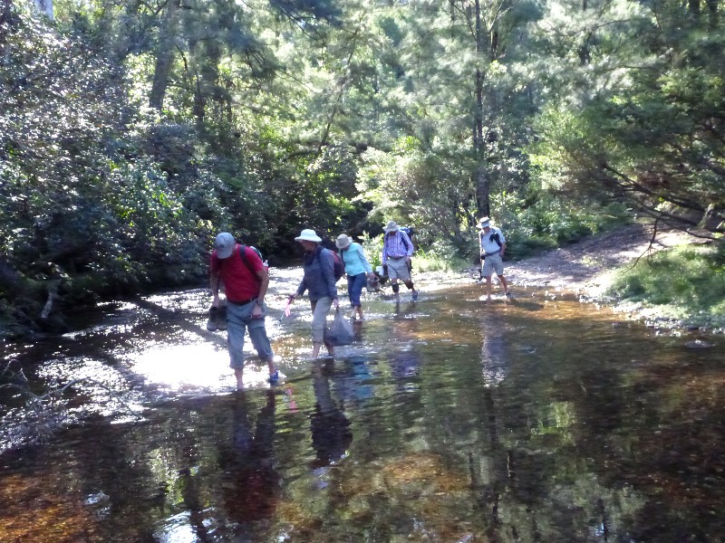
Ryans Creek - Four Crossings
Saturday 27 June 2015
 |
 |
 |
| Dennis, Nancy, Joan and Rob Photo by Bob M Click on thumbnail to enlarge photo |
Tina crossing Ryans Creek Photo by Mary Click on thumbnail to enlarge photo |
Nancy crossing the creek Photo by Mary Click on thumbnail to enlarge photo |
 |
 |
| Betty and Martin Photo by Mary Click on thumbnail to enlarge photo |
John, Karen, Tina and Betty Photo by Bob M Click on thumbnail to enlarge photo |
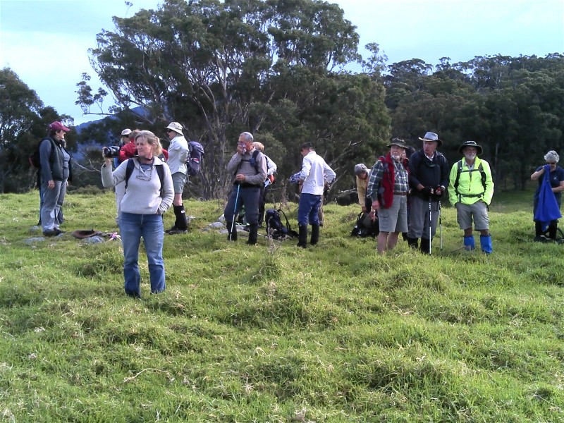
Weatherwise an ideal winter day walk, ably researched and led by Mary and Stan. There was a minor modification to the early part of the walk so that the car shuffle was not necessary. Excellent walking conditions though varied terrain: old disused roads, bush tracks, traditional "bush-bashing" in the descent to 4 crossings of Ryan Creek, no. 3 being the most spectacular across a suspended rock bridge with slippery rocks.
Members of the BBBW used GPS instrumentation to update the maps for future
use. Amongst the surrounding bush we saw ancient blue gum and spotted gum trees
of considerable girth. No fauna to be seen, despite anticipated warnings of
possibly invasive colonies of leeches (due to the wet conditions underfoot),
and bees, thankfully neither reported.
John M
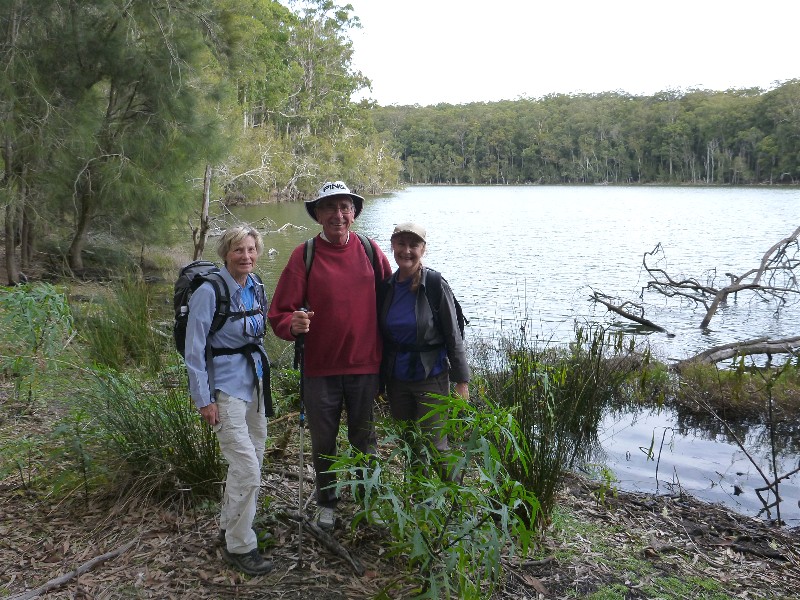
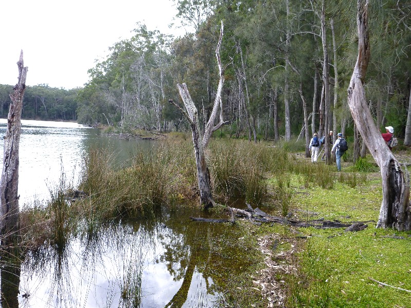
Narrawallee Nature Reserve
Wednesday 24 June 2015
 |
 |
 |
| Underwater track Photo by Erika Click on thumbnail to enlarge photo |
Look at all those shells Photo by ?? Click on thumbnail to enlarge photo |
Old silica mine remains Photo by Erika Click on thumbnail to enlarge photo |
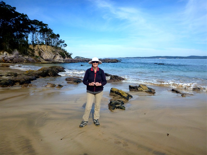
The programmed walk for today, 24 June, was with Karen C in the Narrawallee Nature Reserve, Lake Conjola. Because of recent rains the bush was looking particularly beautiful as we walked through lovely old growth Turpentine forest, along leaf covered trails, stopping at attractive viewing points on the Narrawallee Inlet.
We did some fancy footwork for a few hundred metres along a water covered track where fortunately no-one fell in. The track continued to the Buckley Beach and over Buckley Point where we had lunch on a rocky headland watching the crashing waves. The narrow track then wound along behind the dunes to one last lookout point, then headed inland through the remains of one of the old silica mine sites in that area.
We finished a very pleasant walk with coffee and cake at the Bakery at Milton.
Betty
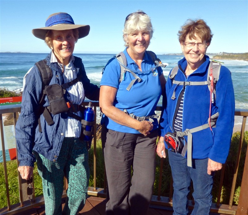
Dalmeny to Narooma
Sunday 21 June 2015
 |
 |
| Betty, Donna and Lesley Photo by Joan Click on thumbnail to enlarge photo |
One of the artworks along the track Photo by Donna Click on thumbnail to enlarge photo |
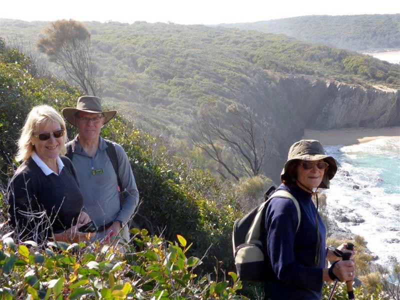
Last Sunday a group of eight lucky Batemans Bay Bushwalkers members, led by Lesley, walked in perfect weather from Dalmeny to Narooma.
The scenery could not have been better, with wonderful views along the coastline of beaches, rocky headlands and crashing waves as well as story boards along the path giving interesting information on the history of this part of the South Coast.
Lunch was taken in a park on the north side of Narooma inlet overlooking the
ocean and with a view to Mount Gulaga. The walk then continued along the north
breakwater wall and along the boardwalk before crossing Narooma bridge.
At the end of the walk the group decided to drive to the south breakwater wall
where they saw several seals swimming, cavorting and enjoying the sunshine on the
rocks - another highlight of the outing.
Joan
Cullendulla Creek via Square Head to Long Beach
Thursday 18 June 2015
Postponed due to wet weather. Rescheduled for next quarter
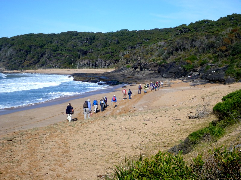
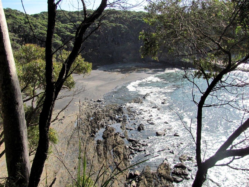
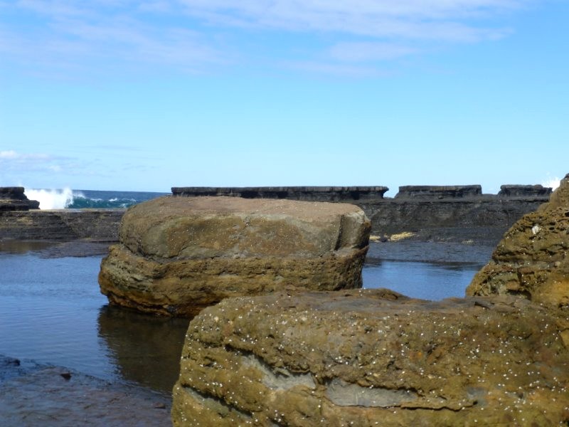
Long Beach to Beyond Reef Point via Beaches and Cliffs
Saturday 13 June 2015
 |
 |
 |
| Starting out on a perfect Long Beach morning Photo by Donna Click on thumbnail to enlarge photo |
Bob, Bob, Bob, and Dennis Photo by Donna Click on thumbnail to enlarge photo |
Karen on more Murramarang coast Photo by Bob M Click on thumbnail to enlarge photo |
 |
 |
 |
| The lunch beach Photo by Karen M Click on thumbnail to enlarge photo |
Tollgate Islands Photo by Bob M Click on thumbnail to enlarge photo |
Another sandy cove Photo by Karen M Click on thumbnail to enlarge photo |
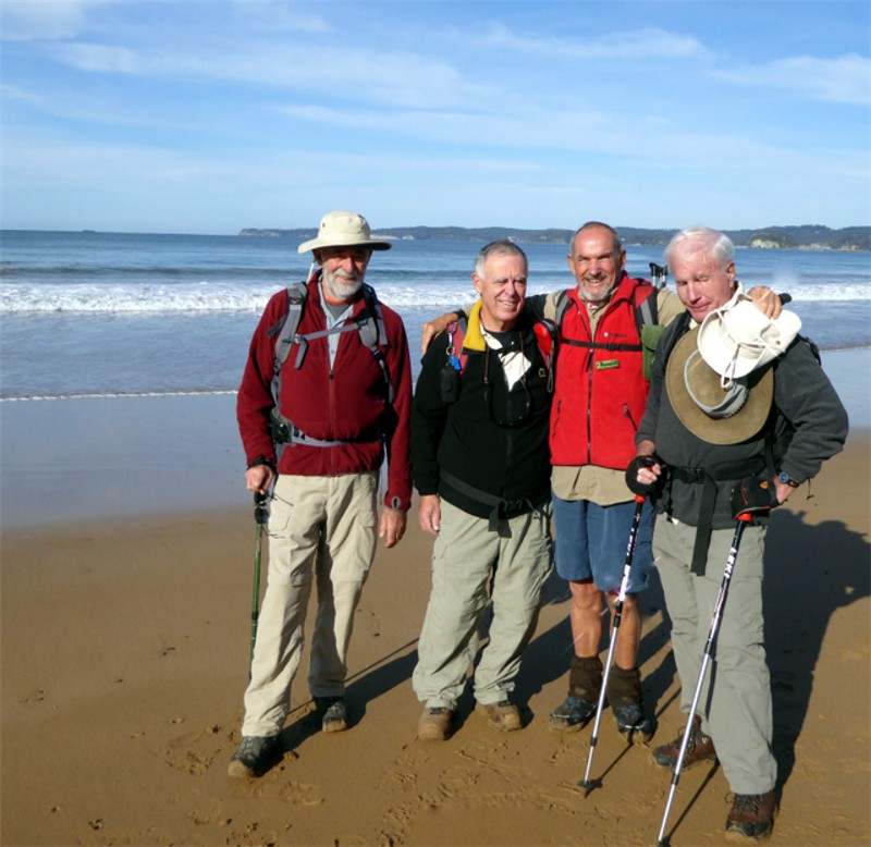
Saturday 13 June, what a beautiful day for a bushwalk, and thirteen members of the Batemans Bay Bushwalkers set off from Long Beach for a memorable walk. Memorable for the participants in that it was the last walk for one of the Club stalwarts, who is heading south of the border to start the next chapter of his life story. It will also mean one less member of the Bob's Club and the loss of one member from the famous seven Bob's walk.
The walk itself was as superb as the weather, great bay and ocean views and with
forest, beach and rock shelf walking. Thanks to Jill for another great walk.
Bob J
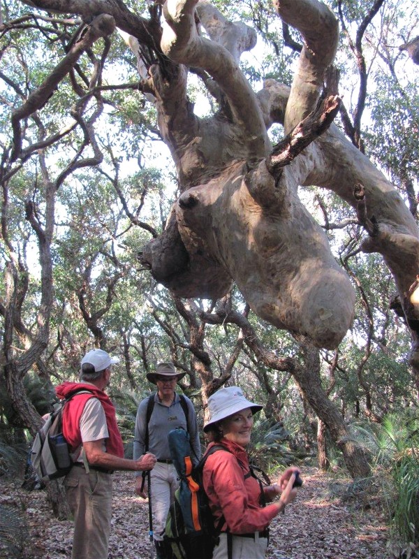
Durras Mountain and the Giant Strangler Fig
Wednesday 10 June 2015
Due to insufficient numbers, walk undertaken on an unofficial basis
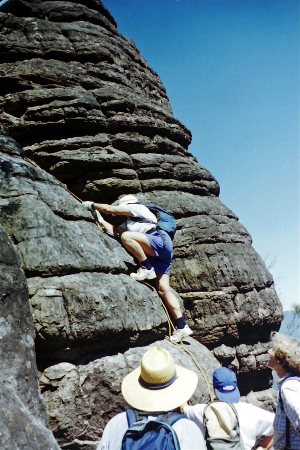
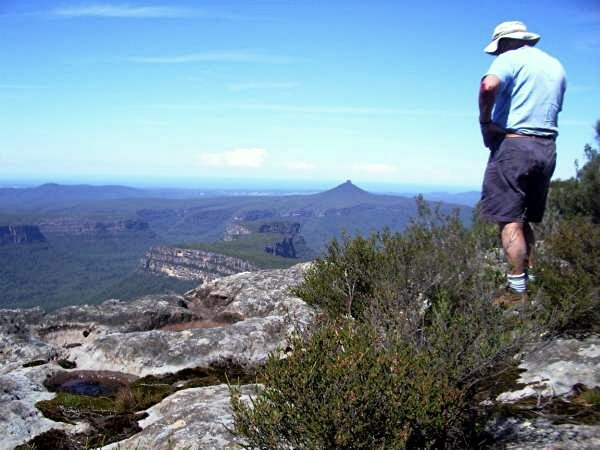
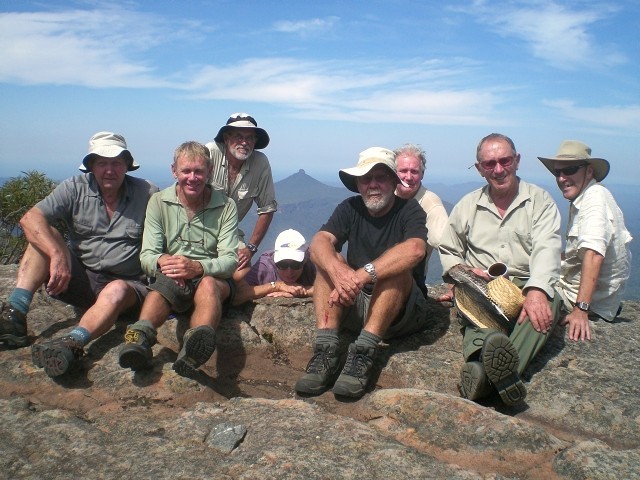
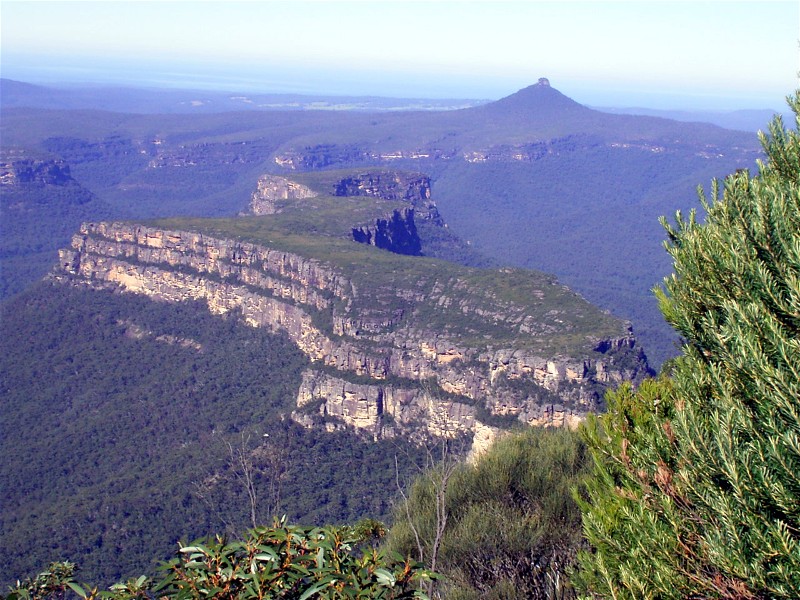
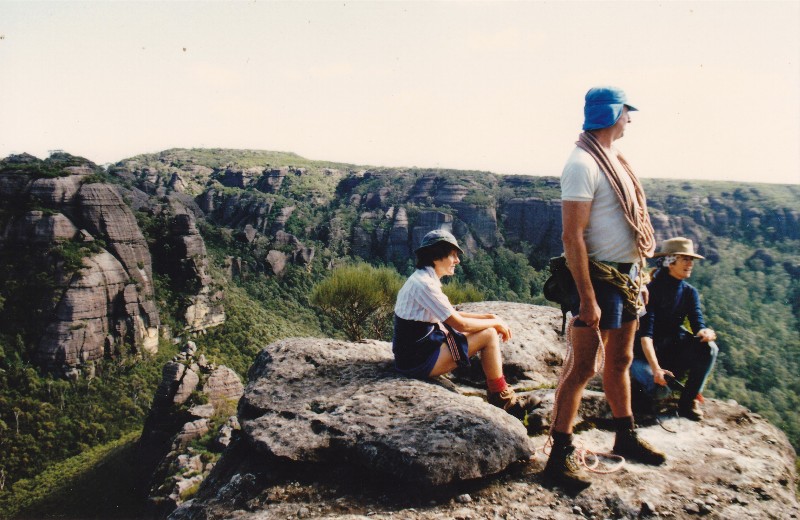
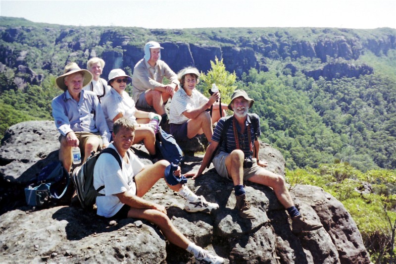
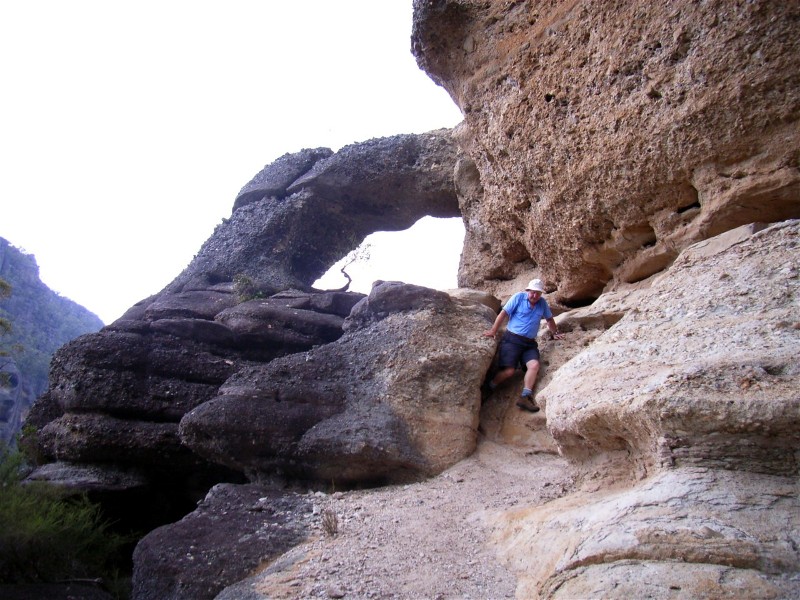
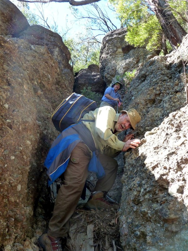
Historic Photos of Walks to The Castle and Byangee Walls
The walk to The Castle is one of the great walks in the Budawangs, for the fit and adventurous. It's about 13 km return from Long Gully on the Yadboro River, takes 10 - 11 hours with breaks, and involves some rock climbing and negotiation of exposed sections.
Only a handful of our leaders have attempted the walk for Batemans Bay Bushwalkers - John Garner, Valerie Harris, Mick Kelly and Len Tompkins. The Club first walked it in November 1987, and there have been quite a few expeditions since, the majority led by Len. A few times we have failed to make it right to the top, either running out of time, or due to bad weather.
Here are some photos from across the years.
 |
 |
 |
| 1994 Backpack to The Castle David Craig, Val Harris, Max Paris, John Garner, Betty Richards and Pat Retter Click on thumbnail to enlarge photo |
Ainslie Morris on the final rope ascent in 1998 watched by Barbara Evans, John Loveband and Bruce Emery Photo by Mike Click on thumbnail to enlarge photo |
View of The Castle taken from Byangee Walls Photo by Kay Click on thumbnail to enlarge photo |
 |
 |
 |
| John Loveband on the summit in 1998 Photo by Mike Click on thumbnail to enlarge photo |
Bob MacLatchy, Bronwyn Dunn and Len Tompkins on the summit in 2005 Photo by Karen M Click on thumbnail to enlarge photo |
Karen MacLatchy, Bronwyn Dunn and Len Tompkins in 2005 Photo by Bob M Click on thumbnail to enlarge photo |
 |
 |
 |
| Max Griffiths on the summit in 2007 Photo by Mike Click on thumbnail to enlarge photo |
Leader Len again in 2008 Photo by Barry Click on thumbnail to enlarge photo |
Len Tompkins, Neville Madden, Stan Marchant, Sharon Macdonald, Geoff Mitchell, Joe Macdougall, Barry Scurrah, Rodney Hills in 2009 Photo by Bob T Click on thumbnail to enlarge photo |
The other great walk starting at Long Gully in the Budawangs is Byangee Walls, also known as Byangee Mountain. Byangee is the huge flat plateau sitting beside and under The Castle.
This 10km walk is not quite as challenging as The Castle, but still takes 8 hours return
to complete. The last section up through the sandstone cliffs to the top is the hardest,
and is reached by climbing a steep narrow cleft, and then using a rope to ascend a chute to the top
of the plateau.
Karen M
 |
 |
 |
| View of Byangee Walls plateau from The Castle Photo by Karen M Click on thumbnail to enlarge photo |
Betty Richards, John Garner and Valerie Harris on Byangee Walls in 1990 Click on thumbnail to enlarge photo |
John Loveband, Ailza Emery, Ainslie Morris, Bruce Emery, John Garner, Barbara & Ron Evans on Byangee in 1998 Photo by Mike Click on thumbnail to enlarge photo |
 |
 |
 |
| Leader Len Tompkins at Castle Arch on Byangee Walls in 2005 Photo by Karen M Click on thumbnail to enlarge photo |
Bob Thurbon and Len Tompkins ascending Byangee sandstone cliffs in 2012 Photo by Kay Click on thumbnail to enlarge photo |
Rodney Hills on Byangee summit in 2012 Photo by Kay Click on thumbnail to enlarge photo |
Little Dromedary Mountain
Sunday 7 June 2015
 |
 |
 |
| Knee deep in lush Tilba pasture Photo by Rob L Click on thumbnail to enlarge photo |
View of Mt Dromedary from the top of Little Dromedary Photo by Rob L Click on thumbnail to enlarge photo |
View of Little Lake from the beach Photo by Rob L Click on thumbnail to enlarge photo |
Batemans Bay Bushwalkers were treated to a walk with interesting variety on Little Dromedary Mountain. While we started off in overcast cool conditions we were soon warmed up by a 500m walk up 70m of elevation to the edge of the forest. The climb up to the peak took us past numerous patches of staghorn ferns on granite outcrops. Our walk leader came well prepared and the sound of his secateurs clipping away up front meant we were traversing another patch of the noxious lantana weed.
After a steep rock scramble we emerged onto a granite outcrop which presented great views of the coast. A further 50m scramble and rock climb brought us onto the mountain peak. Here we had a unique view of Mount Dromedary and nearby Tilba Tilba.
Heading downhill we crossed the Sherringham dairy farm (having obtained permission
from the owners) to the coast. We all
successfully negotiated the cow pats and survived the electric fences which one
walker assured me were active, ouch! Lunch was on the beach at Little Lake and
we surprised a few fisherman who suddenly found 18 "tourists" watching their
activities. The highlight of lunch was watching a sea eagle fly by just off shore
and leisurely pluck a fish from the waves before heading south.
A brief diversion was made as we read the tombstones and stories in the active
cemetery on the road back to the walk start. Many thanks to Dennis and Nancy for a great day.
Rob L
Corang River to Explore Old Gold Mine Water Race
Friday 5 - Sunday 7 June 2015
Cancelled
Billys Hut from Lyons Road
Thursday 4 June 2015
No report received
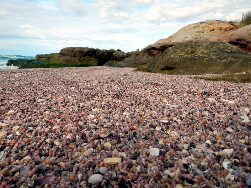
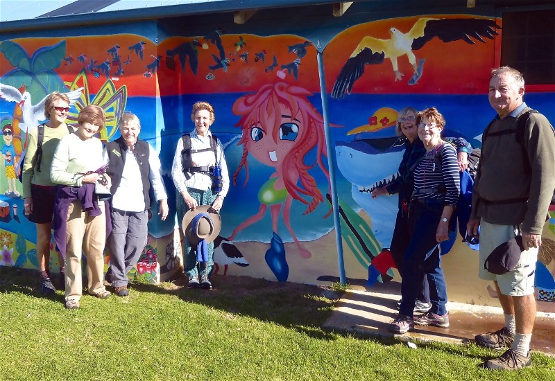
Mystery Bay
Saturday 30 May 2015
 |
| Stan, Mary, Andrea, Lesley, Kay, Lynne Photo by ?? Click on thumbnail to enlarge photo |
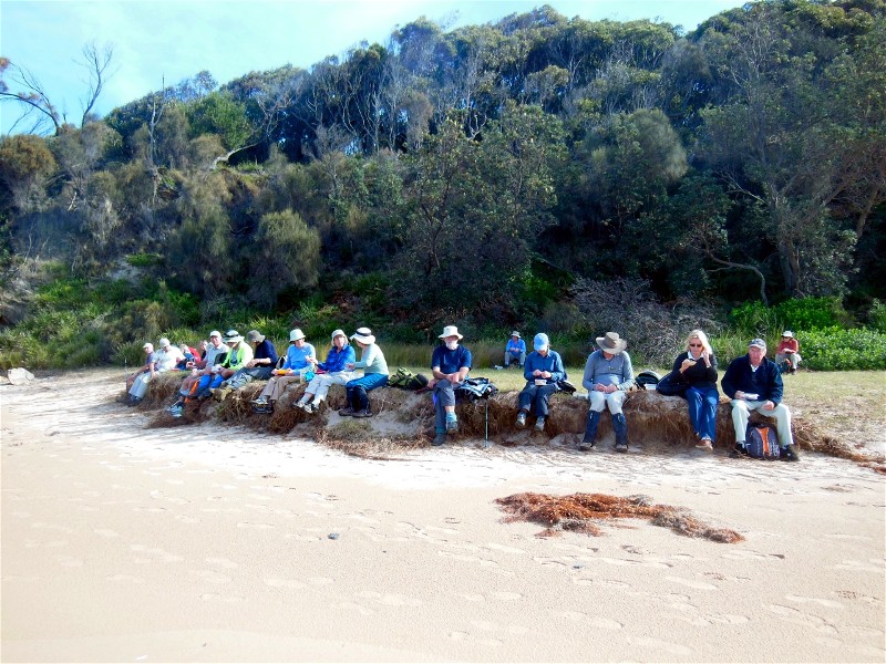
On a typical South Coast Autumn day, Len led 13 members and a visitor along the coast, through historical Mystery Bay. This was the scene of a mysterious and suspicious disappearance of 5 men on official business, who set out from Bermagui by boat to survey the new Montreal goldfields. They disappeared en route, and their boat was found washed up later. Evidence in the boat and nearby indicated foul play. (See Lamont Young, surveyor, on Wikipedia.)
Leaving dark history behind, we enjoyed the clear, mild day, with views of
Montague Island and the features of the rocky shore, had morning tea in a pavilion,
with all facilities nearby, then found our way to the oddly named 1080 beach. After
lunch at Pooles Point, we headed back towards the cars, only diverting slightly
to visit the Corunna Velodrome, a popular place of enthusiastic cycle racing over
a hundred years ago, by "Wheelmen" and some rebellious ladies who rejected
convention to join in the activities. Such was the popularity of bicycles (it's
not just a new fad!) that some would travel on the primitive roads and tracks
from as far away as Cooma, Bega and Gippsland towns, then cycle home again.
Another delightful day in Paradise.
Bob T
Maloneys Beach to North Head for Lunch
Wednesday 27 May 2015
Leaders Pat and Karl with six members participated in a short but varied walk of 11 kms from Maloneys Beach to North Head, via the rocky coastal headlands. This walk thus did involve a considerable amount of rock scrambling (to be attempted only at low tide), interspersed with pleasant meandering through coastal bushland. Morning tea was had perched upon Yellow Rock with views back to the Bay and beyond.
En route a small whale skull was found washed up on the rocks which prompted a short discussion on its possible age and type of whale etc. The highlight of the walk though was definitely the enormous big blue rock pool in the rock platform at the base of North Head. A great spot to snorkel at low tide.
On the return to North Head beach we stopped for an early lunch before returning
to our vehicles via the easier and quicker inland route. A lovely walk for all seasons.
Lynne
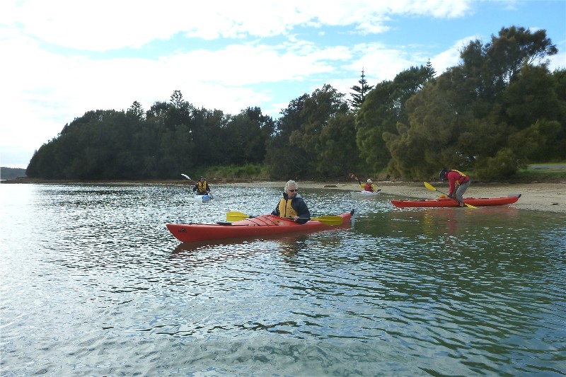
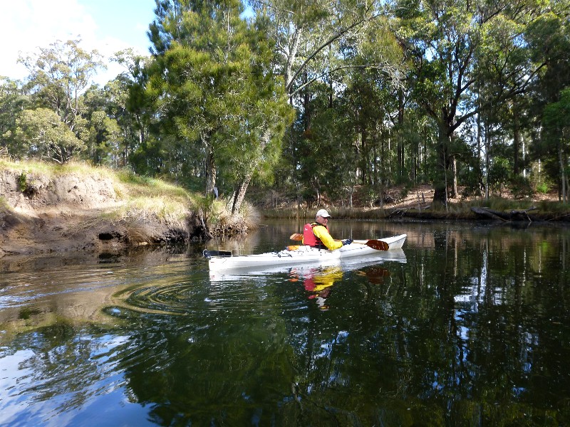
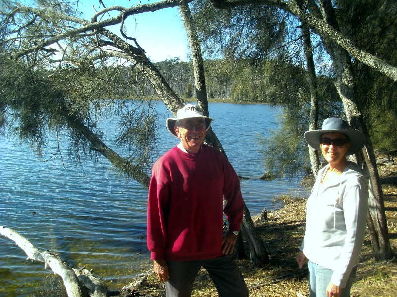
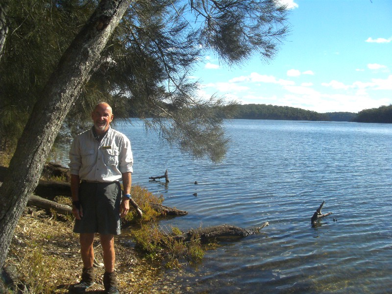
Tomaga River Paddle
Thursday 21 May 2015
 |
 |
 |
| Launching at Mossy Point Photo by Bob M Click on thumbnail to enlarge photo |
Taking a break Photo by Bob M Click on thumbnail to enlarge photo |
Ian in Jeremadra Creek Photo by Bob M Click on thumbnail to enlarge photo |
The paddle up Tomaga River starts at the Mossy Point boatramp, and it is a beautiful trip with the tide in clear green water right up to farmland bordering the river at Mogo. It's possible to go as far as the Mogo Zoo, but at the request of the Zoo's owners, we decided not to paddle past the animal enclosures and turned back to explore Mogo Creek.
Ian and Bob also explored Jeremadra Creek, which is the better option, and has a nice lunch spot on its banks - on the itinerary for next time.
The paddle back to the coast was pretty stiff going against a south easterly wind and we
were relieved to finally see the cars at the boatramp.
Karen M
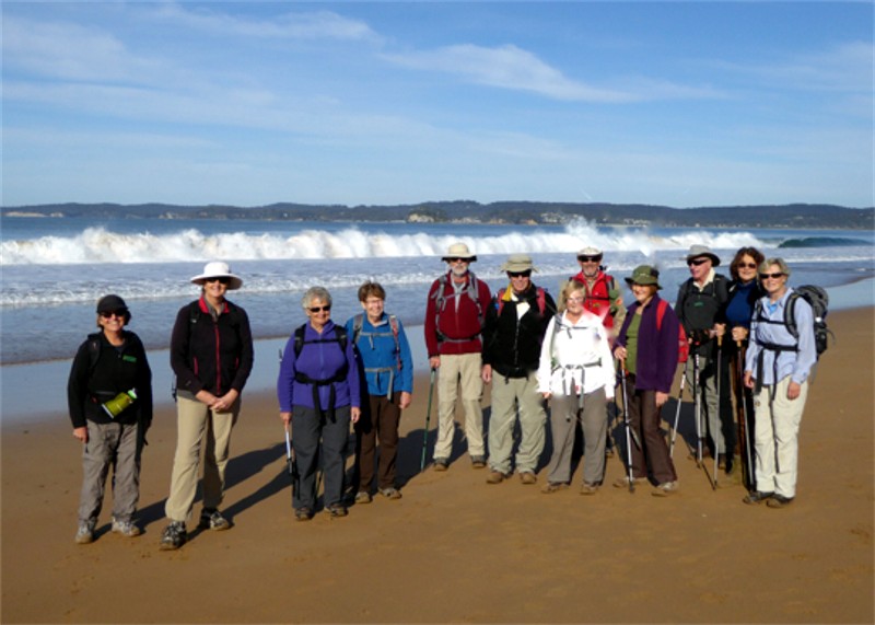
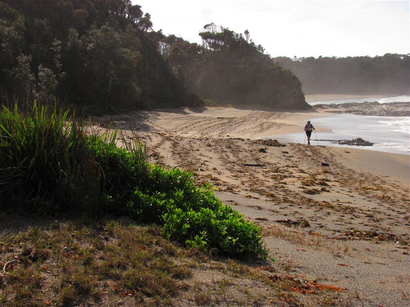
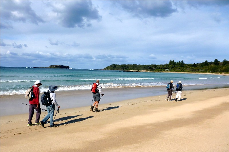
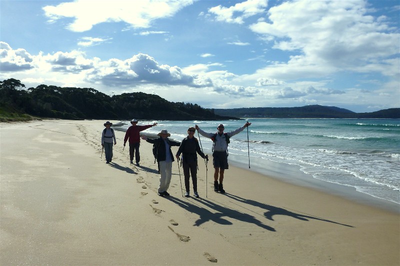
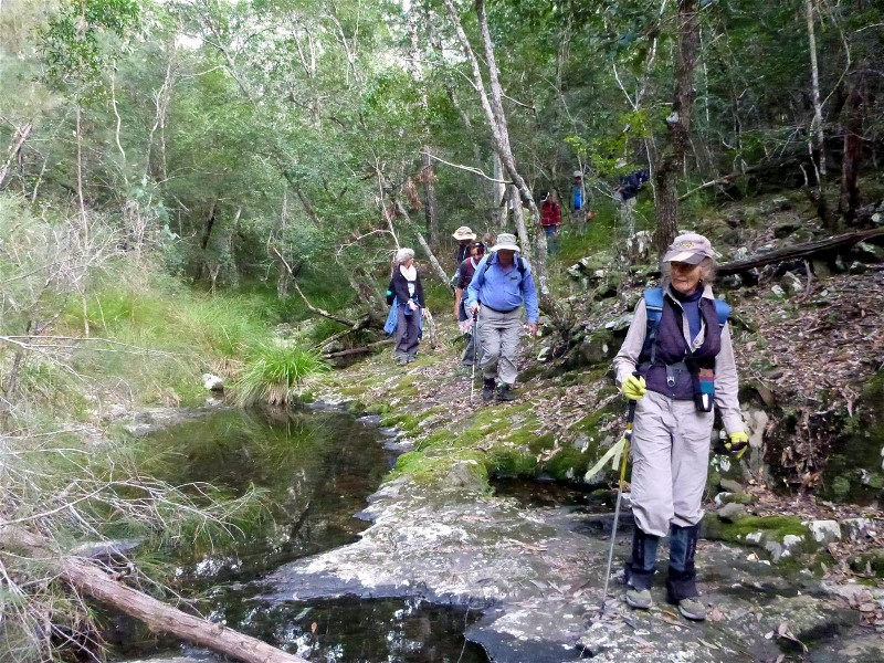
Wasp Head to North Head One Way
Sunday 24 May 2015
 |
 |
 |
| Ready to start Photo by Mary Click on thumbnail to enlarge photo |
First beach - Emily Miller Beach Photo by Bob M Click on thumbnail to enlarge photo |
Second beach - Dark Beach Photo by Helen Click on thumbnail to enlarge photo |
 |
 |
 |
| Third beach - Myrtle Beach Photo by Helen Click on thumbnail to enlarge photo |
Brian and Martin on Myrtle Beach Photo by Kay Click on thumbnail to enlarge photo |
Fourth beach - Richmond Beach Photo by Helen Click on thumbnail to enlarge photo |
 |
 |
 |
| Visiting walker with Rob and Denise Photo by Kay Click on thumbnail to enlarge photo |
Lunch at fifth beach - Oaky Beach Photo by Christine Click on thumbnail to enlarge photo |
Sixth beach - Honeysuckle Beach Photo by Helen Click on thumbnail to enlarge photo |
 |
| Chris, Laurie and Rob in twisted spotted gum forest Photo by Helen Click on thumbnail to enlarge photo |
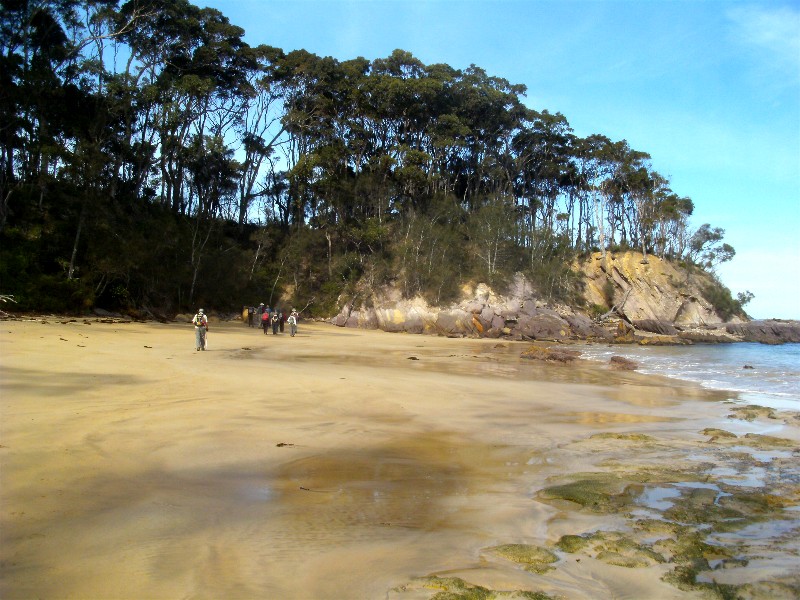
Myles Dunphy, the great pioneering bushwalker and environmentalist was, apparently, very impressed with the natural environment of the area which we now know as the Murramarang National Park, and sought to preserve it for future generations.
So, with such a recommendation, Batemans Bay Bushwalkers were out again in force, walking the tracks around South Durras and visiting or viewing seven beaches as they were ably led for 12kms along the coast on a glorious sunny weekend.
Once the car shuffle was completed, and the 32 walkers were ready, we walked from Wasp Head to North Head via the beautiful beaches and bush land of the area. Shapely spotted gums, large fruiting burrawangs and climbing plants filled the 3kms of pathless bush. The soft sand with an out-going tide gave us a good work-out, as did the climbs to the cliff tops. We watched rock fishermen risk the choppy seas, saw Sooty oystercatchers fly past and had a good view of a sea eagle, but the star of the show was of course the fabulous cliff and sea views that were on every turn.
Many thanks to Brian for leading a lovely walk on a perfect day in one of the
best national parks in Australia.
Helen
Lookout Road, Old Nelligen Road and Perrys Lane
Thursday 21 May 2015
Betty's walk in Benandarah which began and ended on Lookout Road, and included a good variety of walking tracks, and was also very pretty to boot.
Nine participants enjoyed the lush green valleys that were topped with tall straight spotted gums and a variety of other tall companion trees, as well as the tiny creeks with moss covered rocks down in the bottom of them.
Clear strong bird calls, including lyre birds and whip birds, were heard all
day, perhaps encouraging us up the steep-pinch sections of the tracks, and pale
wattle tree blossoms and bright red burrawang seeds bordered some of the tracks.
Pat
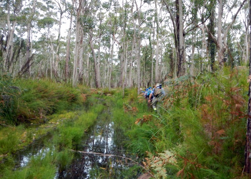
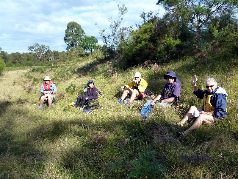
Feed Shed Creek Circuit
Saturday 16 May 2015
 |
| Mary, Laurie and Carol Photo by Kay Click on thumbnail to enlarge photo |
This walk started approximately 25kms north of Batemans Bay, and the first few steps saw us heading down a steep eroded clay track to a creek crossing, after which we then negotiated several large puddles that extended across the track. We soon turned east into the forest following an old vehicle track covered in leaf litter and what is known as "bushwalkers trip sticks"!
Fourteen walkers enjoyed this forest walk and also the fact that we managed
to successfully skirt around several large commercial beehive colonies without
being stung! Our senses were given a real treat, what with occasional strong
smell of honey, the visual forest of tall gums, cabbage tree palms and trees
ferns, and the never ending bird calls, all of which created the perfect introduction
to our bushwalking club for the three visitors on the walk. The cool damp section
of the forest, along the last part of this 10km walk, was especially attractive.
Mary
Bartleys and Punt Arms, Durras Lake, and Ocean Beaches
Wednesday 13 May 2015
 |
 |
 |
| Laurie and Bev Photo by Karen M Click on thumbnail to enlarge photo |
Bob Photo by Karen M Click on thumbnail to enlarge photo |
Susan, Laurie and Carol on Punt Arm Photo by Karen M Click on thumbnail to enlarge photo |
 |
 |
 |
| Durras Lake Photo by Karen M Click on thumbnail to enlarge photo |
Cookies Beach Photo by Karen M Click on thumbnail to enlarge photo |
Enjoying the autumn sunshine Photo by Karen M Click on thumbnail to enlarge photo |
Six bushwalkers set out from South Durras on a sunny autuum day along Old Benandra Road. We walked along through Benandarah State Forest past Iron Bark and Spotted Gum trees and along the peninsula between Bartley's Arm and Punt Arm on Durras Lake.
At the end of the peninsula was a very pleasant sunny spot overlooking the Lake - just right for morning tea. We then skirted the eastern side of Punt Arm following the remains of old logging tracks. When we reached a pretty spot which is being re-vegetated to restore it back into natural bush along the Lake, we stopped for a lunch break which was cut short because of exposure beside the lake to a cold westerly wind.
On our journey back we bush bashed some of the way through an obstacle course of fallen trees and dirt mounds until we reached a track that took us towards Durras Beach. As we walked along the beach we were treated to the spectacle of Terns diving into the sea for fish - they dived so fast and hard into the water we wondered how they managed not to hurt themselves.
We arrived back to the cars after skirting around Durras Village to end our
pleasant day.
Carol
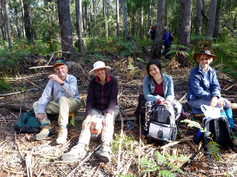
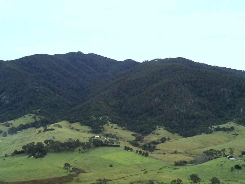
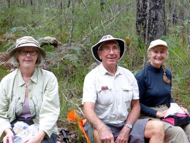
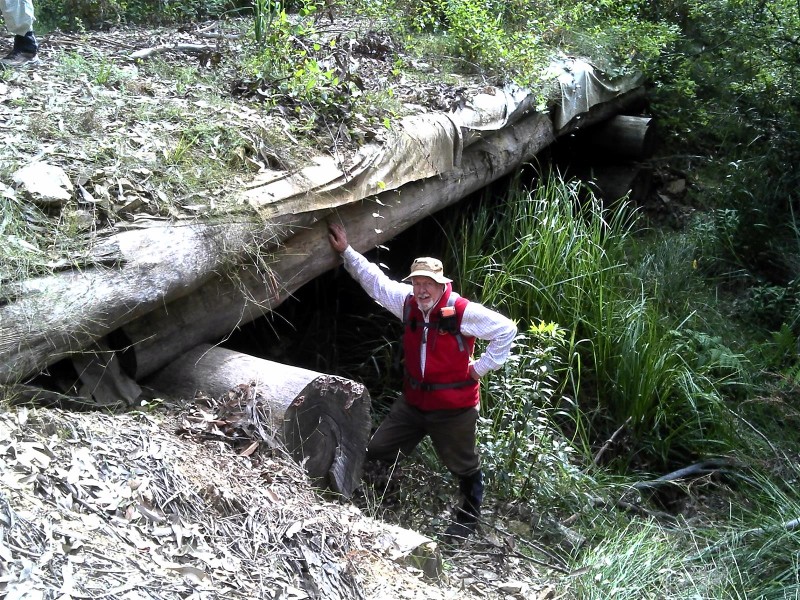
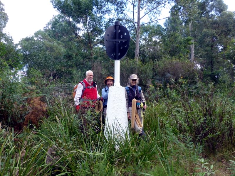
Pollwombra Mountain
Sunday 10 May 2015
Always a good sign when we get two(!) walk reports
 |
 |
 |
| Morning tea on a granite outcrop Photo by Bob T Click on thumbnail to enlarge photo |
Handhewn timber bridge Photo by Bob T Click on thumbnail to enlarge photo |
Pollwombra Mountain Trig Photo by Karen C Click on thumbnail to enlarge photo |
 |
| Looking for a lunch spot Photo by Bob T Click on thumbnail to enlarge photo |
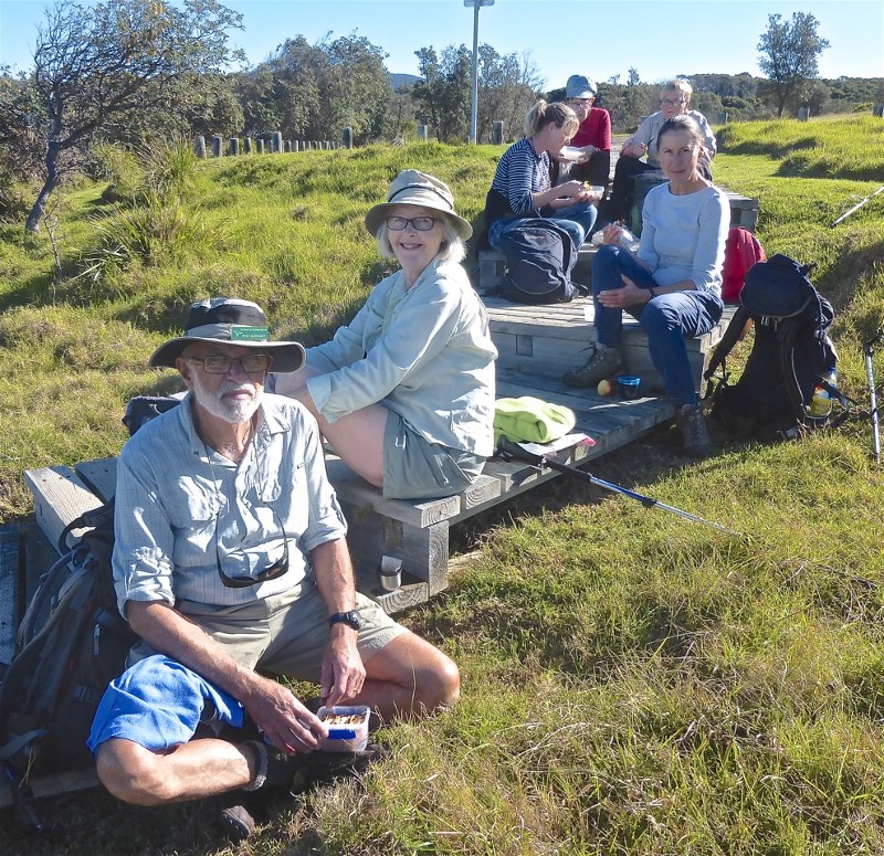
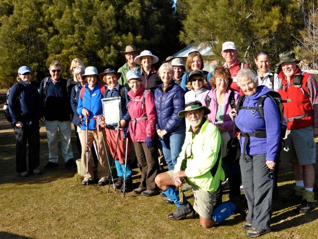
13 members and 2 visitors met near the Moruya Bridge for this walk. The cool temperature and wind at the meeting point started participants thinking, have I got enough clothes. Of course we have; we are always prepared for anything.
The initial climb of 100m vertically from starting point on the Old Highway to Pollwombra Trig had us warmed up after the first 10m. The climb is on a fire trail which has loose gravel under foot. At places it is quite steep maybe 1:4 grade.
A morning tea stop was taken on top of Mt Pollwombra about 200m north of the Trig. This part of the mountain is covered in granite bounders from fist to car size.
The walk then traversed around to the eastern side of the north hump of the mountain. On this side there are several large areas of exposed granite bedrock. One of these exposed areas gives a view of Moruya with the cleared fields of Bergalia in the background.
The site of the Green Range Reef (or Flanagans) gold mine lies on the northern foot of the mountain at about the 160m contour. So this is where we headed. Unfortunately there is not much to see at the circa 1930 mine - just a collapsed hole/trench that was reported to be 7m deep when the mine was working.
The route from here was south westerly first through an area that has been logged then a little bit of rain forest. We had lunch on a small area of exposed rock beside Lynches Creek. A short climb brought us back to the Old Highway a few hundred meters north of our starting point.
The walk leader would be interested to hear from anyone knowing the origin of
the name Pollwombra. (Internet search not productive).
David
David led 14 other Bushwalkers on another new walk, this time over Pollwombra Mountain. After visiting the trig (compulsory), we wandered down a long spur littered with great outcrops, vast sheets and giant boulders of granite. After morning tea on a princely ridge of granite, we followed him to the remains of the gold mine. Just a crumbling trench, with granite on one side and shale on the other, it didn't appear to be very successful, as there were no signs of other diggings.
Then through fields of weeds following logging a few years ago, to lunch in a
pretty gully, then back up to the road and then to the cars. Two lovely Swiss
visitors, who enjoyed the walk very much, as well as the rest of us, joined in
congratulating David on another excellent walk.
Bob T
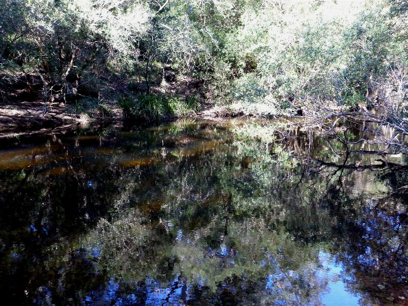
Currowan Creek and Peach Tree Gully
Thursday 7 May 2015
 |
 |
 |
| Rodney shows us the route Photo by Bob M Click on thumbnail to enlarge photo |
Currowan Creek ford Photo by Bob M Click on thumbnail to enlarge photo |
Running out of track Photo by Bob M Click on thumbnail to enlarge photo |
 |
 |
| Back across the ford Photo by Bob M Click on thumbnail to enlarge photo |
Currowan Creek reflections Photo by Bob M Click on thumbnail to enlarge photo |
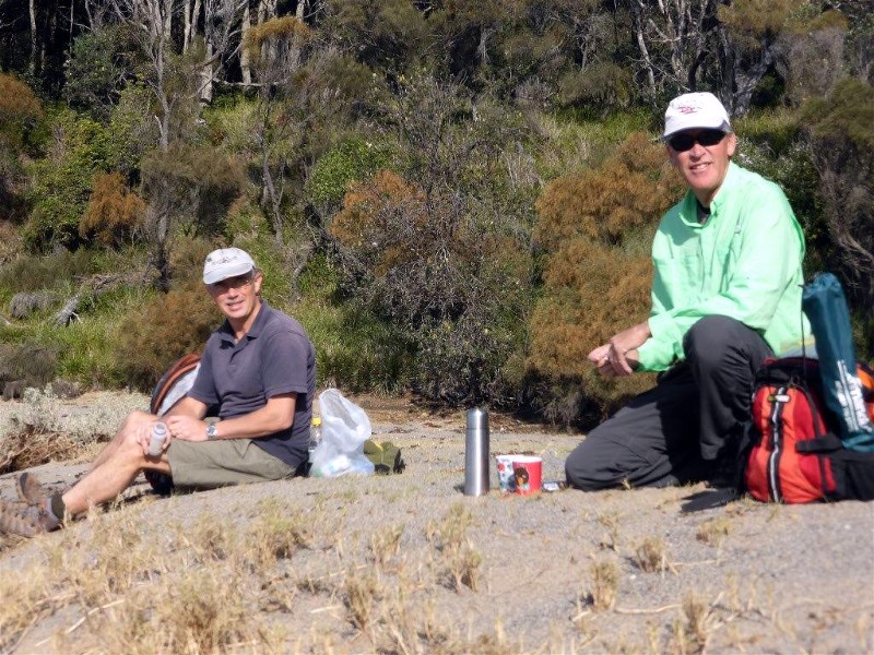
Barefoot Bowls Social Afternoon
Saturday 2 May 2015
On Saturday afternoon Nancy rolled up her sleeves and bravely undertook to organise 30 rank amateur lawn bowlers into an enjoyable bowling competition at Malua Bay Bowling Club. We were divided into 10 teams of 3, given bowls and a quick rundown of the rules and then ushered onto Malua Bay's beautifully kept bowling pitch. After a few practice bowls, we started to play.
Some first timers surprised themselves by being amazingly accurate, however there were plenty of wild shots as well. The setting at Malua Bay is very picturesque and as twilight fell, a lyrebird started its song in the forest opposite.
Many thanks to Nancy for her patience and kindness in sorting out some of the tangles
we found ourselves in, and also thanks for the fun prizegiving after the event. I think
many of us were surprised at how enjoyable the game of bowls can be - there might even be
a few prospective bowlers amongst us.
Karen M
Point Upright to Depot Beach and Return
Saturday 2 May 2015
 |
 |
 |
| Under Point Upright Photo by Karen C Click on thumbnail to enlarge photo |
Rodney and Bob Photo by Karen C Click on thumbnail to enlarge photo |
Perpendicular face of Point Upright Photo by Karen C Click on thumbnail to enlarge photo |
 |
 |
 |
| Rock platforms Photo by Karen C Click on thumbnail to enlarge photo |
Ainslie leads the way Photo by Mike Click on thumbnail to enlarge photo |
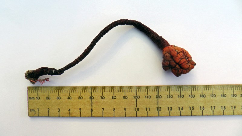
Stalked sea squirt Pyura gibbosa Photo by Mike Click on thumbnail to enlarge photo |
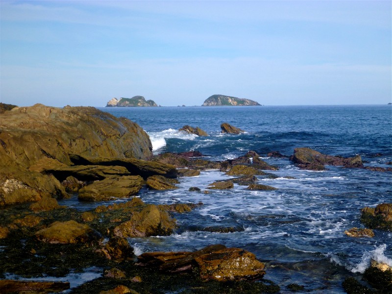
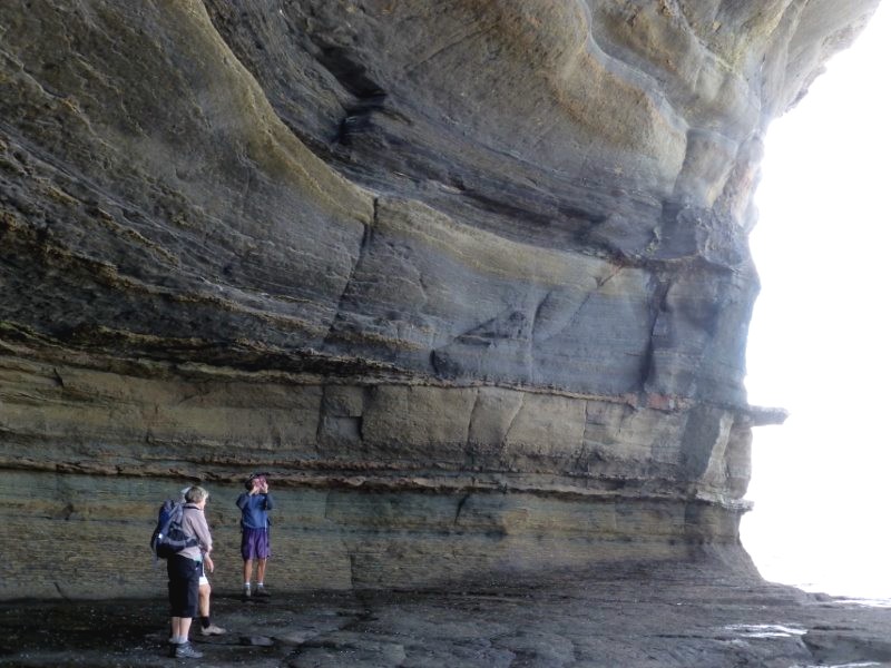
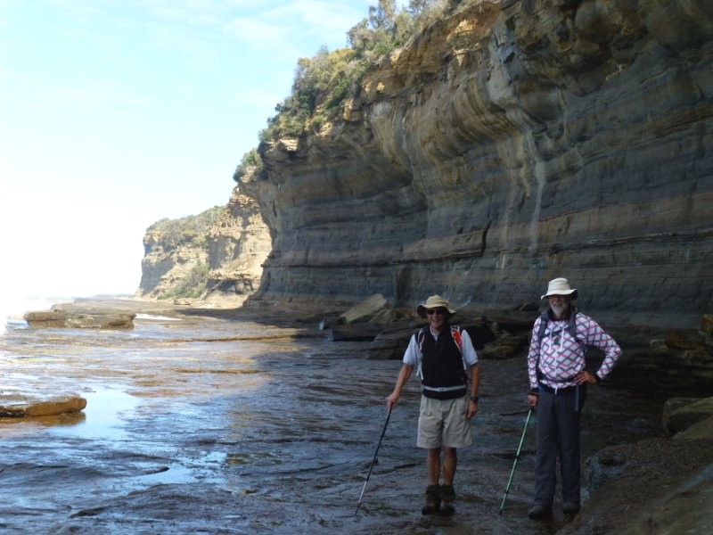
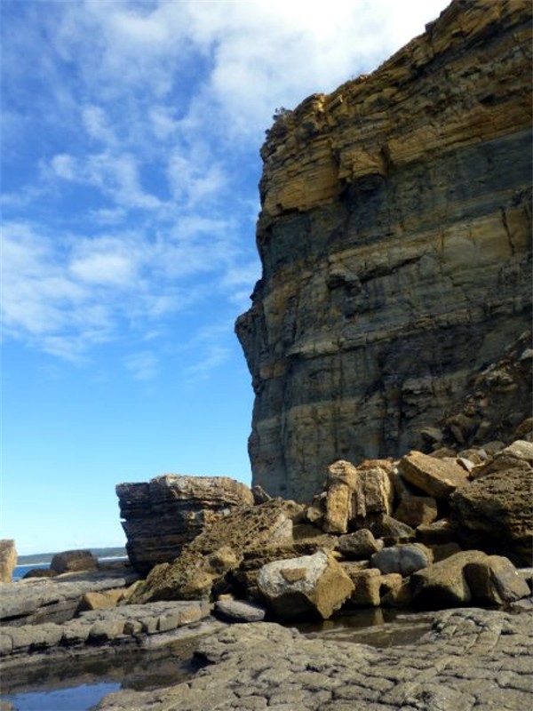
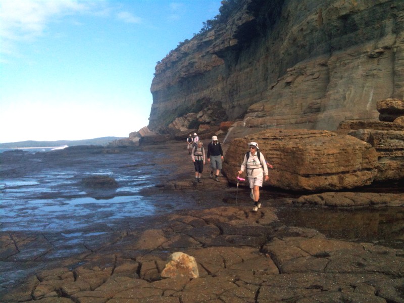
A great challenging walk today, part of the Club's series of coastal walks from Tabourie to Tuross Head being done this year to celebrate 30 years of bushwalking by BBBW. Our walk took us along North Durras Beach to the southern end of Point Upright. Here we left the sandy beach and made our way down to the rock platform. The challenge was negotiating this section, scrambling over rocks, avoiding pools of water and wet slimy surfaces, with always one eye on the outgoing tide, took concentration. Above us the towering sandstone cliff of Point Upright stretched north along the coast. The rocks are sandstones and shales deposited in a shallow sea in the Permian period, some 250 to 300 million years ago. We spotted the fossil casts of some large bivalve shells, and a well-preserved piece of fossilised wood. This cliff face, usually only viewed by rock fishermen or from boats at sea, is awesome and it was hard to take photos that would show its variety of colours and form.
One and a half kilometres later we finally reached Depot Beach and found a sunny spot for lunch with entertainment provided by three Sea Eagles riding the thermals over Grasshopper Island.
We finished our walk by heading south through Depot Beach and up over the Point Upright headland with a short detour to a lookout point with wonderful views to the mountains in the west and Mt Dromedary down south. Then back down to beach and our vehicles for the drive home.
A wonderful walk, thoroughly enjoyed by six Club members and a delighted
visitor, thanks to our leaders Mike & Ainslie.
Karen C
Addendum ........... Mike found the unusual sea plant pictured above, on the rock shelf during the walk, and sent photos of it to be identified at australian_seashores@hotmail.com. It is a stalked sea-squirt Pyura gibbosa, related to the cunjevoi, not often found on beaches as it lives attached to the sea bed by its stalk in deeper offshore waters. The storms last week must have dislodged it.
Tracks and Mines near Moruya
Sunday 26 April 2015
Cancelled due to bad weather
Merry Beach to Snake Bay
Thursday 23 April 2015
Cancelled due to bad weather