Fourth Quarter for 2011. See below for
Walk Reports and Photos
WELCOME TO THE 4TH AND FINAL QUARTER OF 2011. To see walk reports and photos, click on walk headings below, or simply scroll down the page.
Dog Trap Road, Mogo, Wednesday 30 November 2011
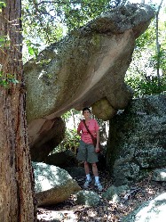
Wombat Ridge Caves, Landslide Creek, Sunday 27 November 2011
Bingie to Mullimburra Point, Dreaming Track, Thursday 24 November 2011
Wagonga Inlet, Ringlands Rotary Walk, Saturday 19 November 2011
Three Walks around Narooma, Scenic Drive and Mystery Lunch, Wednesday 16 November 2011
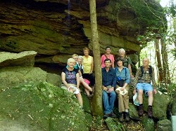
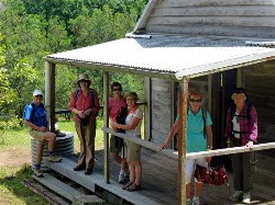
Bomaderry and Bundanoon Weekend Away, Saturday 12 and Sunday 13 November 2011
Corang Cascades, Saturday 12 November 2011
One Pipe Road - Pebbly Beach - Car Shuffle, Saturday 5 November 2011
Granite Bluff Road Monga, Wednesday 2 November 2011
Lawlers Creek - Turquoise and Gold Mines, Sunday 30 October 2011
Meroo Lake and Beach, Thursday 27 October 2011
Cabbage Tree Creek Mogo, Saturday 22 October 2011
Monolith Valley, Saturday 22 October 2011
Potato Point - Tarourga Lake, Wednesday 19 October 2011
Clyde Mountain and Val Plumwood's Ridge, Sunday 16 October 2011
Coastal Walk - Rosedale to Malua Bay, Thursday 13 October 2011
Sugar Loaf Creek Tributary, Saturday 8 October 2011
North Durras - Forest, Lake and Beach, Wednesday 5 October 2011
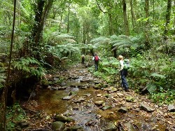
Exploring Burbling Bumbo Creek, Thursday 29 September 2011
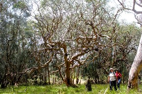
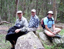
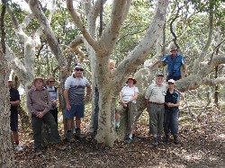
Dog Trap Road, Mogo
Wednesday 30 November 2011
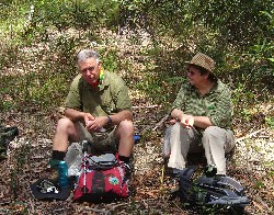
Seven walkers, including 2 visitors and some newer members and led by Betty, set out on a muggy day on the last programmed walk for the year. We had a good 11 km to walk in the forested area encompassing Dog Trap Road, Mogo.
All was still after the fierce lightning storm the night before, but the creeks were running strongly after all the rain and the healthy, fresh green foliage was stunning.
We crossed some of the swollen streams, walked up and down hills and avoided deep puddles as we zigzagged through the area. The native flora provided a lovely show and we were fortunate to hear a lyrebird calling and to see a pair of Glossy Black Cockatoos with their newest offspring, all showing off their beautiful red tails.
Towards the finish, the clouds were threatening but we arrived back at the
cars just in time as a light shower commenced. A delightful walk to end the
year. Thank you Betty.
Susan
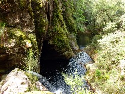
Wombat Ridge Caves, Landslide Creek
Sunday 27 November 2011
 |
 |
 |
| Val watching the incoming storm Photo by Kay Click on thumbnail to enlarge photo |
Flowering snake orchid (Cymbidium suave) Photo by Kay Click on thumbnail to enlarge photo |
Round leaf tea tree Photo by Kay Click on thumbnail to enlarge photo |
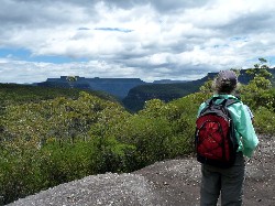
Ten of us set out on an 18 km walk on a perfect Sunday morning. The first 4 kilometres of the walk was mostly uphill, although after the drive there I didn't think there could be any more hill left to climb. Our morning tea spot saw us looking at an imposing aspect of The Castle. We followed Wombat Ridge and had flowering Leptospermums (tea trees) all the way. There were a number of different wildflowers. For most of the walk towards Landslide Creek we were walking with Pigeon House to our right and The Castle to our left. Quite a spectacular sight.
At lunch we were able to sit on a ledge above Landslide Creek looking out to another aspect of The Castle plus Byangee Walls and Pigeon House. Perfect. The skies looked pretty ominous for a while but the clouds drifted away and we strolled back the way we had come.
All in all another lovely walk. Thank you Ian.
Marion
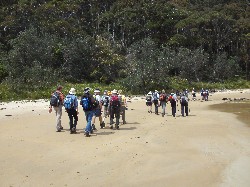
Bingie to Mullimburra Point, Dreaming Track
Thursday 24 November 2011
 |
 |
 |
| Wind twisted forest red gums Photo by Brian Click on thumbnail to enlarge photo |
Walk group Photo by Brian Click on thumbnail to enlarge photo |
Bev, Rob, Bob, Joan, Marlene, Lesley Photo by Brian Click on thumbnail to enlarge photo |
This was one of those perfect walks so much enjoyed by the 20 members who followed leader Helen to Bingie beach car park and then set off on the track north first to Kelly's Lake where dozens of swans and ducks peacefully entertained us. This section of the walk included wonderful groups of twisted forest red gums which enticed us to stop to enjoy them for cuppa time.
We continued down to the beach and the spectre of the large Grey Rocks with orange highlights intrigued us all before moving on to Mullimburra Point and the track south along beaches and clifftops with magnificent views of rock formations.
We arrived at Bingie headland and decided to walk to the rusting oil tank
from the shipwreck of SS Monaro in 1879, so long ago, and still a sight for us
to ponder on its history. Our walk today was stunning, thank you Helen and Karen.
Joan
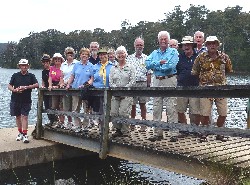
Wagonga Inlet, Ringlands Rotary Walk
Saturday 19 November 2011
 |
 |
 |
| Strangler Fig in Wagonga Rainforest Photo by John F Click on thumbnail to enlarge photo |
Mary and Marlene Photo by John F Click on thumbnail to enlarge photo |
Lace Monitor Photo by John F Click on thumbnail to enlarge photo |
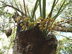
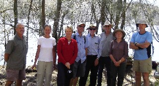
With a forecast of 30 degrees, fifteen members of the club decided that a walk around the foreshores of Wagonga Inlet and the Narooma Boardwalk would be ideal. The walk starts on the eastern shore of the inlet near Ringlands Bay and Shell Point, just south of Narooma. Unfortunately, little evidence remains of the aboriginal middens of cockle shells once found in this area, with much of material being used by the settlers to build roads, or make lime for mortar.
The first part of the walk was on a well-marked section the “Ringland’s Rotary Walk”, which took us south through dry open schlerophyll forests and, closer to the water's edge, casuarinas. We followed the eastern shore south for approximately 3 kms before arriving at a small pocket of rainforest. Here the air was cool and tall Strangler Figs, supporting clusters of epiphytes up in their crowns, spread their buttress roots through the ferns.
Returning back to Ringlands Point, we drove back to the Narooma Boardwalk.
This boardwalk always “delivers”, just the sheer beauty of this waterway is
usually enough. However, the bonus is observing how popular the area is, with
many people boating, fishing and walking. Another great walk which we topped
off with coffee and cake at Bodalla on the way home. The Narooma Rotary Club
has produced a very informative brochure detailing the walk and the history of
the area – available from The Narooma Tourist Information Centre.
Mary
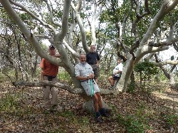
Three Walks around Narooma, Scenic Drive and Mystery Lunch
Wednesday 16 November 2011
 |
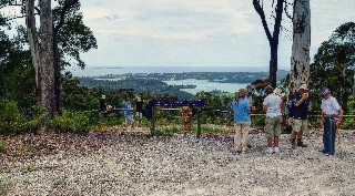 |
| Group at Wagonga Inlet Photo by John F Click on thumbnail to enlarge photo |
At Buckeridge Lookout overlooking Narooma Photo by John F Click on thumbnail to enlarge photo |
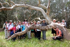
Bomaderry and Bundanoon Weekend Away
Saturday 12 and Sunday 13 November 2011
 |
 |
 |
| Meriel and Grant Photo by Kay Click on thumbnail to enlarge photo |
Heather Photo by Kay Click on thumbnail to enlarge photo |
Group on Bomaderry Creek Walk Photo by Donna Click on thumbnail to enlarge photo |
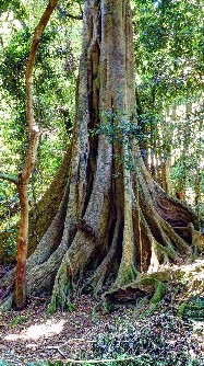
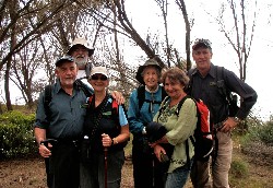
A fabulous weekend was had by those of our members who came along to our walking weekend in Nowra. Many residents of the Bay think of Nowra as a big town that you pass through on your way to Sydney, or somewhere that you go to for goods or services unavailable locally. But it is a town of hidden beauty, and you do not have to go far to find its treasures. There are walks along the Shoalhaven River that are encompassed by huge rock formations, with native bushland, alive with flowers at the moment, and there is their counterpart along the banks of the Bomaderry Creek, where we had chosen to take our walk on this occasion.
The walk begins at the Narang Park where we began with a picnic lunch. We then set off, starting with a creek crossing to test our balance. The route of the track follows the creek which has carved a course through sandstone, forming impressive cliffs, rock walls, overhangs and caves. Although the day was hot, the walk was pleasant, as these cliffs and the tenacious vegetation that manages to grow amongst them, provided very welcome shade for the entire walk.
We retired back to our chosen accommodation to change from our bushwalking gear into something more appropriate to wear to our buffet dinner at the Ex Serviceman’s Club. It was good to use the excuse of our afternoon of exercise to allow for our overindulgence of some very delicious food!
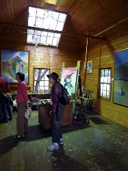
The next day we went to Bundanon, home of Arthur Boyd. "Arthur and Yvonne
Boyd's gift of the Bundanon properties and collections has given Australia an
unique cultural and environmental asset. The gift was borne out of Arthur
Boyd's often stated belief that 'you can't own a landscape' and the deeply felt
wish that others might also draw inspiration from Bundanon. Gifted to the
Australian people in 1993 by Arthur and Yvonne Boyd the Bundanon property
(which includes the Bundanon Homestead site and the Riversdale site) is located
on 1,100 hectares of pristine bush land overlooking the Shoalhaven." (copied
from the Bundanon Trust Website).
We enjoyed a walk across the paddocks to the river, a guided tour of the
homestead with its original furnishings and artworks, and a tour of Arthur’s
studio still splattered with layers of paint and evidence of where he created
his many works. We walked from the studio uphill through the bushland to a
naturally formed amphitheatre which at times is the location for musical
productions. It was an historical setting with wonderful atmosphere to enjoy an
outdoor lunch before proceeding to our cars and our homeward journey.
Kay
 |
 |
| At Bundanon Photo by Donna Click on thumbnail to enlarge photo |
Arthur Boyd's studio at Bundanon Photo by Donna Click on thumbnail to enlarge photo |
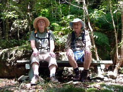
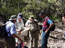
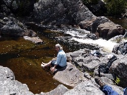
Corang Cascades
Saturday 12 November 2011
 |
 |
 |
| Len waist deep in tea trees Photo by Rodney Click on thumbnail to enlarge photo |
Ian consults the map Photo by Rodney Click on thumbnail to enlarge photo |
Helen cools her toes Photo by Rodney Click on thumbnail to enlarge photo |
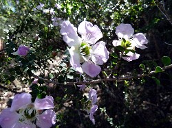
Ian led six walkers from the Wog Wog carpark to the cascades situated on the Western edge of the Moreton National Park. An early start was called for and with rain and storms forecast for the afternoon, the group moved speedily along the forest paths and reached the cascades for lunch. The wildflowers were spectacular, with dense seas of tea trees in bloom at shoulder height, such that it was possible to walk right past the Christmas Bells blooming close to our feet.
The wildlife spotted included a Peregrine Falcon at the Cascades, and
goanna slowly working up the spar of a dead gum, looking for lunch. Some of us
saw the shadows of wallabies as they raced off ahead of the group. It was a
walk with rough ascents and descents out of ferny gullies, plateaus, and rocky
islands that seemed built of conglomerates atop the sandstone. A good walk,
with an opportunity to dip the toes in the Corang River, and back to the cars
just as the rain began.
Rodney
One Pipe Road - Pebbly Beach - Car Shuffle
Saturday 5 November 2011
No report received
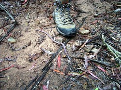
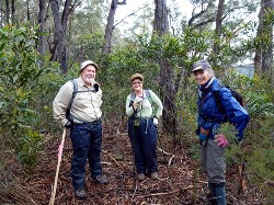
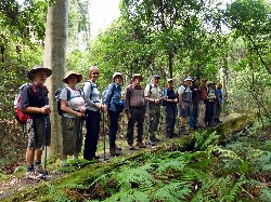
Granite Bluff Road Monga
Wednesday 2 November 2011
 |
 |
 |
| Monga worm Photo by Karen C Click on thumbnail to enlarge photo |
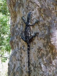
Martin, Rodney and Peter Photo by Karen C Click on thumbnail to enlarge photo |
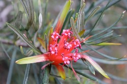
Telopea mongaensis, Monga waratah Photo by Karen C Click on thumbnail to enlarge photo |
Overhead cloud and threatening rain as we drove up the Kings Highway to River Forest Road, Monga Nationa Park, and the start of our Wednesday's walk. Through Monga town, once a busy, noisy timber mill and now private property allowing access into the National Park. Tree ferns crowded the roadside as we manouevered the slippery potholed Monga Lane to the start of our walk on Granite Bluff Road.
Eight keen bushwalkers, with rain now starting fall, commenced the 15 km walk with a gentle downhill which quickly turned into a steady long uphill hike, a left hand turn and still we headed uphill but at least the rain had stopped. All stopped to see a 40cm long worm making its way across the road. We discussed what it would be like as bait, took its photo next to Martin’s boot to get a sense of scale and continued on. The worm headed across the road and we headed uphill.
At last the sun came out just as we took a left hand turn and headed downhill, the paced picked up, there were distant views to the farmlands of Reisdale and lunch was somewhere at the bottom of the hill with frog song and rocks to sit on by the creek. Dark clouds appeared again but we managed to get back without getting wet
We then drove to the Dasyurus Picnic area to see the Monga Waratahs which
grow along on the banks of Mongarlowe River, this year's display is just
spectacular. A great walk in a lovely part of our world.
Karen C
Lawlers Creek - Turquoise and Gold Mines
Sunday 30 October 2011
No report received
Meroo Lake and Beach
Thursday 27 October 2011
 |
 |
 |
| Bev, Rob, Marlene, Narelle and Brian Photo by Brian Click on thumbnail to enlarge photo |
Meroo National Park Photo by Brian Click on thumbnail to enlarge photo |
Mountain devil flower Photo by Brian Click on thumbnail to enlarge photo |
On Thursday 27 October, a select group of Bay Bushwalkers explored parts of the beautiful Meroo National Park, 35 kms north of Batemans Bay. The party comprised Beverley (leader), Rob, Marlene, Brian and Narelle (visitor).
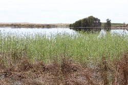
After refreshments at the National Park carpark, the group enjoyed an easy stroll through the Burrawangs, ferns and towering gums and soon arrived at Meroo Lake. Here, we found a pristine wetland with water levels so high that it was impossible to make the short detour onto the beach.
Instead, it was a return walk to the carpark, then down the track to enjoy the open spaces of Termeil Beach, where a calm sea was a welcome sight to all but the surfers who had carried their boards down, only to be disappointed.
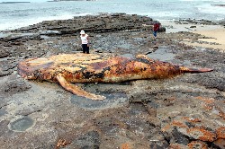
A track south led to Meroo Beach, where the group was amazed to find a dead whale calf washed up on the rocks. This sobering discovery was tempered by the sighting, soon afterwards, of a pod of three healthy whales making their southward journey, no more than 400 metres off shore.
After a lunch stop at this interesting location, we set off on the easy,
45 minute amble back to cars. Many thanks to Bev for her leading.
Brian
 |
 |
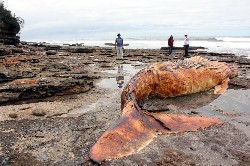 |
| Meroo Lake Photo by Brian Click on thumbnail to enlarge photo |
Dead whale calf Photo by Brian Click on thumbnail to enlarge photo |
Dead whale calf Photo by Brian Click on thumbnail to enlarge photo |
Cabbage Tree Creek Mogo
Saturday 22 October 2011
 |
| Bob and Sandra Photo by Karen C Click on thumbnail to enlarge photo |
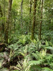
The wildflowers were just spectacular on the Cabbage Tree Creek walk at Mogo on Saturday with a 9 km loop walk through the Mogo State Forest. The easy paced easy/ medium walk meandered along dirt roads, old logging tracks and motor bike trails that twisted and turned through the bush beside Cabbage Tree Creek.
Our morning tea stop in a cleared area with log cut offs as seats, surprised with the diminutive native orchids that were seen, almost overlooked among the abundant pea flowers. The eleven walkers had time to catch up with each other's news, heard tales of recent travel by some, both in China and France and discussed plans for upcoming trips and Christmas while constantly stopping to see different flowers and shrubs along the track.
The pink Indigofera australis was past its best, but the wedding bush with
its white flowers was at its peak. Finally back at the cars there was some
discussion about having afternoon tea at Mogo, but the Moruya Jazz Festival was
the destination for some and shopping for others, so all that was left was to
thank the Leader for a pleasant and enjoyable walk.
Karen C
Monolith Valley
Saturday 22 October 2011
No report received
Potato Point - Tarourga Lake
Wednesday 19 2011
 |
| Michael, Lynne, Carmel, Rodney, Doug, Jan, Marion, Peter Click on thumbnail to enlarge photo |
Nine bushwalkers enjoyed clear skies and gentle breezes while on a walk through Eurobodalla National Park and Bodalla State Forest last Wednesday. Starting and finishing on Horse Island Road, the 15 km circuit walk began by passing through an attractive spotted gum and burrawang forest on a rough 4WD track.
The forest walk emerged at the western end of Lake Tarourga, one of many picturesque coastal lakes in this area. After morning tea by the lake with migrating birds and swans as company, we continued along to Brou Beach, a wild beach in the national park strewn with thousands of blue bottles swept up in recent tides. The group turned north to walk along the beach and up to Jamisons Point, where clear skies gave impressive views in all directions.
After enjoying the scenery, the group continued north along to Potato Point
Beach where local fishermen were hauling in an impressive catch of salmon. The
lunch spot was another pretty location at Piccaninny Beach. After a last
view north from Blackfellows Point towards Tuross Lake, the walkers traversed
gently uphill through coastal forest and back to the cars. The only regret of
the day was that the walk’s leader, the highly regarded bushman Ian, was
indisposed and unable to attend.
Wendy
Clyde Mountain and Val Plumwood's Ridge
Sunday 16 October 2011
No report received
Coastal Walk - Rosdedale to Malua Bay
Thursday 13 October 2011
 |
| Peter, Bob, Marilyn, Olive, Teresa and Brian on Pretty Point Headland Photo by Karen C Click on thumbnail to enlarge photo |
On Thursday 13 October a small party of six walkers led by Bob J set out on a coastal walk from Rosedale Beach. It was an easy leisurely walk with a just a few hills to challenge the group. The temperature was just right for walking and the threat of rain did not eventuate.
Scenery on the coast from Rosedale North is spectacularly beautiful, craggy cliff tops, hidden bays and sandy beaches. The heath headlands displayed a profusion of wild flowers of various colours and the surprise of a patch of shy Donkey orchids. The track wound its way along Mackenzie’s Beach to Pretty Point with wonderful views of our coast, south to Burrewarra Point and north to the Tollgate Islands.
Then on to Malua Bay to finish just in time for lunch, with fish and chips
on the menu for some of the walkers. All agreed it had been lovely easy walk.
Karen C
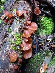
Sugar Loaf Creek Tributary
Saturday 8 October 2011
 |
 |
 |
| Kay disappears in the ferns Photo by Donna Click on thumbnail to enlarge photo |
Following the tributary Photo by Donna Click on thumbnail to enlarge photo |
Val and Bob up the creek Photo by Donna Click on thumbnail to enlarge photo |
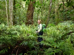
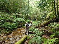
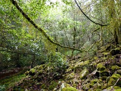
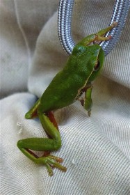
The streams and their valleys which fall from the escarpment, especially from the Clyde Mountain, inspire a feeling of awe and magic. Along the creeks, the lush rainforest, cool and moist, bathed in green light from the dense canopy and featuring tree-fern forests or great colonies of birds-nest ferns, has a feeling of hushed expectancy. This feeling is rewarded frequently by stunning water features, remarkable plants, competing bird-song and unusual creatures. Each creek has a character, and Sugarloaf certainly has its own.
Three hardy members followed Valerie on another brave plunge off the side of the mountain last Saturday (8 Oct), down through the levels of trees and shrubs. From the stony ridge populated by yellow pea-flowered thorny shrubs and tea-tree, to masses of mauve flowers, dotted with Kennedia and Hibbertia, to the lawyer vine level, then the ferns and mosses along the creek. Awed by fine specimens of the giant stinging tree, rock pools with surprisingly good sized fish (which looked very similar to trout), fearsomely large crayfish holes and luminously lime-green frogs, we lunched just above “the gorgeous gorge”.
 |
 |
 |
| Moss and lichen world Photo by Donna Click on thumbnail to enlarge photo |
Val leads the way Photo by Donna Click on thumbnail to enlarge photo |
One of the deep pools Photo by Donna Click on thumbnail to enlarge photo |
By a stroke of luck, there is a crossing which allows views up to a
waterfall that charges through a gap only a few inches wide, and then access
around to a series of waterfalls. One plunges into a seemingly bottomless pool,
which has a mysterious rounded cave on one side, and a deep undercut of the
sheer cliff on the other. Then another waterfall into another deep pool, all
surrounded by sheer, orchid and moss-covered stone walls, decorated along the
edges with masses of mauve flowers. Truly a treat for the adventurous. The gorge
continues, begging further exploration at another time.
 |
 |
 |
| Jelly brown fungus Photo by Donna Click on thumbnail to enlarge photo |
Bob, Kay and Val Photo by Donna Click on thumbnail to enlarge photo |
Adventurous green frog Photo by Donna Click on thumbnail to enlarge photo |
Our long climb out was accompanied by ominous grumbling from the thunder
gods, but our capable leader had us back at the car just as the rain began.
While three of us nursed our tired and bruised bodies, Valerie was as fresh and
chirpy as at the start, adding more amazement to our list of the day’s wonders.
Bob T
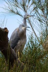
North Durras - Forest, Lake and Beach
Wednesday 5 October 2011
 |
 |
 |
| Cabbage Leaf Palms on the Discovery Trail Photo by Donna Click on thumbnail to enlarge photo |
Discovery Trail Photo by Donna Click on thumbnail to enlarge photo |
Young white faced heron Photo by Donna Click on thumbnail to enlarge photo |
 |
 |
 |
| North Durras Beach Photo by Bob M Click on thumbnail to enlarge photo |
Twisted spotted gum Photo by Donna Click on thumbnail to enlarge photo |
And another one Photo by Donna Click on thumbnail to enlarge photo |
14 bushwalkers joined Karen and Bob for a 14 km walk in Murramarang National Park on Wednesday.
The start and finish was at Depot Beach, one of the picturesque beaches along this part of the coast. We headed down Lake Road to the Discovery Trail, which is a short circuit through some of the loveliest rainforest in the National Park. There are giant cabbage leaf palms along the creek, and huge spotted gums and monkey gums along the track.
The walk then took us by the edge of Durras Lake, which until recently was closed to the ocean. The water has receded since being opened, but we could see where it had inundated the track and drowned some of the vegetation.
We had lunch at the lake entrance overlooking the beach and were entertained by a whistling kite snatching small fish out of the channel right in front of us. There was also a mob of kangaroos, many with joeys, and two fluffy immature white faced heron sitting on a branch, looking comical and cute in their downy feathers.
We walked along North Durras Beach, past the bat cave, and climbed the track
up the side of Point Upright where there are extensive views south as far as Mt
Dromedary. On Point Upright we also admired the fantastical shapes of the wind
twisted spotted gums and saw quite a few yellow flowering tiger orchids.
Karen M
Exploring Burbling Bumbo Creek
Thursday 29 September 2011
Cancelled due to injured leader