First Quarter for 2012. See below for
Walk Reports and Photos
WELCOME TO ANOTHER NEW YEAR AND ANOTHER NEW QUARTER, and some great walk reports and photos. Click on walk headings below, or simply scroll down the page.
Carriages Road, Croobyar State Forest, Thursday 12 April 2012
Potato Point Forest, Lakes and Beaches, Wednesday 4 April 2012
Congo to Mullimburra Point and Return, Thursday 29 March 2012
Byangee Walls to Pickering Point Camp, Saturday 24 March 2012
Lake and Coastal Highlights of Murramarang National Park, Sunday 25 March 2012
Congo to Meringo on the Dreaming Track, Wednesday 21 March 2012
Spotted Gum and Ryans Creek Road, Sunday 18 March 2012
Monga National Park - Pinkwood Walk, Thursday 15 March 2012
Backpack - Corang and Budawang Ranges, Monday to Wednesday, 12 - 14 March 2012
North Head to Richmond Beach Return, Saturday 10 March 2012
Square Head and Cullendulla Nature Reserve, Wednesday 7 March 2012
Oulla Creek and Angophoras, Sunday 4 March 2012
18 Mile Peg - Big Spotted Gum, Thursday 1 March 2012
Mount Dromedary Circuit, Saturday 25 February 2012
Clyde River Oyster Odyssey with Optional Easy Walk, Wednesday 22 February 2012
Long Beach to Beyond Reef Point, via Cliffs and Beaches, Sunday 19 February 2012
Broulee Historic Walk, Thursday 16 February 2012
Durras Lake and Discovery Trail, Saturday 11 February 2012
Corrigans Beach and River Walk, Wednesday 8 February 2012
Picnic Day at Shallow Crossing, Sunday 5 February 2012
Nargal Lake Area, Thursday 2 February 2012
Denhams Three Beach Walk with Sausage Sizzle After, Wednesday 25 January 2012
Carriages Road, Croobyar State Forest
Thursday 12 April 2012
No report received.
Potato Point Forest, Lakes and Beaches
Wednesday 4 April 2012
 |
 |
 |
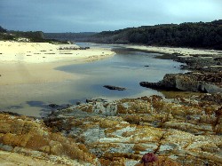
| Tarourga Lake open on the exploratory Photo by Karen M Click on thumbnail to enlarge photo |
Tarourga Lake Photo by Karen M Click on thumbnail to enlarge photo |
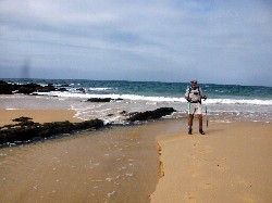
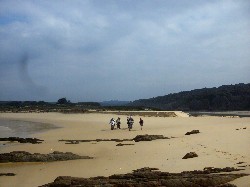
Brou Beach gouged by heavy seas Photo by Bob M Click on thumbnail to enlarge photo |
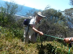
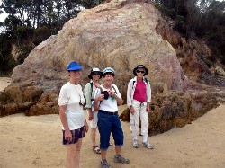
Nine bushwalkers joined Karen and Bob for a 10km scenic walk of the country between Brou Lake and Jemisons Point, south of Potato Point. Recent good rains and heavy seas had opened the mouth of Brou Lake, which had caused its water level to sink dramatically. Instead of the usual rockhop around the lakeshore, we were able to comfortably stroll on white sand beaches, enjoying the view of the surf pounding through the mouth.
Lake Tarourga had also opened to the sea, and on the exploratory only 3 days
prior to the walk, we had to take off our boots and wade across the fast flowing
stream of water into the surf. However by Wednesday, Tarourga had again closed,
although heavy seas had seriously gouged most of the sand off the beach.
Karen M
Congo to Mullimburra Point and Return
Thursday 29 March 2012
 |
 |
| Bob and Joan Photo by Lesley Click on thumbnail to enlarge photo |
Lesley and Ann Photo by Lesley Click on thumbnail to enlarge photo |
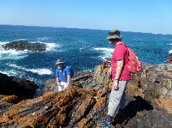
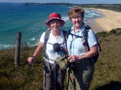
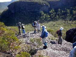
John led 9 participants on a ramble through the forests between Congo and Mullimburra Point, enjoying the lovely autumn sunny weather, with the waters of the Tasman sea glistening and waving to us. John knows the area and broadened our historical knowledge as we walked along. He introduced us to steep rock fissures into the sea at Mullimburra Point and showed where past enterprising fishermen had placed a plank across a crevasse for access. It was a long way down if you missed your footing (say after a day/night of cooling/warming fluids.)
Along the way we found some very large mushrooms (dinner plate size) which were photographed from all angles, with some walkers burrowing into the grass to get upside down shots. During lunch on the rocks we were rewarded by the close fly by of a sea eagle, followed shortly after by a naval reconnaissance plane flying low just off the coast.
On the way back on the track a large fat goanna (monitor lizard to the
educated) waddled along in front of us until we were noticed, which
created a rush off the track to the safety of the bushes.
All in all, John had taken us out of our everyday activities back to
nature and we all thoroughly enjoyed our time.
Bob B
Byangee Walls to Pickering Point Camp
Thursday 29 March 2012
 |
 |
 |
| Rodney crossing the swollen Yadboro River Photo by Kay Click on thumbnail to enlarge photo |
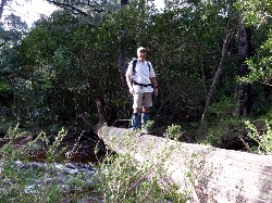
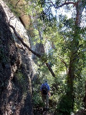
Len on the track up Photo by Kay Click on thumbnail to enlarge photo |
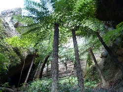
Tree fern grove Photo by Kay Click on thumbnail to enlarge photo |
 |
 |
 |
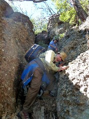
| Len and Bob on the scramble down Photo by Kay Click on thumbnail to enlarge photo |
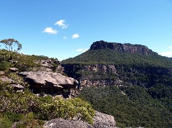
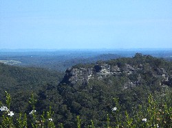
View of the Castle Photo by Kay Click on thumbnail to enlarge photo |
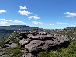
Bob at the top Photo by Kay Click on thumbnail to enlarge photo |
There are 2 walk reports for Byangee Walls - obviously an inspirational experience. Ed
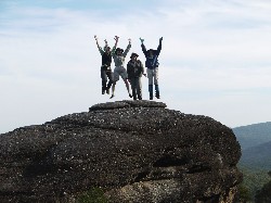
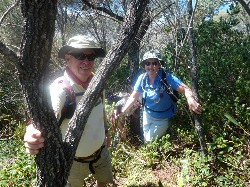
Friday night, sitting by the campfire under a clear, starry night- where else could be better? There were four of us enjoying this enviable scene, in preparation for an early start the next morning for our climbing of the Byangee walls in the Budawang Ranges. We set off with clear skies and a forecast conducive to pleasant walking. It would have been wonderful to share such wondrous scenery and experiences with more of our members. But perhaps our small number was a bonus, when it took us quite some time to cross the swollen creek, one by one balancing along the length of a well positioned tree trunk, and then to navigate some narrow crevices and hoist our way up, and down the notorious “chimney“ aided by ropes, helping hands and positioned knees.
From the top, the view of The Castle and the Clyde Valley was unbelievable set against the deep blue of the sky. It was a bit difficult to ignore the gusts of wind though, that were determined to rearrange our belongings as we tried to eat our lunch!
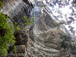
On our descent (several hours later), we passed through a fern gully with tree ferns reaching skyward from their shelter among the boulders. A narrow tunnel opening, formed in a wedge of fallen rock, provided a backdrop of water cascading from the cliff top above.
I have memories of a wonderful day- quite acute ones at the moment,
triggered by some tender bruises and aching muscles – but there will be longer
ones accentuated by photographs taken. Not even the most amateur of
photographers could fail to capture the beauty of such a great place.
Byangee Walls is a walk to be done for those considering conquering the
Castle - it is just one step behind in intensity.
Kay. . . . .
Anticipating another great walk, one member (me) arrived at Long Gully camp, confident that his check-list had ensured the packing of everything that could be needed, with backup. It was quickly realised that he had forgotten his backpack, with all the recommended and required equipment! This led to a plan for a “pack rotation system”, as the other walkers were sure they had all that was required (Len, as usual, had enough for 3, including duct tape and rope). This rotation idea from Rodney was to prove so successful that it may be adopted for hard excursions in future, as we had 3 sets of all the necessaries, plus four lunches, and a walker being rested regularly.
Following a pleasant campfire, we rose early and ascended to the joys and vistas of the track around the foot of The Castle, and up to Byangee Walls. The recent rains caused major and minor waterfalls to cascade from the cliffs far above, with the wind catching and swirling them like aerial jewellery. I found the wrong track, so Len’s rope twice saved us from a long backtrack, and we soon climbed the chutes and enjoyed the unusual vegetation of the top of Byangee. From a distance, it looks like a typical forest, but being so stunted, a walker striding through it appears to be a giant.
The struggling vegetation responds to good conditions, with banksias and
grevillieas flowering, honeyeaters and butterflies in raptures, and frogs
enjoying the abundant water. A venture up the spectacular features of the
Budawangs is always interesting, and usually very rewarding. Thanks, as
usual, to Len.
Bob T
Lake and Coastal Highlights of Murramarang National Park
Sunday 25 March 2012
 |
 |
 |
| Morning tea by Durras Lake Photo by Mike Click on thumbnail to enlarge photo |
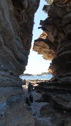
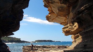
View from the cave Photo by Mike Click on thumbnail to enlarge photo |
The slot left by an eroded volcanic dyke Photo by Mike Click on thumbnail to enlarge photo |
 |
 |
| Passage through sandstone left by eroded volcanic dyke Photo by Mike Click on thumbnail to enlarge photo |
Sandstone overhangs Photo by Mike Click on thumbnail to enlarge photo |
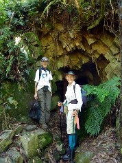
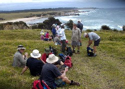
Elizabeth and Geoff led 17 bushwalkers on a 13km medium grade walk around the South Durras section of Murramarang National Park. It was a walk full of surprises for those of us not familiar with that part of the coast.
First we headed down to Durras Lake along wooded tracks where we saw the remains of the old paddle wheel punt used to transfer timber across the water. We then followed the route of the old tramway where horse drawn trolleys transported the timber loaded off the punt to the timber mill.
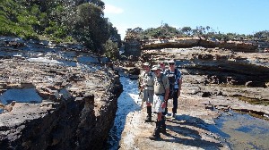
Cutting through the village of South Durras, and back through the forest, we emerged at Dark Beach where we ate lunch. This beach is known for its significant geological formations and is also the southern most tip of the Sydney sandstone basin which extends as far north as Newcastle.
After lunch it was time for some rockhopping along this amazing part of the coastline. There were caves, sandstone overhangs, volcanic dykes, ironstone boxwork, dropstones, fossils - a really scenic and interesting area to explore. We emerged from the rocks at an old rusting boiler - one of the few remains of the long gone timber mill at Mill Bay.
Great weather, great scenery, great company, great way to spend a Sunday.
Thanks Elizabeth and Geoff.
Karen M
Congo to Meringo on the Dreaming Track
Wednesday 21 March 2012
 |
 |
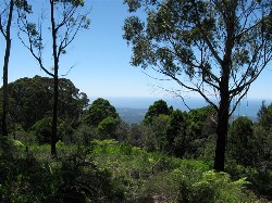
| View South from Meringo Headland Photo by Karen C Click on thumbnail to enlarge photo |
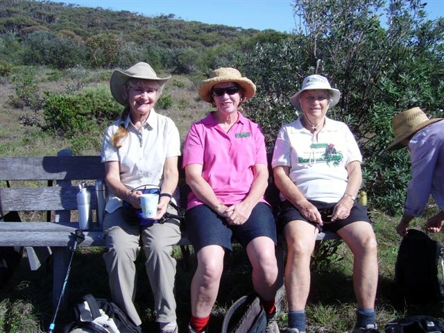
Carol, Jean and Ainslie Photo by Karen C Click on thumbnail to enlarge photo |
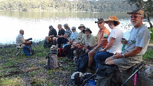
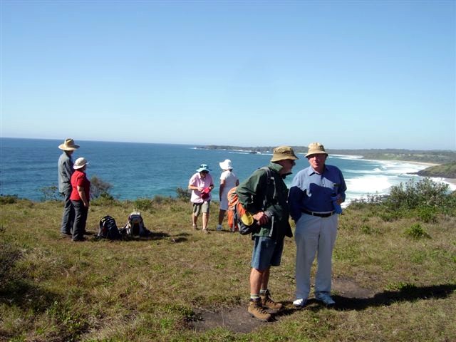
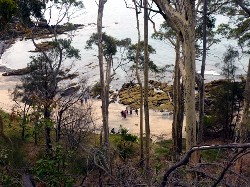
A party of fourteen members of the Batemans Bay Bushwalking Club took full advantage of the fine sunny weather today, enjoying an easy 8 km walk from Congo towards Meringo, and back. The walk followed part of the Bingie Dreaming Track, used by the Brinja-Yuin people. The track follows close to the shoreline through beautiful banksia and eucalypt forest, and the members stopped to admire tiny mauve orchids on the way
The path varied from easy dry clay to softer damp soil criss-crossed by tree roots, and muddy puddles, and the track took the party down to the fine squeaky white sands of Congo Beach. The magnificent views were well worth the walk.
In the whale-watching season, this track allows great opportunity to see whales off Congo Beach. No whales today, but this did not stop the party from enjoying their packed lunches on Congo Beach, which was all the more stunningly beautiful after the weeks of recent rains, with a clear blue sky, brilliant sunshine, and crashing waves.
The members enjoyed lots of friendly chats along the walk, and returned to
their cars by 1 pm with a vote of thanks to the walk leader, Karen C.
Jane......(This is the first time a VISITOR has VOLUNTEERED to write the walk
report - thanks Jane!! Ed.)
Spotted Gum and Ryans Creek Road
Sunday 18 March 2012
 |
 |
 |
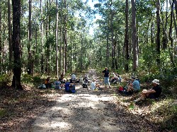
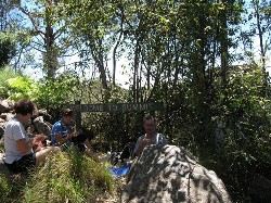
| Lunch Photo by Donna Click on thumbnail to enlarge photo |
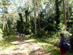
The track Photo by Donna Click on thumbnail to enlarge photo |
Lush forest gully Photo by Bob M Click on thumbnail to enlarge photo |
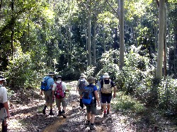
After recent rainfall causing some walk cancellations the day was perfect for 21 happy walkers to set forth with Stan and Mary and drive to Mount Agony Road, North Durras.
Our walk began approximately 3 kms from the highway and led us on a track upwards through lush undergrowth and tall Spotted Gums (Corymbia maculata) to a now disused quarry. From there we walked along a wide fire trail surrounded by magnificent forest, enjoyed our sociable morning tea, and also lunch further along the track as we stayed alert to awareness of the locals such as leeches and bull ants.
The return to our cars along Spotted Gum Road took us quite close as we
passed a large group of bee hives all minding their own business, thankfully,
and we enjoyed the remainder of our walk back along the track, with a thoroughly
contented feeling of being lucky to be part of the environment on a perfect day.
Thank you Stan and Mary.
Joan
Monga National Park - Pinkwood Walk
Thursday 15 March 2012
 |
 |
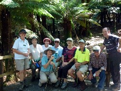
| The group at Penance Grove Photo by Donna Click on thumbnail to enlarge photo |
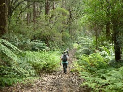
Fern lined River Forest Road Photo by Donna Click on thumbnail to enlarge photo |
9 members and 1 visitor enjoyed the beautiful fine weather and drive up the Clyde Mountain to the Monga National Park. As soon as we entered the Park it became obvious that this was a very special part of the coast with its generous supply of tree ferns, lush foliage and tall trees lining the road.
We parked the cars at the Mongarlowe River Picnic area and began our walk down the old River Forest Road. The track was still quite wet from the recent rains but quite walkable and as we walked we admired the ever present thick lush foliage and the occasional waterfalls beside the track. Wildlife was apparent with many birdcalls and the distinctive sounds of black cockatoos. We reached the river where we had a drink stop and one member was seen up to her knees as she decided to try the waters!
Lunch was at the picnic area with its excellent picnic facilities including
BBQs, tables and toilets. After lunch we made our way along the bush track to
Penance Grove where we explored the rainforest with the aid of an excellently
constructed boardwalk. This is an area that is a ‘must see’ and one could
well imagine the odd goblin/gnome hiding behind the moss covered tree trunks.
Filtered sun made the tree ferns dazzle and we could admire the Pinkwood trees
with blossom evident on the ground and visible high up in the canopy. Thanks to
our Leader, Bob Mi for a most enjoyable day.
Jan
Backpack - Corang and Budawang Ranges
Monday to Wednesday, 12 - 14 March 2012
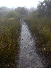
Eleven Batemans Bay Bushwalkers left the Wog Wog car park near Nerriga to explore the upper reaches of the Corang River in Budawang National Park.
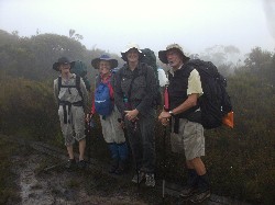
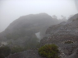
Although the weather was initially fine, the coastal escarpment had captured a gentle easterly flow and we were soon in a dense cloud layer which persisted until nightfall with additional light showers of rain. On top of recent heavy rains, this made the track conditions treacherous, especially on the few boardwalks across the heathy, boggy shelves near Korra Hill. Under heavy packs, more than a few unbalanced members took graceful rolls off into the undergrowth, or recovered with an urgently placed boot into the saturated mire. It was wet, wet, wet!
 |
 |
 |
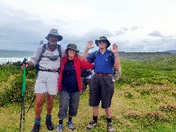
| Bronwyn, Betty, Karen & Rodney looking surprisingly cheerful Photo by Bob M Click on thumbnail to enlarge photo |
The submerged track Photo by Bob M Click on thumbnail to enlarge photo |
Corang Arch in thick fog Photo by Bob M Click on thumbnail to enlarge photo |
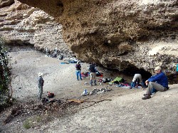
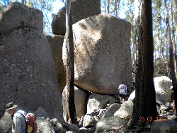
Although the journey’s views were spoiled, and after 6 hours of slog, a dry overhang camp in Burrumbeet Brook, with a warm fire, soon had the spirits lifting and clothes drying. Some collapsed into an early night bedroll. Others gazed into the fading firelight and murmured good things about bushwalking.
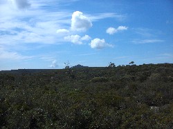
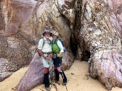
In bright sunshine next day, serious exploration of the surrounds saw the party transect the plateau above the camping caves. Spectacular views of nearby clifflines and overhangs to the west were soon curtailed as the party slowly scrub bashed an exhaustive easterly direction toward the one other descent line through the clifflines and off the imprisoning plateau.
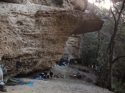
A welcome lunch at the most easterly of the Brook’s caves signaled further exploration of the overhangs and crevasses toward camp, many with watersprays from above. In this area are excellent examples of the union of the two dominant geological layers of the area – where the Budawang horizontal sediments sit atop the tilted and eroded Ordivician sediments running, and faulting, northwards from the headwaters of the Yadboro River. Rarely can one stand with a foot on two distinct geological time zones separated by millions of years!
 |
 |
 |
| The Burrumbeet Overhang was strangely comfortable Photo by Bob M Click on thumbnail to enlarge photo |
And an evening fire made all the difference Photo by Karen M Click on thumbnail to enlarge photo |
Next morning above our cave in welcome sunshine Photo by Bob M Click on thumbnail to enlarge photo |
 |
 |
 |
| What a view Photo by Karen M Click on thumbnail to enlarge photo |
Lots to see Photo by Bob M Click on thumbnail to enlarge photo |
Sandstone overhang with waterspray Photo by Karen M Click on thumbnail to enlarge photo |
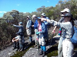
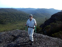
On the third day, exiting the area, the weather cooperated. Fine views of the nearby valleys and clifflines from the Corang Peak ridge were surpassed only by the excitement of standing on the Corang Arch, denied us on the journey inward.
After the obligatory photo shoots, the party trudged westward the final nine kilometres to the waiting mechanical steeds, ready to convey weary bodies home to a warm shower, hot dinner and soft bed, the only luxuries not to be found in the Budawangs.
 |
 |
 |
| Sharon, Bronwyn, Karen & Betty on Corang Arch Photo by Rodney Click on thumbnail to enlarge photo |
Bob and the view from Corang Arch Photo by Karen M Click on thumbnail to enlarge photo |
The walk out in perfect weather Photo by Bob M Click on thumbnail to enlarge photo |
Ian B
North Head to Richmond Beach Return
Saturday 10 March 2012
No report received.
Square Head and Cullendulla Nature Reserve
Wednesday 7 March 2012
No report received.
Oulla Creek and Angophoras
Sunday 4 March 2012
Postponed due to rain.
18 Mile Peg - Big Spotted Gum
Thursday 1 March 2012
Postponed due to rain.
Mount Dromedary Circuit
Saturday 25 February 2012
 |
 |
 |
| Granite tors on Mt Dromedary Photo by Lin Click on thumbnail to enlarge photo |
Lunch at the summit Photo by Patrick W Click on thumbnail to enlarge photo |
Finally, a view from the top Photo by Patrick W Click on thumbnail to enlarge photo |
Ian led 10 intrepid walkers on a sunny, 13km walk on Saturday morning. The starting point was Tilba Tilba, with a car shuffle ensuring that the group completed a circuit walk.
Mt Dromedary (now officially renamed Mount Gulaga) was an active volcano over 60 million years ago and was 3 kilometres high, thankfully today it is extinct and just 800 metres high. It offers many interesting features from the mysterious giant granite tors to the beautiful rainforest. The mountain was also the scene of frantic activity from the 1860’s to the 1920’s where alluvial gold was discovered and mined. Relics such as a stamper battery and foundations of a miner’s residence can be discovered amongst the dense bush.
The group began the ascent, passing a pile of stones built into a cairn to mark the grave of the unknown Chinaman, a miner from the 1800’s. We eventually arrived at the saddle area where we enjoyed morning tea and then continued on to the summit. Following bush fires a few years ago, there are now some spectacular views from the summit, with Bermagui easily seen.
We had lunch at the summit and then commenced our descent through the rainforest where the Pinkwood trees were in bloom. Giant Sassafras and many other species of ferns, plants and trees adorned the forest as well as large granite rocks covered in moss and lichen.
We returned to the saddle and then walked along the alternative access route
to the northern end of the park where the walk was completed. It was a great
walk and a very enjoyable day. Many thanks to Ian for organising it!
Donna G
Clyde River Oyster Odyssey with Optional Easy Walk
Wednesday 22 February 2012
No report received.
Long Beach to Beyond Reef Point, via Cliffs and Beaches
Sunday 22 February 2012
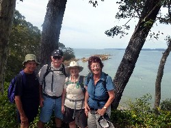 |
| Bruce, Charles, Kay and Pat Photo by Lesley Click on thumbnail to enlarge photo |
A large contingent - 33 in all - made our way to the commencement of our walk at Sandy Place, Long Beach. We set off in fine voice and at a fair pace along the beaches and cliff tops. We spread out a little as we admired the views, took photos, or lingered a moment longer as special things took our interest.
These included a dolphin intent on catching his dinner very close into the shore whilst his pod members swam at the more usual distance and also appeared to be observing his antics. There was a very dark coloured baby goanna clinging on the side of a spotted gum, mum was not in sight. A huge mob of kangas greeted us as we made our way along a grassy track that had a row of houses backing to it one side, and the steep cliff sides of the National Park on the other.
The animals were not the only spectacles. We made our way around the rocks
of Reef Point, the tide had recently receded leaving the rocks wet and with
slight cloud overhead reducing the brightness, the hues were just magnificent.
Report not credited
Broulee Historic Walk
Thursday 16 February 2012
 |
 |
 |
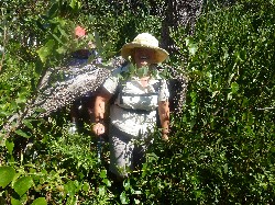
| Ailsa in the undergrowth Photo by Lesley Click on thumbnail to enlarge photo |
Carol on Broulee Island Photo by Lesley Click on thumbnail to enlarge photo |
Bob and Ann Photo by Lesley Click on thumbnail to enlarge photo |
On a lovely summer's day, 24 walkers were led by Ron and Barbara on an easy walk from Broulee to the Tomaga River, taking in points of historic interest. For most present, this included an uphill scramble on Broulee Island to the lonely grave of Mrs Malabar (D 1843) - one of the few remaining reminders of the 12 years of European occupation when Broulee was the centre of government administration for an area from the Monaro to Jervis Bay.
After a walk on hard sand (the tide was out), lunch was enjoyed near the wreck site of the Rover (1841) where 12 lost their lives.
The walk concluded at a good local coffee outlet.
Ian H
Durras Lake and Discovery Trail
Saturday 11 February 2012
Walk postponed due to rain.
Corrigans Beach and River Walk
Wednesday 8 February 2012
No report received
Picnic Day at Shallow Crossing
Sunday 5 February 2012
 |
 |
 |
| Val and Betty and Bimberamala Mine Photo by Donna Click on thumbnail to enlarge photo |
Paddling on the Clyde River Photo by Donna Click on thumbnail to enlarge photo |
Kay, Lesley and Heather at Shallow Crossing Photo by Donna Click on thumbnail to enlarge photo |
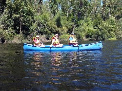
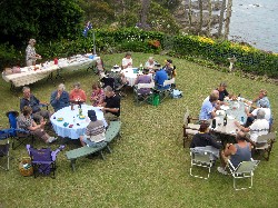
After twice being forced to cancel due to heavy rain, Val finally got to run her long-awaited family picnic and fun day at Shallow Crossing.
33 Members and one visitor, separated into several groups, explored the old workings of a gold mine on the Bimberamala River, then we went in various directions to explore and enjoy the features of the bush. A group were successful in locating the deep shafts above the mine, which showed where the miners had followed the gold seam along the side of the hill, digging through solid rock with picks and shovels about a century ago. The spoil was then laboriously hauled up and dumped in tailing piles, while the gold-bearing ore was fed through a stamper, the remains of which lies rusting near the mine. The hard earned ore was then transported by ox-cart and pack-horse to Nelligen, to be shipped away for extraction of the gold.
After a sweaty walk back to the cars, we then enjoyed a convivial picnic
lunch on the bank of the Clyde River, followed by swimming and kayaking in its
sweet waters. As the weather was perfect on a warm sunny day, several dozen
other people shared our enjoyment of the wonderful Clyde, and the pleasant
surrounds of Shallow Crossing. It was well worth three attempts, and our
congratulations to Val for the concept.
Bob T
Nargal Lake Area
Thursday 2 February 2012
 |
 |
 |
| Morning tea with a view Photo by Bob M Click on thumbnail to enlarge photo |
Bob, Joan and Bob Photo by Lesley Click on thumbnail to enlarge photo |
Mary and Stan on Loader Beach Photo by Lesley Click on thumbnail to enlarge photo |
On a lovely south coast Summer day, 22 bushwalkers drove to Eurobodalla National Park, about 8km south of Narooma. The walk was a 11km circuit taking in all the scenic delights of this exceptional piece of coastline.
We followed Leader Bob T from the Highway through forest to the coast where we stopped to admire the view with Montague Island as a spectacular backdrop. We then descended to the beach and went inland again to cicumnavigate Nargal Lake, complete with black swans. Lunch was enjoyed on the sand dunes looking South towards Mystery Bay.
We all agreed that this walk was another very good reason to live on the
far south coast of NSW.
Bob M
Denhams Three Beach Walk with Sausage Sizzle After
Wednesday 25 January 2012
 |
 |
 |
| Bronwyn, Jean, Lesley and Olive Photo by Donna Click on thumbnail to enlarge photo |
One of Batemans Bay's little coves Photo by Donna Click on thumbnail to enlarge photo |
Sausage sizzle in Lyn and Barry's backyard Photo by Meriel Click on thumbnail to enlarge photo |
The first walk on the 2012 Program was the Three Beaches Walk with Sausage Sizzle after. This was an excellent walk to commence the year. Firstly the weather was cool enough to enjoy beach walking. Secondly the number of people who attended (approximately 35) indicated the popularity of the time, length of walk and the Easy grade, not to mention the promise of a sausage sizzle afterwards.
We met at the home of Leaders Lyn and Barry, at Denhams Beach and divided into two groups. The Easy Walkers were led by Lyn and the people who preferred to walk a little faster and add a bit of headland walking to the beach walk were led by Barry. We began at Denhams Beach and walked along to Surf Beach and Wimbie Beach, turned around and walked back again. The weather was overcast but that didn't stop everyone enjoying being out and in the company of other walkers. It was amusing to see the faces of the youngsters playing on the beach, as well as the grown-ups as 35 bushwalkers traipsed along with walking sticks and (some) backpacks. They stopped their cricket and sandcastle building to watch us.
When we returned to the home of the leaders we were greeted with the smell of sausages sizzling on the barbecue, ably attended by Tony who kept the home fires burning while the rest of us walked. The sausages and bread were well received and a number of people couldn't wait for the onions to be cooked before consuming their sanger.
Lyn and Barry received a great round of applause as people prepared to head
home, thankful that the walking program was under way for another year, and a
good afternoon was had by all who attended.
Meriel