Second Quarter for 2012. See below for
Walk Reports and Photos
WELCOME TO THE START OF COOL WEATHER, OUR SECOND QUARTER, and some great walk reports and photos. Click on walk headings below, or simply scroll down the page.
Merry Beach to Durras Mountain and Return, Thursday 5 July 2012
Wog Wog to Yadboro, Sunday - Wednesday 24-27 June 2012
Meander in Mogo State Forest, Wednesday 27 June 2012
Bushtracks of Bergalia, Thursday 21 June 2012
Baby Chair and Other Fire Trails, Sunday 17 June 2012
Ryan's Creek Area, Wednesday 13 June 2012
Naked Gully, Thursday 7 June 2012
Pig Road, No 4 Logging Road plus Creek Walk, Saturday 2 June 2012
Quondolo Island and Moruya South Head, Wednesday 30 May 2012
Lower Corn Trail, Sunday 27 May 2012
Moruya Silver and Gold Mines, Thursday 24 May 2012
Cullendulla Creek Boardwalk, Saturday 19 May 2012
Great Divide Explorations Camp No 1, North Tallaganda, 18, 19, 20 May 2012
Wrights Road Cullendulla, Wednesday 16 May 2012
Beyond Bimberamala, Sunday 13 May 2012
Meroo Lake and Beach, Thursday 10 May 2012
Historic Houses Walk and Bushmans Lunch, Tuesday 8 May 2012
18 Mile Peg - Big Spotted Gum, Saturday 5 May 2012
Cookie's Beach to Richmond Beach and Return, Wednesday 2 May 2012
Durras Lake and Discovery Trail, Sunday 29 April 2012
Peach Tree Road and Currowan Creek, Thursday 26 April 2012
Bingie, Mullimburra Point, Beach, Figure of Eight, Saturday 21 April 2012
Deep Creek Dam & Area, Wednesday 18 April 2012
Kelly's Mine, Sunday 15 April 2012
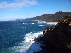
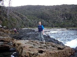
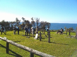
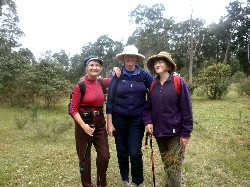
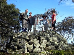
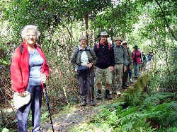
Merry Beach to Durras Mountain and Return
Thursday 5 July 2012
 |
 |
 |
| Coastal views south Photo by Bob M Click on thumbnail to enlarge photo |
Pat and group on Durras Mountain Photo by Bob M Click on thumbnail to enlarge photo |
Karen rockhopping on return leg Photo by Bob M Click on thumbnail to enlarge photo |
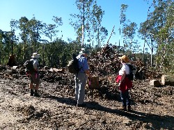
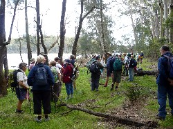
In spite of threatening dark clouds, no rain fell on Ian's walk in the Murramarang National Park on Thursday.
All 11 walkers loved the day with its spectacular coastal views and the splendid forest that they walked through to reach Durras Mountain and on down to the coast. The Spotted Gums plus a number of other natives were all flowering well and plenty of birds were seen and heard, including a sea eagle soaring up in the strong winds.
Following lunch on a headland we followed the coastal track and beaches, and
over the rocky headlands back to Pretty Beach. Everyone was marvelling at the
thundering huges waves crashing on the coastline when, much to our surprise, a
very young seal raced out from the rocks beside us, growling to make himself
seem bigger, before he found a good spot to jump back into the water. It was a
beautiful walk that also included pristine white beaches.
Pat
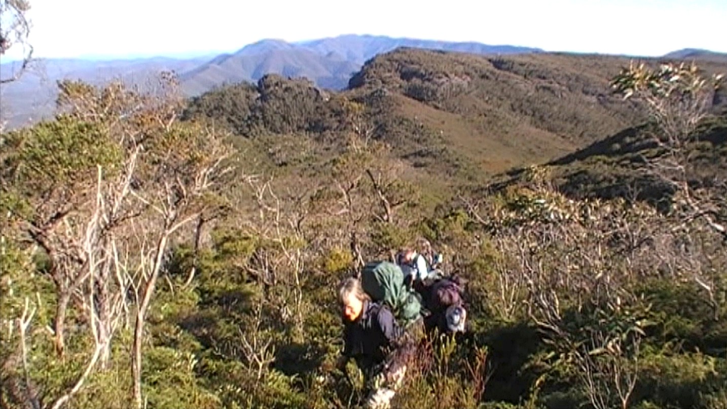
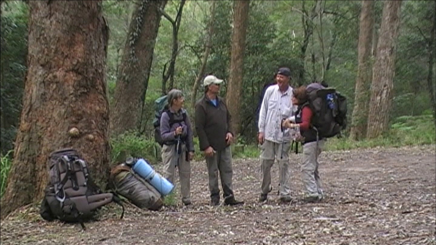
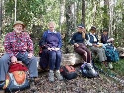
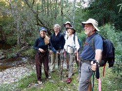
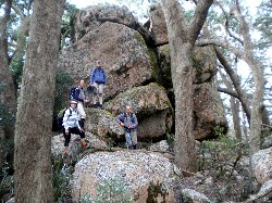
Wog Wog to Yadboro
Sunday-Wednesday 24-27 June 2012
It is difficult to fully appreciate the ruggedness of the Budawangs Wilderness within the upper catchments of the Corang, Endrick and Clyde Rivers without walking through it. But progress is usually slow due to thick vegetation and rock, especially off track.
Four BBBW Club members traversed the area west to east, 35km from Wog Wog to Yadboro over four days for track familiarisation and as a precursor to more detailed future explorations. The use of detailed 1:16,000 scale aerial photos of 1974 allowed detection of features perhaps not previously fully appreciated by other walkers.
A deviation from the main track took us to the Corang Cascades where the Corang River for millennia has fought a hard battle to cross a half kilometre wide band of near vertical hard metamorphics running northward from well south of Currockbilly Mountain.
The resulting rugged Corang Cascades are also known as “Many Rock Ribs” on the old “caterpillar” bushwalking map first drawn in 1960. The rocky falls and deep pools deserve further exploration in the summer months when water temperatures should be bearable. We camped at the pleasant Broula Brook around a bright fire.
After chipping ice off the billys next morning we launched into the maze of phantom tracks through the surrounding thick heath and rocks in the area, mentally making sketch notes for future reference.
 |
 |
 |
| Bronwyn leads out of Burrumbeet Brook Valley Photo by Ian Click on thumbnail to enlarge photo |
Wendy and Rudy and Mt Currockbilly on right Photo by Ian Click on thumbnail to enlarge photo |
Wendy contemplates a shortcut out of the Green Room Photo by Ian Click on thumbnail to enlarge photo |
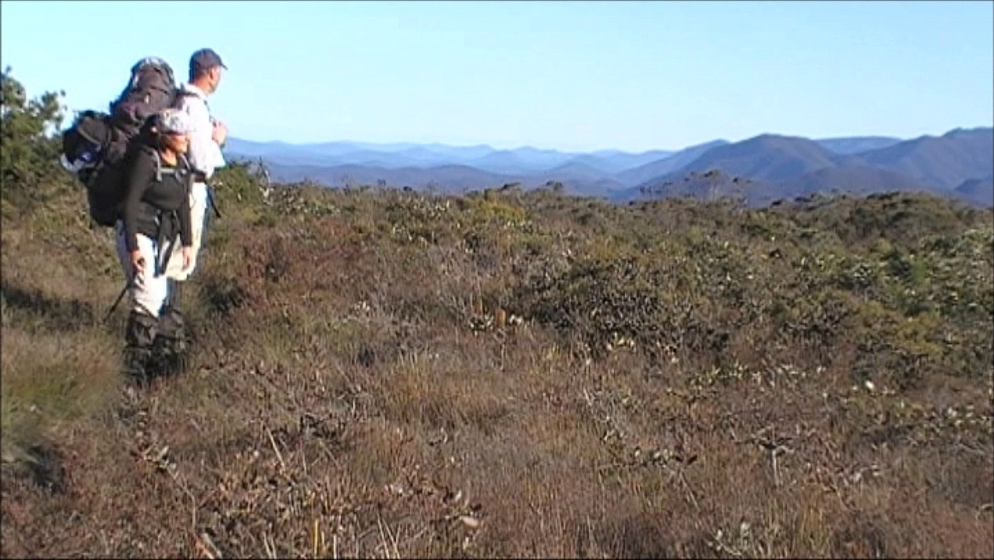
A long trudge through upper Canowie and Burrumbeet Brook basins, and across and up yet another set of “rock ribs”, got us to upper platforms. We had our first expansive views of the southern Budawangs, straight up the infamous Wirritin Ridge toward Currockbilly Mountain. Further south hovered Mount Dromedary, 90 km distant, and to the southwest lay the distinctive conical peaks of Corang and Mt Palerang, the latter which we had challenged only some weeks before.
Our trudge continued around the western slopes of Mount Bibbenluke to bring us within sight of our destination for the next two nights – Mount Cole camping caves – and none too soon in the short winter days. A warming fire was well appreciated around which we celebrated a birthday. Light rain fell beside us.
 |
 |
 |
| Resting on one of the Seven Gods Pinnacles Photo by Ian Click on thumbnail to enlarge photo |
Exiting Monolith Valley as the cloud thickens Photo by Ian Click on thumbnail to enlarge photo |
Still joking at the end - a sure sign of success Photo by Ian Click on thumbnail to enlarge photo |
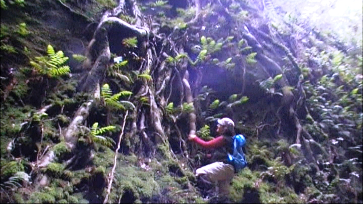
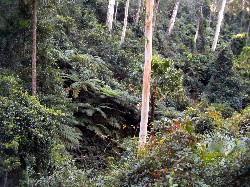
The third day, being a rest day, allowed exploration of nearby Monolith Valley, a rocky haven generally protected from the intense bushfires of the area by Mounts Cole, Owen, Nibelung, Mooryan and assisted by Shrouded Gods and Donjon Mountains. We only had time for the highlights –Seven Gods Pinnacles, the Green Room (and its ante, the Emerald Room), the natural arch, caves below giant chock stones, the Coachwood rainforest with its specimens of Pinkwood. But we had to keep moving – it was wet and chilly.
A navy helicopter bemused us, slowly drifting about the valley’s pinnacles, perhaps on some sort of training run, or sight seeing. Can’t blame them. This complex of pancake layered rock, laid down in the Permian over 250 million years ago by ancient rivers of the Pangea, and now heavily eroded, is a remarkable landscape from any angle.
We searched for Sunrise Cave and came tantalizingly close to falling into it, but the thick scrub and vertical walls convinced us to return to camp and plan another attempt on another day.
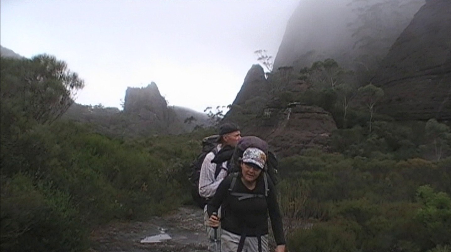
On our fourth and last day, we drifted through Monolith Valley, enjoyed the ramparts under Mounts Mooryan and Nibelung and gazed at the Castle’s fascinating tadpole tail now fast disappearing under the shrouds of descending cloud. We pressed on down the talus, and along the base of the Castle’s cliffs, enjoying the wider, more highly used track, and toward our waiting taxi driver who was five minutes late (or were we early?).
There is much more to be done here.
Ian
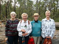
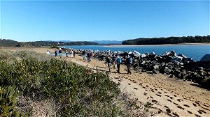
Meander in Mogo State Forest
Wednesday 27 June 2012
 |
 |
| Four Jans Photo by Karen M Click on thumbnail to enlarge photo |
Jill, John, Maureen, Patrick and Ian Photo by Karen M Click on thumbnail to enlarge photo |
Our walk began at the carpark on Tomakin Road at the south end of Mogo. There were 20 walkers including 2 visitors. We walked up James Street to the old Goldfields site where the Mogo State Forest walk begins. The first loop brought us back close to the start and then we went north, parallel to the Princes Highway in the bush behind the properties on the east of the highway. We crossed Dog Trap Road and went on a little further before turning back and returning to Mogo at 12.30 pm.
The track was easy and well maintained. There were a few fallen trees and limbs resulting from the recent heavy winds but they caused little trouble.
Some of the walkers stopped for lunch in Mogo. A great day was had by all.
Jan M
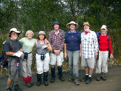
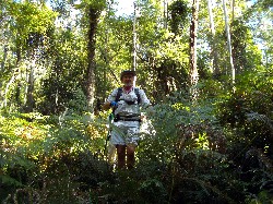
Bushtracks of Bergalia
Thursday 21 June 2012
 |
 |
| Mary and Stan Photo by Carol Click on thumbnail to enlarge photo |
Knee deep in ferns Photo by Bob M Click on thumbnail to enlarge photo |
14 bushwalkers enjoyed a fine bushwalking day exploring 14 kms of track
around Dwyers Creek in the Moruya State Forest. The walk covered a variety of
tracks, from just graded (and very muddy), to over grown and barely there.
We climbed quite a few hills, and passed over a couple of lovely creeks still
running through the gullies after recent rains. High winds had brought a lot
of trees down across the tracks, and small branches littered the floor of the
forest.
Karen M
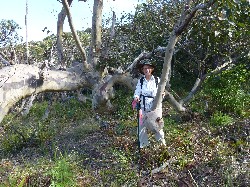
Baby Chair and Other Fire Trails
Sunday 17 June 2012
 |
| Bob ponders the origin of the name Photo by Bob M Click on thumbnail to enlarge photo |
In the BBBW walks prgram Bob T described the walk he led on Sunday 17 June as "Hearty hike for the legs and lungs". How true that turned out to be. Bob took 10 intrepid walkers on a circuit of steep fire trails, including the fascinatingly named "Baby Chair Firetrail". The group puffed and panted up and down challenging tracks through lovely forest and bush with glimpses of the Moruya river estuary in the far distance.
We started and finished our Fire Trail odessy at the Southern end of the Moruya Fire Trail.
At the end we were all feeling the "buzz" that comes after much exertion.
Thanks Bob for setting us on the path to improved fitness.
Bob M
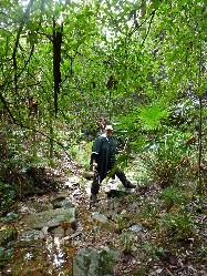
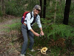
Ryan's Creek Area
Wednesday 13 June 2012
 |
| Some of the group after the walk Photo by Bob M Click on thumbnail to enlarge photo |
This walk was advertised as a “medium” walk but this did not fool any of the walkers. It is very difficult for Ian to lead any but “hard” walks.
It turned out a lovely day and we were only slightly inconvenienced by a light rain shower after lunch.
We walked on dirt roads, old logging roads and overgrown logging roads, followed by some obligatory bush bashing. We went down and up four steep gullies with three creek crossings. The scenery was spectacular and we were constantly serenaded with the bird song. A purple mushroom created much discussion but no-one volunteered to take it home for dinner.
All in all it was a great walk, and it was only 17 kms!
Geoff
Naked Gully
Thursday 7 June 2012
 |
 |
| Geoff and Elizabeth Photo by Lesley Click on thumbnail to enlarge photo |
Logged forest Photo by Lesley Click on thumbnail to enlarge photo |
Although logging had devastated a lovely valley on part of her chosen circuit, Valerie led 10 other members on a pleasant impromptu walk in the forest near Tomboye Hill.
The spotted gum are still flowering, and there were often beehives clustered beside the tracks. Best of all, we were surrounded by the songs of many different birds, including lyrebirds, from start to finish. It was the most “birdy” walk I’ve been on since last Spring.
As it may be a little early for their territorial and mating song battles, we assumed they were just as happy as we, with the good weather following the big blow. Pity we don’t make war with songs.
The scent of Prostanthera was strong along one of the tracks, the lush plants close beside us and even underfoot. Lunch was taken in a pleasant clearing, amid birdsong, spoiled only by being surrounded by mimosa weeds.
Another pleasant day in paradise, with good company, finished in a civilised
manner at the East Lynne Pie Shop. Well done Valerie!
Bob T
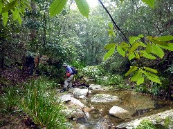
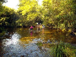
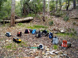
Pig Road, No 4 Logging Road plus Creek Walk
Saturday 2 June 2012
 |
 |
 |
| Lunch Photo by Donna Click on thumbnail to enlarge photo |
Descending into the creek Photo by Donna Click on thumbnail to enlarge photo |
The creek Photo by Donna Click on thumbnail to enlarge photo |
 |
 |
 |
| Karen Photo by Donna Click on thumbnail to enlarge photo |
Len Photo by Donna Click on thumbnail to enlarge photo |
Helen in one of the creek gorges Photo by Donna Click on thumbnail to enlarge photo |
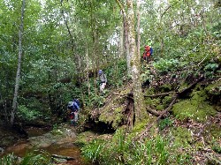
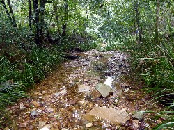
On the weekend 9 walkers headed up the Kings Highway to Pig Road for an 11 km medium/hard walk led by Len. We started with a long uphill stretch in light misty rain, eventually joining overgrown forestry tracks, which led to a little tributary of Currowan Creek.
We followed the bed of this forest stream for about a kilometre, occasionally passing through high rock gorges, and skirting deep clear pools, and where we almost tripped over a water dragon, silent and still on a rock in the middle of the creek.
Oh, and did I mention the leeches??
Karen M
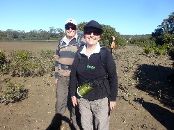
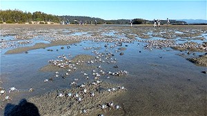
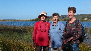
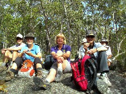
Quondolo Island and Moruya South Head
Wednesday 30 May 2012
 |
 |
 |
| John and Jill Photo by Carol Click on thumbnail to enlarge photo |
Batallions of soldier crabs Photo by Brian Click on thumbnail to enlarge photo |
South Head rockwall Photo by Brian Click on thumbnail to enlarge photo |
 |
 |
 |
| With weatherman Peter at Pilot Station Photo by Karen M Click on thumbnail to enlarge photo |
View from the Pilot Station Photo by Karen M Click on thumbnail to enlarge photo |
Historic graves at Toragy Head Photo by Karen M Click on thumbnail to enlarge photo |
Batemans Bay Bushwalkers' midweek walk was around a 5 km easy ramble around Moruya South Head led by Beverley. 22 members started by circumnavigating Quandolo Island at low tide. Quandolo is a small casuarina covered sand island in the Moruya River. At low tide the place is inundated by hordes of soldier crabs and sand crabs feeding in the mangroves before the tide returns. There's also plenty of bird life, taking advantage of all the activity on the dry sand flats.
We then followed the southern rockwall around to Shelly Beach and climbed up to the Moruya Pilot Station, which is also a weather station. Peter, the weatherman, told us about the history of the site, and what he now does for the Bureau of Meteorology. There are some incredible views from the Pilot Station up the river towards the mountains, over Shelly Beach, and along the coast to Burri Point, especially on such a sunny, clear day.
The walk finished after trekking out to the old graveyard on Toragy
Point, and then following an overgrown track around the headland to South Head
Beach. Well done to Bev for leading her first walk with the Club, and our thanks
for a most enjoyable day.
Karen M
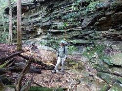
Lower Corn Trail
Sunday 27 May 2012
 |
 |
 |
| Bob, Karen, Carol, Betty & Amanda Photo by Kay Click on thumbnail to enlarge photo |
Carol, Debby, Bob, Betty & Geoff Photo by Kay Click on thumbnail to enlarge photo |
Rainforest gully Photo by Karen M Click on thumbnail to enlarge photo |
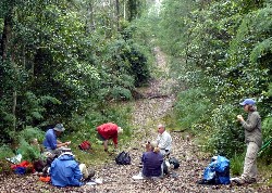
On Sunday 27 May, 26 keen Batemans Bay Bushwalkers headed out to Misty Mountain Road to walk the lower Corn Trail, which is by far the prettiest part of the track and also is easier as there is no mountain to climb. We split into two groups, one being slightly faster than the other, but with the amount of photos being taken speed didn't really come into it. We stopped for morning tea on the track, but decided not to stay too long as a leech was eyeing us over for his lunch.
We walked through some of the most lush rain forest I have ever seen, logs draped and hanging in beautiful thick moss as the track meandered through and round waterfalls, and creek crossings with tree ferns and palms in abundance, all in the shady, silent peace of the true rain forest. Then the dappled light disappeared and we would then come out into bright sunlight, the ground would dry out and become sandy and the trees would be tall and straight with minimal undergrowth. Other areas we walked through had thick scrubby undergrowth and dampness underfoot.
We stopped for lunch by a delightful creek (the Buckenbowra River), then retraced our steps back to the cars. We all knew it was the same track, but it looked quite different in reverse order.
Thank you to our leaders Geoff, Elizabeth and Joan for a truly wonderful and
delightful walk.
Ann
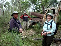
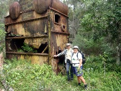
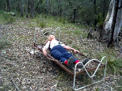
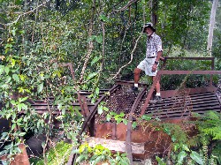
Moruya Silver and Gold Mines
Thursday 24 May 2012
 |
 |
 |
| Carol, Karen and Joan Photo by Lesley Click on thumbnail to enlarge photo |
Dennis, John and Ann Photo by Carol Click on thumbnail to enlarge photo |
Val and Ainslie Photo by Carol Click on thumbnail to enlarge photo |
 |
 |
| Jan takes the weight off Photo by Karen M Click on thumbnail to enlarge photo |
Bob and Lesley Photo by Karen M Click on thumbnail to enlarge photo |
Gold mines and more was the theme of Thursday's 7.5 km interesting walk led by John. Twenty-six Batemans Bay Bushwalkers enjoyed a easy/medium circuit through bush and farmland, taking in 2 of Moruya's historic minesites.
With the property owners' permission, we had morning tea on a stack of logs overlooking a rural valley with views of the mountains west of Moruya. We then ambled off over fields and through forest to have lunch in a grassy spot near Donkey Hill Mine. This mine is now just a couple of holes in the ground filled with water and several old mining bits and pieces, including a rusting old tip truck, and steam boiler.
On the return journey we stopped by Francis Hill Mine, with its old hut,
dunny and processing sheds still reasonably intact. Thank you John for coming
up with this most enjoyable walk.
Bob M
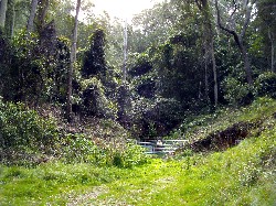
Cullendulla Creek Boardwalk
Saturday 19 May 2012
 |
 |
| Ian and Bev Photo by Carol Click on thumbnail to enlarge photo |
Leader Marilla Photo by Carol Click on thumbnail to enlarge photo |
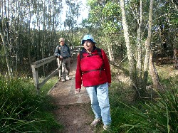
Nine walkers assembled on Saturday 19 May for an easy walk to the Cullendulla Creek Boardwalk. Marilla was the leader. The walk started at the Wharf Road car park and proceeded along Surfside beach to the beginning of the Boardwalk. It was a chilly start but the sun soon warmed everything up. The sand was firm, just right for walking, the sea sparkled and the views across the estuary were beautiful.
Morning tea was taken on a seat thoughtfully provided along the Boardwalk.
The signs posted along the way described the rich life of the mangroves. This
would be an excellent walk to introduce visitors to the variety of life on our
local shores. It was a very pleasant walk on a lovely Autumn day. Thank you
Marilla.
Paul
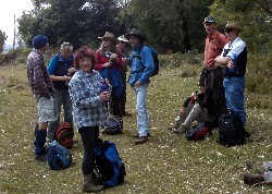
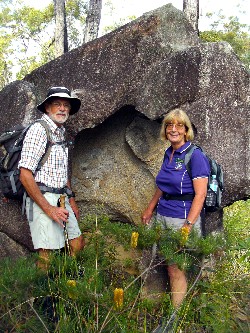
Great Divide Explorations Camp No 1, North Tallaganda
18, 19, 20 May 2012
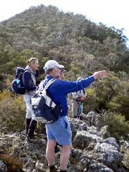
The first of a series of Batemans Bay Bushwalkers Club explorations of the Great Dividing Range between Bungendore and Countegany attracted 5 members – Lynne and Michael, Bronwyn, Lin and Ian. The weather was perfect – clear skies, little wind and cool temperatures - ideal for mountain top walking.
Using a comfortable base camp on the Mulloon Road near the Mulloon Creek crossing within Tallaganda National Park, two day walks were centred on two nearby peaks on the Great Dividing Range - Mounts Palerang and Lowden. Neither route had been walked before so some surprises were expected.
On the Saturday Mount Palerang was approached from the camp along a western ridgeline through mostly dry open forest and some rock outcrops. The 300 metre vertical lift soon had circulatory systems on full load until the cairn was reached and the lunch bags were opened. At 1,264 metres Mount Palerang is conspicuous from the Kings Highway southward. It shows as a distinct sharp peak, a reflection of the highly eroded tilted coarse sandstone and cobblestone conglomerate in this area. The mountain lends its name to the local government area, Palerang Shire.
We continued south along the main Great Dividing Range, dipping and scrambling over the many rocky outcrops, providing great views to the east and west. Vegetation in this area varied greatly. The sharp ridgetop supported Snow Gum, the eastern fall had tall moist Brown Barrel forest mostly with grassy understorey, and the western fall was mostly open shrubbery with at least one large area of bare rock.
The slow westerly descent toward camp, on a long ridge of the more common shales and siltstones of the area, was dominated by fire scarred peppermints and Silvertop Ash, a legacy of many years of hot damaging fires.
Back in the luxuries of camp that night, the group reassessed the walk, aided by the calming effects of various red wines and a copious fire to keep the cold at bay. Under BBBW grading rules this 5 km circuit of 4.5 hours is Medium Hard, mainly due to the initial climb and the rockiness of the ridgetop.
 |
 |
 |
| Leader Ian en route to Mt Palerang Photo by Lin Click on thumbnail to enlarge photo |
Summit of Mt Palerang Photo by Ian B Click on thumbnail to enlarge photo |
Mt Louden Photo by Ian B Click on thumbnail to enlarge photo |
Sunday’s walk along the Great Dividing Range centred on Mount Lowden. It began with a 4wd car shuffle which allowed us to start at the nearby radio repeater station. Walking through grassy snow gum forest we were soon at the Mt Lowden trig cairn of 1,346 metres.
This part of the Range is dominated by Devonian pink granite with many tor outcrops. Using aerial photographs and careful navigation, a number of significant outcrops were visited, giving us some special views to the west and southeast. One in particular was in a beautiful forest setting with abundant fern surrounds and red algae and moss growth. We pressed on from saddle to saddle and lunched within a small grove of Black Oliveberry trees. This is an uncommon tree found only in remnant Gwondana cool temperate rainforests.
The going was often quite bouldery underfoot and progress became quite slow in places, especially where an undergrowth of Pepperberry and ferns in the saddles was thickened a little with Wait-a-While Vine – a little “ouchy”!
Eventually, a carefully navigated descent from the slopes of Mount Major to the Jinglemoney Fire Trail was rewarded by the welcome sight of our waiting 4wd. After another car shuffle we headed back to camp via yet another “scenic route” and a weary return to the (warmer) coast.
Sunday’s 6 km 6 hour traverse of the Range was unanimously assessed under
the BBBW grading system as Hard to Very Hard, mainly due to the difficult
terrain and patches of dense undergrowth.
Ian B
Wrights Road Cullendulla
Wednesday 15 May 2012
This midweek 17 km walk near Cullendulla was led by Betty, who is one of our
bushwalking legends at 79 years old. She guided 9 fellow (and much younger)
members at a cracking pace around a circuitous hilly route through some
beautiful forest only 8 km north of the Bay. We don't have to go very far from
town to find great bushwalking, but we do have to be pretty fit to keep up with
Betty.
Karen M
Beyond Bimberamala
Sunday 13 May 2012
No report received
Meroo Lake and Beach
Thursday 10 May 2012
 |
| Joan, Ainslie and Gay Photo by Mike Click on thumbnail to enlarge photo |
Meroo Lake and Headland is an area of great charm and variety. The walk on Thursday 10th May led by Bev was a little curtailed as the lake waters had risen over the track to Meroo Beach.
After admiring the Lake, we backtracked out to the Headland for a view of
Bawley Point to the south. We then dropped down to Shelley Beach for lunch
with Sea Eagles and a Whistling Kite soaring overhead in the clear blue sky.
Ainslie
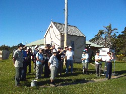
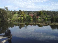
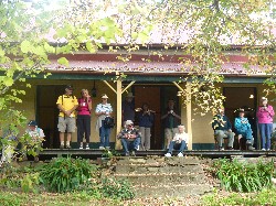
Historic Houses Walk and Bushmans Lunch
Tuesday 9 May 2012
 |
 |
 |
| Runnymeade Farm Photo by Karen C Click on thumbnail to enlarge photo |
Morning tea on the verandah Photo by Lesley Click on thumbnail to enlarge photo |
Hostess Robyn with Paul Photo by Lesley Click on thumbnail to enlarge photo |
A interesting informative Batemans Bay Bushwalker social outing was held on a lovely south coast autumn day. After parking our cars we ambled around the bend to Runnyford Bridge to be met by a picturesque scene of blue sky, autumn coloured leaves, green fields and red roof tops all reflected in the clear waters of Buckenbowra Creek, on which floated a flotilla of black swans. Cameras came out of pockets and backpacks, what a marvellous photo this would make.
We then walked onto “Runnymede” the historic property at Runnyford to be greeted by Robyn, property owner, local passionate historian, our guide and hostess. There were tales of the property which was first settled in the 1830’s, stories of convicts, dairy farmers, cheesemaking, floods, fires and hard times. The old home fell into almost total disrepair, then was purchased by Robyn's family and saved. Robyn spoke of the hard work of restoration, showing us before and after photos, giving us an insight into what has been archieved. While listening to Robyn's tales we enjoyed a lovely morning tea of scones, jam and cream sitting in the sun on the front verandah admiring the view.
Part two of our day started with a short walk to Mays Road and “Poverty Farm”, another historic house being lovingly renovated by Robyn's family, which overlooks the Clyde River. Here we had time to explore and some take the track down to Mays Wharf on the Clyde west of Chinamans Point, where a keen eye spotted a Whistling Kite soaring overhead. A loud whistle called us back for a delicious camp oven lunch, including a surprise dessert, eaten on the lawn in the warmth of the autumn sun.
We headed for home after 34 Bushwalkers warmly thanked Robyn and her
family, as well as our Social Committee for a marvellous, unforgettable day.
Karen C
18 Mile Peg - Big Spotted Gum
Saturday 5 May 2012
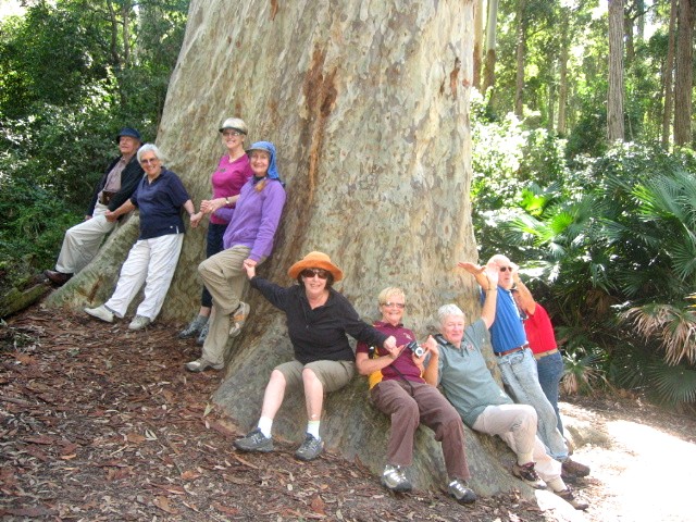 |
| The Big Tree Photo by Joan Click on thumbnail to enlarge photo |
The sunny autumn day enticed 14 enthusiastic walkers led by Bob and Joan to drive north to 18-Mile Peg Road and continue for 1.5 kilometres to a parking space from where we walked up a short hill to be welcomed by 25 bee boxes with some hundreds of bees swarming just 15 metres from us all, but with no interest in us for a second - we passed by amicably to all.
The track continued down a slope to where we branched off to the right and delved into the forest for 20 minutes before morning tea and the search for friendly leeches to be despatched swiftly. We returned to the cars as the track had become overgrown and so the other end of the loop walk was investigated for a further kilometre before again returning to the cars.
Next was a short half kilometre drive down to the parking space near
the giant Spotted Gum (Corymbia maculata) which certainly deserves its
title of 'Old Splotchy' in some brochures. The tree, at first sight,
takes you by surprise as it is well protected from vision until almost
within 10 metres. The path to the tree is not signposted and leads
into the right from the parking space. From internet information the
tree's girth is 10.76 metres and height 59 metres as listed on the
National Register of Trees - these measurements taken in 2008 - and
the age is unlisted, but you could have a guess at close to 1000 years.
Joan
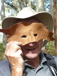
Cookie's Beach to Richmond Beach and Return
Wednesday 2 May 2012
 |
 |
 |
| Birthday girl Betty Photo by Mike Click on thumbnail to enlarge photo |
Incredible rock formations on Murramarang coast Photo by Erika Click on thumbnail to enlarge photo |
Who is that Masked Man Photo by Erika Click on thumbnail to enlarge photo |
Ainslie and Mike led a beautiful walk across rock platforms, with some rock hopping (my favourite ‘walking’) and also passing through some amazingly twisted and gnarled spotted gums.
This was my second walk with The Baybushwalkers, to get me away from the computer, and outside for some fresh air and exercise. With Ainslie and Mike’s excellent knowledge of the local topography and the lovely company, all 9 of us, compared to 31 last Sunday, I was truly rewarded.
We stopped for morning tea at Emily Miller Beach. We passed Wasp Island, and
Flat Rock, saw Grasshopper Island in the distance, observed a volcanic dyke,
drop stones and age old fossils. We had lunch at Richmond Beach before
returning via road.
Erika
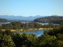
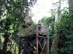
Durras Lake and Discovery Trail
Sunday 29 April 2012
 |
 |
 |
| By Durras lake Photo by Erika Click on thumbnail to enlarge photo |
Lesley on the Discovery Trail Photo by Karen C Click on thumbnail to enlarge photo |
Gill leads the way across the big log Photo by Karen C Click on thumbnail to enlarge photo |
On Sunday 29 April, 31 happy bushwalkers set off to walk the 8 km Discovery Trail at North Durras. The weather was kind and Durras Lake was gleaming and placid as we walked alongside, through cabbage tree palms of great height and age, huge eucalypts, lilli pilli understorey and much more. We leapt the puddles and enjoyed the fact that the bush was sparkling since the recent rain. As usual, some of the walkers had their photos taken looking dwarfed by the huge trees.
On reaching the boardwalk, we set off on a path of discovery with educational signs, stepped along a carved fallen tree to the tree house which overlooks the bush and has a stump with the 'put-log' cuts still showing from the days when logging took place in this beautiful spot.
On the return journey we found some well placed logs on which to sit and eat
our lunch and gaze at the water and catch up with friends. A lovely walk,
thank you, Lesley.
Barbara
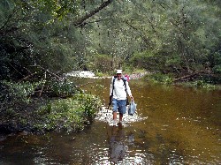
Peach Tree Road and Currowan Creek
Thursday 26 April 2012
 |
 |
 |
| Pat and Geoff on first creek crossing Photo by Karen M Click on thumbnail to enlarge photo |
Bob bushbashing to the road Photo by Karen M Click on thumbnail to enlarge photo |
Rodney crossing Currowan Creek on return leg Photo by Karen M Click on thumbnail to enlarge photo |
Six bushwalkers joined Rodney on his 12 km medium walk starting on Caves Gully Road, crossing the ford at Currowan Creek, and continuing around Peach Tree Gully Road on a circuit back to the ford.
Currowan Creek at the ford is just a beautiful spot and we crossed here twice. We then walked through some nice forest before heading off track for about 500 metres of some enjoyable bushbashing back to the road leading to the ford.
We walked at a fairly fast pace, so were back at the creek by lunchtime, and
back to the cars shortly after that. Thanks Rodney, we'll come again.
Karen M
Bingie, Mullimburra Point, Beach, Figure of Eight
Saturday 21 April 2012
No report received
Deep Creek Dam & Area
Wednesday 19 April 2012
Walk cancelled
Kelly's Mine
Sunday 15 April 2012
 |
 |
 |
| Val and luminous fungi Photo by Karen C Click on thumbnail to enlarge photo |
Morning tea on rocky outcrop Photo by Karen M Click on thumbnail to enlarge photo |
Stan and Karen by the tent rock Photo by Karen M Click on thumbnail to enlarge photo |
 |
 |
 |
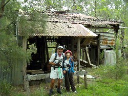
| Kellys Mine Photo by Karen M Click on thumbnail to enlarge photo |
Picnic at Hanging... I mean Kellys Mine Photo by Karen M Click on thumbnail to enlarge photo |
Stan on the ore hopper Photo by Karen M Click on thumbnail to enlarge photo |
Ten Batemans Bay Bushwalkers recently explored 12 kilometres of tracks in the Bimbimbie area of Mogo State Forest.
As well as observing the last of the summer wildflowers, walkers noted the spotted gums had begun flowering and the currawongs had gathered prior to enduring the coming winter.
The Bimbimbie area is characterised by granite geology with outcrops of boulders scattered among the forest. Bushwalkers discovered a unique “tent” boulder, hollowed out by many years of erosion.
The area displays evidence of past gold mining activity. Lunch was enjoyed at the Bimbimbie (Kellys) Mine. The adit has recently been rehabilitated by the Mines Department to restrict human entry. The barriers will also protect the breeding colony of the Little Bentwing Bats who have for years made the mine their home.
As well as providing timber for local industry for many years, the forest
is shared with bushwalkers, mountain bikers, trail bikers, horseriders and
firewood collectors.
Ian B