First Quarter 2013. See below for
Walk Reports and Photos
Walk Reports and Photos for Summer 2013. Click on walk headings below, or simply scroll down the page.
Congo to Tuross, One Way, Wednesday 10 April 2013
Corrigans Beach and River Walk, Thursday 4 April 2013
Mongarlowe River, Monga National Park, Wednesday 27 March 2013
Durras Mountain from the West, Sunday 24 March 2013
Mini Orienteering Event, Thursday 21 March 2013
Pebbly Beach, Snake Bay, Mount Durras Loop, Saturday 16 March 2013
Kayaking and Canoeing on Durras Lake, Wednesday 13 March 2013
Woodleigh Fire Trail, Wednesday 13 March 2013
Backpack Walk, Pilot Wilderness in Kosciusko National Park, Tuesday 12 - Friday 15 March 2013
Potato Point to Tuross Lake, Sunday 10 March 2013
Crazy Whist Card Game and Dinner - Social Event, Saturday 9 March 2013
Malua Bay to Mosquito Bay Return, Thursday 7 March 2013
Car Camp at Bendethera in Deua National Park, Monday 4 - Thursday 7 March 2013
Exploring West Nelligen, Saturday 2 March 2013
Batehaven Town & Country Ramble, Wednesday 27 February 2013
Merry Beach to Bawley Point, Sunday 24 February 2013
Old Bolaro Road, Rainforest and Granite Cascade, Thursday 21 February 2013
Great Divide Car Camp No. 3 at Snowball, Friday 15 - Sunday 17 February 2013
Congo to Meringo, Dreaming Track, Saturday 16 February 2013
Quartpot Creek, Toward the Source, Wednesday 13 February 2013
Sugarloaf Creek, Misty Mountain Descent, Sunday 10 February 2013
Point Upright, Thursday 7 February 2013
Currowan Creek Meander, Saturday 2 February 2013
Denhams Three Beach Walk with Sausage Sizzle to follow, Wednesday 30 January 2013
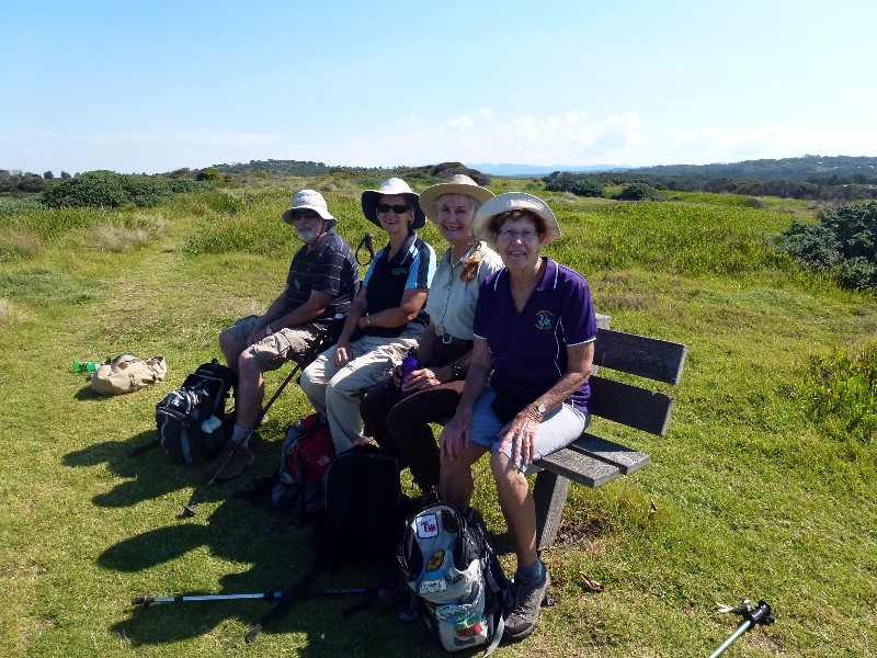
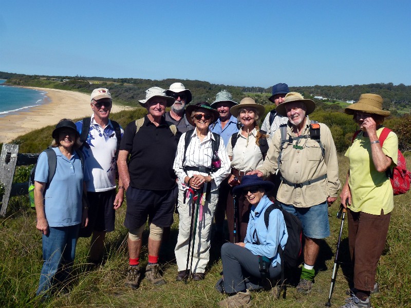
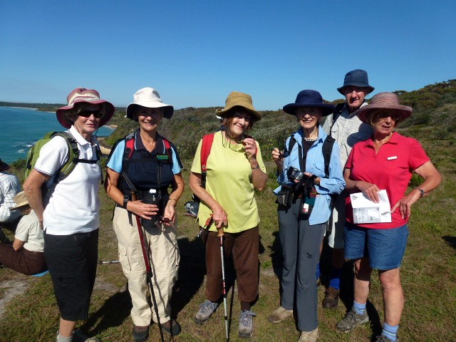
Congo to Tuross, One Way
Wednesday 10 April 2013
 |
 |
 |
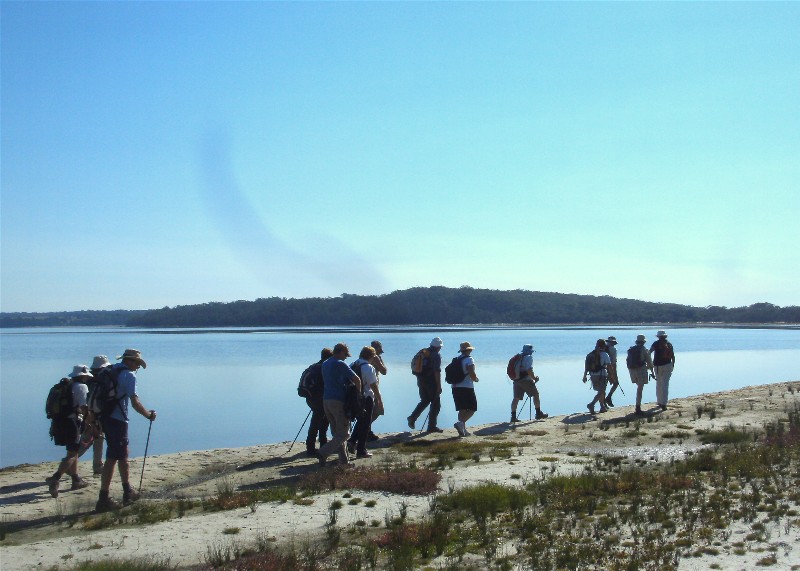
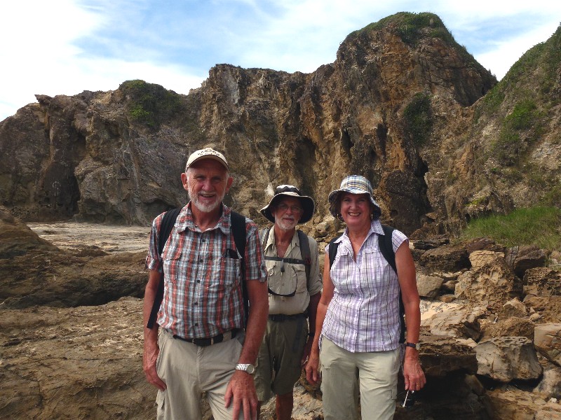
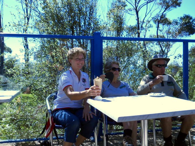
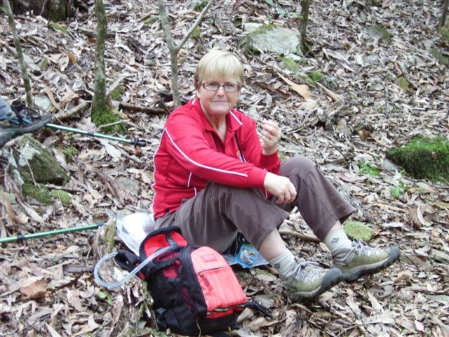
| Peter, Marilyn, Carol and Lesley on Bingie Headland Photo by Lesley Click on thumbnail to enlarge photo |
The group walking north to south Photo by Lesley Click on thumbnail to enlarge photo |
Morning tea with a view Photo by Lesley Click on thumbnail to enlarge photo |
 |
 |
 |
| Coila Lake Photo by Bob M Click on thumbnail to enlarge photo |
Grey Rocks headland Photo by Bob M Click on thumbnail to enlarge photo |
The group walking south to north Photo by Bob M Click on thumbnail to enlarge photo |
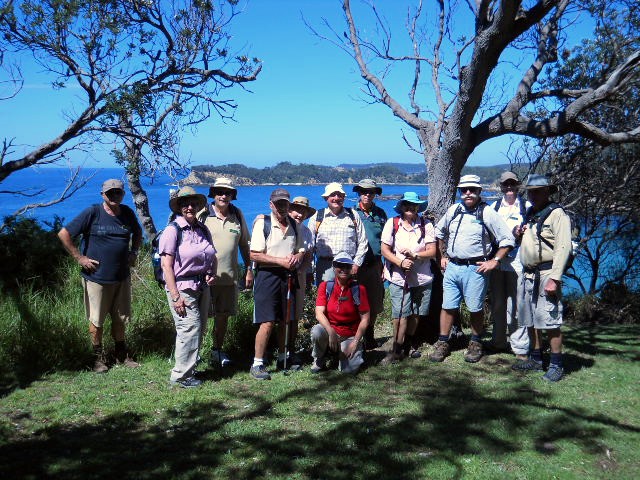
The Bingie Dreaming Track is one of the loveliest (and least hilly!) guided walking tracks in the Eurobodalla. It is 15km one way and runs from Congo to Tuross, past golden beaches, coastal lagoons, geologically interesting headlands, forests of twisted red gums and swamp mahoganys, and views at every turn.
31 Batemans Bay Bushwalkers walked the entire length of the Dreaming Track
mid week on a glorious sunny autumn day, spotting heaps of shore birds and the
endangered white flowering plant, Wilsonia rotundifolia on the shores of Coila
Lake, a school of salmon circling off Grey Rocks, and 3 sea eagles patrolling
different sections of the coast.
Karen M
Corrigans Beach and River Walk
Thursday 4 April 2013
On 4th April a easy walk was led by Marilla, with an overcast sky, 14
persons strolled along Corrigans Beach and River. Evidence of sand dredging
with pipes and slag heaps appeared on the scene. Afternoon tea was taken at the
end of the retaining wall. On our return the tide was coming in, so the walk
was completed with footwear off, a little paddle with the group enjoying
walking on firm sand.
Marilla
Mongarlowe River, Monga National Park
Wednesday 27 March 2013
 |
 |
 |
| Leaders Ainslie and Mike Photo by Lesley Click on thumbnail to enlarge photo |
Knee deep in leaf litter and pinkwood blossom Photo by Lesley Click on thumbnail to enlarge photo |
Tree fern forest Photo by Lesley Click on thumbnail to enlarge photo |
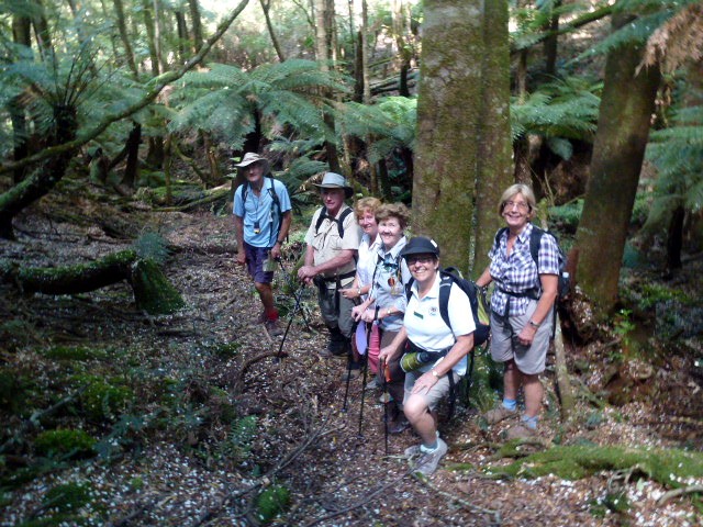
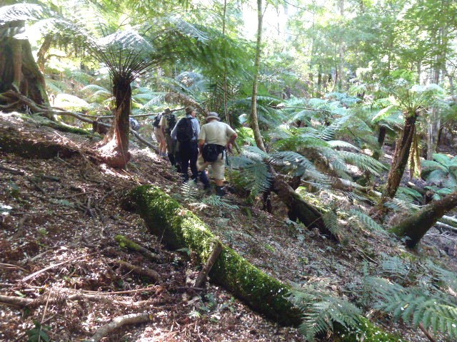
Ten bushwalkers, and I can now add resilient ones, drove up to Monga National Park to commence one of the prettiest and most serene walks in the area. We started out walking on the road and headed up Penance Grove Track. We walked around the boardwalk admiring the tree ferns and the giant moss and being showered by the pinkwood blossoms that were falling like snow from the giant pinkwood trees that abound in this unique area.
Coming out onto the road again, we headed up the hill then veered off through the bush down towards the creek to follow it along. We found the walking turning into an aerobic session as we found it very overgrown since last walking in the area, with many trees fallen along our path which we had to either climb over, under, or skirt around.
We crossed the creek several times to get past trees just too large to climb over, but eventually we came out onto the road again and after a lunch stop we all voted to go the short way back to the cars.
Many thanks to Ainslie and Mike for leading this walk.
Ann
Durras Mountain from the West
Sunday 24 March 2013
 |
| Lunch after slogging through trackless rainforest Photo by Ken Click on thumbnail to enlarge photo |
Val lead an intrepid group of 9 on an interesting 7 kilometre walk up Durras Mountain from the Western side. The way to the top of the mountain led through 2 most interesting rain forested gullies. Granite outcrops above the gullies had bunches of rock orchids and staghorns. Bob T had the unusual experience of disturbing a powerful owl which was using the gully as a roosting place.
After lunch at the top, a trail led back to the vehicles. Most interesting
walk in a new area.
Ken
Mini Orienteering Event
Thursday 21 March 2013
 |
 |
 |
| Susan, Karen and Stan check out the route Photo by Lesley Click on thumbnail to enlarge photo |
It wasn't all hard work Photo by Lesley Click on thumbnail to enlarge photo |
Retrieving the last control point Photo by Karen M Click on thumbnail to enlarge photo |
28 members turned up for Len's mini orienteering event held mid week. We chose which one of the easy, easy-medium or medium routes Len had laid out for us that we wanted to do, and armed with detailed maps, set off to find the marked control points along the way.
I was in the medium group and we followed 11.2 kilometres of tracks winding through
the forest to pick up 17 controls. We all agreed this was an interesting twist on
the usual bushwalk, and the time went quickly as we conferred about the location of
the next point, and made sure we knew where we were by using the GPS and map. Thanks
Len - you did it again!!
Karen M
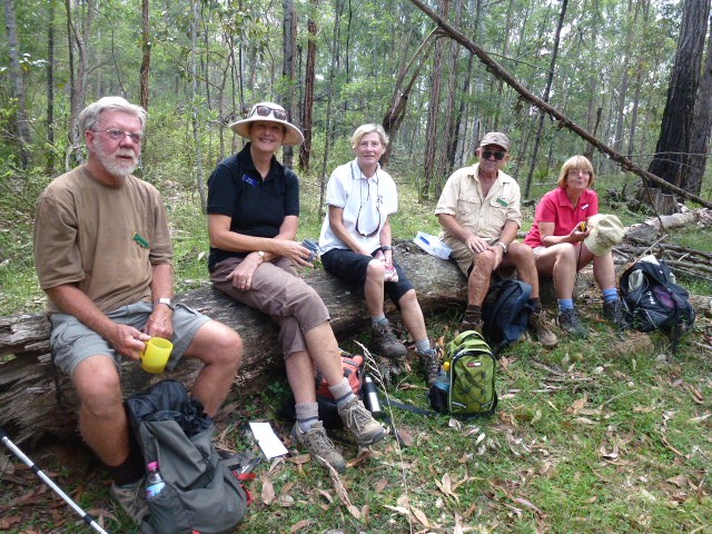
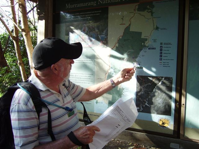
Pebbly Beach, Snake Bay, Mount Durras Loop
Saturday 16 March 2013
 |
 |
 |
| Leader Peter explains the route Photo by Karen C Click on thumbnail to enlarge photo |
Mt Durras Trig Photo by Lesley Click on thumbnail to enlarge photo |
Erika's koala impersonation Photo by Lesley Click on thumbnail to enlarge photo |
 |
| Donna, Lesley and Heather with treestone Photo provided by Lesley Click on thumbnail to enlarge photo |
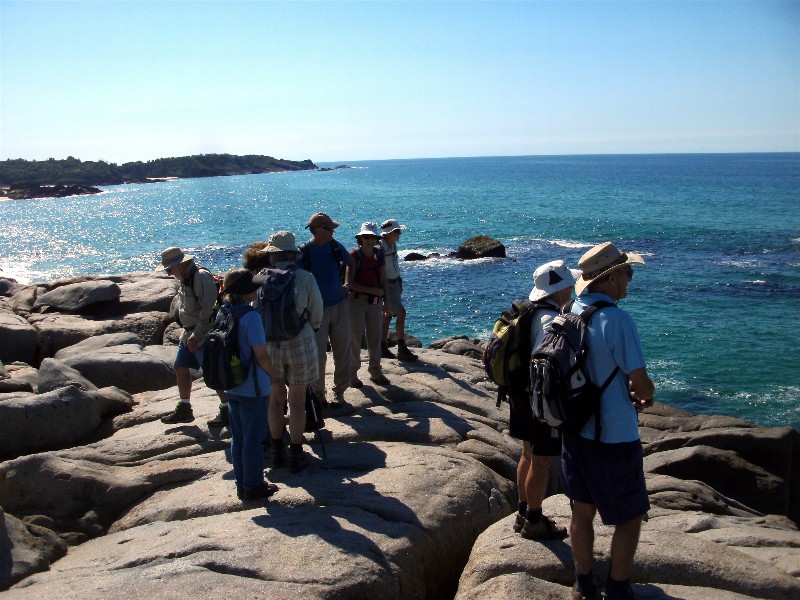
Brilliant blue skies on Saturday for our walk in Murramarang National Park. The walk started at Pebbly Beach and followed the coast track north with a quick detour into Clear Point to take in the wonderful views to the north and south. The next section included some tricky manouvering over the rocks into Snake Bay for morning tea.
We left the track then and were guided through the bush in search of the remains of the old coast road which ran from the top of Durras Mountain to the beach. Once found, it was upwards and onwards. A Lace Monitor spotted at the side of the track, refusing to leave his sunny grassy spot, posed obligingly for the many photographers in our group. Another quick detour to see the old dam and then off track through the shrub and long grass and finally we reached the top of Durras Mountain, 277m above sea level.
Here we identified the site of the old homestead, known as McKays Farm which was originally setttled in 1860 and run as a dairy. After the 1920’s the farm gradually deteriorated and in 1973 became part of the national park. Time for lunch.
A flock of pelicans flew overhead heading north. A last check for leeches
and ticks and then we headed off, taking in some great views east and west.
Along the well defined track we were saddened to see the proliferation of
seeding thistles among the grass, maintenance of this popular track seems
neglected. Then at last we are heading downhill back to the coast. One last
stop along the track to watch a lone surfer riding the waves and then the
camping area is in sight and our walk is over. Twelve club members and one
visitor gave hearty thanks to Peter and Marilyn for a challenging, interesting
walk and for the historical information about the early settlers on top of the
mountain.
Karen C
Kayaking and Canoeing on Durras Lake
Wednesday 13 March 2013
No report received
Woodleigh Fire Trail
Wednesday 13 March 2013
Not an official walk due to insufficient numbers
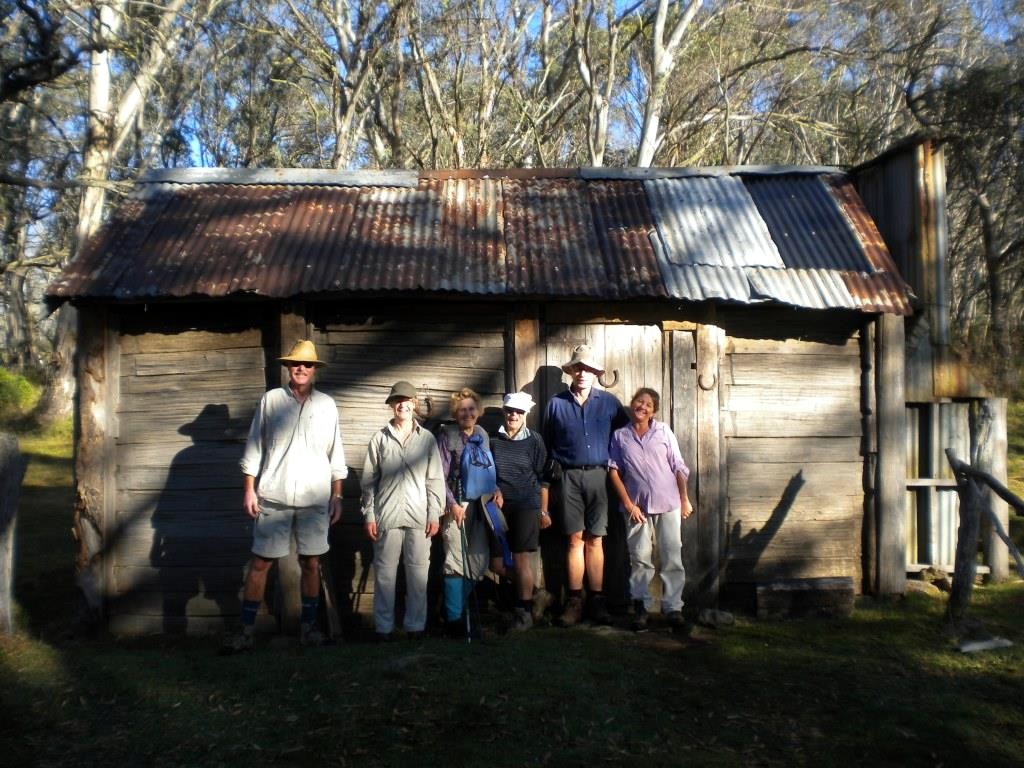
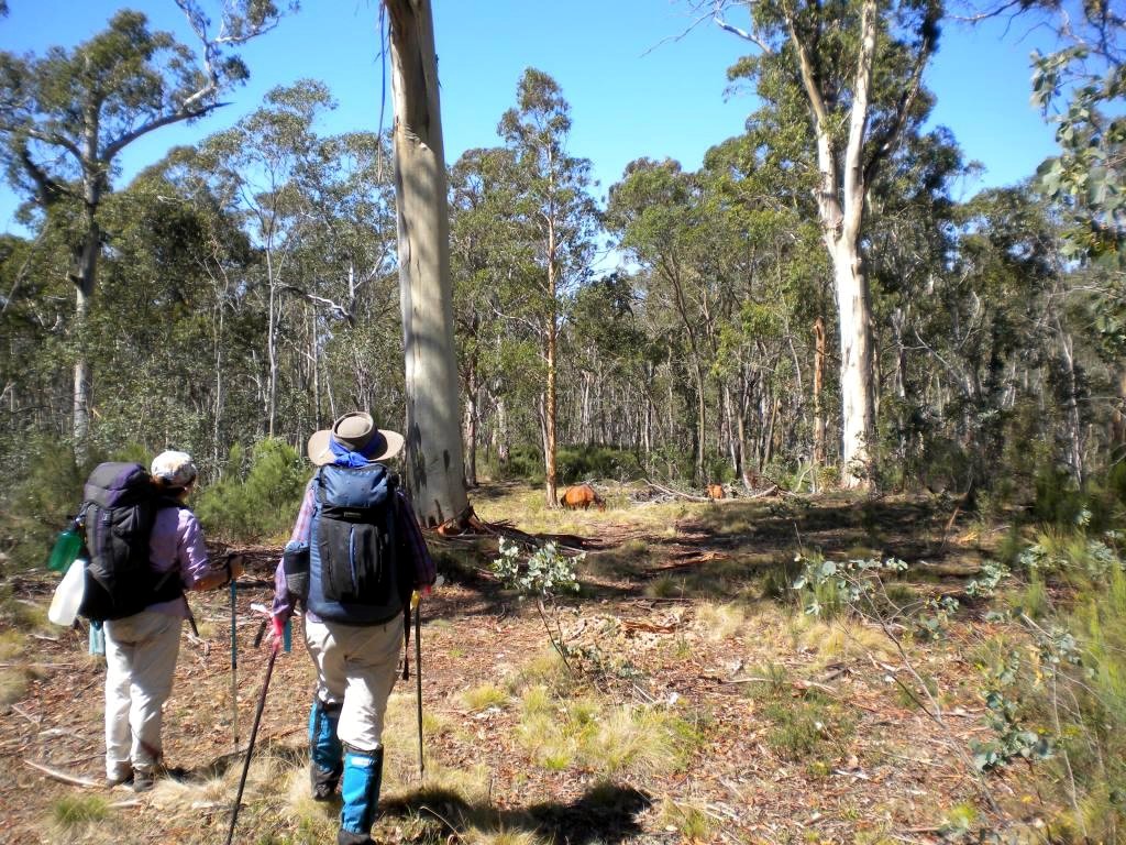
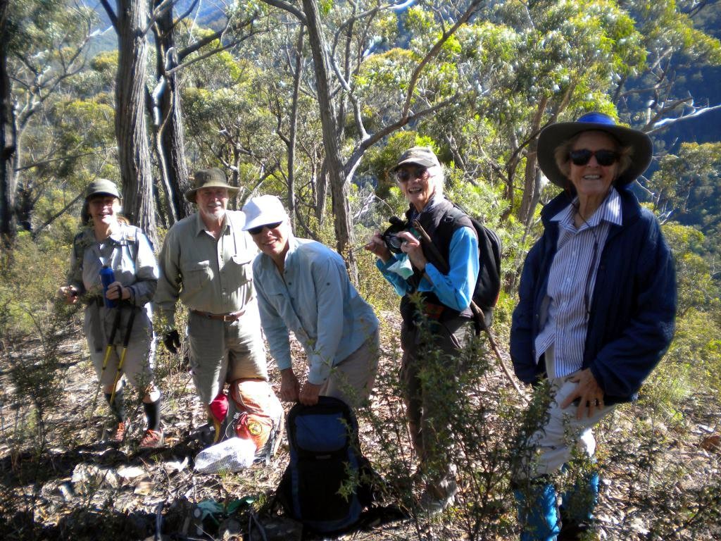
Pilot Wilderness in Kosciusko National Park, Backpack Walk
Tuesday 12 - Friday 15 March 2013
 |
 |
 |
| 14 bright eyes and 7 bushy tails at the starting gate Photo by Ian Click on thumbnail to enlarge photo |
Cascade Hut – a classic Kosciusko scene Photo by Ian Click on thumbnail to enlarge photo |
14 less bright eyes and 7 less bushy tails for day 2 Photo by Ian Click on thumbnail to enlarge photo |
 |
 |
 |
| Betty and Wendy pause for brumby watching Photo by Ian Click on thumbnail to enlarge photo |
Serious card game at Ingeegoodbee River camp Photo by Ian Click on thumbnail to enlarge photo |
Rudy leads a rare uphill climb Photo by Ian Click on thumbnail to enlarge photo |
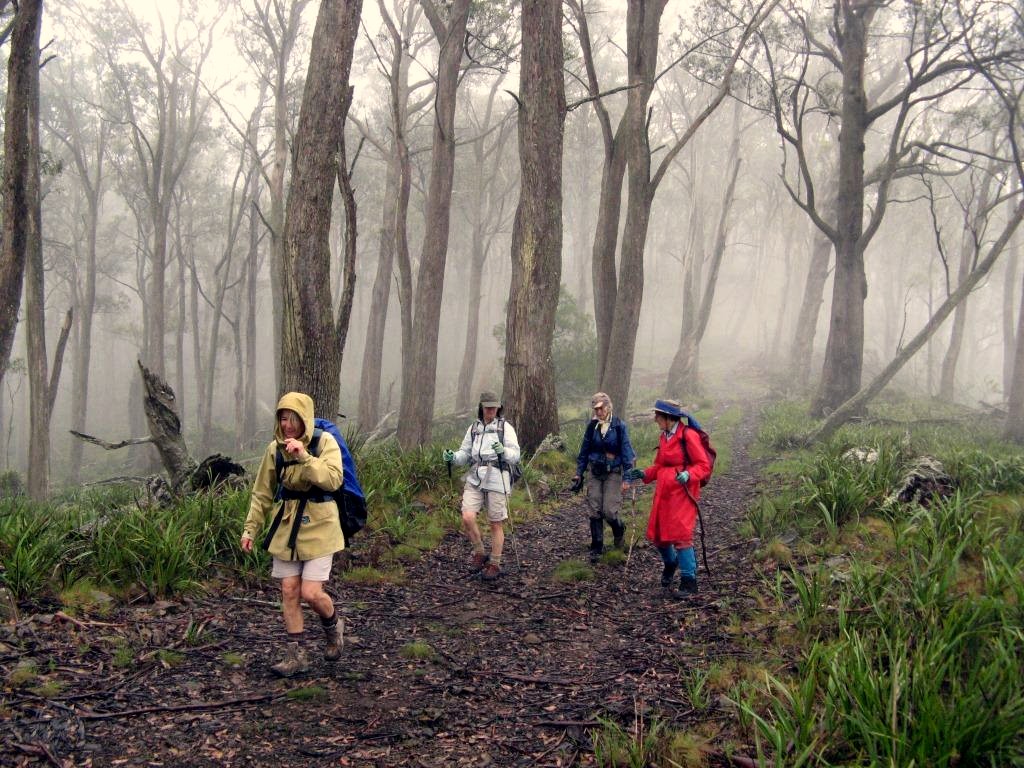
The Pilot Wilderness is a large 92,400 hectare slab of Kosciusko National Park between Thredbo and the Victorian border. It contains the NSW southern extent of the Great Dividing Range, including The Pilot mountain of 1,829 metres asl and the source of the mighty Murray River.
The topography and vegetation varies greatly with altitude. The sub alpine plateaus of snow gum, alpine ash and snow grass quickly plunge up to 1,000 metres into the Murray River to the west and the Jacobs, Pinch and Ingeegoodbee Rivers to the east, themselves tributaries of the Snowy River where dry peppermints, boxes, stringybarks and black cypress pine dominate.
Seven club members – Rudy, Wendy, Betty, Bronwyn, Sharon, Lin and Ian crossed this wilderness north to south from Dead Horse Gap on the Alpine Way to the Pinch River camping area on the Barry Way via The Tin Mines. Rudy organised his Jindabyne mates to look after the 300 km car shuffle which was a big relief because it allowed us about 6 hours more walking.
Apart from a few blisters the distance of 52 kilometres was covered in four days of relatively easy and open trail walking. The sub alpine frost hollows and woodlands were particularly enjoyable. The extensive 2003 fire killed forests south of Dead Horse Gap to Tin Mines were a sea of dead trees and thick regrowth, only a portion of the Australian Alps so treated over the last decade and a salient reminder of probably one of Australia’s greatest environmental events.
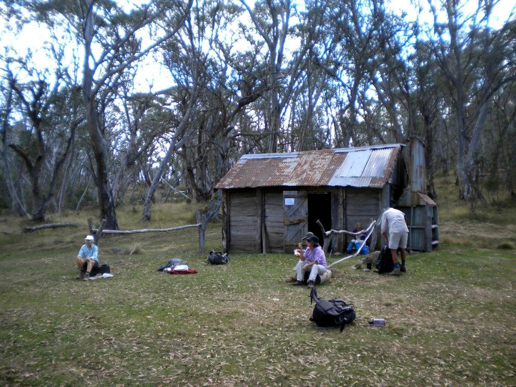
On the first night at Cascade Hut most of us tented under the snow gums and similarly on the second night at Carters Hut (Tin Mines). The third night on the banks of the Ingeegoodbee River near the Freebody Hut site was on snow grass under the stars. Every site was a picture postcard perfect camp site and most worthy of relaxation after each day’s walk. The water temperature in the nearby creek was, on each occasion, bearable for a quick bath.
On day two we left the track in search of the nearby Tin Mine Falls, supposedly the highest in Kosciusko NP, but the thick fire regrowth beat us. Notably, over four days, Sharon found three cameras, all remarkably the same make and model as her own!
The descent of the plateau from the elevated Ingeegoodbee River to Pinch River down the Nine Mile Trail was steep and littered with loose gravel. Progress was slow and the thigh muscles bulged. The change in vegetation from cool, moist sub alpine frost hollow to steep, dry, open woodland in only a few kilometres was remarkable.
Along the route we saw only two other people in the four days, mountain
bikers, but unfortunately horses were numerous and the route was littered, and
stank, of horse shit. We startled a pair of emus in the Pinch River. I think
the snake count was five – the head of the conga line changed at each sighting!
Ian
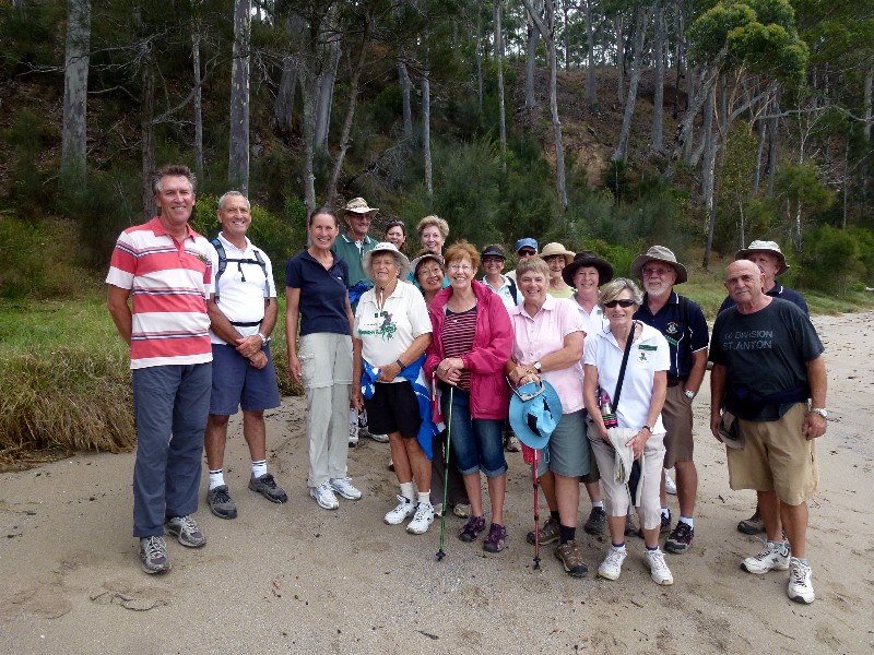
Potato Point to Tuross Lake
Sunday 10 March 2013
 |
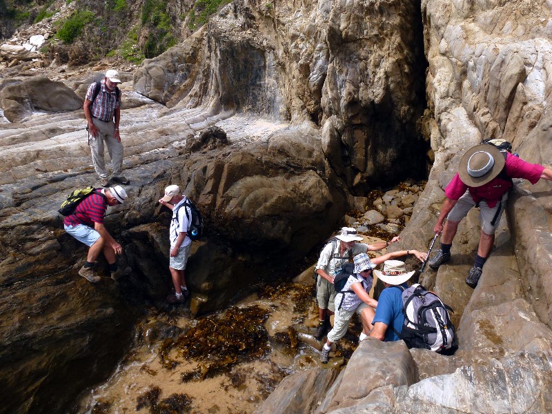 |
| John, Stan and Liz Photo by Lesley Click on thumbnail to enlarge photo |
Rock scrambling Photo by Lesley Click on thumbnail to enlarge photo |
The weather had been perfect all week and Sunday was to be no different. The skies remained blue throughout our walk, and the sea a beautiful shade of aqua marine. Walking along the beach could not have been better for our group of 27 walkers. It was an easy–medium walk along nice firm sand, until we reached the headland at Blackfellows Point. The group could choose a scramble across the rocks or an easier option up along the cliff tops. There was one tricky bit of the rock scramble for some to remember as a challenge, with a gap in the rock shelf requiring a descent into the shallows of some incoming water, and a body weight heave back up again.
The group reassembled and we continued on to Tuross. A tick removal procedure halted us for a while, with lively discussion of the pros and cons of different removal measures. We then skirted inland along the left hand bank of the lake. Emu tracks were visible in the muddy sand. Prospective fisherman were pumping sand holes to extract nippers which they were glad to display to some of us who had not seen them before (we had two overseas visitors with us for the day).
Just prior to our arrival at our lunch spot, the probable makers of the footprints in the mud, two large emus, were in front of us on the track. They moved off into the bush on our approach- thank goodness!
Following lunch we proceeded back towards the cars. This time we mostly
followed back along the unmade cliff top road which offered more beautiful ocean
views. John and Jill, definitely a walk worth future repetition- thank you.
Kay
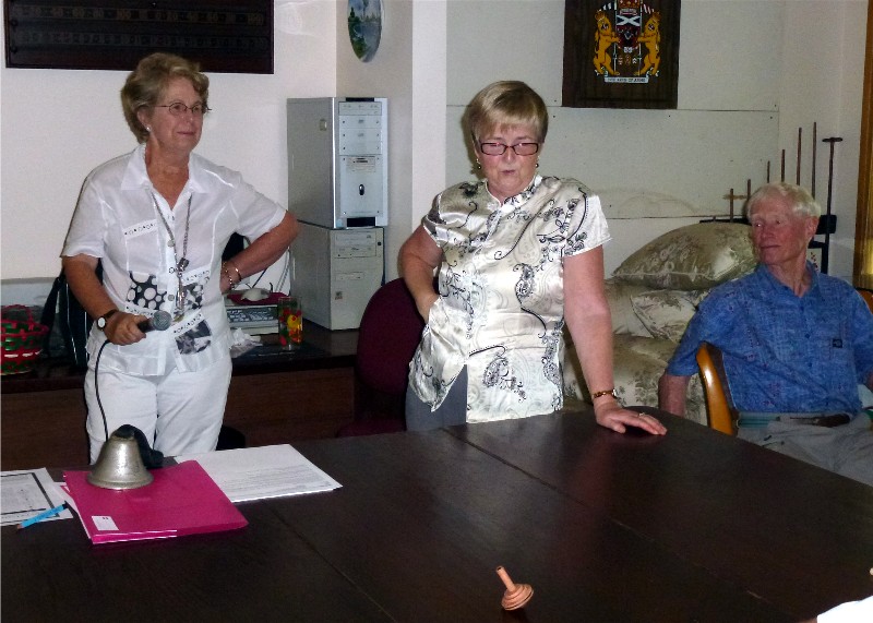
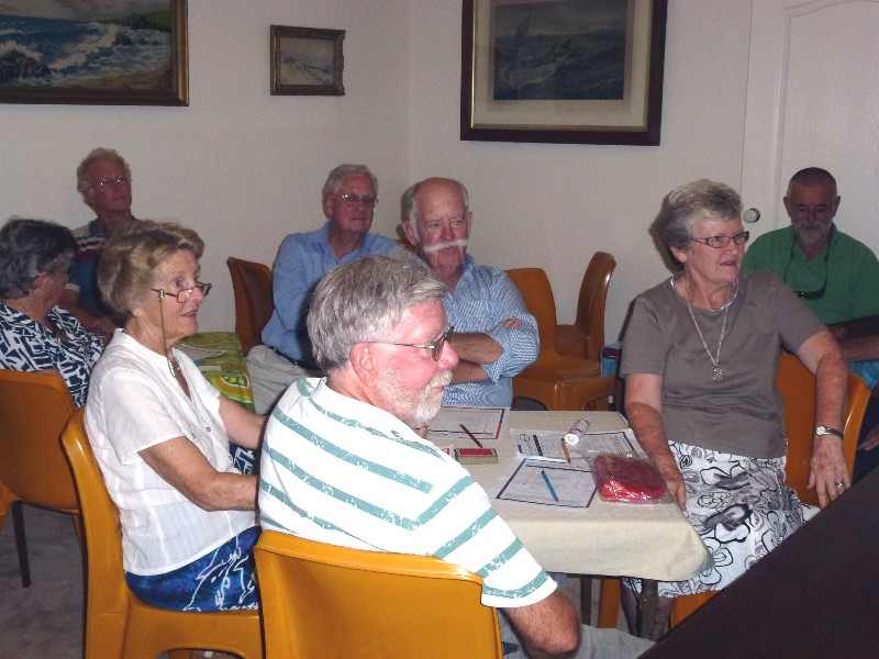
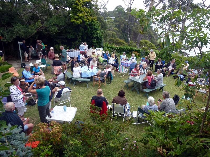
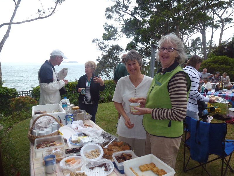
Crazy Whist Card Game and Dinner
Saturday 9 March 2013
 |
 |
| Comperes Lyn and Kay Photo by Lesley Click on thumbnail to enlarge photo |
Some of the players Photo by Lesley Click on thumbnail to enlarge photo |
The social event for this Program was an afternoon of Crazy Whist followed
by supper. Many thanks must go to Ann & Marle, and their son
Charles for opening their home for us, also for all the work they did to accommodate
over 40 members for cards and dinner.
Lyn was our very competent Crazy Whist compere, and Kay and her Social Committee oversaw
all the arrangements. The afternoon finished with the sort of scrumptious meal which
can only come from everyone bringing a plate of their signature dishes.
Lesley
Malua Bay to Mosquito Bay Return
Thursday 7 March 2013
 |
 |
 |
| Roughing it at Mosquito Bay Cafe Photo by Janelle Click on thumbnail to enlarge photo |
Approaching Garden Bay Photo by Janelle Click on thumbnail to enlarge photo |
Malua Bay Photo by Janelle Click on thumbnail to enlarge photo |
 |
 |
 |
| Inviting Garden Bay waters Photo by Janelle Click on thumbnail to enlarge photo |
Group minus 5 after cafe break Photo by Janelle Click on thumbnail to enlarge photo |
Clear pools in Malua Bay Photo by Janelle Click on thumbnail to enlarge photo |
On a warm summer morning, Thursday 7 March, 18 walkers assembled at Malua Bay. The walk headed north around the Malua Bay headland with beautiful ocean views of Malua Bay. Most of the walk was flat with a couple of narrow paths as we headed across a bay and up around the second headland leading to Mosquito Bay. The pace was leisurely and matched the convivial mood of the walkers, who all agreed we were privileged to be living in such a lovely part of Australia.
The Bakery at Mosquito Bay was popular for morning tea/coffee and most of the
walkers returned to their cars at Malua Bay by the same route in reverse.
Many thanks to Jean, the day's leader.
Julie
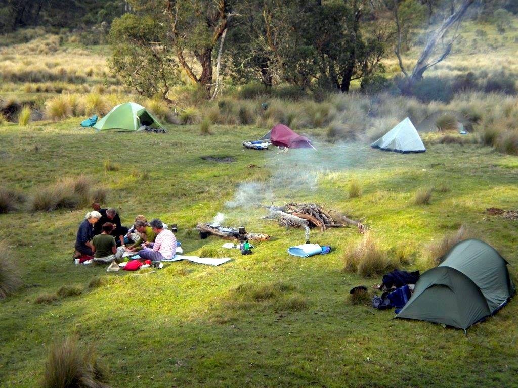
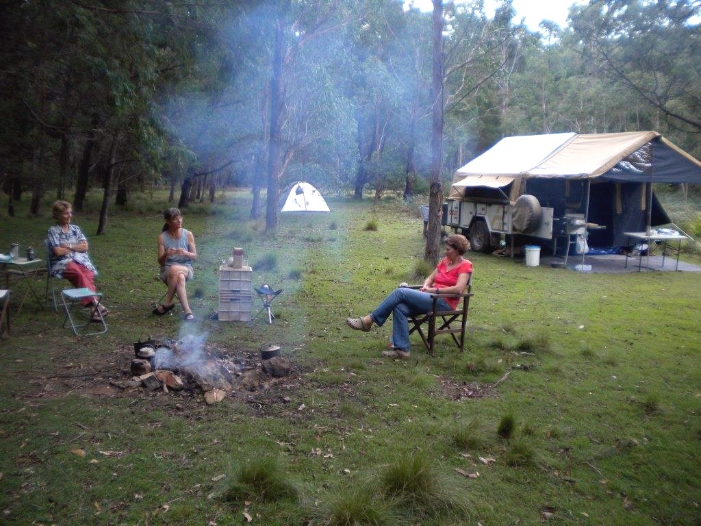
Car Camp at Bendethera in Deua National Park
Monday 4 - Thursday 7 March 2013
 |
 |
 |
| Bendethera, a relaxing campground Photo by Ian Click on thumbnail to enlarge photo |
Bronwyn, Bob, Sharon, Val and Betty put on crampons for the big descent into the river Photo by Ian Click on thumbnail to enlarge photo |
Ian contemplates the drop in the river diversion cutting Photo by Bob T Click on thumbnail to enlarge photo |
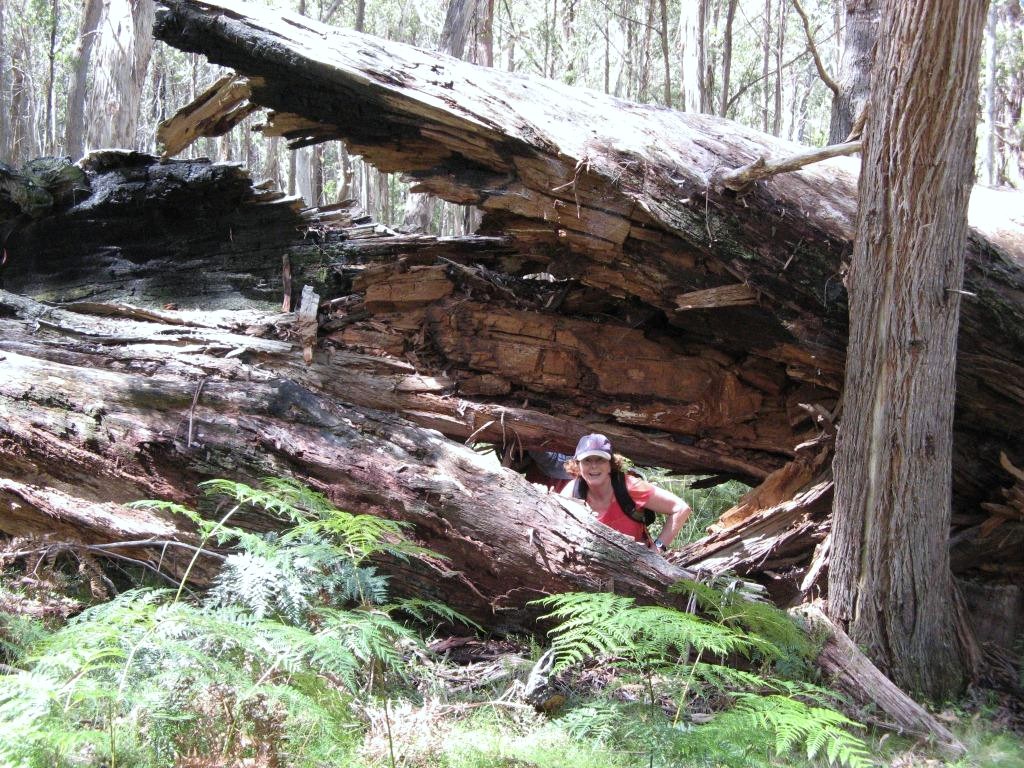
Bendethera is on the Deua River within the heart of Deua National Park. It is remote and accessible only by 4wd. Although it is well known and reasonably popular during holiday weekends, we saw only one other car in four days.
The camping area is an old farm, first settled in the 1860’s. Its 3km of river banks are grassy and extensive, so finding a spot by the river is not difficult. Apart from being a mecca for camping and four wheel driving, Bendethera can also be used as a handy base for bushwalking in the surrounding thousands of hectares of rugged ridges and valleys. However, one must be prepared for some serious ups and downs because the altitudinal range is often up to 900 metres over short distances.
Our camp of three nights, in superb weather and on lawn like green grass, attracted seven Club members (Sharon, Betty, Bob T, Val, Bronwyn, Lin and Ian) and we went for two day walks, the first a little more adventurous than the second.
On the first day, by squeezing all seven into a Land Cruiser and grinding our way up Bendethera Fire Trail, then down the Deua Fire Trail to the south, we launched westward into the 1994 declared Deua-Woila Wilderness Area south of Dry Creek. Almost immediately it was down, down, down, dropping 400m elevation in little over a kilometre. Mountain goat country.
As planned, we hit the Deua River right at one of Australia’s most remote artificial waterfalls. Possibly a century ago, gold miners diverted the water at the gooseneck of a large loop in the river, thereby gaining access to a kilometre of the river’s alluvial bed. The diversion is only 20 metres in length for the water to rejoin the river, but to achieve it the miners tore down a solid rock wall 10 metres in height. The resulting waterfall is 4 metres in height with an opening of 8 metres in width. It is a very interesting site and would be a very impressive sight in a flood!
 |
 |
 |
| One of Australia’s most remote artificial waterfall Photo by Ian Click on thumbnail to enlarge photo |
Riverbed walking at its best Photo by Ian Click on thumbnail to enlarge photo |
Lin gets right into it Photo by Ian Click on thumbnail to enlarge photo |
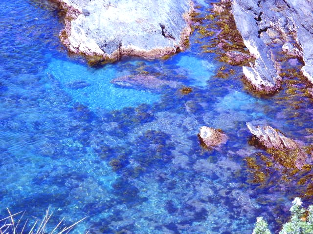
We then made our way six kilometres downriver to the camp, crossing from side to side and often wading the gravel beds to avoid the thick bracken on the river bank laced with raspberry plants and stinging nettles. Fairly leechy too. The river was running a good fresh and the going was a bit tough at times. Our bare shins did not fare well. However, the crystal clear water, the brilliant green water cressed shallows and the river oak groves all made it worth while.
The second day’s walk could not begin until we retrieved the car left on the
Deua River Fire Trail the previous day. Imagine our shock to round a bend in
the trail many kilometres in and be confronted with a freshly fallen large log.
And not a breath of wind over night! Thankfully it was mostly rotten and after
half an hour of ripping it apart with our bare hands we gained just enough
thoroughfare to solve the problem.
 |
 |
| Car shuffling rarely gets more comfortable Photo by Ian Click on thumbnail to enlarge photo |
The view west from Bendethera “rocks” Note the hillside of grey/green Bendethera wattle at Bendethera Cave in the left distant Photo by Ian Click on thumbnail to enlarge photo |
Our short walk for the day began just to the north of Bendethera Trig where, on a ridge jutting westward, a large spine of bedrock overlooks the Deua River some 800 metres below. From the clifftops, and under rare Jillaga Ash, the views to the west were superb and extensive, including to the Great Dividing Range where only two weeks before we had walked in the Snowball area.
We returned to camp, swam the refreshing waters of the river, supped coffee, and enjoyed an afternoon nap in the warm afternoon sun.
Great place, great weather, great walking, great company.
Ian
Exploring West Nelligen
Saturday 2 March 2013
 |
| Bushbashing west of Nelligen Photo by Bob T Click on thumbnail to enlarge photo |
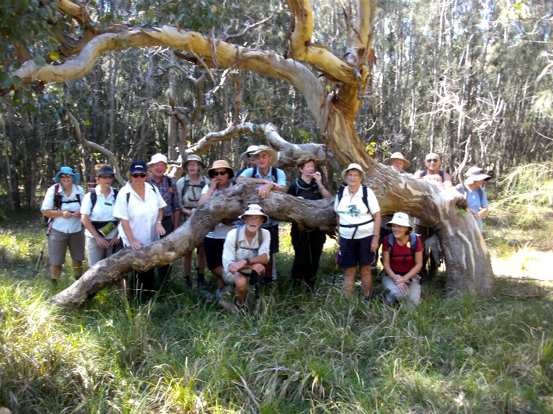
Proving again that, after more than a quarter of a century of regular activities, Batemans Bay Bushwalkers are still finding new areas to explore, a group went into the hills west of Nelligen, and enjoyed some features which our leaders had discovered.
After following several old tracks, we descended into a lovely gully where water from the recent rains was babbling and tumbling over the moss and lichen covered rocks. Some interesting rock strata were found, and the surrounding forest watched silently as we carefully followed the gully down to a point where we had to leave it.
A slow and laborious climb up a steep slope to another track on top of the
ridge earned a rest, while we discussed the interesting features of the gully,
and enjoyed the pleasure that comes from exertion and the company of good friends.
Bob T
Batehaven Town and Country Ramble
Wednesday 27 February 2013
Thirty five enthusiastic walkers arrived at Corrigans Beach Car Park for the Batehaven Town and Country Ramble led by Charles and Karen C. Twenty seven took off at 10 am for the 6km less strenuous walk, and there was a lot of noisy talking and laughter as we rambled along Beach Road towards the high school. We could have been mistaken for a bunch of excited high school kids, except for all the grey hair. What a surprise to find a short distance out of suburbia we were in bushland.
A beautiful pure white egret was spotted in one of the dams showing a perfect reflection, shame no one carried a camera. Morning tea break was taken beside a nice dam. Some of us came home with souvenirs from hundreds of mosquitos, despite lots of spraying.
Eight other walkers led by Karen C took a longer distance walk of 9.5km to the Round Hill Lookout, at the back of Batehaven. They were challenged by a few steep hills I believe. We all joined in and ended a wonderful morning with a very social BBQ lunch at Corrigans Beach.
A great morning enjoyed by all, thank you Leaders.
Ailza
Merry Beach to Bawley Point
Sunday 24 February 2013
Cancelled due to wet weather
Old Bolaro Road, Rainforest and Granite Cascade
Thursday 21 February 2013
Walk cancelled due to wet conditions
Great Divide Car Camp No. 3 at Snowball
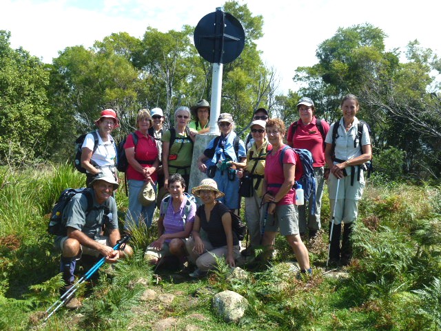
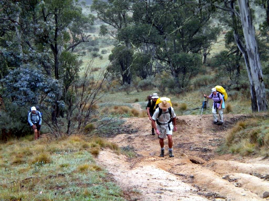
Friday 15 - Sunday 17 February 2013
 |
 |
 |
| Len, Ian, Betty, Val, Sharon, Bronwyn and Lin at the Big Badja trig Photo by Ian B Click on thumbnail to enlarge photo |
Sharon, Bronwyn, Val and Betty enjoy the early morning Great Dividing Range fog on Big Badja Mountain Photo by Ian B Click on thumbnail to enlarge photo |
Lin wonders why the leader chose a path through a tree Photo by Ian B Click on thumbnail to enlarge photo |
 |
 |
 |
| Meadow walking in the Badja Swamps Photo by Ian B Click on thumbnail to enlarge photo |
Crossing the upper Badja River on a makeshift bridge Photo by Ian B Click on thumbnail to enlarge photo |
Morning tea on a rocky outcrop on Middle Mountain Photo by Ian B Click on thumbnail to enlarge photo |
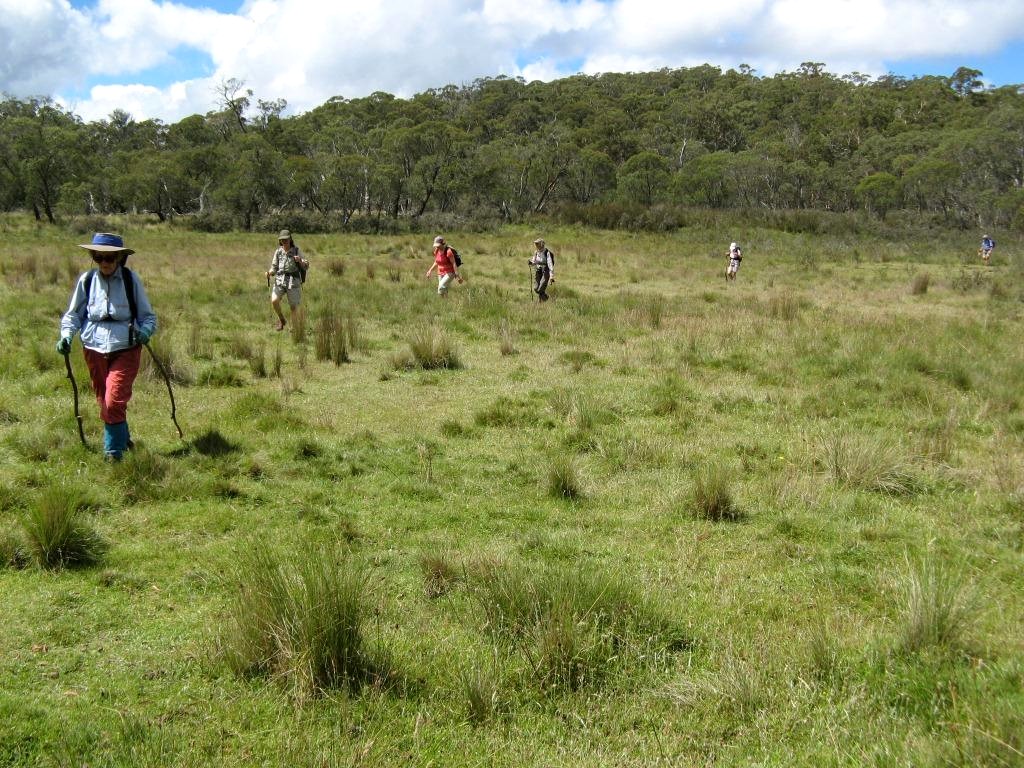
The third camp of our exploration of the Great Dividing Range was on Middle Mountain Road, Snowball. Nearby was the Currambene Creek which is the uppermost catchment of the mighty Shoalhaven River. The flat campsite was very comfortable with ample firewood and water.
Our seven Club members enjoyed two exploratory day walks in the Snowball/Pike’s Saddle area, familiar to Braidwood-Cooma Road motorists, both walks graded medium to medium/hard.
Saturday’s walk initially followed the Great Dividing Range ridgeline southwards from Pike’s Saddle along a fire trail. We called into the Big Badja Mountain trig of 1,362 metres, but unfortunately the early morning fog obscured the views. We contemplated the fact this area has five significant rivers arising in the near vicinity – the Shoalhaven, Deua, Tuross, Badja and Queanbeyan Rivers. Also, and perhaps uniquely in NSW, on a clear winter’s day both the snow and the sea can be seen from the Big Badja trig.
At an appropriate point further south we cut westward through open Brown Barrel forest and snow grass toward Badja Swamps. The flat, spongey plains are the upper catchment of the Badja River which ultimately flows into the Murrumbidgee River. Thankfully, the swamp plains were dry and the walking in and out of Snow Gum forest and grassy meadows was most pleasant.
Negotiating the Badja River itself required a quick temporary bridge. The camera was ready for a highly prospective collapse to the water but everyone “passed weight” and no fall was offered. A short walk up to the Braidwood-Cooma road and we were able to find our waiting car for return to camp.
Sunday’s walk was closer to camp. We traversed the Middle Mountain range north to south which splits the two arms of the upper Shoalhaven River. The walking was a bit tough in places with heavy rock and log and stick debris requiring constant negotiation.
From a high rock outcrop we enjoyed a lovely view of the upper Currambene Creek catchment and distant views of upper Woila Creek and Mother Woila mountain within the Tuross River catchment.
After a scrubby descent of the southern end of the range we struck Middle Mountain Road and after a trudge reached camp by mid afternoon.
Great Divide Explorations Camp 3 proved to be a very pleasant weekend of
exploring and creekside camping.
Ian B
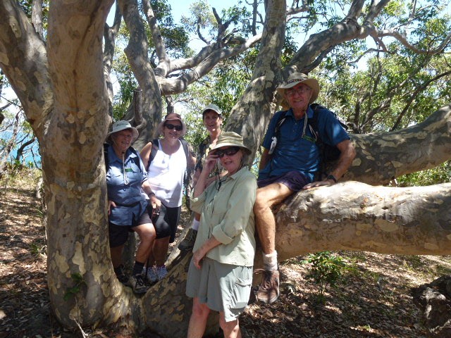
Congo to Meringo, Dreaming Track
Saturday 16 February 2013
 |
| Every Tom, Dick and Harry and a few Bobs Photo by Bob T Click on thumbnail to enlarge photo |
Forty enthusiastic walkers, including guests from Germany and England set off on a very sunny and warm Saturday to discover the Northern section of the Dreaming Track, located some 10 kilometres south of Moruya.
This is one of the most popular walks for members of the Batemans Bay Bushwalking Club, as it is reasonably level and takes in some wonderful coastal views whilst walking on shaded bush tracks.
On the way, a grave complete with headstone dated 1865 was discovered. Thanks to
Leaders Barbara and Ron for safely shepherding the crowd around the track.
Charles
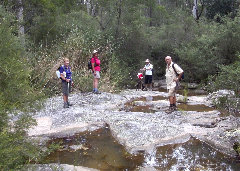
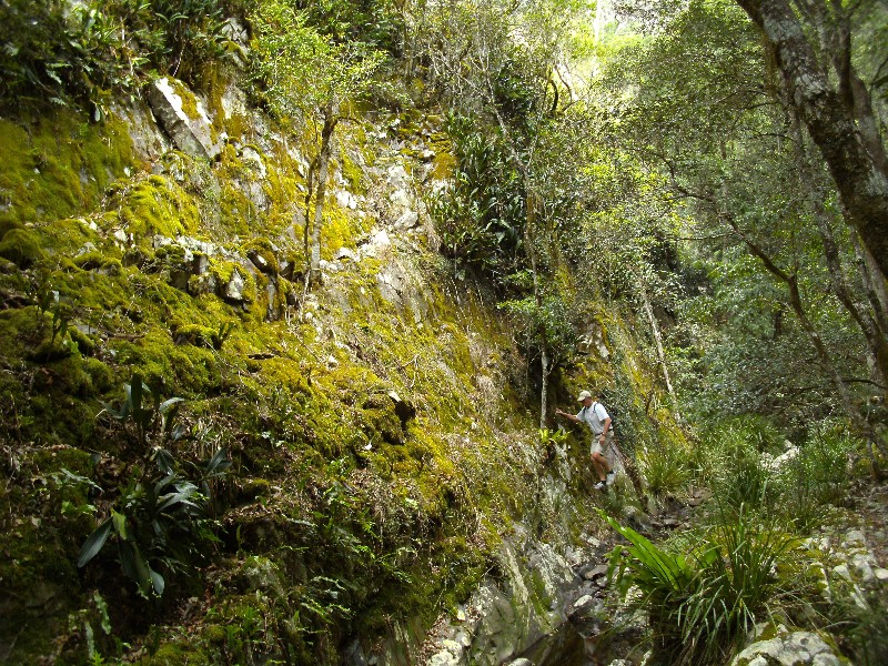
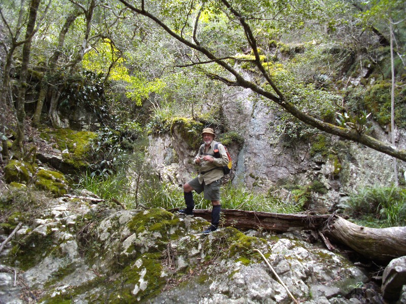
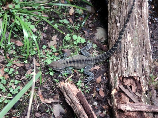
Quartpot Creek, Toward the Source
Wednesday 13 February 2013
 |
 |
 |
| White browed scrub wren nest Photo by Bob T Click on thumbnail to enlarge photo |
Stan climbs the side creek Photo by Karen M Click on thumbnail to enlarge photo |
Ian among the mosses, ferns and rock orchids Photo by Karen M Click on thumbnail to enlarge photo |
 |
 |
| Bob at top of side creek Photo by Karen M Click on thumbnail to enlarge photo |
Water Dragon looking for a bit of peace and quiet Photo by Bob T Click on thumbnail to enlarge photo |
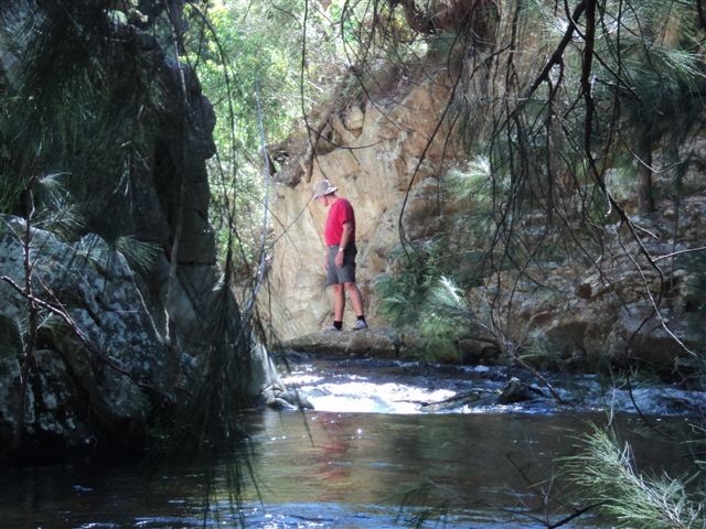
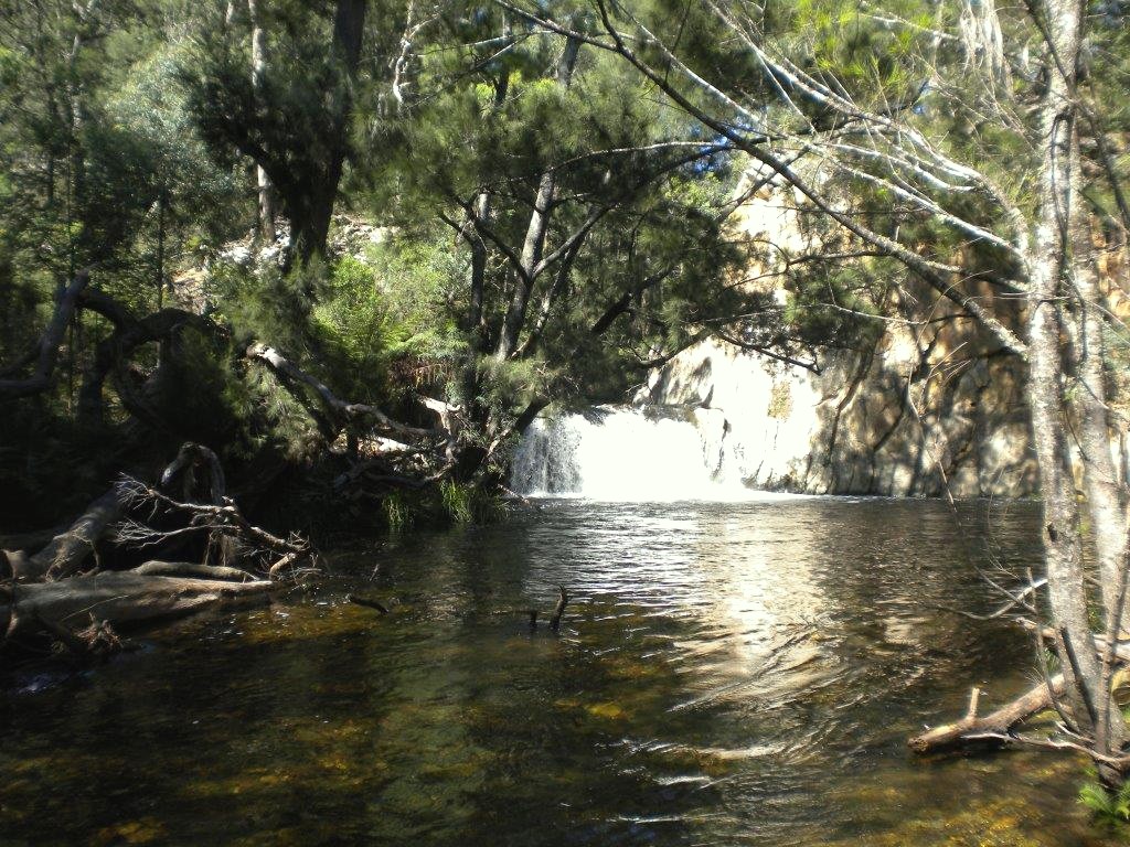
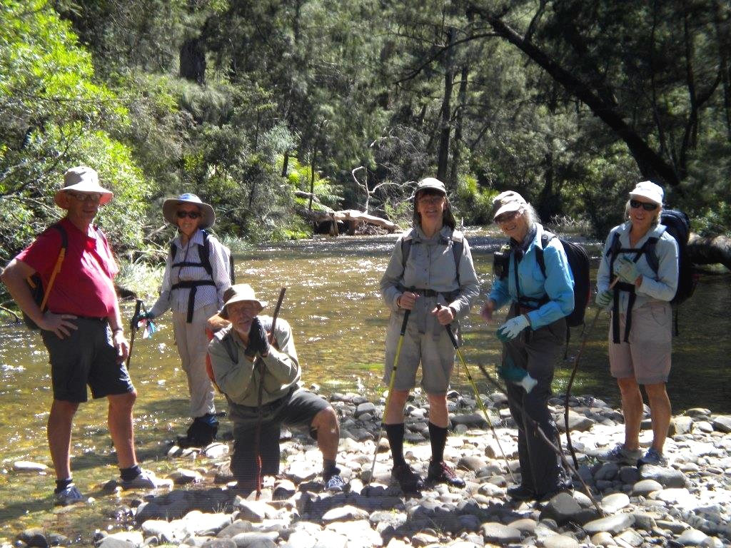
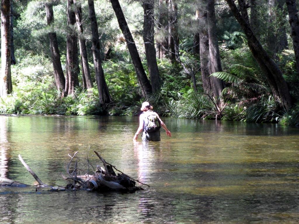
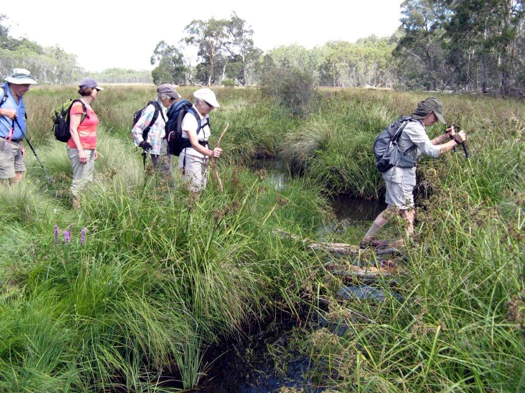
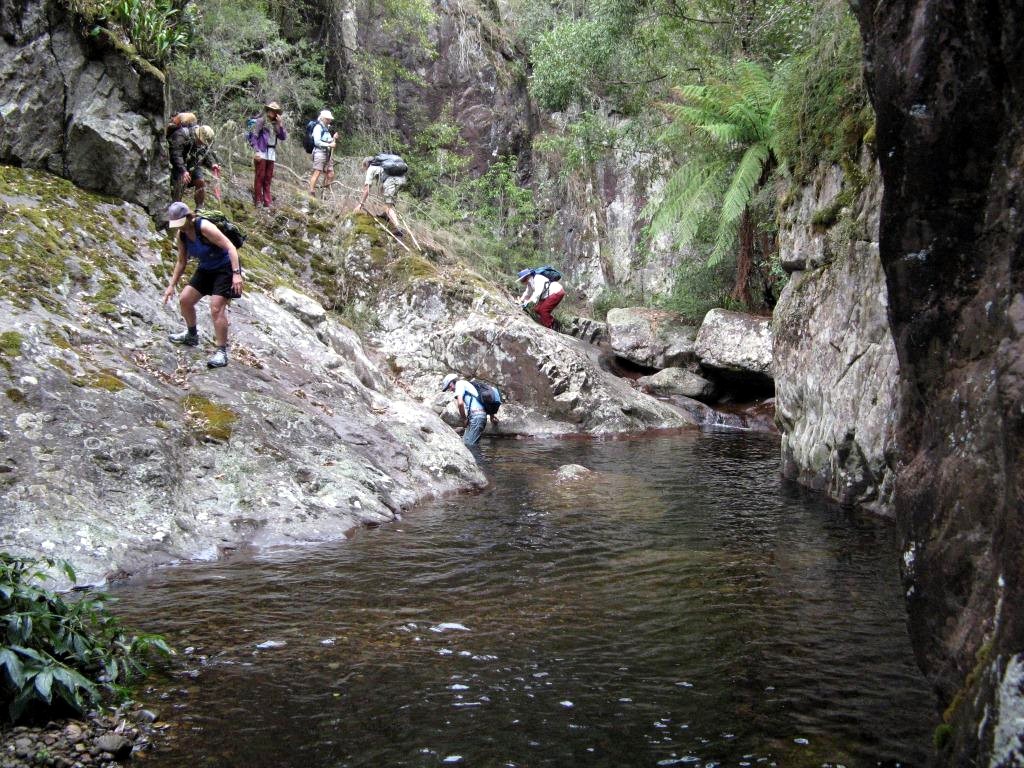
After an interesting drive in to the top one of 10 crossings on Quartpot Creek, seven members set out to discover the features of the upper parts of the creek. We waded and wandered towards the source through pools and forest, finding cascades, scrub wren nests, thickets of birds nest ferns, and leeches. The scrub wren nests look like flood debris, hanging from the end of branches over the water, with a secret entrance and emergency exit. Being located there makes it hard for any predators to access them.
When we stopped for lunch, we discussed options, and though our original plan was to return down the creek, Ian suggested turning in to the southern tributary, and exiting up a hill to the top of the track. As this was an exploratory, the idea appealed, and it was an inspired suggestion, as we soon found ourselves in a remarkable ravine. Over millennia, the creek had cut and tumbled down through soft rocks, creating a mystical gorge, with vertical rock faces which had beautiful strata, and swathes of rock orchids, ferns and mosses decorating this most unusual feature. It felt like the Garden of Eden.
After a stiff climb, we found the track, and happily ambled a couple of
kilometres back to the cars, satisfied that we had found one of the most
beautiful features in this area, and now have another walk option for the Club.
Even the discovery of more leeches and feet leaking blood from several holes
failed to affect our feeling that we had more than achieved our objective.
Bob T
Sugarloaf Creek, Misty Mountain Descent
Sunday 10 February 2013
 |
 |
 |
| All bright and bushytailed at the start Photo by Ian B Click on thumbnail to enlarge photo |
In the rainforest and framed by a large soapybox Photo by Ian B Click on thumbnail to enlarge photo |
Betty leads the way through the shallows Photo by Ian B Click on thumbnail to enlarge photo |
 |
 |
 |
| Like Brown's cows it's hard to get lost in a creek Photo by Ian B Click on thumbnail to enlarge photo |
Hmmm, looks a bit tight down there Photo by Ian B Click on thumbnail to enlarge photo |
Easy wet way or tricky dry way Photo by Ian B Click on thumbnail to enlarge photo |
This descent of Sugarloaf Creek (the Misty Mountain one) was enjoyed by eleven Club members. The walk was short in distance(5km)but relatively long in time 5 hrs),and in effort required.
Sugarloaf Creek is located south of the Kings Highway and is one of the major creeks draining the steep Clyde Mountain escarpment. It lies to the west of Misty Mountain Road within the Monga National Park, and is within a 9,180 hectare wilderness area declared in 2002.
We left a car on Misty Mountain Road at the Sugarloaf Creek bridge and then continued up the road toward Misty Mountain itself. After leaving the car and a peer over the side, the steep descent westward into Sugarloaf Creek soon had thigh muscles bulging and kneecaps popping.
Upon plopping into the creek, and because we had plenty of time, we made a short westward detour over a low ridge into the pleasant rainforest patch we had previously explored in August 2012. The large Coachwoods and Soapy Box, festooned with Birds Nest ferns, were still intact, obviously still healthy despite the recent scorching hot days.
After some pleasant wandering through the open understory we returned to the main creek and were soon hemmed in by occasional solid rock outcrops. Oh drat! We had to wade through short sections of crystal clear water but surprisingly, despite the pleasant water temperature, there was some reluctance to risk a wet bum. After a couple of accidental swims, most soon got into the spirit of things.
A kilometre downstream the creek really tightened up with large rock outcrops above us on the ridges. We were soon confronted with a solid rock slot, which didn’t appear to drop significantly, but with twists and turns as far as the eye could see. This raised the adrenaline levels – yahoo! - but unfortunately, a chock stone prevented a full descent. However, after a high detour and a swim upstream we were able to fully check it out from the bottom. Not a canyon by any means, but an interesting feature nontheless.
Another interesting fact arose at this site. We now know that a Garmin GPS dropped 5 metres onto solid rock, and bouncing from its rubber bottom, will survive and still function. Bob T thoughtfully decided to conduct the test, though we are not sure this was intentional at the time.
The rest of the descent was uneventful apart from yabbie and eel sightings and a few leeches. The creek valley opened out and became a pleasant rock hopping alleyway, finally terminating at the bridge and our waiting car.
In summary, a very accessible and pleasant creek descent.
From later reports, there were some weary and scratched up bodies that night
enjoying a very fitful sleep.
Ian B
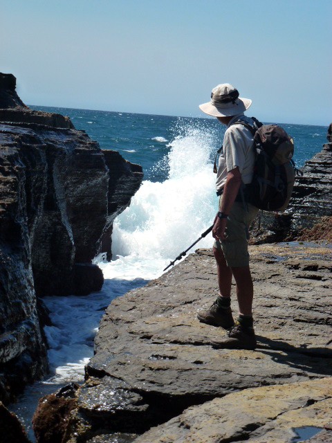
Point Upright
Thursday 7 February 2013
 |
 |
 |
| Stan on Point Upright rock platforms Photo by Lesley Click on thumbnail to enlarge photo |
Grassy picnic lunch spot Photo by Lesley Click on thumbnail to enlarge photo |
Twisted spotted gums on Point Upright Photo by Lesley Click on thumbnail to enlarge photo |
A beautiful sunny day forecast to be a hot one, but for nine bushwalkers the day at the coast turned out to be the very best place to be, with a cooling brisk wind lifting our hats, as well as giving every wave a white cap as far as the horizon - perfect for the walkers.
We enjoyed morning tea in the shade at the northern end of Beagle Bay, North Durras, and then continued along the bush track and around the extensive flat rock platform below the vertical cliffs of Point Upright, where the waves were spectacular as they crashed high over the platform edge.
Lunch was enjoyed at Depot Beach fanned by the brisk breeze and then onwards up and along the top of Point Upright to the outer end where views to the south were clear and impressive, before heading back down to North Durras.
Thank you to Ainslie and Mike for taking us to this special part of
the coast.
Joan
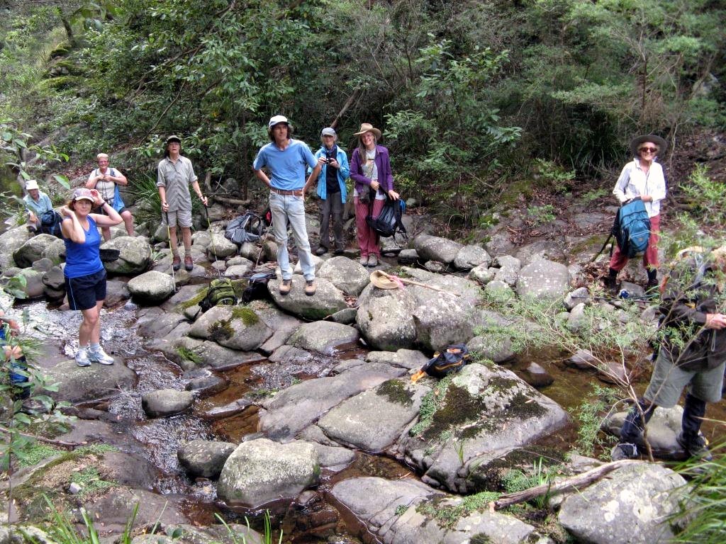
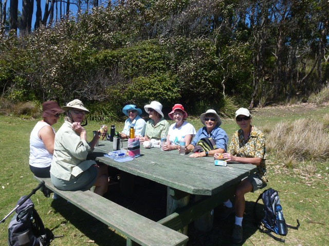
Currowan Creek Meander
Saturday 2 February 2013
 |
 |
 |
| Kay Photo by Karen C Click on thumbnail to enlarge photo |
Denise Photo by Karen C Click on thumbnail to enlarge photo |
Devonshire Tea at Cliffs after walk Photo by Lesley Click on thumbnail to enlarge photo |
Twenty seven Bay Bushwalkers enjoyed an easy-going creek meander just off the Western Distributor Road last weekend, led by leader and host Cliff.
The bubbling little brook was pristine and we saw frogs and little dragons along the way; some tiny native orchids, and lovely rock faces edging the creek in places. The fresh green understory of native shrubs and beautiful gum trees reflected in the creek were also a big feature of the walk. The cool day made for nice easy walking.
Following the walk, Cliff's hospitality shone, with everyone enjoying the
barbecue followed by his famous freshly baked scones,jam and whipped cream.
Pat
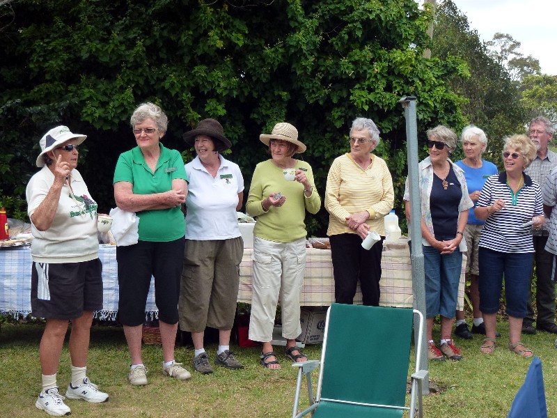
Denhams Three Beach Walk with Sausage Sizzle to follow
Wednesday 30 January 2013
By all accounts, and by the look of the photos below, Lyn and Barry's opening to the walking season was a great success. 65 members turned out and enjoyed 3 walks before returning to Lyn and Barry's home for a sausage sizzle and an opportunity to catch up after the summer bushwalking break.
 |
 |
 |
| Host Lyn entertains the troops Photo by Lesley Click on thumbnail to enlarge photo |
Ainslie makes a point Photo by Lesley Click on thumbnail to enlarge photo |
One of the walk groups on the beach Photo by Lesley Click on thumbnail to enlarge photo |
 |
 |
 |
| Apres walk sausage sizzle Photo by Lesley Click on thumbnail to enlarge photo |
Mary, Jean and a groaning goodies table Photo by Lesley Click on thumbnail to enlarge photo |
Mike and Ron Photo by Lesley Click on thumbnail to enlarge photo |