Second Quarter 2013. See below for
Walk Reports and Photos
Walk Reports and Photos for Autumn 2013. Click on walk headings below, or simply scroll down the page.
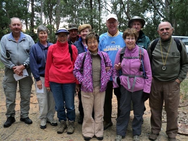
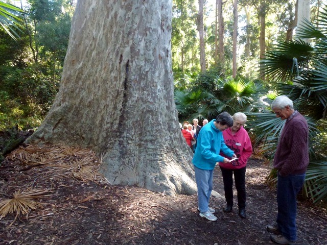
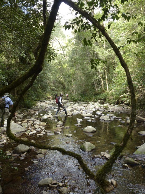
Coastal Lagoons and Beaches near Potato Point, Thursday 27 June 2013
Moruya South Head, Bike Tracks, Beach and Bush, Saturday 22 June 2013
Forest and Fern Gullies West of Termeil, Wednesday 19 June 2013
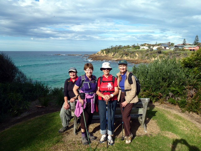
Dalmeny - Narooma, Sunday 16 June 2013
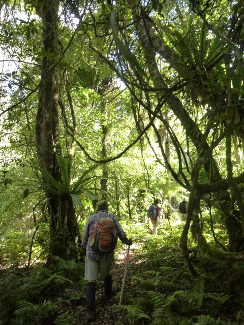
Donald's Creek Area, Thursday 13 June 2013
Blitz and McCardys Creek Road, Saturday 8 June 2013
Meroo and Willinga Lakes, Wednesday 5 June 2013
Bush Navigation Course, Monday 4 June 2013
Mummaga and Brou Lakes, and Brou Beach, Sunday 2 June 2013
Dalmeny to Kianga, Tracks and Trails, Thursday 30 May 2013
An Amazing Race Car Rally, Sunday 26 May 2013
Cliffs and Beaches, Tomakin to Guerilla Bay, Saturday 25 May 2013
Depot to Pebbly Beach - Coast to Forest Circuit, Wednesday 22 May 2013
Norfolk Island Camp, Sunday 3 - Sunday 10 May 2013
Broula Brook, Budawangs, Friday 17 - Monday 20 May 2013
West of Cullendulla, Sunday 19 May 2013
Golden Gully, Thursday 16 May 2013
Tracks and Mines near Moruya, Saturday 11 May 2013
Pollwombra Mountain, Wednesday 8 May 2013
Upper Buckenbowra River - Lower Corn Trail, Sunday 5 May 2013
Bartleys Arm, Murramarang National Park, Thursday 2 May 2013
Oulla Creek and Angophoras, Saturday 27 April 2013
Long Beach to Acheron Ledge via Maloneys, Wednesday 24 April 2013
South Brooman Forest, Sunday 21 April 2013
Currowan Creek Hidden Jewel, Thursday 18 April 2013
Quartpot Creek Road West, Saturday 13 April 2013
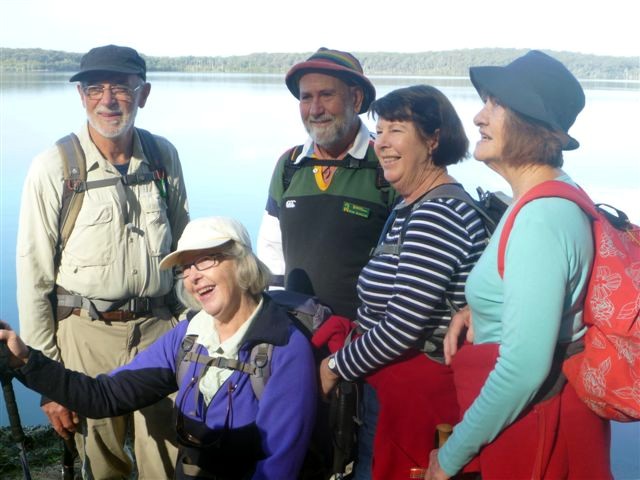
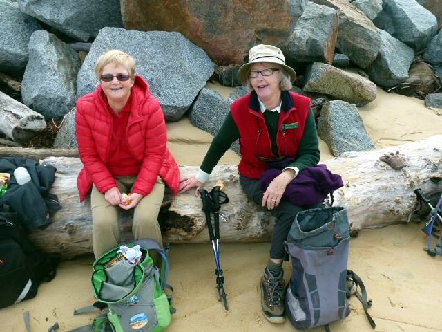
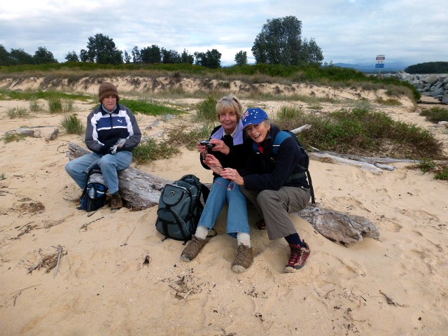
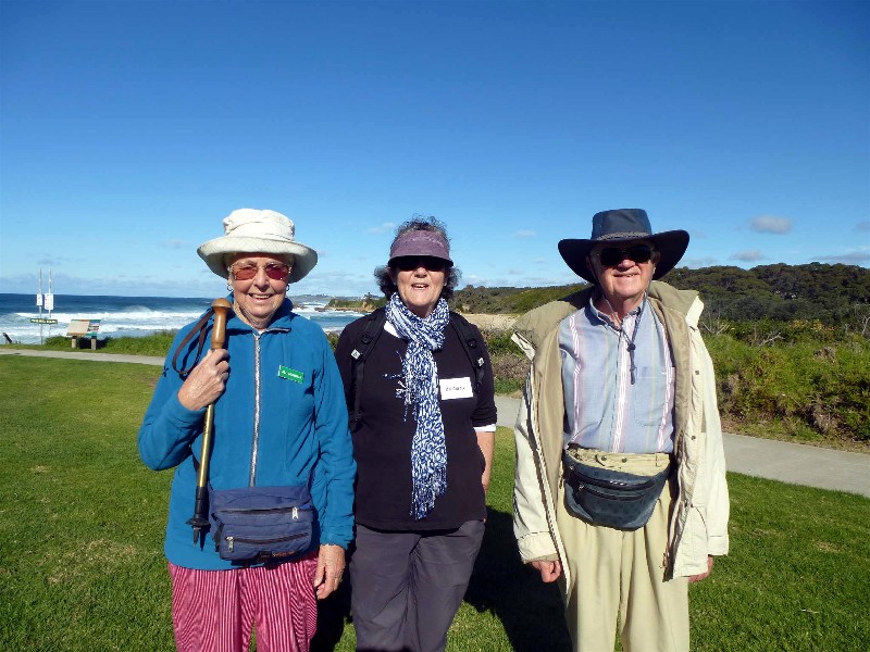
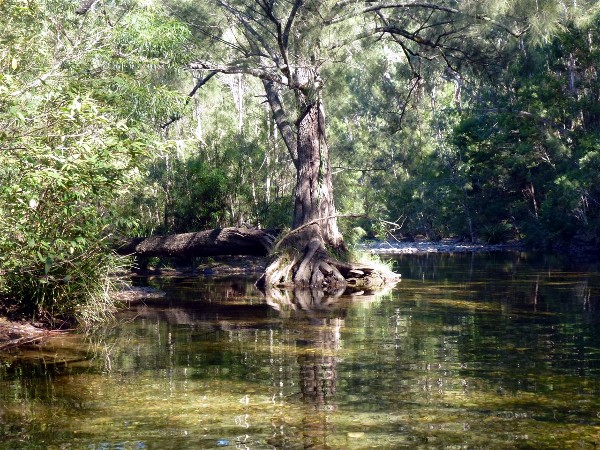
Coastal Lagoons and Beaches near Potato Point
Thursday 27 June 2013
 |
 |
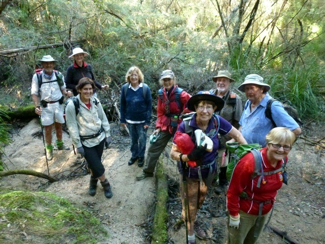
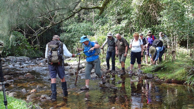
| Stan, Mary, Bob, Elizabeth and Joan Photo by Bob T Click on thumbnail to enlarge photo |
Could it be the elusive Drop Bear Photo by Lesley Click on thumbnail to enlarge photo |
Despite the forecast, it was a perfect day, and 11 Bushwalkers enjoyed the freshly washed bush, accompanied by the sight and song of male lyrebirds. Brou Lake was as calm as glass, not a breath of wind, and birds sang around us.
We then walked along Brou Beach where a huge swell pounded and scoured the beach, washing up the ravaged vegetation near Jemisons Point. The seas have been so big that some of the flotsam was washed over the sandbar and into Lake Tarouga, where a variety of waterfowl were to be seen both on and around the water.
The group ended their excursion in a most civilised manner, with afternoon
tea in Bodalla.
Bob T
Moruya South Head, Bike Tracks, Beach and Bush
Saturday 22 June 2013
 |
 |
 |
| Bob and Judy at Shelly Beach Photo by Lesley Click on thumbnail to enlarge photo |
Kay and Mary Photo by Lesley Click on thumbnail to enlarge photo |
Heather, Karen and Val Photo by Lesley Click on thumbnail to enlarge photo |
Despite there having been some rain overnight, and that the skies were still leaden, a hardy group of walkers turned up for what proved to be an interesting 10km walk.
Starting near the boat ramp on the southern shore of the Moruya River, just west of South Moruya township, the group headed along the bike track to the northern tip of Shelly Beach. Then it was up to Toragy Lookout, where looking east we could see dolphins feeding just off shore, and to the west, the pioneer cemetery facing the sea, a reminder of the early settlers who made this area home.
Then it was through the bush and down to the Moruya Surf Club, where the group took to the beach heading to Pedro Point. The rough seas that we have been experiencing of late on the south coast, added a new dimension to the waters around the rocky platform that stretches out from Pedro Point.
Leaving Pedro Point and turning west, we crossed Pedro Point Road and took a bush track through an interesting forest. The track appeared to be the dividing line between spotted gum and cycads on one side, and ironbark, stringy bark and banksia on the other. We then reached “Heinz Road”, an unofficial name of an undeveloped gazetted road ie “public right of way” that heads through the bush and, after a decent hill, arrives at Hazel Road. Walking a short distance along Hazel Road, we then turned right down Dell Parade and finally, taking a little detour between houses, we finished our walk by walking through Newstead Wetland Reserve.
An interesting walk, enhanced by the snippets of historical information
provided by fellow member Bob T, a South Moruya local.
Mary
Forest and Fern Gullies West of Termeil
Wednesday 19 June 2013
No report received
Dalmeny - Narooma
Sunday 16 June 2013
 |
 |
 |
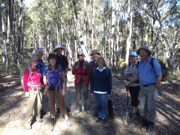
| Joan, Charles and Jan Photo by Lyn Click on thumbnail to enlarge photo |
Judith and John Photo supplied by Lyn Click on thumbnail to enlarge photo |
Jill, Barbara and John Photo by Lyn Click on thumbnail to enlarge photo |
 |
 |
| Elizabeth, Geoff, John, Dennis and Nancy Photo by Lyn Click on thumbnail to enlarge photo |
Bev, Barry, Elaine and Margaret Photo by Lyn Click on thumbnail to enlarge photo |
What a gorgeous sunny day after several of the grey and cloudy variety for 25 bushwalkers, including 3 visitors, to enjoy the spectacular scenery along this part of the south coast. Lyn gave the group three distance options with a car shuffle so that all could enjoy the walk, and then we set off around the edge of a very peaceful Mummaga Lake until we reached the first reward at the coffee shop opposite the Dalmeny Caravan Park which overlooks the ocean.
Having all enjoyed coffee with Anzac biscuit we set off on the next stage of the walk around the headland and along the clifftop path with photographic tempting scenery for some walkers and lookouts with history boards for all of us learn about the area. Some were overheard to say how good it was having time to smell the roses, or should it be the ozone.
Lunch was very soon on our minds and we soon arrived after approximately 8 kms at Antons of Dalmeny where we all tucked in to a delicious variety of chosen lunches and then to make our way home.
Thank you very much to Lyn and Barry for leading this most enjoyable walk.
Joan
Donald's Creek Area
Thursday 13 June 2013
Cancelled - will be rescheduled next Program
Blitz and McCardys Creek Road
Saturday 8 June 2013
 |
 |
| Bob and Val Photo by Donna Click on thumbnail to enlarge photo |
Jenny, Jill and Sharon Photo by Donna Click on thumbnail to enlarge photo |
Seventeen walkers relished some good uphill walking in the McCardy's Creek area on Saturday. The circuit they walked was characterised by a lovely variety of native trees and shrubs all the way. There were plenty of creamy white flowering wattles beside the track that were beautiful as the sun shone down through them.
Up in the tall gum treetops white flowers would have attracted plenty of birds and bees, and at the same time hidden away in the bush, lyrebirds were busy all day showing off their song repertoires to potential mates. A keen eyed bushwalker spotted some dendrobium orchids growing up the trunk and branches of an ironbark tree, but these were not in yet in flower.
We crossed over a fascinating old log bridge that had some of its
outer logs subsiding towards the pretty creek down below - and
generally the day's walk was very relaxing - and good exercise walking
up those uphill parts.
Pat
Meroo and Willinga Lakes
Wednesday 5 June 2013
 |
 |
 |
| Joan and Carol Photo by Lesley Click on thumbnail to enlarge photo |
Morning tea on the beach Photo by Lesley Click on thumbnail to enlarge photo |
Waterlogged Photo by Lesley Click on thumbnail to enlarge photo |
This week's walk was in the Meroo and Williga Lakes area 40 kilometres north of Batemans Bay. However, the walkers were blocked by the recent rain falls at Williga Lake as they headed north from Bawley Point.
The passage between the lake and the beach had been breached by a swift flowing torrent across the traditional walking path.
Undeterred, the group drove further north to Meroo Head and walked the
track in a reverse direction. All went well until the bush tracks became
waterlogged. The group headed bush in many places to higher ground and
completed the walk exhausted, waterlogged, but satisfied in reaching their
heated cars.
Charles
Bush Navigation Course
Monday 4 June 2013
 |
| Len with Jean, Sharon, Marle, Ann, Min, Wayne, Lesley, Pat and Simeon Photo by Bob T Click on thumbnail to enlarge photo |
About 10 members arrived 9 am to begin their journey to become successful navigators through the bush under the guidance of Len and his always cheery offsider, Bob T. They instructed us on co-ordinate systems and map datums, grid and contour lines, the deviation between the different "norths" and how to set a compass course using a map - and this was just in the morning session.
The afternoon saw us learning how to use a GPS to find our present location.
A couple of days later came the dreaded practical. With compass and map in hand,
we confidently left the designated walking track and strode through the bush
where others feared to follow! We all successfully found our destination
and a big thank you was given to our "nav gurus", Len and Bob.
Wayne
Mummaga and Brou Lakes, and Brou Beach,
Sunday 2 June 2013
No report received
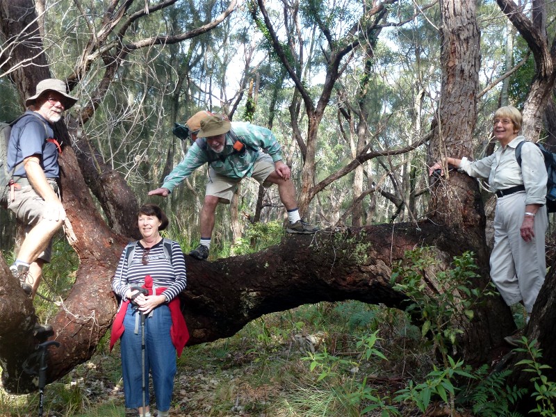
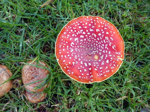
Dalmeny to Kianga, Tracks and Trails
Thursday 30 May 2013
 |
 |
| Robyn, Lesley, Denise and Carol Photo by Lesley Click on thumbnail to enlarge photo |
Don't eat this one, Amanita muscaria Photo by Lesley Click on thumbnail to enlarge photo |
Wednesday was a lovely sunny day and 22 enthusiastic walkers set off to do the Kianga/Dalmeny walk. The walk took us along the coastline which is just spectacular, and then up through rainforest and back down along the bike path, to our lunch spot on the headland.
From here we walked further along the bike path to where we broke into two groups, some opting to stay on path whilst the remainder walked along the beach and rocks, joining the path again just before arriving back at the car park.
One of the highlights of the walk was a sighting of a small clump of red and white toadstools, AMANITA MUSCARIA, commonly known as "Fly Allergic". It is an introduced poisonous fungi and there is some concern that their spreading may effect changes in our ecosystem, causing decline or elimination of some native fungi.
Thanks Karen and Bev for leading this great walk.
Denise
An Amazing Race Car Rally
Sunday 26 May 2013
 |
 |
 |
| Rallying at Big Bit Photo by Donna Click on thumbnail to enlarge photo |
From the Big Tree, to the . . . . Photo by Donna Click on thumbnail to enlarge photo |
. . . . Mogo Lolly Shop Photo by Donna Click on thumbnail to enlarge photo |
No report received
Cliffs and Beaches, Tomakin to Guerilla Bay
Saturday 25 May 2013
 |
 |
 |
| Leaders Barbara and Ron Photo by Donna Click on thumbnail to enlarge photo |
We never tire of these views Photo by Donna Click on thumbnail to enlarge photo |
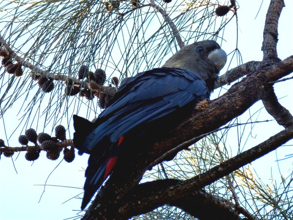
Great photo of a Glossy Black Cockatoo in the casuarinas Photo by Donna Click on thumbnail to enlarge photo |
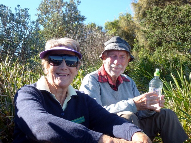
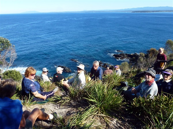
A happy group of bushwalkers set off from Melville Point, along Barlings Beach, our destination, Burrewarra Point, clearly visible across the placid, mercurial blue waters of the ocean. Past the island named after a very early settler in the area, Richard Barling and on through the forests and up the hills to Long Nose Point, where we took in the wonderful views while having a little sustenance.
We proceeded along a narrow trail that led past several houses sitting high
on the ridge, overlooking several unspoilt, rarely visited bays. Lunch was
taken overlooking Tomakin Bay, almost at the lighthouse. A little further on
we came across a relic from World War 2, a munitions shelter, duly spray
painted in glorious colour. We finally reached the car park at Guerilla Bay
where a big thank you was offered to our wonderful walk leaders.
Wayne
Depot to Pebbly Beach - Coast to Forest Circuit
Wednesday 22 May 2010
 |
 |
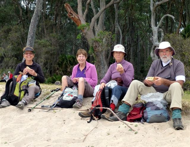
| Jill with Lesley, Denise and Bob Photo by Karen C Click on thumbnail to enlarge photo |
Marilla Photo by Karen C Click on thumbnail to enlarge photo |
It is 7 degrees, cloudy and windy but 21 stalwart bushwalkers turn up for the walk on 22 May at 9.15 am. After driving to Depot Beach we climbed a long hill through superb spotted gum and macrozamias to find the track to Pebbly Beach. A winding track down took us to lovely unspoilt bush complete with a male lyrebird, several kangaroos and grand views of the rocks and beach. We were surprised to find jonquils in bloom near the beach in a National Park and several other exotic plants.
The walk back to Depot Beach was along the rocks and under the cliffs and the sun came out to enhance our pleasant lunch spot. We sat and watched the blue wrens playing at our feet, a grey fantail catching insects over our heads and unidentified raptors circling above the trees. The climb back to the carpark is through the Rainforest Walk and makes a perfect end to the walk.
This is a splendid 8 km walk and we were grateful to our leader, Jill, for
making this a great day to be out walking.
Barbara
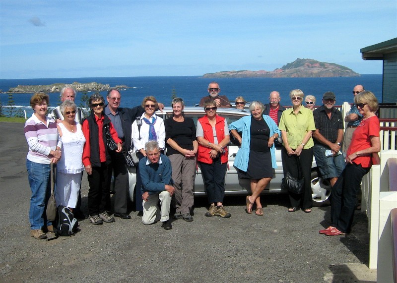
Norfolk Island Camp
Sunday 3 - Sunday 10 May 2013
 |
 |
 |
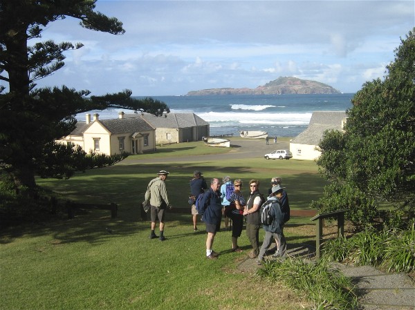
| Norfolk Island Photo by Joan Click on thumbnail to enlarge photo |
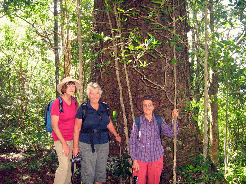
Joan, Nancy and Betty with ancient Norfolk Island Pine Photo supplied by Joan Click on thumbnail to enlarge photo |
View from our Panorama accommodation Photo by Joan Click on thumbnail to enlarge photo |
 |
 |
 |
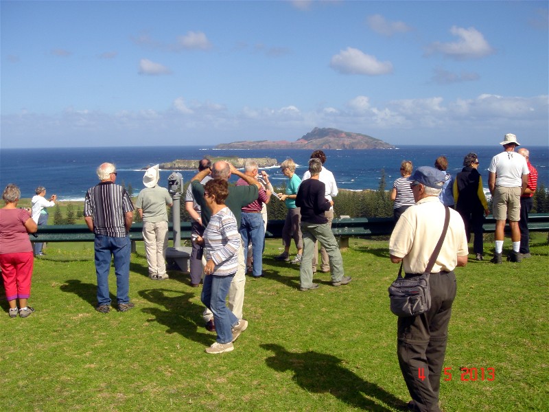
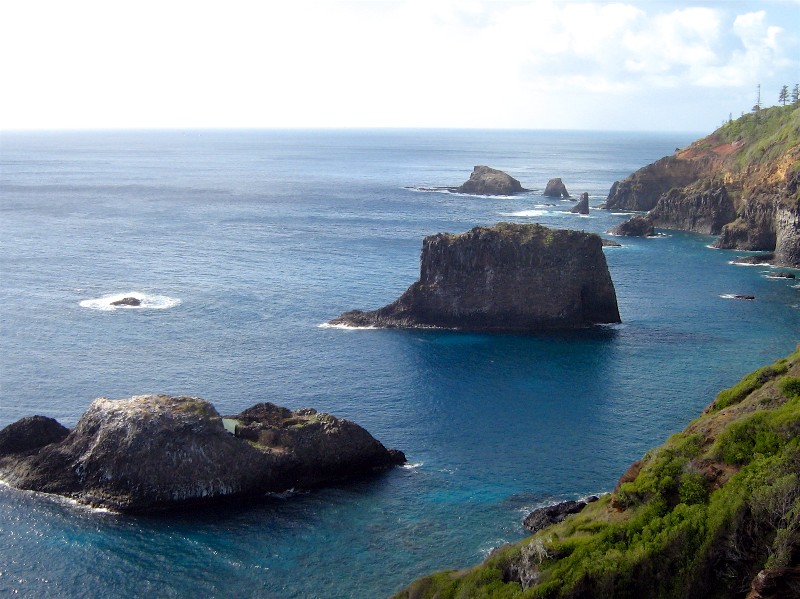
| View from Captain Cook Lookout in National Park Photo by Joan Click on thumbnail to enlarge photo |
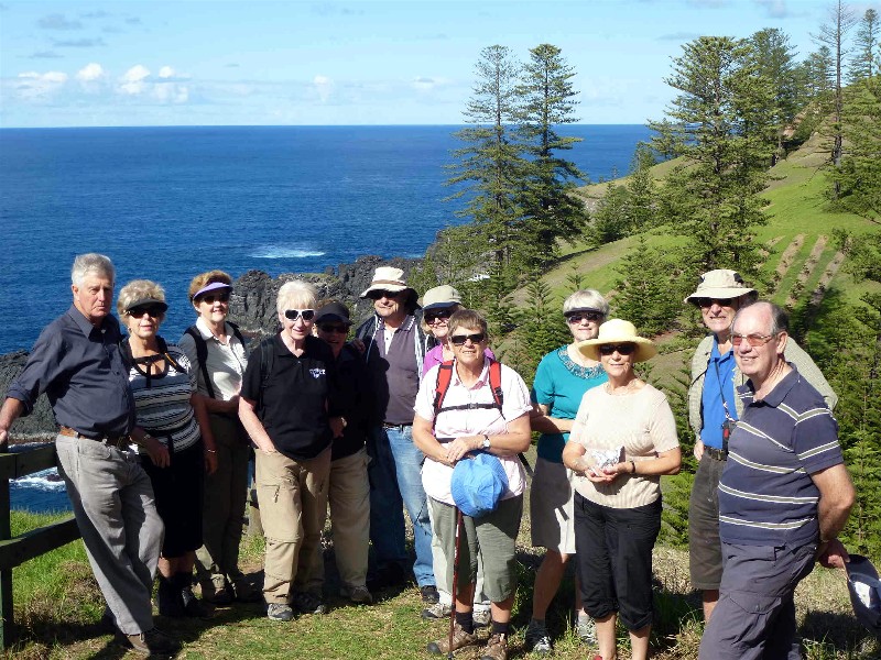
Walkers and yet another view Photo by Lyn Click on thumbnail to enlarge photo |
Group outside Panorama accommodation Photo by Joan Click on thumbnail to enlarge photo |
All 26 campers had a very happy and wonderful week exploring every possible pathway over all of Norfolk Island with walk leaders Jill and John, Betty, Lyn and Barry, Bev, Jan and Robert, Joan and Bob, Charles, Nancy and Dennis who were all adventurous and found unexpected walks aplenty - scrambling over fences, down to bays, along meandering tracks to mountain tops and cliff tops and all with incredible scenery and views included every day.
Then there were the island extra entertainments including with various descendants of Fletcher Christian of Bounty mutiny fame which we all enjoyed on various occasions, and particularly the reward for Betty's walk group of the mixed berry ice cream sundaes - we all know who you are.
You were all a great group, thank you.
Bob and Joan, Camp Leaders
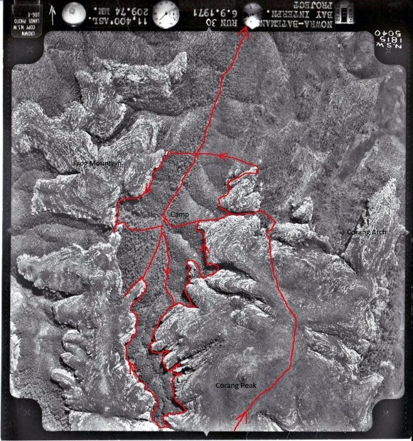
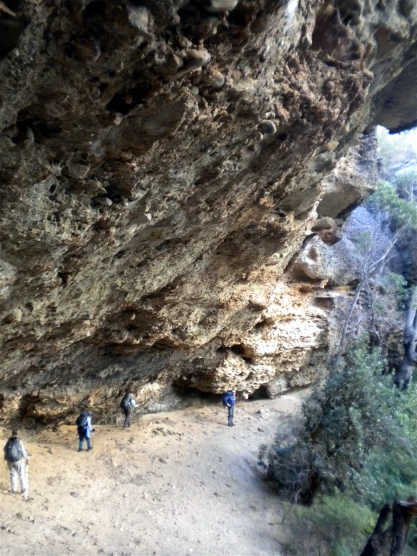
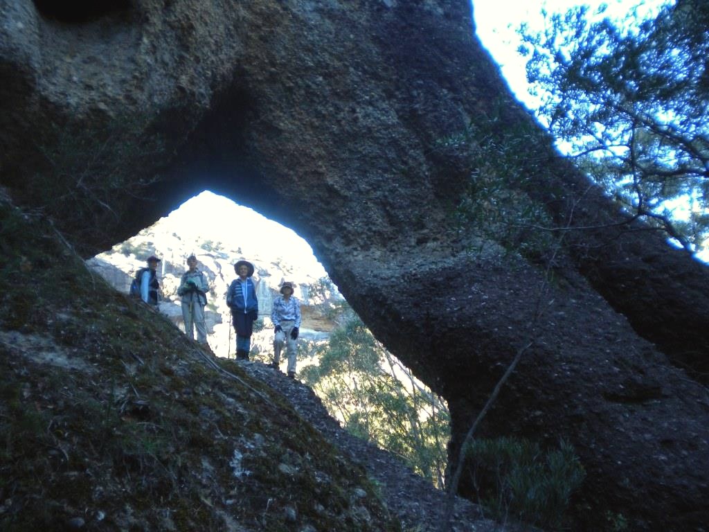
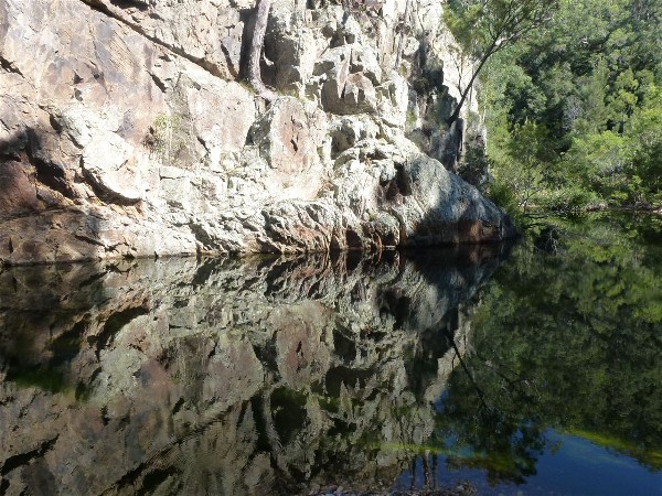
Broula Brook, Budawangs
Friday 17 - Monday 20 May 2013
 |
 |
 |
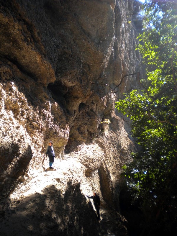
| Aerial photo of Broula Brook area showing route walked
Photo by Ian Click on thumbnail to enlarge photo |
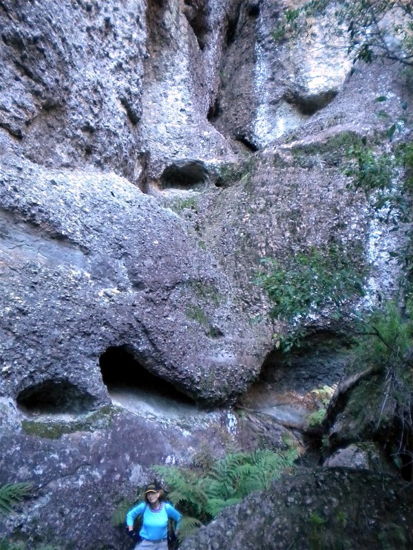
Typical large overhang in cliffline Photo by Ian Click on thumbnail to enlarge photo |
Sharon, Bronwyn, Betty and Lin under natural arch Photo by Ian Click on thumbnail to enlarge photo |
 |
 |
 |
| Betty on an apparent Peruvian trail to nowhere Photo by Ian Click on thumbnail to enlarge photo |
Lin below sculptured cliffs
Photo by Ian Click on thumbnail to enlarge photo |
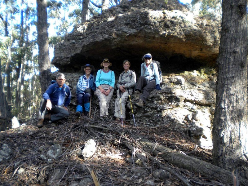
Ian, Betty, Lin, Bronwyn, Sharon at Frogmouth Rock, an entry point to Frog Mountain
Photo by Ian Click on thumbnail to enlarge photo |
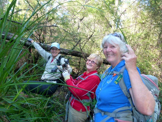
Broula Brook is a southern tributary of the Corang River in the western Budawangs Wilderness. Most Budawang visitors who start from the Wog Wog car park circumnavigate Broula Brook as they walk the main track to Corang Arch and then return via Canowie Brook and the Goodsells track. They almost certainly pay little regard to Broula Brook’s catchment apart from admiring its surrounding impenetrable clifflines from a few vantage points along the established tracks. They are also certainly rarely tempted to launch into the thick scrub to see what lies within the basin.
The temptation was too great for five BBBW members – Sharon, Betty, Bronwyn, Lin and Ian – who spent four days in fine, cool weather exploring under the clifflines in the upper reaches of Broula Brook.
The trudge along the main track from Wog Wog carpark occupied most of the first day. Picking up the old overgrown Corang track from just northeast of Corang Peak, we descended through the cliffline to then immediately push westwards off the track into thick scrub toward Broula Brook. The narrow pass through the rock between the catchments of Canowie and Broula Brooks at 365924 was easily negotiated, we contoured under the southern cliffline, then descended quickly to the only respectable creekside campsite in the area at 360922. This site was not only central to the upper catchment clifflines – it had ample flat ground, firewood and clean running water.
After a chilly first night, adequately buffered with an appropriate sized campfire, on day two we explored the upper reaches of the Brook by traversing under clifflines which varied in height from 30 to 80 metres. We explored all the narrow gully heads, some terminating in weeping waterfalls and pretty rainforest glens. Pinkwood (Eucryphia moorei) was noted in a number of places. Abandoned lyrebird nests adorned some low rocky ledges, otherwise evidence of wildlife was scant.
The cliffs are visually interesting, of conglomerate sediment, heavily honeycombed from thousands of years of wind and water erosion. The sculptures of caves, overhangs, holes, cracks and ledges are, at times, stunning. The conglomerate of river stones, pebbles and sand overlays harder tilted metamorphic bedrock. The union is sometimes so evident one can run a finger along the fine line between the two geologic events separated by a mere 100 million years.
We came upon a handsome natural arch at 361915 not previously recorded. It is approximately a quarter the size of the more popularly known Corang arch and is easily accessed.
On day three we continued the cliffline traverse, completing the eastern edge to 364924 and then climbed a rock ramp to the top for a sunny lunch and from where a very good view of the Budawangs to the north was enjoyed. A kilometre distant to the east, two walkers were briefly seen on the distinctive Corang Arch. The afternoon was spent exploring the remaining western cliffline on the locally, and appropriately, named Frog Mountain (its aerial view reveals its jumping frog shape – see aerial photo). The one and only pass westward to Goodsell Basin, the area we explored in September 2012, was proved to be quite accessible. It is located at 357922 and it was in a small overhang at the pass that we found the only evidence of previous visitation – one small rusty tent peg and a cache of dry firewood, left probably thirty years ago.
On day four we left the area by walking Broula Brook downstream to the Goodsell Basin track on the Corang River and thence back to Wog Wog.
Despite the heavy bush bashing in some areas due to the tremendous fuel
build up (the last fires in the area appear to have been many decades ago) the
six kilometres of clifflines traversed (see aerial photo) were often pleasant
and the discovery of the arch was notable. The camp was very comfortable and
the company most agreeable.
Ian B
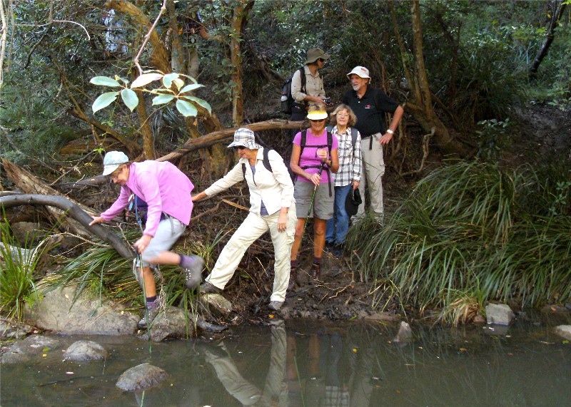
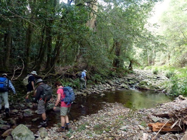
West of Cullendulla
Sunday 19 May 2013
 |
 |
 |
| Bashing to the creek Photo by Lesley Click on thumbnail to enlarge photo |
In the creek Photo by Donna Click on thumbnail to enlarge photo |
Finally, a track to walk on Photo by Bob M Click on thumbnail to enlarge photo |
Awaiting report
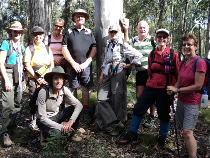
Golden Gully
Thursday 16 May 2013
 |
 |
 |
| Karen and Karen Photo by Lesley Click on thumbnail to enlarge photo |
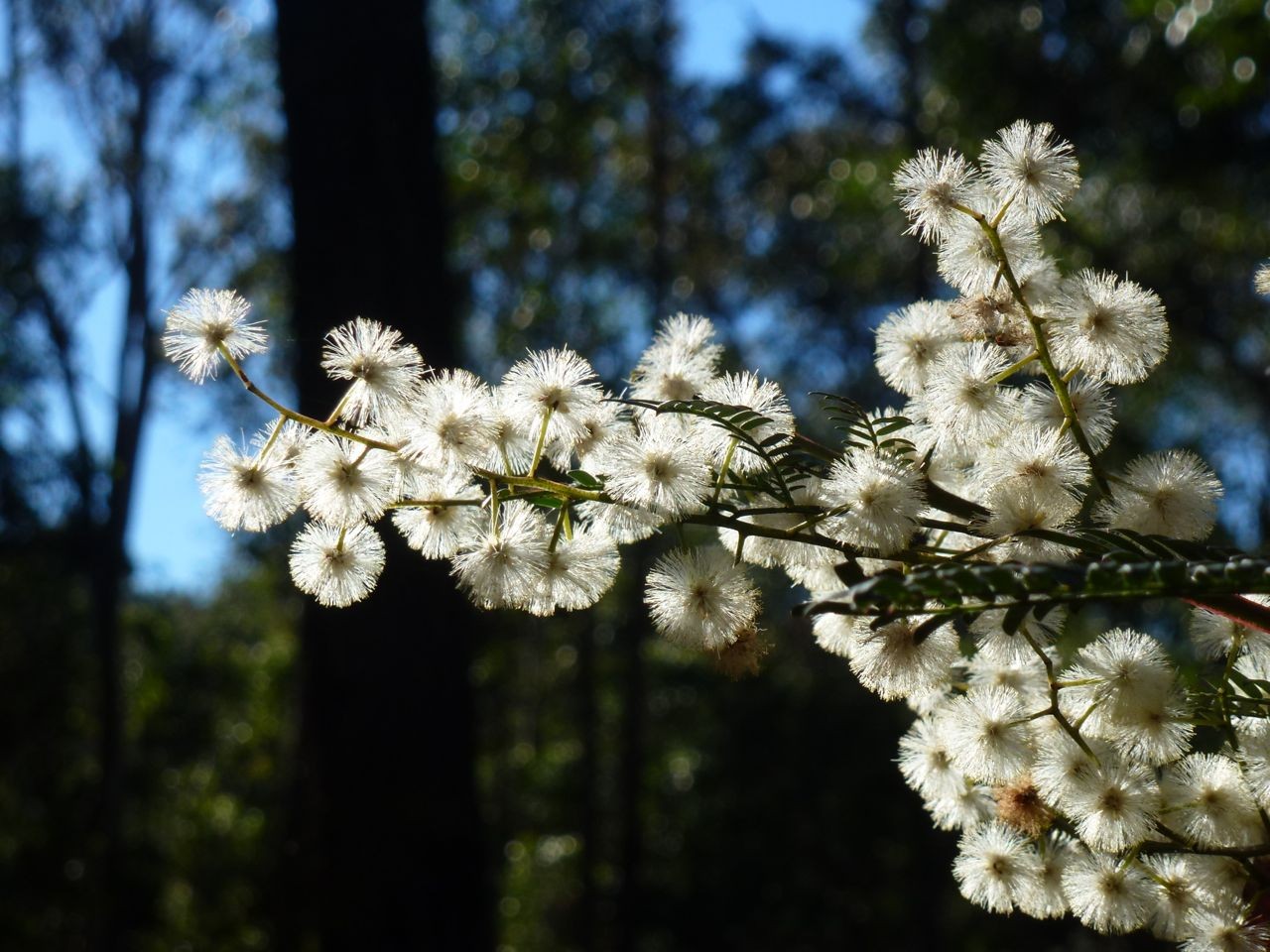
Sunshine wattle Photo by Donna Click on thumbnail to enlarge photo |
Sheoak flower Photo by Donna Click on thumbnail to enlarge photo |
19 Batemans Bay Bushwalkers set out in gorgeous autumn sunshine on Thursday to tackle a hilly 11km walk in the State Forests bounded by Hawdons, I-Ridge, and Golden Gully Roads not far from Moruya.
We started by walking alongside a lovely little creek in dappled shade, but then climbed out of the gully up to the ridge, from where we could see Larry's Mountain right above, with Wamban Mountain and Mt Dromedary looming to the south. The forest on the ridges had been heavily logged, but is growing back in abundance. The creamy Sunshine Wattle was flowering everywhere, and we found a couple of different types of Pomaderris in bud, plus the stinky smelling Boronia ledifolia, two species of native cherry, and the yellow flowering Geebung, amongst lots of other interesting plants thriving in the light, before the eucalypts grow big enough and take over again.
We finished the walk shortly after lunch and then drove back to the Leader's
home nearby for a convivial afternoon tea before heading back to Moruya.
Karen M
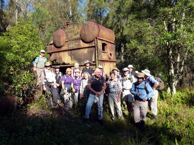
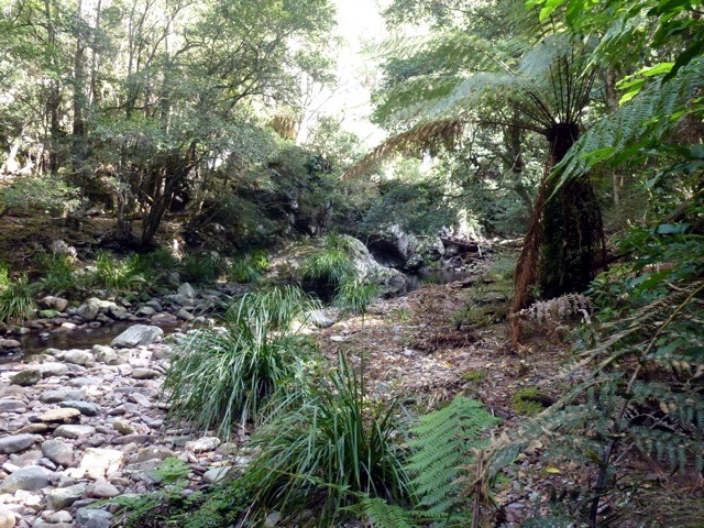
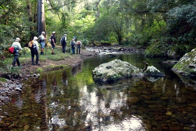
Tracks and Mines near Moruya
Saturday 11 May 2013
 |
 |
 |
| Candoin Creek Photo by Karen M Click on thumbnail to enlarge photo |
Crossing Candoin Photo by Karen M Click on thumbnail to enlarge photo |
Abandoned boiler Photo by Donna Click on thumbnail to enlarge photo |
 |
 |
 |
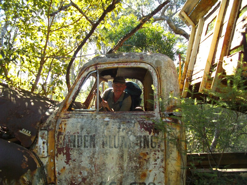
| Martin of Sanden Plumbing Photo by Karen M Click on thumbnail to enlarge photo |
Bob and Karen C Photo by Karen M Click on thumbnail to enlarge photo |
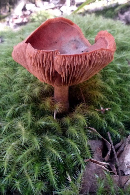
One of the many fungi in the forest Photo by Donna Click on thumbnail to enlarge photo |
Was it the fabulous weather, the chance to explore on a new walk, or the lure of gold that brought 23 bushwalkers out for Saturday's walk?
Tucked in behind Dwyers Creek Road in Moruya are the remains of gold mines, and it was these we walked to and explored. Although the walk was short, the terrain was often steep, strewn with rocks and logs and we crossed a pleasant creek to get to the mining area. You needed to watch your step not just for the abandoned gold mine shafts, but so as not to squash all the fungi which were also out in force.
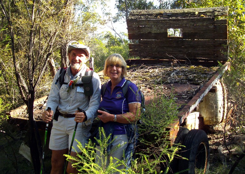
At the mines we investigated the old shelters, water tanks, mining shafts,
concrete lined ponds, a large boiler and an old Chevrolet truck rusting away.
Unable to find an old grave that was seen here previously, our leader showed us
a fallen tree deemed to be one that Ned Kelly tied his horse to in times
past......hmmm, I think that's a fisherman's tale!
Helen
Pollwombra Mountain
Wednesday 8 May 2013
Cancelled due to lack of interest. Apologies to Leader, Ian C who
spent a day exploring and reacquainting himself with this walk, and then drove down
to Moruya to lead it - and back home to the Bay again when nobody turned up!
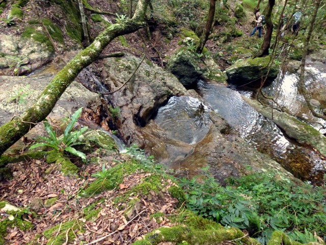
Upper Buckenbowra River - Lower Corn Trail
Sunday 6 May 2013
 |
 |
 |
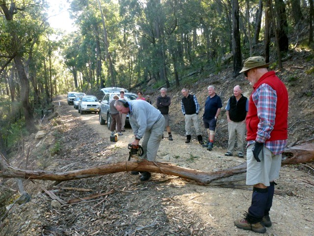
| Len's chainsaw comes to the rescue Photo by Donna Click on thumbnail to enlarge photo |
Sunlit rainforest Photo by Donna Click on thumbnail to enlarge photo |
Creek crossing Photo by Donna Click on thumbnail to enlarge photo |
 |
 |
 |
| What a beauty! Photo by Donna Click on thumbnail to enlarge photo |
Creek views Photo by Donna Click on thumbnail to enlarge photo |
And again Photo by Donna Click on thumbnail to enlarge photo |
Bartleys Arm, Murramarang National Park
Thursday 2 May 2013
 |
 |
 |
| At the big spotty Photo by Karen C Click on thumbnail to enlarge photo |
View of Murramarang coastline Photo by Karen C Click on thumbnail to enlarge photo |
Over the fallen tree Photo by Karen C Click on thumbnail to enlarge photo |
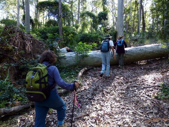
Thursday's 15 km bushwalk, rated medium, took eight keen walkers through some of the most interesting varied scenery in Murramarang National Park. Starting on North Head Road South Durras, we followed roads and forgotten logging tracks down to our morning tea stop at one of the tallest Spotted Gums in the area. Lots of photos were taken highlighting the autumn sunlight streaming through the trees.
Another two kilometres on and we were on the headland overlooking Flat Rock Island to the east and magnifient views over the ocean and coast as far south as Mt Dromeday. On to Myrtle Beach and even though we saw a little sign saying nude beach, the southerly wind must have discouraged any naturalist. Spotted gums and Burrawangs were plentiful on the next section, as well as a variety of vines strung between trees.
Next another old track and some time was spent trying to decide the make of a car long abandoned in the bush, well past the DIY restoration stage. We had remnant rainforest, water obstacles, a huge gum across the track, more water vine, thorny wild raspberry and grasses along a track which was slowly reverting back to bush alongside Bartleys Creek.
One last hill and we were back at our cars, after a quick check for leeches
and a hearty thank you to our leader Ian, another wonderful Batemans Bay Bushwalkers
walk was completed
Karen C
Editors Note - Ian C is doubly thanked for stepping in to fill this date at the last moment. He has offered to lead 3 walks on the current Program, two of them to fill slots left empty by our scarcity of easy and easy/medium walk leaders.
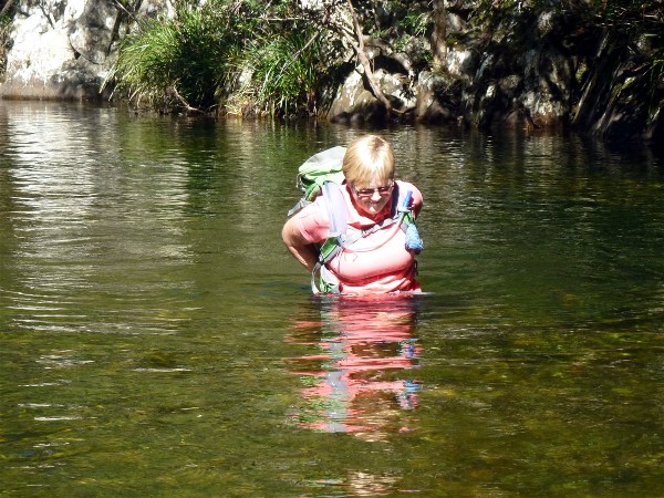
Oulla Creek and Angophoras
Saturday 27 April 2013
 |
 |
 |
| Oulla Creek Photo by Donna (taken on exploratory) Click on thumbnail to enlarge photo |
Reflections Photo by Donna (taken on exploratory) Click on thumbnail to enlarge photo |
Kay gets out of her depth Photo by Donna (taken on exploratory) Click on thumbnail to enlarge photo |
Oulla Creek, west of Moruya, provided a great Saturday walk for twelve members.
Led by Kay, we set off from Oulla Creek's junction with Burra Creek, walking upstream on the forested banks beside the deeper holes, and wading the crystal waters on a bed of worn gravels in the shallower reaches.
We walked up the gentle slope of the creek for three hours, through diverse habitats of rainforest, and some areas of scattered eucalypt forest. The creek banks hosted wombat holes, lyre-bird diggings, skinks, occasional roos and a goanna, plus a large exposed native bee colony, one and a half metres in extent, clinging to a rocky slope above a quiet pool in the stream. Heaps of water-borne debris from the forest showed us just how furious that little creek can sometimes be, and recently, was.
Our lunch stop was a gravelly bend of the creek, in dappled sunshine, perched on logs and rocks, watchful for the odd leach that also wanted lunch, then we trekked back down that delightful valley to our starting point. Only two people took an unintended swim, but the water was quite warm anyway.
Special thanks to the people who own the property, and kindly allowed us
access for the walk, and to their great little dog Foxy, who refused to go home,
and accompanied us with gusto.
Joe
Long Beach to Acheron Ledge via Maloneys
Wednesday 24 April 2013
No report received
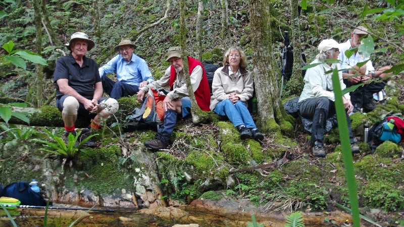
South Brooman Forest
Sunday 21 April 2013
 |
| Medium walkers with Leader Val Photo by Bob T Click on thumbnail to enlarge photo |
Nine willing Bushwalkers joined Valerie for a stimulating walk in some lovely forest. We willingly followed her up hills and down into lush gullies, admiring magnificent trees, listening to many bird calls, and enjoying the fresh air in the sparkling bush that was washed and refreshed by the previous day’s rain.
Gullies and creeks trickled and babbled as the birds sang, and we shared the knowledge of the flora and fauna, as well as the secrets of controlling computers, rather than letting them control us. An odd item of conversation, to be sure, but many are the topics raised and discussed while we enjoy the environment. The exercise and the company stimulates interesting conversations.
Another pleasant day out, walking in forests and sharing the pleasures with
friends.
Bob T
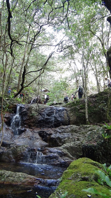
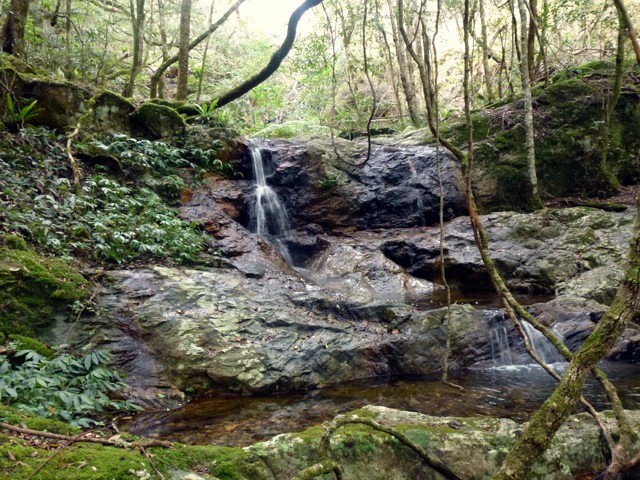
Currowan Creek Hidden Jewel
Thursday 18 April 2013
 |
 |
 |
| Crossing the creek Photo by Mike Click on thumbnail to enlarge photo |
Hidden Jewel Waterfall Photo by Mike Click on thumbnail to enlarge photo |
More creek views Photo by Donna Click on thumbnail to enlarge photo |
 |
 |
 |
| Waterfall from the top Photo by Donna Click on thumbnail to enlarge photo |
And another view Photo by Donna Click on thumbnail to enlarge photo |
Patrick, Doug, Bob, Elaine, Mary and Stan Photo by Mike Click on thumbnail to enlarge photo |
CURROWAN CREEK’S HIDDEN JEWEL was promised by our leader Cliff, which
attracted seventeen members of Batemans Bay Bushwalkers. We angled down steeply
off-track to the creek, which we followed up by scrambling along its scrubby
banks or wading in water running over coloured pebbles. We were in a botanical
wonderland of giant Casuarinas decorated with Elkhorn ferns and orchids and
hanging lianas, Sandpaper Figs, and mossy boulders.
When we saw a clearing with a smart new cabin, we realised we had gone past the
hidden entrance to our side creek with its ravine and waterfalls, but soon we
were there and having lunch. A few members climbed up the steep side towards
Bird’s Nest Ferns, one of which was twice the height of a man. A clamber up and
we burst out of the scrub at the cars.
Ainslie
Quartpot Creek West
Saturday 13 April 2013
Cancelled, due to car trouble